Valmunster
| Valmunster | ||
|---|---|---|
| Commune | ||
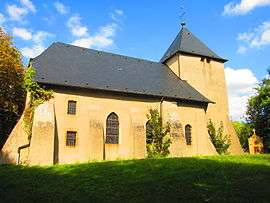 The church in Valmunster | ||
| ||
 Valmunster Location within Grand Est region  Valmunster | ||
| Coordinates: 49°14′34″N 6°30′29″E / 49.2428°N 6.5081°ECoordinates: 49°14′34″N 6°30′29″E / 49.2428°N 6.5081°E | ||
| Country | France | |
| Region | Grand Est | |
| Department | Moselle | |
| Arrondissement | Forbach-Boulay-Moselle | |
| Canton | Boulay-Moselle | |
| Intercommunality | Communauté de communes du Pays boulageois | |
| Government | ||
| • Mayor (2008–2014) | Marie-Thérèse Pignon | |
| Area1 | 3.14 km2 (1.21 sq mi) | |
| Population (2000)2 | 94 | |
| • Density | 30/km2 (78/sq mi) | |
| Time zone | UTC+1 (CET) | |
| • Summer (DST) | UTC+2 (CEST) | |
| INSEE/Postal code | 57691 /57220 | |
| Elevation |
209–320 m (686–1,050 ft) (avg. 115 m or 377 ft) | |
|
1 French Land Register data, which excludes lakes, ponds, glaciers > 1 km2 (0.386 sq mi or 247 acres) and river estuaries. 2 Population without double counting: residents of multiple communes (e.g., students and military personnel) only counted once. | ||

Valmunster (German: Walmünster) is a commune in the Moselle department in Grand Est in north-eastern France.
See also
| Wikimedia Commons has media related to Valmunster. |
This article is issued from
Wikipedia.
The text is licensed under Creative Commons - Attribution - Sharealike.
Additional terms may apply for the media files.