Gandrange
| Gandrange | ||
|---|---|---|
| Commune | ||
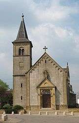 New church Saint-Pierre of Boussange. | ||
| ||
 Gandrange Location within Grand Est region  Gandrange | ||
| Coordinates: 49°16′20″N 6°07′33″E / 49.2722°N 6.1258°ECoordinates: 49°16′20″N 6°07′33″E / 49.2722°N 6.1258°E | ||
| Country | France | |
| Region | Grand Est | |
| Department | Moselle | |
| Arrondissement | Thionville | |
| Canton | Hayange | |
| Intercommunality | Communauté de communes du Sillon mosellan | |
| Government | ||
| • Mayor (2008–2014) | Henri Octave | |
| Area1 | 4.08 km2 (1.58 sq mi) | |
| Population (2011)2 | 2,933 | |
| • Density | 720/km2 (1,900/sq mi) | |
| Time zone | UTC+1 (CET) | |
| • Summer (DST) | UTC+2 (CEST) | |
| INSEE/Postal code | 57242 /57175 | |
| Elevation |
154–224 m (505–735 ft) (avg. 180 m or 590 ft) | |
|
1 French Land Register data, which excludes lakes, ponds, glaciers > 1 km2 (0.386 sq mi or 247 acres) and river estuaries. 2 Population without double counting: residents of multiple communes (e.g., students and military personnel) only counted once. | ||
.svg.png)
Gandrange (German: Gandringen) is a commune in the Moselle department in Grand Est in north-eastern France.
See also
| Wikimedia Commons has media related to Gandrange. |
This article is issued from
Wikipedia.
The text is licensed under Creative Commons - Attribution - Sharealike.
Additional terms may apply for the media files.