Wittring
| Wittring | ||
|---|---|---|
| Commune | ||
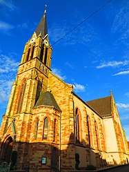 The church in Wittring | ||
| ||
 Wittring Location within Grand Est region  Wittring | ||
| Coordinates: 49°03′19″N 7°08′48″E / 49.0553°N 7.1467°ECoordinates: 49°03′19″N 7°08′48″E / 49.0553°N 7.1467°E | ||
| Country | France | |
| Region | Grand Est | |
| Department | Moselle | |
| Arrondissement | Sarreguemines | |
| Canton | Sarreguemines | |
| Intercommunality | Sarreguemines Confluences | |
| Government | ||
| • Mayor (2014-2020) | Claude Wackenheim | |
| Area1 | 8.09 km2 (3.12 sq mi) | |
| Population (2014)2 | 801 | |
| • Density | 99/km2 (260/sq mi) | |
| Time zone | UTC+1 (CET) | |
| • Summer (DST) | UTC+2 (CEST) | |
| INSEE/Postal code | 57748 /57905 | |
| Elevation | 199–336 m (653–1,102 ft) | |
|
1 French Land Register data, which excludes lakes, ponds, glaciers > 1 km2 (0.386 sq mi or 247 acres) and river estuaries. 2 Population without double counting: residents of multiple communes (e.g., students and military personnel) only counted once. | ||

Wittring (Lorraine Franconian: Wittringe) is a commune in the Moselle department in Grand Est in north-eastern France.
See also
| Wikimedia Commons has media related to Wittring. |
This article is issued from
Wikipedia.
The text is licensed under Creative Commons - Attribution - Sharealike.
Additional terms may apply for the media files.