Arzviller
| Arzviller | ||
|---|---|---|
| Commune | ||
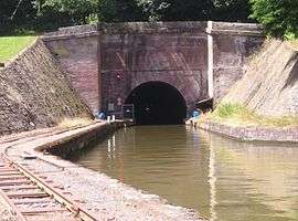 Tunnel of the Marne-Rhine Canal in Arzviller | ||
| ||
 Arzviller Location within Grand Est region  Arzviller | ||
| Coordinates: 48°43′13″N 7°09′58″E / 48.7203°N 7.1661°ECoordinates: 48°43′13″N 7°09′58″E / 48.7203°N 7.1661°E | ||
| Country | France | |
| Region | Grand Est | |
| Department | Moselle | |
| Arrondissement | Sarrebourg-Château-Salins | |
| Canton | Phalsbourg | |
| Intercommunality | CC Pays Phalsbourg | |
| Government | ||
| • Mayor (2014-2020) | Michel Carabin | |
| Area1 | 5.21 km2 (2.01 sq mi) | |
| Population (2015)2 | 544 | |
| • Density | 100/km2 (270/sq mi) | |
| Time zone | UTC+1 (CET) | |
| • Summer (DST) | UTC+2 (CEST) | |
| INSEE/Postal code | 57033 /57405 | |
| Elevation |
273–354 m (896–1,161 ft) (avg. 320 m or 1,050 ft) | |
|
1 French Land Register data, which excludes lakes, ponds, glaciers > 1 km2 (0.386 sq mi or 247 acres) and river estuaries. 2 Population without double counting: residents of multiple communes (e.g., students and military personnel) only counted once. | ||

Arzviller (German: Arzweiler) is a commune in the Moselle department in Grand Est in northeastern France.
Population
| Historical population | ||
|---|---|---|
| Year | Pop. | ±% |
| 1962 | 494 | — |
| 1968 | 507 | +2.6% |
| 1975 | 486 | −4.1% |
| 1982 | 544 | +11.9% |
| 1990 | 508 | −6.6% |
| 1999 | 516 | +1.6% |
| 2006 | 520 | +0.8% |
| 2009 | 526 | +1.2% |
| 2015 | 544 | +3.4% |
See also
References
| Wikimedia Commons has media related to Arzviller. |
This article is issued from
Wikipedia.
The text is licensed under Creative Commons - Attribution - Sharealike.
Additional terms may apply for the media files.