Villers-sur-Nied
| Villers-sur-Nied | ||
|---|---|---|
| Commune | ||
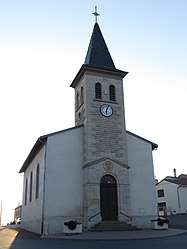 The church in Villers-sur-Nied | ||
| ||
 Villers-sur-Nied Location within Grand Est region  Villers-sur-Nied | ||
| Coordinates: 48°55′21″N 6°32′12″E / 48.9225°N 6.5367°ECoordinates: 48°55′21″N 6°32′12″E / 48.9225°N 6.5367°E | ||
| Country | France | |
| Region | Grand Est | |
| Department | Moselle | |
| Arrondissement | Sarrebourg-Château-Salins | |
| Canton | Le Saulnois | |
| Intercommunality | Communauté de communes du Saulnois | |
| Government | ||
| • Mayor (2008–2014) | Bernard Lemale | |
| Area1 | 4.25 km2 (1.64 sq mi) | |
| Population (1999)2 | 63 | |
| • Density | 15/km2 (38/sq mi) | |
| Time zone | UTC+1 (CET) | |
| • Summer (DST) | UTC+2 (CEST) | |
| INSEE/Postal code | 57719 /57340 | |
| Elevation |
244–358 m (801–1,175 ft) (avg. 250 m or 820 ft) | |
|
1 French Land Register data, which excludes lakes, ponds, glaciers > 1 km2 (0.386 sq mi or 247 acres) and river estuaries. 2 Population without double counting: residents of multiple communes (e.g., students and military personnel) only counted once. | ||

Villers-sur-Nied (German: Niedweiler) is a commune in the Moselle department in Grand Est in north-eastern France.
See also
| Wikimedia Commons has media related to Villers-sur-Nied. |
This article is issued from
Wikipedia.
The text is licensed under Creative Commons - Attribution - Sharealike.
Additional terms may apply for the media files.