Guilligomarc'h
| Guilligomarc'h Gwelegouarc'h | |
|---|---|
| Commune | |
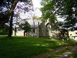 The chapel of Saint-Eloi, in Guilligomarc'h | |
 Guilligomarc'h Location within Brittany region  Guilligomarc'h | |
| Coordinates: 47°56′13″N 3°24′52″W / 47.9369°N 3.4144°WCoordinates: 47°56′13″N 3°24′52″W / 47.9369°N 3.4144°W | |
| Country | France |
| Region | Brittany |
| Department | Finistère |
| Arrondissement | Quimper |
| Canton | Quimperlé |
| Intercommunality | Pays de Quimperlé |
| Government | |
| • Mayor (2014–2020) | Alain Follic |
| Area1 | 22.75 km2 (8.78 sq mi) |
| Population (2008)2 | 678 |
| • Density | 30/km2 (77/sq mi) |
| Time zone | UTC+1 (CET) |
| • Summer (DST) | UTC+2 (CEST) |
| INSEE/Postal code | 29071 /29300 |
| Elevation | 22–148 m (72–486 ft) |
|
1 French Land Register data, which excludes lakes, ponds, glaciers > 1 km2 (0.386 sq mi or 247 acres) and river estuaries. 2 Population without double counting: residents of multiple communes (e.g., students and military personnel) only counted once. | |
Guilligomarc'h (Breton: Gwelegouarc'h) is a commune in the Finistère department of Brittany in north-western France.
Population
Inhabitants of Guilligomarc'h are called in French Guillogomarc'hois.
| Historical population | ||
|---|---|---|
| Year | Pop. | ±% |
| 1793 | 1,000 | — |
| 1800 | 1,050 | +5.0% |
| 1806 | 957 | −8.9% |
| 1821 | 936 | −2.2% |
| 1831 | 1,005 | +7.4% |
| 1836 | 1,056 | +5.1% |
| 1841 | 1,038 | −1.7% |
| 1846 | 1,141 | +9.9% |
| 1851 | 1,053 | −7.7% |
| 1856 | 1,070 | +1.6% |
| 1861 | 1,111 | +3.8% |
| 1866 | 1,113 | +0.2% |
| 1872 | 1,011 | −9.2% |
| 1876 | 1,056 | +4.5% |
| 1881 | 1,064 | +0.8% |
| 1886 | 1,125 | +5.7% |
| 1891 | 1,206 | +7.2% |
| 1896 | 1,210 | +0.3% |
| 1901 | 1,257 | +3.9% |
| 1906 | 1,228 | −2.3% |
| 1911 | 1,276 | +3.9% |
| 1921 | 1,284 | +0.6% |
| 1926 | 1,275 | −0.7% |
| 1931 | 1,172 | −8.1% |
| 1936 | 1,142 | −2.6% |
| 1946 | 1,250 | +9.5% |
| 1954 | 924 | −26.1% |
| 1962 | 936 | +1.3% |
| 1968 | 666 | −28.8% |
| 1975 | 560 | −15.9% |
| 1982 | 569 | +1.6% |
| 1990 | 520 | −8.6% |
| 1999 | 573 | +10.2% |
| 2008 | 678 | +18.3% |
See also
References
- Mayors of Finistère Association (in French);
External links
| Wikimedia Commons has media related to Guilligomarc'h. |
- Official website (in French)
- French Ministry of Culture list for Guilligomarc'h (in French)
This article is issued from
Wikipedia.
The text is licensed under Creative Commons - Attribution - Sharealike.
Additional terms may apply for the media files.