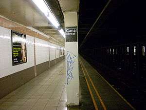
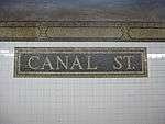
Canal Street (IRT Broadway–Seventh Avenue Line)
Canal Street | |||||||||||
|---|---|---|---|---|---|---|---|---|---|---|---|
|
| |||||||||||
 | |||||||||||
| Station statistics | |||||||||||
| Address |
Canal Street & Varick Street New York, NY 10013 | ||||||||||
| Borough | Manhattan | ||||||||||
| Locale | SoHo, Tribeca | ||||||||||
| Coordinates | 40°43′19″N 74°00′22″W / 40.722°N 74.006°WCoordinates: 40°43′19″N 74°00′22″W / 40.722°N 74.006°W | ||||||||||
| Division | A (IRT) | ||||||||||
| Line | IRT Broadway–Seventh Avenue Line | ||||||||||
| Services |
1 2 | ||||||||||
| Transit connections |
| ||||||||||
| Structure | Underground | ||||||||||
| Platforms | 2 side platforms | ||||||||||
| Tracks | 4 | ||||||||||
| Other information | |||||||||||
| Opened | July 1, 1918 | ||||||||||
| Station code | 325[1] | ||||||||||
| Wireless service |
| ||||||||||
| Traffic | |||||||||||
| Passengers (2017) |
1,756,236[3] | ||||||||||
| Rank | 269 out of 425 | ||||||||||
| Station succession | |||||||||||
| Next north |
Houston Street: 1 | ||||||||||
| Next south |
Franklin Street: 1 | ||||||||||
| |||||||||||
| |||||||||||
| |||||||||||


Canal Street is a local station on the IRT Broadway–Seventh Avenue Line of the New York City Subway, located in Lower Manhattan at the intersection of Canal and Varick Streets. It is served by the 1 train at all times, and by the 2 train during late nights.
Station layout
| G | Street Level | Exit/Entrance |
| P Platform level |
Side platform, doors will open on the right | |
| Northbound local | ← ← | |
| Northbound express | ← | |
| Southbound express | → | |
| Southbound local | → → | |
| Side platform, doors will open on the right | ||
This underground station is located on the street of the same name, which is the boundary of SoHo and Tribeca. Lying within a block of three different pocket parks (St. John's Park, Duane Park, and Cavala Park), the station sits at the entrance to the Holland Tunnel outside of the Tribeca North Historic District.[4] Much of the surrounding area is characterized by its historic loft architecture.
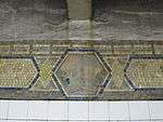
Like all stations on the IRT Broadway–Seventh Avenue Line south of 34th Street–Penn Station, Canal Street opened on July 1, 1918 as part of a southwestern expansion of the line to the South Ferry loop station. (That station has been replaced by another with the same name.) The station was renovated in 1992 by MTA New York City Transit's in-house staff.
This station has two side platforms and four tracks, numbered 1 to 4 from west to east, with center tracks 2 and 3 serving the 2 and 3 express trains that bypass the station during daytime hours. The platforms are mildly offset and, although there are no crossovers or crossunders to allow free transfers between directions, there is evidence of a sealed crossunder on both of the platforms.
Exits
Fare control is on platform level for both sides. The two northbound street stairs are on the northeast corner of Varick Street and Canal Street, and the one southbound street stair is on the northwest corner.[5] The northeast-corner entrances have been floodproofed.[6][7]
References
- ↑ "Station Developers' Information". Metropolitan Transportation Authority. Retrieved June 13, 2017.
- ↑ "NYC Subway Wireless – Active Stations". Transit Wireless Wifi. Retrieved May 18, 2016.
- ↑ "Facts and Figures: Annual Subway Ridership 2012–2017". Metropolitan Transportation Authority. July 12, 2018. Retrieved July 12, 2018.
- ↑ "Tribeca North Historic District" (PDF). New York City Landmarks Commission. Retrieved 2011-07-10.
- ↑ "MTA Neighborhood Maps: SoHo / Tribeca" (PDF). Metropolitan Transportation Authority. 2015. Retrieved August 6, 2015.
- ↑ Kirby, Jen (2016-04-07). "Here's One Way the MTA Is Getting the Subway Ready for the Next Superstorm Sandy". Daily Intelligencer. Retrieved 2017-01-01.
- ↑ "Can We Make Our Subways Flood-Proof Or What?". Popular Science. 2016-08-03. Retrieved 2017-01-01.
Further reading
- Lee Stokey. Subway Ceramics : A History and Iconography. 1994. ISBN 978-0-9635486-1-0
External links
| Wikimedia Commons has media related to Canal Street (IRT Broadway – Seventh Avenue Line). |
- nycsubway.org – IRT West Side Line: Canal Street
- Station Reporter – 1 Train
- Canal Street entrance from Google Maps Street View
- Platforms from Google Maps Street View