Breistroff-la-Grande
| Breistroff-la-Grande | ||
|---|---|---|
| Commune | ||
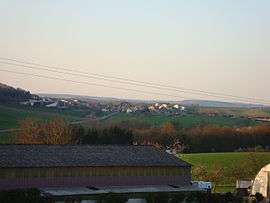 A general view of Breistroff-la-Grande | ||
| ||
 Breistroff-la-Grande Location within Grand Est region  Breistroff-la-Grande | ||
| Coordinates: 49°27′27″N 6°13′08″E / 49.4575°N 6.2189°ECoordinates: 49°27′27″N 6°13′08″E / 49.4575°N 6.2189°E | ||
| Country | France | |
| Region | Grand Est | |
| Department | Moselle | |
| Arrondissement | Thionville | |
| Canton | Yutz | |
| Intercommunality | Cattenom et environs | |
| Government | ||
| • Mayor (2014–2020) | Gérard Theis | |
| Area1 | 10.63 km2 (4.10 sq mi) | |
| Population (2009)2 | 578 | |
| • Density | 54/km2 (140/sq mi) | |
| Time zone | UTC+1 (CET) | |
| • Summer (DST) | UTC+2 (CEST) | |
| INSEE/Postal code | 57109 /57570 | |
| Elevation |
157–242 m (515–794 ft) (avg. 200 m or 660 ft) | |
|
1 French Land Register data, which excludes lakes, ponds, glaciers > 1 km2 (0.386 sq mi or 247 acres) and river estuaries. 2 Population without double counting: residents of multiple communes (e.g., students and military personnel) only counted once. | ||
.svg.png)
Breistroff-la-Grande (German: Breisdorf) is a commune in the Moselle department in Grand Est in northeastern France.
The localities of Boler (German: Boler) and Évange (German: Ewingen) are incorporated in the commune.
Population
| Historical population | ||
|---|---|---|
| Year | Pop. | ±% |
| 1962 | 267 | — |
| 1968 | 277 | +3.7% |
| 1975 | 281 | +1.4% |
| 1982 | 320 | +13.9% |
| 1990 | 338 | +5.6% |
| 1999 | 416 | +23.1% |
| 2006 | 541 | +30.0% |
| 2009 | 578 | +6.8% |
See also
References
| Wikimedia Commons has media related to Breistroff-la-Grande. |
This article is issued from
Wikipedia.
The text is licensed under Creative Commons - Attribution - Sharealike.
Additional terms may apply for the media files.