Caddo County, Oklahoma
| Caddo County, Oklahoma | |
|---|---|
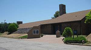 The Southern Plains Indian Museum in Anadarko | |
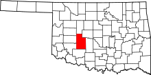 Location in the U.S. state of Oklahoma | |
 Oklahoma's location in the U.S. | |
| Founded | August 6, 1901 |
| Named for | Caddo Tribe |
| Seat | Anadarko |
| Largest city | Anadarko |
| Area | |
| • Total | 1,290 sq mi (3,341 km2) |
| • Land | 1,278 sq mi (3,310 km2) |
| • Water | 12 sq mi (31 km2), 0.9% |
| Population (est.) | |
| • (2013) | 29,594 |
| • Density | 23/sq mi (9/km2) |
| Congressional district | 3rd |
| Time zone | Central: UTC−6/−5 |
Caddo County is a county located in the U.S. state of Oklahoma. As of the 2010 census, the population was 29,600.[1] Its county seat is Anadarko.[2] Created in 1901 as part of Oklahoma Territory, the county is named for the Caddo tribe who were settled here on a reservation in the 1870s. Caddo County is immediately west of the seven-county Greater Oklahoma City metro area, and although is not officially in the metro area, it has many economic ties in this region.
History
Caddo County was organized on August 6, 1901 when the Federal Government allotted the Kiowa, Comanche, and Arapaho reservations and sold the surplus land to white settlers.[3] The reservation land was part of Oklahoma Territory until Oklahoma became a state on November 16, 1907. Part of its land was taken at statehood to form neighboring Grady County. Some additional land was taken in 1911 and also awarded to Grady County.[3]
Agriculture has been the mainstay of the local economy since its founding. The main crops were cotton, corn, wheat, alfalfa, broom corn, and kaffir corn. Poultry and livestock production have also been important. By 1960, Caddo County ranked first in Oklahoma for producing of peanuts, hogs and poultry.[3]
The first oil field (Cement Field) in the county was discovered in 1911, and oil production has remained important to the county economy since then. Smaller-scale booms in oil production occurred in the 1960s, 1970s and 1980s.[3]
Geography
According to the U.S. Census Bureau, the county has a total area of 1,290 square miles (3,300 km2), of which 1,278 square miles (3,310 km2) is land and 12 square miles (31 km2) (0.9%) is water.[4] The county mostly lies in the Gypsum Hills and the Red Bed plains physiographic areas. The extreme southwestern corner is in the Wichita Mountains. The county is drained by the Washita River and Pond and Sugar Creeks. Major reservoirs are Chickasha Lake, Ellsworth Lake, and Fort Cobb Lake,[3] Red Rock Canyon State Park near Hinton is notable for having the only remaining stand of native Caddo maple trees.
Major highways
Adjacent counties
- Blaine County (north)
- Canadian County (northeast)
- Grady County (east)
- Comanche County (south)
- Kiowa County (southwest)
- Washita County (west)
- Custer County (northwest)
Demographics
| Historical population | |||
|---|---|---|---|
| Census | Pop. | %± | |
| 1910 | 35,685 | — | |
| 1920 | 34,207 | −4.1% | |
| 1930 | 50,779 | 48.4% | |
| 1940 | 41,567 | −18.1% | |
| 1950 | 34,913 | −16.0% | |
| 1960 | 28,621 | −18.0% | |
| 1970 | 28,931 | 1.1% | |
| 1980 | 30,905 | 6.8% | |
| 1990 | 29,550 | −4.4% | |
| 2000 | 30,150 | 2.0% | |
| 2010 | 29,600 | −1.8% | |
| Est. 2016 | 29,557 | [5] | −0.1% |
| U.S. Decennial Census[6] 1790-1960[7] 1900-1990[8] 1990-2000[9] 2010-2013[1] | |||
As of the census[10] of 2000, there were 30,150 people, 10,957 households, and 7,965 families residing in the county. The population density was 9/km² (24/sq mi). There were 13,096 housing units at an average density of 4/km² (10/sq mi). The racial makeup of the county was 65.55% White, 2.92% Black or African American, 24.28% Native American, 0.17% Asian, 0.02% Pacific Islander, 2.70% from other races, and 4.36% from two or more races. 6.28% of the population were Hispanic or Latino of any race. 93.8% English, 4.5% Spanish and 1.2% Kiowa as their first language.
There were 10,957 households out of which 33.30% had children under the age of 18 living with them, 55.20% were married couples living together, 13.00% had a female householder with no husband present, and 27.30% were non-families. 24.80% of all households were made up of individuals and 12.50% had someone living alone who was 65 years of age or older. The average household size was 2.62 and the average family size was 3.13.
In the county, the population was spread out with 28.50% under the age of 18, 8.50% from 18 to 24, 26.00% from 25 to 44, 22.10% from 45 to 64, and 14.90% who were 65 years of age or older. The median age was 36 years. For every 100 females there were 98.60 males. For every 100 females age 18 and over, there were 96.00 males.
The median income for a household in the county was $27,347, and the median income for a family was $32,118. Males had a median income of $26,373 versus $18,658 for females. The per capita income for the county was $13,298. About 16.70% of families and 21.70% of the population were below the poverty line, including 28.00% of those under age 18 and 15.90% of those age 65 or over.
Politics
During the 20th century, Anadarko County was a bellwether county: between 1912 and 2004, the county voted for the winner in every election but 1956 and 1998. However, it has become more conservative in recent years, with John McCain (2008), Mitt Romney (2012) and Donald Trump (2016) each receiving at list 64% of the county's vote.
| Voter Registration and Party Enrollment as of January 15, 2018[11] | |||||
|---|---|---|---|---|---|
| Party | Number of Voters | Percentage | |||
| Democratic | 7,006 | 53.18% | |||
| Republican | 4,504 | 34.19% | |||
| Others | 1,663 | 12.62% | |||
| Total | 13,173 | 100% | |||
| Year | Republican | Democratic | Third parties |
|---|---|---|---|
| 2016 | 69.3% 6,482 | 25.9% 2,420 | 4.8% 446 |
| 2012 | 64.3% 5,687 | 35.8% 3,164 | |
| 2008 | 65.3% 6,413 | 34.7% 3,404 | |
| 2004 | 62.4% 6,491 | 37.6% 3,916 | |
| 2000 | 52.5% 4,835 | 46.4% 4,272 | 1.1% 103 |
| 1996 | 35.4% 3,422 | 50.1% 4,844 | 14.5% 1,404 |
| 1992 | 31.9% 3,664 | 42.3% 4,861 | 25.8% 2,963 |
| 1988 | 46.1% 4,689 | 52.9% 5,387 | 1.0% 101 |
| 1984 | 60.1% 6,811 | 39.4% 4,463 | 0.6% 67 |
| 1980 | 54.1% 5,945 | 42.7% 4,695 | 3.2% 355 |
| 1976 | 34.0% 3,854 | 65.2% 7,382 | 0.8% 91 |
| 1972 | 70.4% 7,683 | 26.8% 2,921 | 2.8% 308 |
| 1968 | 43.7% 4,712 | 39.1% 4,212 | 17.2% 1,858 |
| 1964 | 33.3% 3,724 | 66.7% 7,447 | |
| 1960 | 53.7% 5,920 | 46.4% 5,115 | |
| 1956 | 47.5% 5,331 | 52.5% 5,884 | |
| 1952 | 52.6% 6,834 | 47.4% 6,153 | |
| 1948 | 31.9% 3,793 | 68.1% 8,110 | |
| 1944 | 44.6% 5,529 | 55.2% 6,850 | 0.2% 24 |
| 1940 | 43.1% 6,304 | 56.5% 8,280 | 0.4% 61 |
| 1936 | 35.5% 5,205 | 63.8% 9,358 | 0.7% 106 |
| 1932 | 21.3% 2,972 | 78.7% 11,001 | |
| 1928 | 64.3% 7,313 | 34.1% 3,885 | 1.6% 180 |
| 1924 | 46.0% 4,388 | 44.2% 4,211 | 9.8% 931 |
| 1920 | 53.2% 4,823 | 39.6% 3,594 | 7.2% 654 |
| 1916 | 36.8% 2,272 | 44.3% 2,735 | 19.0% 1,174 |
| 1912 | 40.4% 2,413 | 42.1% 2,514 | 17.6% 1,050 |
Economy
Caddo County is home to cattle ranching and significant wheat and peanut farm operations—with a few of the producers practicing environmentally friendly no-till or reduced tillage farming methods.[13]
There is also one winery and vineyard in the county (Woods and Waters Winery and Vineyard).
Communities

City
- Anadarko (county seat)
Towns
Unincorporated communities
NRHP sites
The following sites in Caddo County are listed on the National Register of Historic Places:
- Amphlett Brothers Drug and Jewelry Store, Apache
- Anadarko Armory, Anadarko
- Anadarko Downtown Historic District, Anadarko
- Apache State Bank, Apache
- Bridgeport Hill-Hydro Route 66 Segment, Hydro
- Caddo County Medicine Creek Archeological District Binger
- First Baptist Church (Colored), Anadarko
- Fort Cobb Site, Fort Cobb
- Provine Service Station, Hydro
- Randlett Park, Anadarko
- Rock Mary, Hinton
- Stevens Rock Shelter, Gracemont
See also
References
- 1 2 "State & County QuickFacts". United States Census Bureau. Retrieved November 8, 2013.
- ↑ "Find a County". National Association of Counties. Archived from the original on 2011-05-31. Retrieved 2011-06-07.
- 1 2 3 4 5 Wilson, Linda D. (2009). "Caddo County". Encyclopedia of Oklahoma History and Culture (online ed.). Oklahoma Historical Society. Retrieved April 16, 2015.
- ↑ "2010 Census Gazetteer Files". United States Census Bureau. August 22, 2012. Retrieved February 18, 2015.
- ↑ "Population and Housing Unit Estimates". Retrieved June 9, 2017.
- ↑ "U.S. Decennial Census". United States Census Bureau. Archived from the original on May 12, 2015. Retrieved February 18, 2015.
- ↑ "Historical Census Browser". University of Virginia Library. Retrieved February 18, 2015.
- ↑ Forstall, Richard L., ed. (March 27, 1995). "Population of Counties by Decennial Census: 1900 to 1990". United States Census Bureau. Retrieved February 18, 2015.
- ↑ "Census 2000 PHC-T-4. Ranking Tables for Counties: 1990 and 2000" (PDF). United States Census Bureau. April 2, 2001. Retrieved February 18, 2015.
- ↑ "American FactFinder". United States Census Bureau. Archived from the original on 2013-09-11. Retrieved 2008-01-31.
- ↑ https://www.ok.gov/elections/documents/20180115%20-%20Registration%20By%20County%20%28vr2420%29.pdf
- ↑ Leip, David. "Dave Leip's Atlas of U.S. Presidential Elections". uselectionatlas.org. Retrieved 2018-03-28.
- ↑ Reducefarmcosts.com Archived 2011-07-15 at the Wayback Machine.
External links
- Encyclopedia of Oklahoma History and Culture - Caddo County
- Oklahoma Digital Maps: Digital Collections of Oklahoma and Indian Territory
Places adjacent to Caddo County, Oklahoma | |
|---|---|
Municipalities and communities of Caddo County, Oklahoma, United States | ||
|---|---|---|
| City | | |
| Towns | ||
| Unincorporated communities | ||
| Footnotes | ‡This populated place also has portions in an adjacent county or counties. | |
| Anadarko |
| |
|---|---|---|
| Apache |
| |
| Binger |
| |
| Bridgeport | ||
| Fort Cobb | ||
| Gracemont |
| |
| Hinton | ||
| Hydro | ||
