Seminole County, Oklahoma
| Seminole County, Oklahoma | |
|---|---|
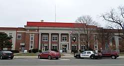 Seminole County Courthouse in Wewoka | |
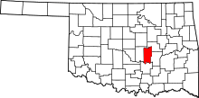 Location in the U.S. state of Oklahoma | |
 Oklahoma's location in the U.S. | |
| Founded | 1907 |
| Seat | Wewoka |
| Largest city | Seminole |
| Area | |
| • Total | 640 sq mi (1,658 km2) |
| • Land | 633 sq mi (1,639 km2) |
| • Water | 7.6 sq mi (20 km2), 1.2% |
| Population (est.) | |
| • (2015) | 25,548 |
| • Density | 40/sq mi (20/km2) |
| Congressional district | 5th |
Seminole County is a county located in the U.S. state of Oklahoma. As of the 2010 census, the population was 25,482.[1] Its county seat is Wewoka.[2] Before Oklahoma's admission as a state, the county was the entire small portion of Indian Territory allocated to the Seminole people, who were removed from Florida in the 1820s.
Seminole County is notable for the Greater Seminole Field, one of the most important oil fields ever found, which is still producing.[3] It extends into nearby counties. In the early years of the oil boom, workers and adventurers flooded into the county, rapidly tripling the population. As oil production later declined, jobs and residents left.
History
Seminole County has been an important part of the Oklahoma and United States petroleum industry for over 80 years. The Greater Seminole Field was one of the most important oil fields ever found and is still producing.[3] Discovered one field after another in 1926, it contained an estimated 822,000,000 barrels (130,700,000 m3) of oil.[4] To group the fields together, the oil companies decided to come up with a name, and this was suggested by Paul Hedrick, oil editor of the Tulsa World. Other important oil fields in the area were the Cromwell oil field, discovered in 1923, and the Maud oil field. The Maud field, discovered in 1927 by Amerada Petroleum, was the first discovery using reflection seismology.[5] This marked the beginning of the use of modern geophysical methods in the petroleum industry.
The Seminole County Courthouse was built in 1927.
Geography
According to the U.S. Census Bureau, the county has a total area of 640 square miles (1,700 km2), of which 633 square miles (1,640 km2) is land and 7.6 square miles (20 km2) (1.2%) is water.[6] The county is bounded on the north by the North Canadian River and on the south by the Canadian River.[7]
Adjacent counties
- Okfuskee County (northeast)
- Hughes County (east)
- Pontotoc County (south)
- Pottawatomie County (west)
Demographics
| Historical population | |||
|---|---|---|---|
| Census | Pop. | %± | |
| 1910 | 19,964 | — | |
| 1920 | 23,808 | 19.3% | |
| 1930 | 79,621 | 234.4% | |
| 1940 | 61,201 | −23.1% | |
| 1950 | 40,672 | −33.5% | |
| 1960 | 28,066 | −31.0% | |
| 1970 | 25,144 | −10.4% | |
| 1980 | 27,473 | 9.3% | |
| 1990 | 25,412 | −7.5% | |
| 2000 | 24,894 | −2.0% | |
| 2010 | 25,482 | 2.4% | |
| Est. 2016 | 25,207 | [8] | −1.1% |
| U.S. Decennial Census[9] 1790-1960[10] 1900-1990[11] 1990-2000[12] 2010-2013[1] | |||

As of the census[13] of 2000, there were 24,894 people, 9,575 households, and 6,788 families residing in the county. The population density was 15/km² (39/mi²). There were 11,146 housing units at an average density of 7/km² (18/mi²). The racial makeup of the county was 70.74% White, 5.59% Black or African American, 17.39% Native American, 0.22% Asian, 0.05% Pacific Islander, 0.74% from other races, and 5.28% from two or more races. 2.22% of the population were Hispanic or Latino of any race. 94.7% spoke English, 2.9% Muskogee and 1.7% Spanish as their first language.
There were 9,575 households out of which 30.70% had children under the age of 18 living with them, 53.30% were married couples living together, 13.30% had a female householder with no husband present, and 29.10% were non-families. 25.90% of all households were made up of individuals and 13.10% had someone living alone who was 65 years of age or older. The average household size was 2.54 and the average family size was 3.05.
In the county, the population was spread out with 26.30% under the age of 18, 9.00% from 18 to 24, 24.40% from 25 to 44, 23.40% from 45 to 64, and 16.70% who were 65 years of age or older. The median age was 38 years. For every 100 females there were 93.20 males. For every 100 females age 18 and over, there were 90.00 males.
The median income for a household in the county was $25,568, and the median income for a family was $30,791. Males had a median income of $25,954 versus $18,285 for females. The per capita income for the county was $13,956. About 16.70% of families and 20.80% of the population were below the poverty line, including 28.90% of those under age 18 and 14.40% of those age 65 or over.
Politics
| Voter Registration and Party Enrollment as of January 15, 2018[14] | |||||
|---|---|---|---|---|---|
| Party | Number of Voters | Percentage | |||
| Democratic | 5,942 | 51.99% | |||
| Republican | 3,981 | 34.83% | |||
| Others | 1,507 | 13.18% | |||
| Total | 11,430 | 100% | |||
| Year | Republican | Democratic | Third Parties |
|---|---|---|---|
| 2016 | 69.8% 5,613 | 25.8% 2,071 | 4.4% 353 |
| 2012 | 65.1% 4,856 | 34.9% 2,600 | |
| 2008 | 65.3% 5,600 | 34.7% 2,977 | |
| 2004 | 60.7% 5,624 | 39.3% 3,648 | |
| 2000 | 51.0% 4,011 | 48.1% 3,783 | 0.9% 72 |
| 1996 | 35.7% 2,935 | 51.3% 4,225 | 13.0% 1,069 |
| 1992 | 31.8% 3,253 | 45.2% 4,624 | 23.1% 2,363 |
| 1988 | 45.0% 4,078 | 54.1% 4,911 | 0.9% 84 |
| 1984 | 59.9% 6,009 | 39.5% 3,957 | 0.6% 64 |
| 1980 | 50.0% 5,067 | 46.6% 4,726 | 3.5% 352 |
| 1976 | 41.5% 4,237 | 57.6% 5,874 | 0.9% 91 |
| 1972 | 70.0% 6,879 | 28.0% 2,746 | 2.0% 199 |
| 1968 | 38.1% 3,711 | 39.9% 3,889 | 22.0% 2,142 |
| 1964 | 35.8% 3,676 | 64.2% 6,582 | |
| 1960 | 56.4% 5,505 | 43.6% 4,256 | |
| 1956 | 47.0% 5,230 | 53.0% 5,897 | |
| 1952 | 48.5% 6,668 | 51.5% 7,076 | |
| 1948 | 29.7% 3,423 | 70.4% 8,122 | |
| 1944 | 39.0% 4,560 | 60.9% 7,116 | 0.1% 16 |
| 1940 | 38.1% 6,880 | 61.8% 11,167 | 0.2% 36 |
| 1936 | 25.4% 4,001 | 74.2% 11,695 | 0.5% 72 |
| 1932 | 21.6% 3,348 | 78.4% 12,154 | |
| 1928 | 64.6% 8,072 | 35.4% 4,423 | |
| 1924 | 40.1% 2,326 | 51.8% 3,007 | 8.2% 475 |
| 1920 | 60.7% 3,382 | 33.6% 1,869 | 5.7% 318 |
| 1916 | 26.8% 872 | 44.4% 1,444 | 28.8% 935 |
| 1912 | 27.0% 715 | 44.3% 1,172 | 28.7% 758 |
Communities
See also
References
- 1 2 "State & County QuickFacts". United States Census Bureau. Retrieved November 13, 2013.
- ↑ "Find a County". National Association of Counties. Retrieved 2011-06-07.
- 1 2 Bobby D. Weaver, "Greater Seminole Field," Encyclopedia of Oklahoma History and Culture, Oklahoma Historical Society, 2009. Accessed April 5, 2015.
- ↑ Historical Dictionary of the Petroleum Industry, Appendix 13
- ↑ Historical Dictionary of the Petroleum Industry, p. 40
- ↑ "2010 Census Gazetteer Files". United States Census Bureau. August 22, 2012. Retrieved February 22, 2015.
- ↑ Mullins, William H. "Seminole County," Encyclopedia of Oklahoma History and Culture, Oklahoma Historical Society, 2009. Accessed April 5, 2015.
- ↑ "Population and Housing Unit Estimates". Retrieved June 9, 2017.
- ↑ "U.S. Decennial Census". United States Census Bureau. Retrieved February 22, 2015.
- ↑ "Historical Census Browser". University of Virginia Library. Retrieved February 22, 2015.
- ↑ Forstall, Richard L., ed. (March 27, 1995). "Population of Counties by Decennial Census: 1900 to 1990". United States Census Bureau. Retrieved February 22, 2015.
- ↑ "Census 2000 PHC-T-4. Ranking Tables for Counties: 1990 and 2000" (PDF). United States Census Bureau. April 2, 2001. Retrieved February 22, 2015.
- ↑ "American FactFinder". United States Census Bureau. Retrieved 2008-01-31.
- ↑ https://www.ok.gov/elections/documents/20180115%20-%20Registration%20By%20County%20%28vr2420%29.pdf
- ↑ Leip, David. "Dave Leip's Atlas of U.S. Presidential Elections". uselectionatlas.org. Retrieved 2018-03-30.
Places adjacent to Seminole County, Oklahoma | ||||||||||
|---|---|---|---|---|---|---|---|---|---|---|
| ||||||||||
Municipalities and communities of Seminole County, Oklahoma, United States | ||
|---|---|---|
| Cities | | |
| Towns | ||
| Unincorporated communities |
| |
| Footnotes | ‡This populated place also has portions in an adjacent county or counties | |
