Rogers County, Oklahoma
| Rogers County, Oklahoma | |
|---|---|
 | |
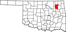 Location in the U.S. state of Oklahoma | |
 Oklahoma's location in the U.S. | |
| Founded | 1907 |
| Named for | Clement Vann Rogers |
| Seat | Claremore |
| Largest city | Claremore |
| Area | |
| • Total | 711 sq mi (1,841 km2) |
| • Land | 676 sq mi (1,751 km2) |
| • Water | 36 sq mi (93 km2), 5.0% |
| Population (est.) | |
| • (2015) | 90,802 |
| • Density | 129/sq mi (50/km2) |
| Congressional districts | 1st, 2nd |
| Time zone | Central: UTC−6/−5 |
| Website |
www |
Rogers County is a county located in the northeastern part of the U.S. state of Oklahoma. As of the 2010 census, the population was 86,905.[1] Its county seat is Claremore,[2] making it the sixth-largest county in Oklahoma based on population. Rogers County is included in the Tulsa, OK Metropolitan Statistical Area.
Originally created in 1907 from the western Saline District of the Cherokee Nation, this area was named the Cooweescoowee District, and Cooweescoowee County at the time of statehood. But the residents protested and the name was changed to Rogers County, after Clem Vann Rogers, a prominent Cherokee rancher and father of Will Rogers.[3][4]
History
According to the Encyclopedia of Oklahoma History and Culture, the Arkansas Band of the Osage Nation settled in the Three Forks area (the junction of the Arkansas River, Grand River and Verdigris River during the 1760s and established two villages called Pasuga and Pasona in what is now Rogers County. Pasona was near an ancient earthwork platform mound near the Verdigris River. It was later called Claremore Mound, to honor Osage chief Claremore (aka Gra-mon in Osage, meaning Arrow Going Home; his name was first recorded by French colonists as Clermont.)[3]
In 1828, Cherokee bands who had left the Southeast early exchanged their Arkansas land for an area that included present-day Rogers County. This had been ceded by the Osage in 1825 under a treaty to the United States.[3] The area became organized by the Cherokee Nation as the Saline District of their portion of Indian Territory. In 1907 the western portion of that district was organized as the Cooweescoowee District.[3]
Upon statehood in 1908, the district was designated as a county named Cooweescoowee. Residents supported renaming the county in honor of Clement Vann Rogers, an early Cherokee settler and prominent rancher here.[3]
Shortly after statehood, Eastern University Preparatory School was established on College Hill, just west of Claremore, Oklahoma.[5] The Oklahoma Military Academy, established in 1919, took over the facility.[5] In 1971 the academy was closed and the facility was converted for use by Claremore Junior College.[5] As a four-year curriculum and graduate departments were added, the state legislature renamed the institution as Rogers State College and Rogers University, before settling in 1998 on the current Rogers State University.[5]
Geography
According to the U.S. Census Bureau, the county has a total area of 711 square miles (1,840 km2), of which 676 square miles (1,750 km2) is land and 36 square miles (93 km2) (5.0%) is water.[6] The largest body of water is Lake Oologah. The main streams are the Caney River and the Verdigris River. There are also several smaller creeks and lakes in the county.[3]
Adjacent counties
- Nowata County (north)
- Craig County (northeast)
- Mayes County (east)
- Wagoner County (south)
- Tulsa County (southwest)
- Washington County (northwest)
Demographics
| Historical population | |||
|---|---|---|---|
| Census | Pop. | %± | |
| 1910 | 17,736 | — | |
| 1920 | 17,605 | −0.7% | |
| 1930 | 18,956 | 7.7% | |
| 1940 | 21,078 | 11.2% | |
| 1950 | 19,532 | −7.3% | |
| 1960 | 20,614 | 5.5% | |
| 1970 | 28,425 | 37.9% | |
| 1980 | 46,436 | 63.4% | |
| 1990 | 55,170 | 18.8% | |
| 2000 | 70,641 | 28.0% | |
| 2010 | 86,905 | 23.0% | |
| Est. 2017 | 91,444 | [7] | 5.2% |
| U.S. Decennial Census[8] 1790-1960[9] 1900-1990[10] 1990-2000[11] 2010-2013[1] | |||
As of the census[12] of 2010, there were 86,905 people, 31,884 households, and 24,088 families residing in the county. The population density was 105 people per square mile (40/km²). There were 27,476 housing units at an average density of 41 per square mile (16/km²). The racial makeup of the county was 75.3% White, 1.0% Black or African American, 13.1% Native American, 1.1% Asian (0.5% Hmong, 0.1% Filipino, 0.1% Indian),[13] 0.1% Pacific Islander, 1.4% from other races, and 8.1% from two or more races. 3.7% of the population were Hispanic or Latino of any race (2.7% Mexican, 0.3% Puerto Rican, 0.2% Spanish, 0.1% Peruvian).[14][15][16] 18.1% were of German, 13.8% Irish, 8.7% English, 3.0% French, 2.5% Scottish, and 2.2% Italian ancestries.[17]
96.7% spoke English, 1.7% Spanish, and 0.4% German as their first language.[18]
There were 31,884 households out of which 38.40% had children under the age of 18 living with them, 65.60% were married couples living together, 8.90% had a female householder with no husband present, and 21.90% were non-families. 19.00% of all households were made up of individuals and 7.50% had someone living alone who was 65 years of age or older. The average household size was 2.71 and the average family size was 3.10.
In the county, the population was spread out with 28.70% under the age of 18, 7.40% from 18 to 24, 28.60% from 25 to 44, 24.00% from 45 to 64, and 11.30% who were 65 years of age or older. The median age was 36 years. For every 100 females, there were 96.80 males. For every 100 females age 18 and over, there were 94.40 males.
The median income for a household in the county was $58,434 and the median income for a family was $67,691. The per capita income for the county was $26,400. About 7.2% of families and 9.9% of the population were below the poverty line, including 13.3% of those under age 18 and 7.3% of those age 65 or over.[14][19][20]
Politics
| Voter Registration and Party Enrollment as of January 15, 2018[21] | |||||
|---|---|---|---|---|---|
| Party | Number of Voters | Percentage | |||
| Democratic | 15,083 | 28.50% | |||
| Republican | 30,776 | 58.16% | |||
| Others | 7,056 | 13.33% | |||
| Total | 52,915 | 100% | |||
| Year | Republican | Democratic | Third Parties |
|---|---|---|---|
| 2016 | 75.7% 30,913 | 19.3% 7,902 | 5.0% 2,047 |
| 2012 | 75.1% 27,553 | 24.9% 9,148 | |
| 2008 | 72.0% 27,743 | 28.0% 10,772 | |
| 2004 | 67.7% 24,976 | 32.3% 11,918 | |
| 2000 | 61.2% 17,713 | 37.4% 10,813 | 1.5% 425 |
| 1996 | 50.4% 12,883 | 37.4% 9,544 | 12.2% 3,127 |
| 1992 | 44.7% 12,455 | 29.6% 8,257 | 25.7% 7,180 |
| 1988 | 59.2% 12,940 | 40.1% 8,771 | 0.6% 140 |
| 1984 | 72.4% 16,137 | 27.0% 6,013 | 0.6% 138 |
| 1980 | 62.1% 11,581 | 34.3% 6,399 | 3.6% 662 |
| 1976 | 49.4% 7,318 | 49.7% 7,368 | 0.9% 129 |
| 1972 | 76.2% 9,697 | 20.5% 2,607 | 3.3% 424 |
| 1968 | 44.4% 4,631 | 25.5% 2,665 | 30.1% 3,141 |
| 1964 | 43.5% 4,202 | 56.5% 5,449 | |
| 1960 | 63.1% 5,412 | 36.9% 3,167 | |
| 1956 | 58.5% 4,487 | 41.5% 3,185 | |
| 1952 | 56.0% 4,873 | 44.0% 3,830 | |
| 1948 | 40.4% 2,849 | 59.6% 4,197 | |
| 1944 | 53.8% 3,739 | 46.1% 3,209 | 0.1% 8 |
| 1940 | 50.2% 4,086 | 49.5% 4,028 | 0.3% 25 |
| 1936 | 41.9% 3,119 | 57.6% 4,290 | 0.6% 42 |
| 1932 | 26.0% 1,879 | 74.0% 5,347 | |
| 1928 | 61.4% 3,477 | 37.9% 2,147 | 0.7% 41 |
| 1924 | 41.3% 2,207 | 54.3% 2,901 | 4.4% 237 |
| 1920 | 51.5% 2,844 | 44.6% 2,459 | 3.9% 216 |
| 1916 | 37.0% 1,435 | 49.0% 1,900 | 14.1% 546 |
| 1912 | 37.7% 1,258 | 49.0% 1,637 | 13.3% 445 |
Communities
Cities
- Catoosa
- Claremore (county seat)
- Collinsville (primarily in Tulsa County)
- Owasso (primarily in Tulsa County)
- Tulsa (primarily in Tulsa County)
Towns
- Chelsea
- Fair Oaks (primarily in Wagoner County)
- Foyil
- Inola
- Oologah
- Talala
- Valley Park
- Verdigris
Census-designated places
Unincorporated communities
NRHP sites
The following sites in Rogers County are listed on the National Register of Historic Places:
- I.W.W. Beck Building, Oologah
- The Belvidere, Claremore
- Chelsea Motel, Chelsea
- Claremore Auto Dealership, Claremore
- Eastern University Preparatory School, Claremore
- Ed Galloway's Totem Pole Park, Foyil
- Hanes Home, Sageeyah
- Hogue House, Chelsea
- Mendenhall's Bath House, Claremore
- Maurice Meyer Barracks, Claremore
- Oologah Bank, Oologah
- Oologah Pump, Oologah
- Pryor Creek Bridge, Chelsea
- Will Rogers Birthplace, Oologah
- Will Rogers Hotel, Claremore
- Verdigris Club Lodge, Catoosa
References
- 1 2 "State & County QuickFacts". United States Census Bureau. Retrieved November 12, 2013.
- ↑ "Find a County". National Association of Counties. Retrieved 2011-06-07.
- 1 2 3 4 5 6 Thomas, Sarah C. "Rogers County," Encyclopedia of Oklahoma History and Culture, Oklahoma Historical Society, 2009. Accessed April 5, 2015.
- ↑ "Oklahoma: Individual County Chronologies". Oklahoma Atlas of Historical County Boundaries. The Newberry Library. Retrieved February 24, 2015.
- 1 2 3 4 Paul B. Hatley, "Rogers State University", Encyclopedia of Oklahoma History and Culture, Oklahoma Historical Society, 2009. Accessed April 5, 2015.
- ↑ "2010 Census Gazetteer Files". United States Census Bureau. August 22, 2012. Retrieved February 22, 2015.
- ↑ "Population and Housing Unit Estimates". Retrieved June 9, 2017.
- ↑ "U.S. Decennial Census". United States Census Bureau. Retrieved February 22, 2015.
- ↑ "Historical Census Browser". University of Virginia Library. Retrieved February 22, 2015.
- ↑ Forstall, Richard L., ed. (March 27, 1995). "Population of Counties by Decennial Census: 1900 to 1990". United States Census Bureau. Retrieved February 22, 2015.
- ↑ "Census 2000 PHC-T-4. Ranking Tables for Counties: 1990 and 2000" (PDF). United States Census Bureau. April 2, 2001. Retrieved February 22, 2015.
- ↑ "American FactFinder". United States Census Bureau. Retrieved 2008-01-31.
- ↑ Bureau, U.S. Census. "American FactFinder - Results". factfinder2.census.gov.
- 1 2
- ↑ Bureau, U.S. Census. "American FactFinder - Results". factfinder2.census.gov.
- ↑ Bureau, U.S. Census. "American FactFinder - Results". factfinder2.census.gov.
- ↑ Bureau, U.S. Census. "American FactFinder - Results". factfinder2.census.gov.
- ↑ "Archived copy". Archived from the original on 2006-06-19. Retrieved 2013-08-01.
- ↑ Bureau, U.S. Census. "American FactFinder - Results". factfinder2.census.gov.
- ↑ Bureau, U.S. Census. "American FactFinder - Results". factfinder2.census.gov.
- ↑ "Oklahoma State Election Board - Error 404" (PDF). www.ok.gov. Archived from the original (PDF) on 2018-01-25.
- ↑ Leip, David. "Dave Leip's Atlas of U.S. Presidential Elections". uselectionatlas.org. Retrieved 2018-03-30.
External links
- Rogers County Government's website
- Rogers County Genealogy page
- Oklahoma Digital Maps: Digital Collections of Oklahoma and Indian Territory
- Voices of Oklahoma interview with Frank Robson. First person interview conducted on November 2, 2009 with Frank Robson referencing the history of Rogers County, Oklahoma. Original audio and transcript archived with Voices of Oklahoma oral history project.
Places adjacent to Rogers County, Oklahoma | |
|---|---|
Municipalities and communities of Rogers County, Oklahoma, United States | ||
|---|---|---|
| Cities | | |
| Towns | ||
| CDPs | ||
| Other unincorporated communities |
| |
| Footnotes | ‡This populated place also has portions in an adjacent county or counties | |
| Counties |  | |
|---|---|---|
| Principal city | ||
| Cities over 20k | ||
| Cities 10k-20k | ||
| Cities 5k-10k | ||
| Cities and towns 1k-5k | ||
