Lawton, Oklahoma
| Lawton, Oklahoma | |
|---|---|
| City | |
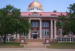 Lawton City Hall | |
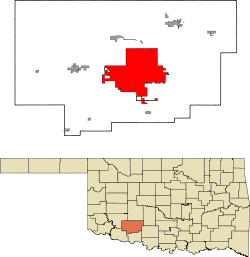 Location in the state of Oklahoma | |
 Lawton, Oklahoma Location in Oklahoma | |
| Coordinates: 34°36′15″N 98°23′44″W / 34.60417°N 98.39556°WCoordinates: 34°36′15″N 98°23′44″W / 34.60417°N 98.39556°W | |
| Country | United States |
| State | Oklahoma |
| County | Comanche |
| Founded | August 6, 1901 |
| Named for | Henry Ware Lawton |
| Government | |
| • Type | Council-manager |
| • Mayor | Fred L. Fitch |
| • City council |
List of Council Members
|
| • City Manager | Jerry Ihler [1] |
| Area | |
| • City | 81.0 sq mi (210 km2) |
| • Land | 81.0 sq mi (210 km2) |
| • Water | 0 sq mi (0 km2) |
| Elevation | 1,112 ft (339 m) |
| Population (2010)[2] | |
| • City | 96,867 |
| • Estimate (2013)[3] | 97,151 |
| • Rank | US: 304th |
| • Density | 1,195.4/sq mi (461.5/km2) |
| • Urban | 94,457 (US: 312th) |
| • Metro | 131,089 (US: 300th) |
| Time zone | UTC−6 (CST) |
| • Summer (DST) | UTC−5 (CDT) |
| ZIP codes | 73501–73507 |
| Area code(s) | 580 |
| FIPS code | 40-41850[4] |
| GNIS feature ID | 1094539[5] |
| Website | City of Lawton |
The city of Lawton is the county seat of Comanche County, in the State of Oklahoma.[6] Located in southwestern Oklahoma, about 87 mi (140 km) southwest of Oklahoma City,[7][8] it is the principal city of the Lawton, Oklahoma Metropolitan Statistical Area. According to the 2010 census, Lawton's population was 96,867, making it the fifth-largest city in the state.[9]
Built on former reservation lands of Kiowa, Comanche, and Apache Indians, Lawton was founded on 6 August 1901, and was named after Major General Henry Ware Lawton, a Civil War Medal of Honor recipient killed in action in the Philippine–American War. Lawton's landscape is typical of the Great Plains, with flat topography and gently rolling hills, while the area north of the city is marked by the Wichita Mountains.
The city's proximity to Fort Sill Military Reservation gave Lawton economic and population stability throughout the 20th century.[10] Although Lawton's economy is still largely dependent on Fort Sill, it has also grown to encompass manufacturing, higher education, health care, and retail.[11] The city's government is run by a council-manager government consisting of a city manager and a city council headed by a mayor. Interstate 44 and three major United States highways serve the city, while Lawton-Fort Sill Regional Airport connects Lawton by air. Recreation can be found at the city's many parks, lakes, museums, and festivals. Notable residents of the city include many musical and literary artists, as well as several professional athletes.
History
The land that is present-day Oklahoma was first settled by prehistoric American Indians including the Clovis 11500 BCE, Folsom 10600 BCE and Plainview 10000 BCE cultures. Historic indigenous peoples who inhabited the region included the Wichita and Caddo peoples. In the 16th century, Spanish explorer Francisco Vásquez de Coronado visited in 1541, beginning European contact. Around the 1700s, two tribes from the north, the Comanches and Kiowas, migrated to the Oklahoma and Texas region.[12]
For most of the 18th century, the Oklahoma region was under nominal French control as Louisiana. The limited interaction between the peoples was based on fur trading. In 1803, the Louisiana Purchase by Thomas Jefferson brought the area under United States control. In 1830, Congress passed the Indian Removal Act, which removed American Indian tribes from the Southeast and relocated them to Indian Territory west of the Mississippi River. The southern part of this territory was originally assigned to the Choctaw and Chickasaw. In 1867, the United States used the Medicine Lodge Treaty to allot the southwest portion of the Choctaw and Chickasaw’s lands to the Comanche, Kiowa, and Apache tribes.[12][13]
Fort Sill was established in 1869 after the American Civil War by Major General Philip Sheridan, who was leading a campaign in the Indian Territory to stop raids into Texas by American Indian tribes.[14] In 1874, the Red River War broke out in the region when the Comanche, Kiowa, and Southern Cheyenne left their Indian Territory reservation. Attrition and skirmishes by the US Army finally forced the return of the tribes back to Indian Territory in June 1875.[14]
In 1891, the United States Congress appointed a commission to meet with the tribal leaders and come to an agreement allowing white settlement. Years of controversy and legal maneuvering ensued before President William McKinley issued a proclamation on 4 July 1901, that gave the federal government control over 2,000,000 acres (8,100 km2) of surplus Indian land.[15][16] Under other legislation, the United States through the Dawes Commission allotted communal lands as plots to individual households of tribal members, selling off what remained as "surplus". These actions extinguished the tribal claims to communal lands, a condition needed for the admission of Oklahoma as a state in 1907.
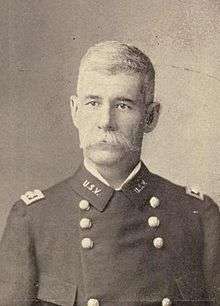
After these changes, the legislature of the new state began to organize counties. Three 320-acre sites in Kiowa, Caddo and Comanche counties were selected for county seats, with Lawton designated as the Comanche County seat. The town was named for Major General Henry W. Lawton, a quartermaster at Fort Sill, who had taken part in the pursuit and capture of Geronimo.[17] The city was opened to settlement through an auction of town lots beginning on 6 August 1901, which was completed 60 days later.[18] By 25 September 1901, the Rock Island Railroad expanded to Lawton and was soon joined by the Frisco Line.[19] The first city elections were held 24 October 1901.[20]
The United States' entry into World War I accelerated growth at Fort Sill and Lawton. The availability of 5 million US gallons (19,000 m3) of water from Lake Lawtonka, just north of Fort Sill, was a catalyst for the War Department to establish a major cantonment named Camp Doniphan, which was active until 1922.[21] Following World War II, Lawton enjoyed steady population growth, with the population increasing from 18,055 to 34,757 from 1940 to 1950.[22] By the 1960s, it had reached 61,697.[22]
In the postwar period, Lawton underwent tremendous growth during the late 1940s and 1950s, leading city officials to seek additional water sources to supplement existing water from Lake Lawtonka. In the late 1950s, the city purchased large parcels of land along East Cache Creek in northern Comanche County for the construction of a man-made lake with a dam built in 1959 on the creek just north of U.S. 277 west of Elgin. Lake Ellsworth, named for a former Lawton mayor, soft-drink bottler C.R. Ellsworth, was dedicated in the early 1960s. It offered additional water resources, but also recreational opportunities and flood control along Cache Creek.[23]
In 1966, the Lawton City Council annexed several miles of land on the city's east, northeast, west, and northwest borders, expanding east beyond the East Cache Creek area and west to 82nd Street.[24][25] On 1 March 1964, the north section of the H. E. Bailey Turnpike was completed, connecting Lawton directly to Oklahoma City, the capital. The south section of the turnpike leading to the Texas border was completed on April 23, 1964.[26] Urban renewal efforts in the 1970s transformed downtown Lawton. A number of buildings dating to the city's founding were demolished to build an enclosed shopping mall.[7]
On 23 June 1998, the city expanded when Lawton annexed neighboring Fort Sill.[27] With the advent of the Base Realignment and Closure of 2005 increasing the size of Fort Sill, Lawton is expected to see continued population and economic growth over the course of the next 20 years.[28]
Geography
Lawton is the fifth largest city in Oklahoma, located at 34°36′16″N 98°23′45″W / 34.60444°N 98.39583°W (34.604444 N, 98.395833 W). The city has a total area of 75.1 sq mi (195 km2), all land.[29] Lawton is located approximately 84 mi (135 km) southwest of Oklahoma City. Other surrounding cities include Wichita Falls about 47 mi (76 km) to the south, Duncan about 33 mi (53 km) to the east, and Altus about 56 mi (90 km) to the west.[30]
Lawton lies in an area typical of the Great Plains, with prairie, few trees, and flat topography with gently rolling hills.[31] The region north of the city consists of the Wichita Mountains, including Mount Scott and Mount Pinchot, the area's highest peaks.[32] The area consists mostly of Permian Post Oak Conglomerate limestone on the northern sections of the city. In the south sections of the city, Permian Garber sandstone is commonly found with some Hennessey Group shale. Area creeks including East Cache Creek contain deposits of Quaternary alluvium. To the northwest, the Wichita Mountains consist primarily of Wichita Granite Group from the Cambrian era.[33]
Climate
Lawton lies in a dry subtropical climate (Köppen climate classification Cfa), with frequent variations in weather daily, except during the constantly hot and dry summer months. Frequent strong winds, usually from the south or south-southeast during the summer, help to lessen the hotter weather. Northerly winds during the winter can occasionally intensify cold periods.[31]
The average mean temperature for southwest Oklahoma is 61.9 °F (16.6 °C). The summers can be extremely hot; Lawton averages 21 days with temperatures 100 °F (37.8 °C) and above.[34] The winter months are typically mild, though periods of extreme cold can occur. Lawton averages eight days that fail to rise above freezing.[34] The city receives about 31.6 inches (800 mm) of precipitation[34] and less than 3 in (80 mm) of snow annually.[31]
Lawton is located squarely in the area known as Tornado Alley and is prone to severe weather from late April through early June.[35] Most notably, an F4 tornado in 1957, and an F3 tornado in 1979 struck the southern region of the city.[36]
| Climate data for Lawton, Oklahoma. (Elevation 1,150ft) | |||||||||||||
|---|---|---|---|---|---|---|---|---|---|---|---|---|---|
| Month | Jan | Feb | Mar | Apr | May | Jun | Jul | Aug | Sep | Oct | Nov | Dec | Year |
| Record high °F (°C) | 85 (29) |
97 (36) |
98 (37) |
100 (38) |
113 (45) |
114 (46) |
114 (46) |
120 (49) |
110 (43) |
104 (40) |
97 (36) |
88 (31) |
120 (49) |
| Average high °F (°C) | 51.8 (11) |
57.1 (13.9) |
65.5 (18.6) |
74.9 (23.8) |
82.3 (27.9) |
90.8 (32.7) |
96.2 (35.7) |
96.1 (35.6) |
87.9 (31.1) |
77.2 (25.1) |
63.8 (17.7) |
53.7 (12.1) |
74.8 (23.8) |
| Average low °F (°C) | 27.1 (−2.7) |
31.2 (−0.4) |
38.9 (3.8) |
49.0 (9.4) |
58.2 (14.6) |
66.8 (19.3) |
70.7 (21.5) |
69.8 (21) |
62.2 (16.8) |
50.6 (10.3) |
38.2 (3.4) |
29.8 (−1.2) |
49.4 (9.7) |
| Record low °F (°C) | −11 (−24) |
−3 (−19) |
6 (−14) |
22 (−6) |
30 (−1) |
45 (7) |
52 (11) |
46 (8) |
35 (2) |
16 (−9) |
11 (−12) |
−8 (−22) |
−11 (−24) |
| Average precipitation inches (mm) | 1.19 (30.2) |
1.36 (34.5) |
2.00 (50.8) |
2.84 (72.1) |
4.97 (126.2) |
3.77 (95.8) |
2.33 (59.2) |
2.38 (60.5) |
3.24 (82.3) |
3.30 (83.8) |
1.71 (43.4) |
1.54 (39.1) |
30.62 (777.7) |
| Average snowfall inches (cm) | 1.4 (3.6) |
1.3 (3.3) |
0.5 (1.3) |
0 (0) |
0 (0) |
0 (0) |
0 (0) |
0 (0) |
0 (0) |
0 (0) |
0.1 (0.3) |
0.6 (1.5) |
4.0 (10.2) |
| Average precipitation days (≥ 0.01 in) | 4.2 | 4.3 | 6.2 | 6.1 | 7.8 | 7.3 | 4.7 | 5.6 | 6.3 | 5.7 | 4.9 | 4.3 | 67.4 |
| Average snowy days (≥ 0.1 in) | 0.3 | 0.3 | 0 | 0 | 0 | 0 | 0 | 0 | 0 | 0 | 0 | 0.1 | 0.7 |
| Source: The Western Regional Climate Center[37] | |||||||||||||
Demographics
| Historical population | |||
|---|---|---|---|
| Census | Pop. | %± | |
| 1910 | 7,788 | — | |
| 1920 | 8,930 | 14.7% | |
| 1930 | 12,121 | 35.7% | |
| 1940 | 18,055 | 49.0% | |
| 1950 | 34,757 | 92.5% | |
| 1960 | 61,697 | 77.5% | |
| 1970 | 74,470 | 20.7% | |
| 1980 | 80,054 | 7.5% | |
| 1990 | 80,561 | 0.6% | |
| 2000 | 92,757 | 15.1% | |
| 2010 | 96,867 | 4.4% | |
| Est. 2016 | 94,653 | [38] | −2.3% |
| U.S. Decennial Census[39] 2013 Estimate[3] | |||
As of the census of 2010, 96,867 people, 34,901 households, and 22,508 families resided in the city. The population density was 1,195.4 people per square mile (461.5/km²). The 39,409 housing units averaged 486.3 per square mile (187.8/km²). The racial makeup of the city was 60.3% White, 21.4% African American, 4.7% Native American, 2.6% Asian, 0.3% Pacific Islander, 3.4% from other races, and 4.9% from two or more races. Hispanics or Latinos of any race were 12.6% (7.8% Mexican, 2.8% Puerto Rican, 0.3% Panamanian).[40]
Of the 34,901 households, 36.6% had children under the age of 18 living with them, 43.8% were married couples living together, 15.8% had a female householder with no husband present, and 35.5% were not families. Of all households, 29.4% were made up of individuals, and 2.3% had someone living alone who was 65 years of age or older. The average household size was 2.48 and the average family size was 3.08.
In the city, the population was distributed as 24.9% under the age of 18, 15.3% from 18 to 24, 30.2% from 25 to 44, 20.3% from 45 to 64, and 9.4% who were 65 years of age or older. The median age was 29 years. For every 100 females, there were 108.1 males. For every 100 females age 18 and over, there were 110.0 males.
The median income for a household in the city was $41,566, and for a family was $50,507. Males had a median income of $36,440 versus $31,825 for females. The per capita income for the city was $20,655. About 16.6% of families and 19.0% of the population were below the poverty line, including 33.5% of those under age 18 and 4.9% of those age 65 or over.
Crime
Lawton has one of the highest crime rates in not only Oklahoma, but the rest of the U.S. Violent crimes and property crimes are the most prevalent, with the respective probabilities of being a victim of these crimes being 1 in 102 and 1 in 22. The overall crime rate is Lawton is 56 per 1000 residents.[41]
Economy and workforce
Lawton is primarily centered on government, manufacturing, and retail trade industries. Lawton MSA ranks fourth in Oklahoma with a gross domestic product of $4.2 billion produced in 2008, with a majority ($2.1 billion) in the government sector.[11] Fort Sill is the largest employer in Lawton, with over 5,000 full-time employees. In the private sector, the largest employer is Goodyear Tire and Rubber Company with 2,400 full-time employees. Major employers in the Lawton area also include: Lawton Public Schools, Comanche County Memorial Hospital, City of Lawton, and Cameron University. Lawton includes two major industrial parks. One is located in the southwest region of town, while the second is located near the Lawton-Fort Sill Regional Airport.[42]
At present, the city of Lawton is undertaking the Downtown Revitalization Project. Its goal is to redesign the areas between Elmer Thomas Park at the north through Central Mall to the south to be more visually appealing and pedestrian friendly to encourage business growth in the area.[43][44]
Lawton had 35,374 employed civilians as of the 2010 Census, and of them, 49.1% were female. Of the civilian workers, 21,842 (61.7%) were private for-profit wage and salary workers. Of the for-profit wage and salary workers, 659 (1.9% of the total Lawton civilian workforce) were employees of their own corporations. The nonprofit sector had 2,571 (7.3%) private nonprofit wage and salary workers. The government sector included 4,713 (13.3%) federal workers, 2,545 (7.2%) state government workers, and 2,160 (6.1%) local government workers. In addition, the city had 1,634 (4.6%) self-employed workers and unpaid family workers.[45]
Arts and culture
Events and festivals
Lawton is home to many annual attractions, including the Prince of Peace Easter passion play held in the Holy City in the Wichita Mountain Refuge each year on Palm Sunday, continuing to Easter Eve. It continues to be one of the longest-running Easter passion plays in the nation and was the basis for the 1949 movie The Prince of Peace.[46][47] The passion play was also featured in a documentary called Jesus Town, USA which focuses on a new actor portraying the role of Jesus after the former actor of 8 years retired from the role.[48] The documentary is light-hearted and amusing, but turns slightly serious when he announces to the camera that he had become a Buddhist. He struggles with the decision to tell his fellow castmates and family about his rejection of the Christian church. Many folks are upset about his decision, but he is allowed to continue in the role of Jesus despite his faith.
In May, Lawton Arts for All, Inc hosts the Arts for All Festival. The festival accommodates several judged art competitions, as well as live entertainment. The festival is typically held at Shepler Park.[49] In late September, The International Festival is held in the city. Founded in 1979, the event showcases the many different culture, arts, and music of the community.[50][51]
Museums
Lawton has three public museums. The Museum of the Great Plains is dedicated to natural history and early settlement of the Great Plains.[52] Outdoor exhibits include a replica of the Red River Trading Post, the original Blue Beaver schoolhouse, and Elgin Train Depot with a Frisco locomotive.[53] The Fort Sill Museum, located on the military base of the same name, includes the old Fort Sill corral and several period buildings, including the old post guardhouse, chapel, and barracks, as well as several artillery pieces.[54] The old fort is also designated as a National Historic Landmark.[55] The Comanche National Museum and Cultural Center, operated by the Comanche Nation Tribe, focuses on exhibits and art relating to the Comanche culture past and present. The museum also hosts traveling American Indian exhibitions from the Smithsonian Institution, Michigan State University Museum, and Chicago's Field Museum.[56]
Sports
Lawton is home to Cameron University, which is a NCAA Division II school in the Lone Star Conference. Noted for winning the NAIA Football National Championship in 1987, the school currently does not have a football program. However, Cameron remains competitive in 10 varsity sports, including Men's and Women's Basketball, Baseball, and Softball.[57][58]
Lawton was the former home to the Lawton-Fort Sill Cavalry. The Cavalry moved in 2007 from Oklahoma City to Lawton, where they won two Continental Basketball Association championships and a Premier Basketball League championship.[59][60] In 2011, the Cavalry ceased operations in their second year in the PBL.[61]
Parks and recreation

Lawton is home to 80 parks and recreation areas in varying sizes, including the largest Elmer Thomas Park.[62] Along with the park system, the city is near three major lakes, Lake Lawtonka, Lake Ellsworth, and Elmer Thomas Lake, where boating, swimming, camping, and fishing are permitted.[63] The Lawton branch of the Young Men's Christian Association (YMCA) offers a wide variety of recreational programs to members, and the Lawton Country Club maintains an 18 hole, par 71 golf course.[64][65] Recreation can also be found in many amateur leagues, including: adult softball, youth baseball, soccer, softball, and volleyball.[66]
Northwest of the city is the Wichita Mountains Wildlife Refuge, managed by the US Fish and Wildlife Service to preserve the natural fauna of southwest Oklahoma. The refuge includes a Visitor Center, several camping areas, hiking trails, and many lakes for the public to explore.[67]
Government
| Mayor | Fred L. Fitch "Mayor's Office". |
| Ward 1 | Robert Morford "Robert Morford". |
| Ward 2 | Keith Jackson "Keith Jackson". |
| Ward 3 | Caleb Davis "Caleb Davis". |
| Ward 4 | Jay Burk "Jay Burk". |
| Ward 5 | Dwight Tanner, Jr "Dwight Tanner". |
| Ward 6 | Cherry Phillips "Cherry Phillips". |
| Ward 7 | V. Gay Freeman McGahee "Gay McHahee". |
| Ward 8 | Doug Wells "Doug Well". |
Lawton uses the council-manager model of municipal government. The city's primary authority resides in the City Council, which approves ordinances, resolutions, and contracts. The city is divided into eight wards, with each ward electing a single city council representative for a three-year term.[68] The mayor, who is elected every three years, presides and sets the agenda of the City Council, but is primarily ceremonial as a head of government.[69] The administrative day-to-day operation of the city is headed by the City Manager, who is appointed by the City Council.[70] As of August 2016, the Mayor of Lawton was Fred L. Fitch. As of July 2015, the City Manager was Gerald (Jerry) S. Ihler.[68][71]
Lawton is the county seat of Comanche County, and houses county offices and courts. Three elected commissioners serving four-year terms manage the county government.[72]
At the federal level, Lawton lies in Oklahoma 4th Congressional District, represented by Tom Cole.[73] In the State Senate, Lawton is in District 31 (Don Barrington) and 32 (Randy Bass).[74][75] In the House, District 62 (John Michael Montgomery ), 63 (Jeff Coody), and 64 (Ann Coody) cover the city.[76]
Education
Higher education
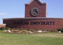
Cameron University is the largest four-year, state-funded university in southwest Oklahoma, offering more than 50 degree programs in areas of Business, Education, Liberal Arts, and Science and Technology.[77] Founded in 1909, Cameron has an average fall enrollment of 6,000 students with 70 endowed faculty positions.[78] Other colleges in Lawton include Comanche Nation College. Founded in 2004, the college provides lower-division programs and educational opportunities in higher education for the Comanche Nation and the public.[79][80]
Lawton is also served by the Great Plains Technology Center, which is part of the Oklahoma Department of Career and Technology Education system. Great Plains provides occupational education, training, and development opportunities to area residents.[81]
Primary and secondary schools
Lawton Public Schools serves most of the city of Lawton. The district operates two prekindergarten centers, 24 elementary schools, four middle schools, and three high schools – Eisenhower, Lawton, and MacArthur.[82] In 2008, Lawton Public Schools had an enrollment of about 16,000 students with about 1,000 teachers.[83] Two independent districts, Bishop and Flower Mound, serve portions of Lawton. Bishop operates a single PK–6 elementary campus and Flower Mound has a PK–8 campus. Secondary students living in these districts attend Lawton Public Schools. A small portion of far-west Lawton is served by Cache Public Schools.[84]
Other schools in Lawton include St. Mary's Catholic School, which has both elementary and middle schools. St. Mary's has served the greater Lawton area and the Fort Sill community for over 100 years and offers accredited Catholic education for grades pre-K through eighth grade.[85] Trinity Christian Academy, Lawton Academy of Arts & Science, and Lawton Christian School are three other private schools. Trinity Christian Academy offers classes from K–3 through the eighth grade.[86] Lawton Academy of Arts & Science, and Lawton Christian has the city's only two private independent high schools. Lawton Christian, founded in 1976, offers education from prekindergarten through the 12th grade, and has a student body of 426 students.[87]
Media
The Lawton Constitution, the only daily newspaper published in Lawton, has a circulation of 30,000. In addition, the Fort Sill newspaper, The Cannoneer, is published weekly primarily for military personnel, as well as the newspaper The Cameron Collegian, whose main audience is Cameron University students.[88] Additionally, Okie Magazine is a monthly magazine that focuses on news and entertainment in the Southwest Oklahoma area.[89]
Radio stations in Lawton include two AM stations – CBS Sports Radio affiliate KXCA (1050) and urban adult contemporary station KKRX (1380) – and 15 FM stations – including NPR member KCCU (89.3), country stations KFXI (92.1) and KLAW (101.3), rock music station KZCD (94.1), Hot AC station KMGZ (95.3), urban contemporary outlet KJMZ (97.9), and CHR station KVRW (107.3).[88]
"Lawton Living Magazine". With You in Mind Publications. is a free magazine distributed throughout Lawton and Duncan with stories, historical pieces, pictorials, and articles describing philanthropic individuals or organizations; an online version of magazine available through Amazon.
Lawton is part of a bi-state media market that also includes the nearby, larger city of Wichita Falls, Texas; the market, which encompasses six counties in southwestern Oklahoma and ten counties in western north Texas, has 152,950 households with at least one television set, making it the 148th-largest in the nation as of the 2016–2017 season, according to Nielsen Media Research.[90] KSWO-TV (channel 7), an ABC affiliate (which also carries affiliations with MeTV and Telemundo on digital subchannels), is the only broadcast television station in the market that is licensed to Lawton, and its local news programming maintains a primary focus on southwestern Oklahoma in its coverage.[91] All other major stations in the area, including KFDX-TV (channel 3; NBC), KAUZ-TV (channel 6; CBS, which is a sister station to KSWO through a shared services agreement but maintains separate operations on the Texas side of the market), and KJTL (channel 18; Fox), are based in Wichita Falls.
Infrastructure
Transportation
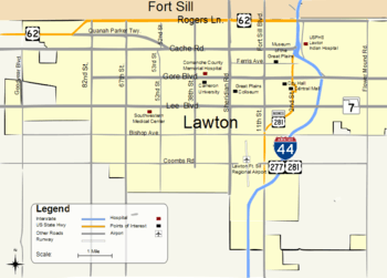
Lawton is primarily served by Interstate 44, designated as the H. E. Bailey Turnpike. It connects the city to Oklahoma City to the northeast and to Wichita Falls, Texas, to the south. The city is also connected by US Highway 62, which connects to the regional towns of Altus to the west and Anadarko to the north. Other major thoroughfares include US Highway 277 and 281, which parallels the H. E. Bailey Turnpike to Wichita Falls to the south and leads to regional towns of Anadarko and Chickasha, respectively, to the north, and OK-7, which connects Lawton to Duncan.[92]
Lawton Area Transit System (LATS) provides public transit for both Lawton and Fort Sill. Founded in 2002, LATS had a ridership of 427,088 in 2009,[93] and provides five major routes throughout the city.[94]
By air, Lawton is served by the Lawton-Fort Sill Regional Airport (LAW, KLAW). At present, it offers daily American Eagle flights to Dallas/Fort Worth International Airport, and is also used for military transport.[95][96]
Health care
Lawton has three major hospitals in the area. The largest, Comanche County Memorial Hospital, is a 283-bed nonprofit hospital that employs 250 physicians.[97] Southwestern Medical Center is a 199-bed hospital with a staff of 150 physicians.[98] In addition, the U.S. Public Health Lawton Indian Hospital is located in the city to provide health services for the large American Indian population. It has 26 beds with a staff of 23 physicians.[99]
Notable people
Musicians and authors
Notable musicians from Lawton include country singers Bryan White,[100] Kelly Willis,[101] and Leon Russell,[102] Sissy Brown, and Grammy nominated jazz trombonist Conrad Herwig.[103][104] Notable authors include Pulitzer Prize-winning author N. Scott Momaday,[105] poet Don Blanding,[106] Hugo Award-winning science fiction writer C. J. Cherryh[107] and Christian fiction author Cheryl Wolverton.
Political leaders
Among the prominent political leaders from Lawton are: US Senator Thomas Gore,[108] US Representatives Scott Ferris,[109] L. M. Gensman,[110] Elmer Thomas,[111] Speaker of the Oklahoma House of Representatives T.W. Shannon,[112] Democratic State Senator Randy Bass[113] and former US Ambassador to Czechoslovakia Julian Niemczyk (born on Fort Sill).[114] Oklahoma State Supreme Court Justice Fletcher Riley came to Lawton with his parents in 1901 and resided there until going to Oklahoma University in 1916.[115]
Frontier lawman Heck Thomas, who in 1896 captured the outlaw Bill Doolin, the founder of the Wild Bunch gang, spent his later years as the first elected police chief in Lawton.
Gregory A. Miller, an attorney and a Republican member of the Louisiana House of Representatives from St. Charles Parish, was born at Fort Sill in 1962, where his father, Ralph R. Miller, was stationed. Ralph Miller was a state representative from St. Charles Parish from 1968 to 1980 and 1982 to 1992.[116]
Other notable residents
Other notable Lawton residents include World War II Comanche code talker Charles Chibitty,[117] Academy Award-winning actress Joan Crawford,[118] WWII ace Robert S. Johnson,[119] actor Paul Sparks, Jesse Dalton from Dalton Gang Outdoors, television personality and producer Paul Harrop,[120] three-time NBA champion Stacey King,[121] former NBA All-Star Michael Ray Richardson,[122] Miss America 2007 Lauren Nelson,[123] infamous University of Oklahoma quarterback Charles Thompson,[124] NFL Pro Bowlers Will Shields[125] and Jammal Brown,[126] 2006 contender, champion boxer Grady Brewer,[127] Buffalo Bisons manager and former MLB infielder Marty Brown, former MLB catcher Tom Jordan, and IFBB professional bodybuilder Vickie Gates.[128]
References
- ↑ https://www.lawtonok.gov/departments/city-manager
- ↑ "American FactFinder". United States Census Bureau. Retrieved 2014-08-30.
- 1 2 "Population Estimates". United States Census Bureau. Archived from the original on 2014-05-22. Retrieved 2014-08-30.
- ↑ American Fact Finder. "Geographic Identifiers". US Census Bureau. Retrieved 2011-05-05.
- ↑ "Lawton". Geographic Names Information System. United States Geological Survey. 18 December 1979. Retrieved 5 May 2011.
- ↑ "Places in Comanche County, OK". National Association of Counties. Archived from the original on 13 January 2013. Retrieved 5 May 2011.
- 1 2 Savage, Cynthia. "Lawton". Encyclopedia of Oklahoma History and Culture. Archived from the original on 18 May 2010. Retrieved 17 June 2010.
- ↑ "Lawton". Encyclopedia of Oklahoma History and Culture. Archived from the original on 31 May 2010. Retrieved 17 June 2010.
- ↑ "U.S. Census Bureau Delivers Oklahoma's 2010 Census Population Totals". US Census Bureau. Archived from the original on 19 February 2011. Retrieved 3 April 2010.
- ↑ "Major Employers". Lawton Ft. Sill Economic Development Team. Archived from the original on 20 August 2008. Retrieved 15 May 2010.
- 1 2 "Gross Domestic Product by Metropolitan Area". Archived from the original on 23 May 2017. Retrieved 19 May 2010.
- 1 2 "Oklahoma Almanac 2005" (pdf). Oklahoma History. Oklahoma Department of Libraries. pp. 687–691. Retrieved 25 April 2011.
- ↑ Kappler, Charles (1903). Indian Affairs: Laws and treaties. 2. Washington D.C.: Government Printing Office. p. 755.
- 1 2 "Fort Sill". Globalsecurity.org. Retrieved 23 May 2010.
- ↑ Lone Wolf v. Hitchcock, 187 U.S. 553 (1903).
- ↑ Kappler, Charles (1904). Indian Affairs: Laws and treaties. 1. Washington D.C.: Government Printing Office. p. 1012.
- ↑ "Major-General Henry Ware Lawton, U.S. Volunteers". The California Military Museum. Retrieved 23 May 2010.
- ↑ Kutchta, Howard (2001). Lawton, a centennial history, 1901-2001. Bell Books. pp. 7–8.
- ↑ Kutchta (2001) p. 10
- ↑ Kutchta (2001) p. 15
- ↑ Kutchta (2001) p. 28
- 1 2 "Historical census population; City by County 1890 to 2000" (PDF). Oklahoma Department of Commerce. Archived from the original (pdf) on 1 June 2010. Retrieved 13 May 2010.
- ↑ Kutchta (2001) p. 72
- ↑ Official State Highway Map (Map) (1954 ed.). Oklahoma Department of Transportation.
- ↑ Official State Highway Map (Map) (1975 ed.). Oklahoma Department of Transportation.
- ↑ "History". Oklahoma Turnpike Authority. Retrieved 27 September 2011.
- ↑ Kutchta (2001) p. 100
- ↑ "Lawton figures Fort Sill annex to add 12500".
- ↑ "U.S. Gazetteer Files". U.S. Census Bureau. Retrieved 20 April 2010.
- ↑ Official State Highway Map (Map) (2009 ed.). Oklahoma Department of Transportation.
- 1 2 3 "Oklahoma's Climate: An overview" (pdf). University of Oklahoma. Retrieved 20 April 2010.
- ↑ "Frequently Asked Questions". US Fish and Wildlife Service. Archived from the original on 26 July 2010. Retrieved 28 May 2010.
- ↑ "Reconnaissance of the Water Resources of the Lawton Quadrangle, Southwestern Oklahoma" (pdf). Oklahoma Geological Survey. Retrieved 26 April 2011.
- 1 2 3 "Lawton, OK" (PDF). Climatography of the United States. National Oceanic and Atmospheric Administration. NO. 20 1971−2000. Archived from the original (PDF) on 13 July 2014. Retrieved 7 February 2011.
- ↑ Edwards, Rodger. "Tornado Climatology". Storm Prediction Center. Retrieved 29 May 2010.
- ↑ "Comanche County, OK Tornadoes (1875–2009)". National Weather Service - Norman. Retrieved 28 May 2010.
- ↑ "Seasonal Temperature and Precipitation Information". Western Regional Climate Center. Retrieved 2 April 2013.
- ↑ "Annual Estimates of the Resident Population for Incorporated Places: April 1, 2010 to July 1, 2015". Archived from the original on 2 June 2016. Retrieved 2 July 2016.
- ↑ "Census of Population and Housing". United States Census Bureau. Archived from the original on 12 May 2015. Retrieved 30 August 2014.
- ↑ "Archived copy". Archived from the original on 18 December 2014. Retrieved 8 October 2014.
- ↑ "Lawton crime rates". Neighborhood Scout. Retrieved 29 January 2018.
- ↑ "Lawton Municipal Airport". Lawton Fort Sill Economic Development Team. Archived from the original on 20 August 2008. Retrieved 15 May 2010.
- ↑ "Downtown Revitalization Plan". City of Lawton Oklahoma. Archived from the original on 24 June 2010. Retrieved 15 May 2010.
- ↑ "Downtown Lawton Actions" (PDF). City of Lawton Oklahoma. Archived from the original (pdf) on 21 July 2011. Retrieved 15 May 2010.
- ↑ "Lawton, Oklahoma". Class of Worker by Sex and Median Earnings in the Past 12 Months (In 2010 Inflation-Adjusted Dollars) for the Civilian Employed Population 16 Years and Over. US Census Bureau. 2010. S2408. Retrieved 24 October 2011.
- ↑ "About Us". The Holy City of the Wichitas. Archived from the original on 9 April 2010. Retrieved 23 April 2010.
- ↑ The Lawton Story on IMDb
- ↑ "Jesus Town, USA". plot summary. IMDb.
- ↑ "AFA Festival". Arts for All Lawton. Archived from the original on 17 March 2010. Retrieved 16 May 2010.
- ↑ Kutchta (2001) p. 98
- ↑ "International Festival". City of Lawton Oklahoma. Retrieved 23 April 2010.
- ↑ "Museum of the Great Plains Educators". Museum of the Great Plains. Archived from the original on 6 December 2010. Retrieved 7 April 2011.
- ↑ "Museum of the Great Plains Outdoor Exhibits". Museum of the Great Plains. Archived from the original on 9 October 2010. Retrieved 23 April 2010.
- ↑ "Museum History". Fort Sill Historical Landmark Museum. Retrieved 11 November 2010.
- ↑ "Fort Sill". National Historic Landmarks Program. National Park Service. Archived from the original on 14 December 2009. Retrieved 25 June 2010.
- ↑ "About the Museum". Comanche Nation Museum. Archived from the original on 14 April 2011. Retrieved 5 April 2011.
- ↑ "Championship Records" (pdf). National Association of Intercollegiate Athletics. Retrieved 2 June 2010.
- ↑ "Sports Information". Cameron Office of Sports Information. Archived from the original on 4 February 2011. Retrieved 3 April 2011.
- ↑ "CBA Cavalry finds a home; Lawton steps up". The Daily Oklahoman. 10 July 2007.
- ↑ Nick Livingston (2010-04-29). "Consistency key to Cavalry's title success". The Lawton Constitution.
- ↑ "Lawton-Fort Sill Cavs suspend operations". KSWO. Archived from the original on 5 September 2012. Retrieved 26 April 2011.
- ↑ "Parks & Grounds". City of Lawton Oklahoma. Retrieved 23 April 2010.
- ↑ "Lakes Division". City of Lawton Oklahoma. Retrieved 23 April 2010.
- ↑ "LFY Our Cause". Lawton Family YMCA. Archived from the original on 24 April 2012. Retrieved 27 September 2011.
- ↑ "Course Information". Lawton Country Club. Archived from the original on 23 March 2012. Retrieved 27 April 2011.
- ↑ "Sports&Aquatics". City of Lawton Oklahoma. Retrieved 23 April 2010.
- ↑ "Wichita Mountains Wildlife Refuge". Frequently Asked Questions. US Fish & Wildlife Service. Archived from the original on 27 February 2010. Retrieved 23 April 2010.
- 1 2 3 "Mayor/Council". City of Lawton Oklahoma. Retrieved 16 May 2017.
- ↑ "Lawton, Oklahoma, Municipal Code art. C-2-2". Archived from the original on 26 July 2011. (accessed 2011-03-30)
- ↑ {{cite web |url=http://search.municode.com/html/14726/level2/APXCCICHLA_ARTC-3CIMAADDEATOFAT.html#APXCCICHLA_ARTC-3CIMAADDEATOFAT_C-3-3CIMAOWDU |title=Lawton, Oklahoma, Municipal Code art. C-3-2 |archive-url=https://web.archive.org/web/20110726142106/http://search.municode.com/html/14726/level2/APXCCICHLA_ARTC-3CIMAADDEATOFAT.html#APXCCICHLA_ARTC-3CIMAADDEATOFAT_C-3-3CIMAOWDU |archive-date=July 26, 2011 |access-date=2011-03-30} |df=dmy-all}
- ↑ "City manager named". The Lawton Constitution. 24 June 2015.
- ↑ "Board of Commissioners". Comanche County of Oklahoma. Retrieved 15 May 2010.
- ↑ "2002 Congressional Districts". Oklahoma House of Senate. Archived from the original on 28 May 2010. Retrieved 14 May 2010.
- ↑ "Senate District 31" (PDF). Oklahoma Senate. Archived from the original (pdf) on 27 May 2010. Retrieved 14 May 2010.
- ↑ "Senate District 32" (PDF). Oklahoma Senate. Archived from the original (pdf) on 27 May 2010. Retrieved 14 May 2010.
- ↑ "Stillwater Lawton Enid House Districts Map" (pdf). Oklahoma House of Representatives. Retrieved 14 May 2010.
- ↑ "Academic Information". Cameron University. Archived from the original on 27 May 2010. Retrieved 30 May 2010.
- ↑ "CU Fast Facts". Cameron University. Archived from the original on 28 August 2013. Retrieved 23 April 2010.
- ↑ "Mission / Purpose". Comanche Nation College. Retrieved 20 January 2012.
- ↑ "History of the Comanche Nation College" (pdf). Comanche Nation College. p. 3.
- ↑ "About GPTC". Great Plain Technology Center. Retrieved 23 April 2010.
- ↑ "Schools". Lawton Public Schools. Archived from the original on 17 December 2002. Retrieved 30 May 2010.
- ↑ "District details for Lawton". National Center for Educational Statistics. Retrieved 4 April 2011.
- ↑ "School Districts". Comanche County Oklahoma. Retrieved 27 April 2011.
- ↑ "Home". St. Mary's Catholic School of Lawton. Archived from the original on 16 July 2011. Retrieved 25 April 2011.
- ↑ "Student Application". Trinity Christian Academy. Archived from the original on 22 March 2012. Retrieved 4 April 2011.
- ↑ "About Us". Lawton Christian Schools. Retrieved 14 May 2010.
- 1 2 "City Services". Lawton Fort Sill Chamber of Commerce. Retrieved 24 May 2010.
- ↑ "Okie Magazine". MondoTimes. Retrieved 11 November 2010.
- ↑ "Local Television Market Universe Estimates" (PDF). Nielsen Media Research. Retrieved 2 August 2017.
- ↑ "About KSWO-TV". KSWO-TV. Retrieved 24 May 2010.
- ↑ Official State Highway Map (Map) (2010 ed.). Oklahoma Department of Transportation.
- ↑ "2010 Directory of Public Transportation in Oklahoma" (pdf). Oklahoma Department of Transportation. pp. 20–21. Retrieved 24 January 2012.
- ↑ "RIDE LATS". Lawton Area Transit System. Retrieved 24 May 2010.
- ↑ "American/American Eagle Airlines". Lawton Metropolitan Area Airport Authority. Archived from the original on 23 July 2011. Retrieved 3 April 2011.
- ↑ "Lawton-Fort Sill Regional Airport". AirNav. Retrieved 24 May 2010.
- ↑ "About US". Comanche County Memorial Hospital. Retrieved 2011-05-05.
- ↑ "Lawton, Ok". Capella Healthcare. Archived from the original on 7 April 2011. Retrieved 27 April 2011.
- ↑ "Lawton Service Unit". Indian Health Services. Retrieved 3 April 2011.
- ↑ White, Bryan. "About Bryan White". Archived from the original on 16 May 2010. Retrieved 30 May 2010.
- ↑ Kelly Willis (I) on IMDb
- ↑ "Leon Russell". Country Music Television. Retrieved 30 May 2010.
- ↑ Herwig, Conrad. "Press Materials". Retrieved 25 April 2011.
- ↑ Chancellor, Jennifer (16 February 2010). "In his element: Drozd in tune as a master teacher" (PDF). Tulsa World. Tulsa Oklahoma. Retrieved 30 May 2010.
- ↑ "Momaday, N. Scott". Oklahoma State Digital Library. Archived from the original on 30 July 2010. Retrieved 30 May 2010.
- ↑ Goins, Charles; Goble, Danney; Morris, John W. (2006). Historical Atlas of Oklahoma. Norman, Oklahoma: University of Oklahoma Press. p. 232.
- ↑ "Cherry, Caroline Janice". Oklahoma State Digital Library. Archived from the original on 18 October 2010. Retrieved 30 May 2010.
- ↑ "Gore, Thomas Pryor". Biographical Directory. United States Congress. Retrieved 24 October 2011.
- ↑ "Ferris, Scott". Biographical Directory. United States Congress. Retrieved 24 October 2011.
- ↑ Biographical Directory of the United States Congress. "Gensman, Lorraine Michael". Retrieved 24 October 2011.
- ↑ "Thomas, John William Elmer". Biographical Directory. United States Congress. Retrieved 24 October 2011.
- ↑ McNutt, Michael (9 January 2013). "T.W. Shannon, of Lawton, officially takes Oklahoma House speaker's post". The Oklahoman. Retrieved 21 January 2014.
- ↑ "Senator Randy Bass - District 32". Oklahoma State Senate. Archived from the original on 27 May 2010. Retrieved 30 May 2010.
- ↑ "Julian M. Niemczyk". The Notable Names Database. Retrieved 30 May 2010.
- ↑ Riley, Fletcher (1930). Harlow, Victor E., ed. Makers of Government in Oklahoma. Oklahoma City: Harlow Publishing Co. p. 128. Retrieved 9 May 2018 – via Google Books.
- ↑ "Mary Sparacello, St. Charles Parish-based 56th Louisiana House district draws trio of hopefuls". New Orleans Times-Picayune. 28 September 2011. Retrieved 26 August 2013.
- ↑ Holley, Joe (26 July 2005). "Comanche code talker Charles Chibitty dies". Obituary. The Washington Post. Washington DC. Retrieved 30 May 2010.
- ↑ "Crawford, Joan". Encyclopedia of Oklahoma History and Culture. Archived from the original on 18 October 2010. Retrieved 3 April 2011.
- ↑ "Robert S. Johnson". Air University. Retrieved 30 May 2010.
- ↑ "Paul Harrop". KAUZ Newschannel 6. Retrieved 28 September 2017.
- ↑ "Stacey King NBA & ABA Statistics". Basketball Reference. Retrieved 30 May 2010.
- ↑ "Where is Micheal Ray Richardson?". 2011-08-17.
- ↑ Lauren Nelson on IMDb
- ↑ "Thompson released". Sports People: Football. The New York Times. New York City, NY. 16 February 1989. Retrieved 7 July 2010.
- ↑ "Retired Jersey: #75". huskers.com (Nebraska Athletics official website). Retrieved 30 May 2010.
- ↑ "Jammal Brown". Pro Football Reference. Retrieved 20 March 2011.
- ↑ "Grady Brewer". BoxRec. Retrieved 20 March 2011.
- ↑ "Vickie Gates profile". Archived from the original on 8 March 2005.
External links
| Wikivoyage has a travel guide for Lawton (Oklahoma). |
- "Lawton official website".
- Lawton, Oklahoma at Curlie (based on DMOZ)
Municipalities and communities of Comanche County, Oklahoma, United States | ||
|---|---|---|
| Cities | 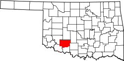 | |
| Towns | ||
| Unincorporated communities | ||
| Footnotes | ‡This populated place also has portions in an adjacent county or counties | |