Pittsburg County, Oklahoma
| Pittsburg County, Oklahoma | |
|---|---|
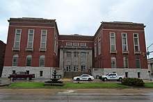 Pittsburg County Courthouse | |
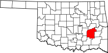 Location in the U.S. state of Oklahoma | |
 Oklahoma's location in the U.S. | |
| Founded | 1907 |
| Seat | McAlester |
| Largest city | McAlester |
| Area | |
| • Total | 1,378 sq mi (3,569 km2) |
| • Land | 1,305 sq mi (3,380 km2) |
| • Water | 72 sq mi (186 km2), 5.3% |
| Population (est.) | |
| • (2013) | 44,703 |
| • Density | 35/sq mi (14/km2) |
| Congressional district | 2nd |
| Website |
pittsburg |
Pittsburg County is a county located in the U.S. state of Oklahoma. As of the 2010 census, the population was 45,837.[1] Its county seat is McAlester.[2] The county was formed from part of the Choctaw Nation in Indian Territory in 1907. County leaders believed that its coal production compared favorably with Pittsburgh, Pennsylvania at the time of statehood.[3]
Pittsburg County comprises the McAlester, OK Micropolitan Statistical Area.
History
The area forms the present Pittsburg county was part of the Choctaw Nation after the Choctaw tribe was forced to relocate to Indian Territory from its home in the Southeastern United States in the early 1830s. Some important trails, including the Texas Road and one route of the California Trail passed through it. In 1840, James Perry established a village called Perryville that became an important stop near the place where the two trails crossed. During the Civil War, Perryville served as an important supply depot for Confederate forces until the Union Army captured and burned the town. It became defunct after the Missouri, Kansas and Texas Railway (MK&T) bypassed it in 1872, and the remaining inhabitants moved to McAlester. The Butterfield Overland Mail route followed a route through this area.[3]
James J. McAlester moved to the Choctaw Nation in 1872, opened a trading post and married a Chickasaw woman. This qualified him to obtain citizenship rights in the Choctaw and Chickasaw Nations. When the MK&T built its line, McAlester laid claim to the coal deposits in the Perryville area, which he and some partners leased to the Osage Coal and Mining Company, which was owned by the Missouri Pacific Railroad and acquired by the MK&T in 1888.[3]
Pittsburg County was formed on July 16, 1907 as an original county from Choctaw land. County leaders, thinking its coal production compared favorably with Pittsburgh, Pennsylvania, was named the new county after the Pennsylvania city with the "h" removed. Coal mining continued to expand until the early 20th century. Production began to decline after 1920, and never fully recovered. By 1966, the county production was no longer reported.[3]
Geography
According to the U.S. Census Bureau, the county has a total area of 1,378 square miles (3,570 km2), of which 1,305 square miles (3,380 km2) is land and 72 square miles (190 km2) (5.3%) is water.[4] The county's topography is generally hilly to mountainous. The Ouachita Mountains extend into the southeastern portion. The Canadian River drains most of the county and with Eufaula Lake form the northern boundary of the county. The southern part of the county is drained by several creeks that flow into the Kiamichi River and then into the Red River.[3]
Adjacent counties
- McIntosh County (north)
- Haskell County (northeast)
- Latimer County (east)
- Pushmataha County (southeast)
- Atoka County (south)
- Coal County (southwest)
- Hughes County (west)
Demographics
| Historical population | |||
|---|---|---|---|
| Census | Pop. | %± | |
| 1910 | 47,650 | — | |
| 1920 | 52,570 | 10.3% | |
| 1930 | 50,778 | −3.4% | |
| 1940 | 48,985 | −3.5% | |
| 1950 | 41,031 | −16.2% | |
| 1960 | 34,360 | −16.3% | |
| 1970 | 37,521 | 9.2% | |
| 1980 | 40,524 | 8.0% | |
| 1990 | 40,581 | 0.1% | |
| 2000 | 43,953 | 8.3% | |
| 2010 | 45,837 | 4.3% | |
| Est. 2016 | 44,173 | [5] | −3.6% |
| U.S. Decennial Census[6] 1790-1960[7] 1900-1990[8] 1990-2000[9] 2010-2013[1] | |||
As of the census[10] of 2010, there were 45,837 people, 18,623 households, and 15,389 families residing in the county. The population density was 13/km² (34/mi²). There were 22,634 housing units at an average density of 6/km² (16/mi²). The racial makeup of the county was 73.6% White/Caucasian, 3.3% Black or African American, 13.8% Native American, 0.40% Asian, 0.03% Pacific Islander, 0.78% from other races, and 7.6% from two or more races. 3.14% of the population were Hispanic or Latino of any race. 17.4% were of American, 12.7% Irish, 11.3% German, 9.4% English and 7.2% Italian ancestry according to Census 2010.
There were 18,623 households out of which 29.00% had children under the age of 18 living with them, 54.90% were married couples living together, 11.20% had a female householder with no husband present, and 30.40% were non-families. 27.70% of all households were made up of individuals and 13.30% had someone living alone who was 65 years of age or older. The average household size was 2.40 and the average family size was 2.90.
In the county, the population was spread out with 23.50% under the age of 18, 7.80% from 18 to 24, 26.90% from 25 to 44, 24.60% from 45 to 64, and 17.10% who were 65 years of age or older. The median age was 39 years. For every 100 females there were 101.50 males. For every 100 females age 18 and over, there were 100.10 males.
The median income for a household in the county was $28,679, and the median income for a family was $35,190. Males had a median income of $28,470 versus $19,886 for females. The per capita income for the county was $15,494. About 13.60% of families and 17.20% of the population were below the poverty line, including 22.70% of those under age 18 and 13.30% of those age 65 or over.
Politics
| Voter Registration and Party Enrollment as of January 15, 2018[11] | |||||
|---|---|---|---|---|---|
| Party | Number of Voters | Percentage | |||
| Democratic | 14,144 | 55.70% | |||
| Republican | 7,393 | 29.11% | |||
| Others | 3,856 | 15.19% | |||
| Total | 25,393 | 100% | |||
| Year | Republican | Democratic | Third Parties |
|---|---|---|---|
| 2016 | 73.8% 12,753 | 21.5% 3,711 | 4.7% 807 |
| 2012 | 69.2% 10,841 | 30.8% 4,831 | |
| 2008 | 68.3% 11,752 | 31.7% 5,457 | |
| 2004 | 59.9% 11,134 | 40.1% 7,452 | |
| 2000 | 52.1% 8,514 | 46.6% 7,627 | 1.3% 216 |
| 1996 | 35.6% 5,966 | 50.6% 8,475 | 13.9% 2,325 |
| 1992 | 30.1% 5,659 | 45.3% 8,523 | 24.7% 4,645 |
| 1988 | 46.5% 7,594 | 52.8% 8,623 | 0.8% 125 |
| 1984 | 58.3% 9,778 | 40.9% 6,860 | 0.7% 122 |
| 1980 | 44.5% 7,062 | 52.3% 8,292 | 3.2% 503 |
| 1976 | 30.6% 4,807 | 68.5% 10,743 | 0.9% 142 |
| 1972 | 66.4% 9,989 | 31.6% 4,748 | 2.0% 303 |
| 1968 | 28.8% 3,978 | 44.2% 6,112 | 27.0% 3,726 |
| 1964 | 26.4% 3,555 | 73.6% 9,903 | |
| 1960 | 44.4% 5,834 | 55.6% 7,310 | |
| 1956 | 38.5% 5,239 | 61.5% 8,382 | |
| 1952 | 38.2% 5,909 | 61.8% 9,546 | |
| 1948 | 23.2% 2,893 | 76.8% 9,576 | |
| 1944 | 32.2% 4,068 | 67.6% 8,535 | 0.2% 23 |
| 1940 | 30.6% 4,484 | 69.3% 10,169 | 0.2% 23 |
| 1936 | 26.7% 3,651 | 73.0% 9,974 | 0.3% 43 |
| 1932 | 18.5% 2,396 | 81.5% 10,536 | |
| 1928 | 49.2% 5,875 | 49.9% 5,960 | 0.9% 107 |
| 1924 | 33.0% 3,554 | 56.3% 6,062 | 10.7% 1,149 |
| 1920 | 47.2% 5,371 | 47.1% 5,361 | 5.8% 655 |
| 1916 | 30.3% 1,879 | 55.4% 3,441 | 14.3% 889 |
| 1912 | 27.1% 1,574 | 47.6% 2,767 | 25.3% 1,473 |
Economy
Although Pittsburg county was originally noted for its coal production, agriculture has long been important to the county economy. Just after statehood, farmers controlled 20 percent of the county's land area. The most important cash crops were corn and cotton. By 1960, sorghum had become the most important crop. In 2000, wheat had become the top crop.[3]
Manufacturing became significant when the U.S. Navy built an ammunition depot at McAlester during World War II. It employed 8,000 people in 1945. The U. S. Army took over the facility in 1977.[3]
The Corps of Engineers built Eufaula Lake between 1956 and 1964, which brought tourism, land development and a major source of hydroelectric power.[3]
Communities
Cities
- Haileyville
- Hartshorne
- Krebs
- McAlester (county seat)
Towns
Census-designated places
Other unincorporated places
NRHP sites
The following sites in Pittsburg County are listed on the National Register of Historic Places:
- Aldridge Hotel, McAlester
- Blackburn's Station Site, Pittsburg
- Busby Office Building, McAlester
- Busby Theatre, McAlester
- Canadian Jail and Livery Stable, Canadian
- Choate Cabin, Indianola
- Cole Chapel School, Hartshorne
- Federal Building and US Courthouse, McAlester
- First Presbyterian Church, McAlester
- Hokey's Drugstore, Krebs
- Jeff Lee Park Bath House and Pool, McAlester
- Mass Grave of the Mexican Miners, McAlester
- McAlester Armory, McAlester
- McAlester DX, McAlester
- McAlester House, McAlester
- McAlester Scottish Rite Temple, McAlester
- Mine Rescue Station Building, McAlester
- New State School, McAlester
- OKLA Theater, McAlester
- Perryville, McAlester
- Pittsburg County Courthouse, McAlester
- Pittsburg School and Gymnasium, Pittsburg
- Southern Ice and Cold Storage Company, Pittsburg
- St. Joseph's Catholic Church, Krebs
- Tipton Ridge School, Blocker
References
- 1 2 "State & County QuickFacts". United States Census Bureau. Archived from the original on July 16, 2011. Retrieved November 12, 2013.
- ↑ "Find a County". National Association of Counties. Retrieved 2011-06-07.
- 1 2 3 4 5 6 7 8 O'Dell, Larry. "Pittsburg County," Encyclopedia of Oklahoma History and Culture, Oklahoma Historical Society, 2009. Accessed April 4, 2015.
- ↑ "2010 Census Gazetteer Files". United States Census Bureau. August 22, 2012. Retrieved February 22, 2015.
- ↑ "Population and Housing Unit Estimates". Retrieved June 9, 2017.
- ↑ "U.S. Decennial Census". United States Census Bureau. Retrieved February 22, 2015.
- ↑ "Historical Census Browser". University of Virginia Library. Retrieved February 22, 2015.
- ↑ Forstall, Richard L., ed. (March 27, 1995). "Population of Counties by Decennial Census: 1900 to 1990". United States Census Bureau. Retrieved February 22, 2015.
- ↑ "Census 2000 PHC-T-4. Ranking Tables for Counties: 1990 and 2000" (PDF). United States Census Bureau. April 2, 2001. Retrieved February 22, 2015.
- ↑ "American FactFinder". United States Census Bureau. Retrieved 2008-01-31.
- ↑ https://www.ok.gov/elections/documents/20180115%20-%20Registration%20By%20County%20%28vr2420%29.pdf
- ↑ Leip, David. "Dave Leip's Atlas of U.S. Presidential Elections". uselectionatlas.org. Retrieved 2018-03-29.
Places adjacent to Pittsburg County, Oklahoma | |
|---|---|
Municipalities and communities of Pittsburg County, Oklahoma, United States | ||
|---|---|---|
| Cities | | |
| Towns | ||
| CDPs | ||
| Other unincorporated communities | ||
| Ghost town | ||
