Interstate 44 in Oklahoma
| ||||
|---|---|---|---|---|
|
I-44 highlighted in red | ||||
| Route information | ||||
| Maintained by ODOT & OTA | ||||
| Length | 328.53 mi[1] (528.72 km) | |||
| Existed | 1956 – present | |||
| Major junctions | ||||
| West end |
| |||
|
| ||||
| East end |
| |||
| Location | ||||
| Counties | Cotton, Comanche, Grady, McClain, Cleveland, Oklahoma, Lincoln, Creek, Tulsa, Rogers, Mayes, Craig, Ottawa | |||
| Highway system | ||||
|
Oklahoma State Highway System
| ||||
.svg.png)
Interstate 44 runs diagonally through the U.S. state of Oklahoma, spanning from the Texas state line near Wichita Falls to the Missouri border near Joplin. It connects three of Oklahoma's largest cities, Oklahoma City, Tulsa, and Lawton. Most of I-44 in Oklahoma is a toll road. In southwestern Oklahoma, I-44 is the H.E. Bailey Turnpike and follows a north–south direction. From Oklahoma City to Tulsa, I-44 follows the Turner Turnpike. As I-44 leaves Tulsa it becomes the Will Rogers Turnpike to the Missouri border. In the Lawton, Oklahoma City, and Tulsa metro areas, I-44 is toll-free.
I-44 is paralleled by former US-66 (now mostly SH-66) from Oklahoma City to the Missouri state line.
In Oklahoma City, I-44 is also known as the Will Rogers Expressway.
Route description

I-44 crosses the Red River near Burkburnett, Texas. It is toll-free until Exit 5, which is the last free exit before the start of the southern section of the H.E. Bailey Turnpike. At Exit 30, the tolls end and I-44 becomes a non-tolled highway again through Lawton and Fort Sill until Exit 46. The northern section of the H.E. Bailey Turnpike carries I-44 north, serving Chickasha, before ending at U.S. Highway 62 (Exit 107) in Newcastle.
From Newcastle, I-44 heads north through rural parts of Oklahoma City before serving as the western terminus of Interstate 240. It then indirectly serves Will Rogers World Airport by connecting to S.W. 59th St. (which becomes S.W. 54th St before reaching the airport) and SH-152, the Airport Road freeway. I-44 meets Interstate 40 west of downtown, at an interchange sometimes referred to as the Amarillo Junction. I-44 then passes west of the state fairgrounds and continues north to provide access to Bethany and Warr Acres. It then turns more eastbound before reaching a junction with Interstate 235, which also signifies the northern end of I-235, and US-77 also known as the Broadway Extension which connects Downtown, Oklahoma City to Edmond Oklahoma. It then meets and follows a stretch of Interstate 35, which it overlaps with until the Turner Turnpike interchange where it takes an easterly turn again.
I-44 then follows the Turner Turnpike to Sapulpa, where it becomes a non-tolled road after meeting OK 66. I-44 bypasses downtown Tulsa; Interstate 244 serves the downtown areas. After meeting the Creek Turnpike again on the east side of the city, I-44 becomes a turnpike once again, gaining the Will Rogers Turnpike designation.
The Will Rogers Turnpike section serves many northeast Oklahoma towns, including Claremore, Vinita (where it passes under the world's largest McDonald's), and Miami. After passing Miami, I-44 crosses the state line into Missouri, about 600 feet south of the Kansas-Missouri-Oklahoma tripoint.
History
I-44 was designated through Oklahoma to replace the section of US-66 running from Oklahoma City to Joplin, Missouri. I-44 covered the already-existing Turner Turnpike and Will Rogers Turnpike, with a western terminus at I-35 in Oklahoma City, the current western terminus of the Turner Turnpike.
I-44 was assigned to the H.E. Bailey Turnpike in 1982, when I-44 was assigned to the west and north legs of I-240 (then a semi-beltway around Oklahoma City) and the H.E. Bailey Turnpike as part of Oklahoma's "Diamond Jubilee" celebrations.[2] Before I-44 was assigned to it, the freeway connector to the north end of the H.E. Bailey Turnpike was named the Will Rogers Expressway.[3] The non-tolled section through Lawton was the Pioneer Expressway.[3]
Westbound I-44 northeast of Tulsa was affected by a sinkhole found on June 2, 2010. According to the local news, the sinkhole measured 12 feet wide and 24 feet long. Traffic was only affected for a short period of time and the roadway has since been reopened.
Southeast of Catoosa, I-44 was redesigned to have an interchange with the eastern expansion of the Creek Turnpike. A 1.5 mile stretch of the original roadbed remains, however it is unused and is not maintained by ODOT or any of the surrounding cities. In 2012, the only bridge over the abandoned stretch, Pine Street, was removed and replaced with a grade crossing.
Interstate 440
| |
|---|---|
| Location | Oklahoma City |
The designation I-440 had been given to a stretch of Interstate Highway from I-240 to US-66 in Oklahoma City. It was a part of the original Grand Boulevard that had been built in compliance with Interstate standards. In 1975, the American Association of State Highway and Transportation Officials approved renumbering I-440 as I-240 to create a single numeric designation for the Oklahoma City loop. In 1982, as part of Oklahoma's "Diamond Jubilee", I-44's western terminus was moved from the I-35/I-44 junction near Edmond, Oklahoma to the Texas/Oklahoma state-line via the Belle Isle Freeway (part of the recently designated I-240 connecting the former I-440 with I-35); I-240, the H.E. Bailey Turnpike; and the turnpike connector road on the eastern edge of Lawton, Oklahoma.[4] While the I-440 number was dropped in 1975, it is available if needed in the future.
Exit list
| County | Location | mi | km | Exit | Destinations | Notes | ||
|---|---|---|---|---|---|---|---|---|
| Cotton | Red River | 0.00 | 0.00 | Continuation into Texas | ||||
| President George W. Bush Bridge | ||||||||
| | 1.13 | 1.82 | 1 | |||||
| | 5.65 | 9.09 | 5 | Eastern terminus of US-277/US-281 concurrency | ||||
| | ||||||||
| Walters | 20.65 | 33.23 | 20 | Walters toll plaza is located at this interchange | ||||
| Comanche | | 30 | Western terminus of US-277/US-281 concurrency | |||||
| Lawton | 33 | |||||||
| 36A | Signed as exits 36A (east) and 36B (west) westbound | |||||||
| 37 | Gore Boulevard | |||||||
| 39B | Westbound exit and eastbound entrance | |||||||
| 39A | Cache Road – Lawton Business District | Signed as exit 38 eastbound | ||||||
| Lawton–Fort Sill line | 40A | Signed as exits 40A (east) and 40B (west) westbound | ||||||
| Fort Sill | 41 | Key Gate | ||||||
| | 45 | |||||||
| | 46 | Eastbound exit and westbound entrance, eastern terminus of US-62/US-277/US-281 concurrency | ||||||
| Elgin | 53 | |||||||
| | 62 | Fletcher, Cyril, Sterling | Westbound exit and eastbound entrance | |||||
| Caddo |
No major junctions | |||||||
| Grady | | Chickasha toll plaza | ||||||
| Chickasha | 80 | |||||||
| 83 | ||||||||
| | Newcastle toll plaza | |||||||
| | 99A | Cloverleaf interchange | ||||||
| | 99B | |||||||
| McClain | Newcastle | |||||||
| 107 | Western terminus of US-62 concurrency | |||||||
| 108 | Western terminus of SH-37 concurrency | |||||||
| 108A | Frontage Road | Westbound exit and eastbound entrance | ||||||
| Cleveland | Oklahoma City | 109 | SW 149th Street | |||||
| 110 | Eastern terminus of SH-37 concurrency | |||||||
| 111 | SW 119th Street | |||||||
| 112 | SW 104th Street | |||||||
| Oklahoma | 113 | SW 89th Street | ||||||
| 114 | SW 74th Street | |||||||
| 115 | Eastern terminus of US-62 concurrency, western terminus of SH-3 concurrency, left exit & no exit number westbound; I-240 exit 1A | |||||||
| 116A | SW 59th Street | |||||||
| 116B | ||||||||
| 117A | SW 44th Street | Signed as exit 117B westbound | ||||||
| 118 | SW 29th Street | |||||||
| 119 | SW 15th Street | |||||||
| 120 | Signed as exits 120A (west) and 120B (east); I-40 exits 147A-B | |||||||
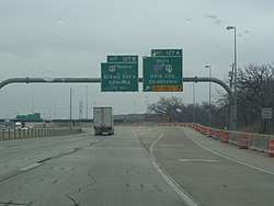
| 121 | NW 10th Street – Fair Park | Signed as exits 121A (east) and 121B (west) | ||||||
| 122 | NW 23rd Street | |||||||
| 123A | NW 36th Street | Eastbound exit and westbound entrance | ||||||
| East end of SH-3 overlap | ||||||||
| 123B | Western terminus of SH-66 concurrency | |||||||
| 124 | N. May Avenue | No westbound entrance | ||||||
| 125A | N. Penn Avenue | Full name is "Pennsylvania" | ||||||
| 125C | Northwest Expressway | No eastbound exit | ||||||
| 125B | Classen Boulevard | No westbound enterance | ||||||
| 126 | Western Avenue | Westbound exits onto NW Grand Blvd | ||||||
| 127 | Split into exits 127A (south) and 127B (north) eastbound; westbound entrance includes direct entrance ramp from N. 63rd Street | |||||||
| 128A | Lincoln Boulevard – State Capitol | |||||||
| 128B | Kelley Avenue | |||||||
| 129 | M.L. King Avenue | |||||||
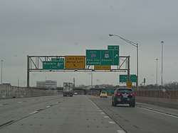
| 130 | Western terminus of I-35 concurrency; I-35 exit 133; no exit number westbound | |||||||
| 134 | Wilshire Boulevard | Exit numbers follow I-35 | ||||||
| 135 | Britton Road | |||||||
| 136 | Hefner Road | |||||||
| 137 | NE 122nd Street | |||||||
| — | Eastern terminus of I-35/SH-66 concurrency; eastbound exit and westbound entrance; I-35 exit 138A | |||||||
| — | No eastbound exit | |||||||
| — | Westbound exit and eastbound entrance | |||||||
| 146 | Luther / Jones | |||||||
| Luther | Eastern Oklahoma County Turnpike south | Under construction since January 2018[5] | ||||||
| Lincoln | Wellston | 158 | ||||||
| Chandler | 166 | |||||||
| Stroud | 179 | |||||||
| Creek | | Stroud Toll Plaza | ||||||
| Bristow | 196 | |||||||
| Sapulpa | 211 | |||||||
| 215 | ||||||||
| 218A | Eastbound exit and westbound entrance | |||||||
| 218B | Eastbound exit and westbound entrance | |||||||
| 221A | 57th West Avenue | Westbound exit only | ||||||
| Creek–Tulsa county line | 221B | Westbound exit and eastbound entrance, west end of SH-66 overlap | ||||||
| Tulsa | 222A | 49th West Avenue | ||||||
| 222B | 55th Place | Eastbound exit only | ||||||
| 222C | 56th Street | Westbound exit only | ||||||
| 223A | Western terminus of I-244; I-244 exit 1A | |||||||
| 223B | 51st Street | Access via Gilcrease Expressway; no eastbound exit | ||||||
| Tulsa | 223C | 33rd West Avenue | ||||||
| 224 | Union Avenue | C/D lanes provide access to US-75 and Elwood Ave. | ||||||
| Cloverleaf interchange; accessible to and from C/D lanes | ||||||||
| 225 | Elwood Avenue | Eastbound access is part of exit 224 accessible from C/D lanes originating at Union Ave. exit | ||||||
| 226A | Riverside Drive | |||||||
| 226B | Peoria Avenue | |||||||
| 227 | Lewis Avenue | |||||||
| 228 | 51st Street / Harvard Avenue | |||||||
| 229 | Yale Avenue | |||||||
| 230 | 41st Street / Sheridan Road | |||||||
| 231 | ||||||||
| 232 | E. 31st Street / Memorial Drive | Eastbound exit is part of exit 231 | ||||||
| 233 | E. 21st Street | Signed as exit 233B westbound | ||||||
| 234A | No eastbound exit to US-169 south | |||||||
| 234B | Garnett Road | Eastbound exit and westbound entrance | ||||||
| 235 | E. 11th Street | |||||||
| 236 | 129th East Avenue | |||||||
| 236B | Westbound exit and eastbound entrance; western terminus of US-412 concurrency; eastern terminus of I-244 | |||||||
| Tulsa–Rogers county line | Tulsa–Catoosa line | 238 | 161st East Avenue | |||||
| 240 | ||||||||
| Catoosa | 241 | No eastbound entrance; east end of SH-66 overlap; no exit number westbound | ||||||
| Tulsa–Fair Oaks line | — | East end of US-412 overlap; left entrances; no westbound exit; former SH-33 east | ||||||
| Rogers | Fair Oaks | — | Left exit and entrances; no eastbound exit; Will Rogers Tpk. exit 34 | |||||
| | 35 | E. Pine Street | Westbound exit and eastbound entrance; exit number based on a continuation of Creek Tpk. mileposts | |||||
| Verdigris | 248 | |||||||
| Claremore | 255 | |||||||
| Mayes | | 269 | Eastbound exit and westbound entrance | |||||
| Craig | Big Cabin | 283 | ||||||
| | Toll plaza | |||||||
| Vinita | Service plaza | |||||||
| | 289 | |||||||
| Ottawa | | 302 | ||||||
| Miami | 313 | |||||||
| Oklahoma–Missouri line | 328.53 | 528.72 | ||||||
| Continuation into Missouri | ||||||||
1.000 mi = 1.609 km; 1.000 km = 0.621 mi
| ||||||||
References
Route map:
- ↑ Stuve, Eric. "Interstate Highways at OKHighways.com". OKHighways. Retrieved 2007-11-11.
- ↑ "I-240 Section Changing to I-44". The Daily Oklahoman. 1982-10-09.
- 1 2 Highway Map of Oklahoma (Map) (1966 ed.). Cartography by Diversified Map Co. Skelly Oil Company. § 11C.
- ↑ "Interstate 240 Oklahoma". Interstate Guide. Retrieved 29 August 2017.
- ↑ "Turnpike Construction Begins". Luther Register. January 18, 2018. Retrieved April 13, 2018.
| Previous state: Texas |
Oklahoma | Next state: Missouri |