Love County, Oklahoma
| Love County, Oklahoma | |
|---|---|
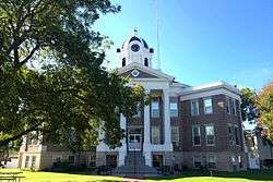 Love County Courthouse in October 2014 | |
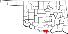 Location in the U.S. state of Oklahoma | |
 Oklahoma's location in the U.S. | |
| Founded | 1907 |
| Named for | Overton Love, a judge of the Chickasaw Nation |
| Seat | Marietta |
| Largest city | Marietta |
| Area | |
| • Total | 532 sq mi (1,378 km2) |
| • Land | 514 sq mi (1,331 km2) |
| • Water | 18 sq mi (47 km2), 3.5% |
| Population (est.) | |
| • (2013) | 9,742 |
| • Density | 18/sq mi (7/km2) |
| Congressional district | 4th |
| Time zone | Central: UTC−6/−5 |
| Website |
love |
Love County is a county on the southern border of the U.S. state of Oklahoma. As of the 2010 census, the population was 9,423.[1] Its county seat is Marietta.[2] The county was created at statehood in 1907 and named for Overton Love, a prominent Chickasaw farmer, entrepreneur and politician.[3]
Love County is a part of the Texoma region.
History
The Louisiana Purchase, effected in 1803, included all of the present state of Oklahoma except the Panhandle. Explorers and traders began travelling extensively through the area, intending to find trade routes to Santa Fe. The Quapaw were the principal Native Americans living south of the Canadian River. The Quapaws ceded their land to the American government in 1818, and were replaced by the Choctaws in the early 1830s. The Chickasaws were assigned land in the middle of Choctaw territory during 1837-8.[3]
Overton Love was one of the earliest Chickasaws who settled in present-day Love County. He was twenty years old when he arrived in Indian Territory from Mississippi in 1843. His settlement became known as Love's Valley (about 6 miles (9.7 km) east of the present town of Marietta). He later became one of the largest Chickasaw landowners and cattle raisers in the area, working 8,000 acres (3,200 ha) of Red River Bottomland.. Eventually, he became a member of both houses of the Chickasaw National Council, a county and district judge, and a member of the Dawes Commission.[3]
Prior to statehood, the area now known as Love County was part of Pickens County, Chickasaw Nation, Indian Territory. It had three incorporated towns: Marietta (the county seat, founded in 1887), Leon (established 1883) and Thackerville (established 1882). It also contained two unincorporated postal areas: Burneyville (post office established 1879) and Overbrook (post office established 1887).[3] The settlement of Courtney at the mouth of Mud Creek was settled ca. 1872 by Henry D. Courtney.
Geography

According to the U.S. Census Bureau, the county has an area of 532 square miles (1,380 km2), of which 514 square miles (1,330 km2) is land and 18 square miles (47 km2) (3.5%) is water.[4] It is the fifth-smallest county in Oklahoma by land area.
Love County is within the Red River Plains physiographic region, with a rolling to hilly topography. The Red River and its tributaries Simon Creek, Walnut Bayou, Hickory Creek and Mud Creek drain the county. Lake Murray is on the northeastern border and Lake Texoma is on the southern border.[3]
Adjacent counties
- Carter County (north)
- Marshall County (east)
- Cooke County, Texas (south)
- Montague County, Texas (southwest)
- Jefferson County (northwest)
Demographics
| Historical population | |||
|---|---|---|---|
| Census | Pop. | %± | |
| 1910 | 10,236 | — | |
| 1920 | 12,433 | 21.5% | |
| 1930 | 9,639 | −22.5% | |
| 1940 | 11,433 | 18.6% | |
| 1950 | 7,721 | −32.5% | |
| 1960 | 5,862 | −24.1% | |
| 1970 | 5,637 | −3.8% | |
| 1980 | 7,469 | 32.5% | |
| 1990 | 8,157 | 9.2% | |
| 2000 | 8,831 | 8.3% | |
| 2010 | 9,423 | 6.7% | |
| Est. 2016 | 9,997 | [5] | 6.1% |
| U.S. Decennial Census[6] 1790-1960[7] 1900-1990[8] 1990-2000[9] 2010-2013[1] | |||

As of the census[10] of 2000, there were 8,831 people, 3,442 households, and 2,557 families residing in the county. The population density was 17 people per square mile (7/km²). There were 4,066 housing units at an average density of 8 per square mile (3/km²). The racial makeup of the county was 84.15% White, 2.19% Black or African American, 6.41% Native American, 0.26% Asian, 0.01% Pacific Islander, 3.58% from other races, and 3.41% from two or more races. 7.01% of the population were Hispanic or Latino of any race.
There were 3,442 households out of which 31.70% had children under the age of 18 living with them, 60.40% were married couples living together, 10.00% had a female householder with no husband present, and 25.70% were non-families. 22.90% of all households were made up of individuals and 12.00% had someone living alone who was 65 years of age or older. The average household size was 2.54 and the average family size was 2.97.
In the county, the population was spread out with 25.70% under the age of 18, 7.00% from 18 to 24, 25.40% from 25 to 44, 25.70% from 45 to 64, and 16.20% who were 65 years of age or older. The median age was 39 years. For every 100 females, there were 98.20 males. For every 100 females age 18 and over, there were 94.90 males.
The county's median household income was $32,558, and the median family income was $38,212. Males had a median income of $30,024 versus $20,578 for females. The county's per capita income was $16,648. About 8.80% of families and 11.80% of the population were below the poverty line, including 14.40% of those under age 18 and 13.80% of those age 65 or over.
Politics
| Voter Registration and Party Enrollment as of January 15, 2018[11] | |||||
|---|---|---|---|---|---|
| Party | Number of Voters | Percentage | |||
| Democratic | 3,181 | 54.39% | |||
| Republican | 1,711 | 29.25% | |||
| Others | 957 | 16.36% | |||
| Total | 5,849 | 100% | |||
| Year | Republican | Democratic | Third Parties |
|---|---|---|---|
| 2016 | 77.1% 2,922 | 19.4% 735 | 3.5% 132 |
| 2012 | 70.2% 2,436 | 29.8% 1,034 | |
| 2008 | 67.3% 2,589 | 32.7% 1,257 | |
| 2004 | 59.9% 2,295 | 40.1% 1,538 | |
| 2000 | 53.6% 1,807 | 45.4% 1,530 | 1.0% 35 |
| 1996 | 37.1% 1,224 | 50.7% 1,675 | 12.3% 405 |
| 1992 | 25.1% 922 | 46.4% 1,708 | 28.5% 1,049 |
| 1988 | 41.7% 1,361 | 57.8% 1,889 | 0.5% 17 |
| 1984 | 57.1% 1,833 | 42.4% 1,359 | 0.5% 17 |
| 1980 | 47.1% 1,449 | 51.3% 1,578 | 1.6% 48 |
| 1976 | 30.5% 846 | 69.2% 1,923 | 0.3% 9 |
| 1972 | 66.8% 1,407 | 31.8% 671 | 1.4% 30 |
| 1968 | 28.5% 677 | 39.2% 931 | 32.3% 766 |
| 1964 | 26.3% 663 | 73.8% 1,863 | |
| 1960 | 39.2% 932 | 60.8% 1,443 | |
| 1956 | 29.4% 731 | 70.6% 1,756 | |
| 1952 | 29.0% 806 | 71.0% 1,972 | |
| 1948 | 10.2% 249 | 89.8% 2,191 | |
| 1944 | 18.5% 446 | 81.3% 1,955 | 0.2% 4 |
| 1940 | 21.6% 687 | 78.1% 2,485 | 0.4% 11 |
| 1936 | 16.4% 440 | 82.9% 2,227 | 0.7% 20 |
| 1932 | 7.2% 187 | 92.8% 2,426 | |
| 1928 | 39.9% 843 | 60.1% 1,268 | |
| 1924 | 17.6% 479 | 62.8% 1,713 | 19.7% 536 |
| 1920 | 28.2% 711 | 65.8% 1,662 | 6.0% 152 |
| 1916 | 15.2% 266 | 64.1% 1,125 | 20.8% 365 |
| 1912 | 14.7% 199 | 55.2% 750 | 30.1% 409 |
Economy
Love County is home to Winstar World Casino, across the Red River from the Texas-Oklahoma border. The casino is operated by the Chickasaw Nation, and is the county's largest private employer. Agriculture and ranching have been important to the county economy since its inception. Leading non-agricultural employers include the Marietta Bakery, Murray Biscuit Company, Marietta Sportswear, Robertson Hams, Rapistan Systems, Earth Energy Systems, and the Joe Brown Company. The county also produces natural gas and its co-products propane and butanes.[3]
Education
The following school districts are in Love County:
- Greenville Public Schools
- Marietta Public Schools
- Thackerville Public Schools
- Turner Public Schools
Transportation
Major highways
Airports
Public-use airports in Love County:
- Falconhead Airport (37K) in Burneyville
- McGehee Catfish Restaurant Airport (T40) in Marietta
- McGehee Catfish Restaurant Airport (4O2) in Marietta (closed)
Communities
City
- Marietta (county seat)
Towns
Census-designated place
Other unincorporated places
See also
References
- 1 2 "State & County QuickFacts". United States Census Bureau. Archived from the original on July 14, 2011. Retrieved November 9, 2013.
- ↑ "Find a County". National Association of Counties. Retrieved 2011-06-07.
- 1 2 3 4 5 6 Susan L. Webb, and Sandra L. Thomas. "Love County," Encyclopedia of Oklahoma History and Culture. 2009. Accessed April 4, 2015.
- ↑ "2010 Census Gazetteer Files". United States Census Bureau. August 22, 2012. Retrieved February 21, 2015.
- ↑ "Population and Housing Unit Estimates". Retrieved June 9, 2017.
- ↑ "U.S. Decennial Census". United States Census Bureau. Retrieved February 21, 2015.
- ↑ "Historical Census Browser". University of Virginia Library. Retrieved February 21, 2015.
- ↑ Forstall, Richard L., ed. (March 27, 1995). "Population of Counties by Decennial Census: 1900 to 1990". United States Census Bureau. Retrieved February 21, 2015.
- ↑ "Census 2000 PHC-T-4. Ranking Tables for Counties: 1990 and 2000" (PDF). United States Census Bureau. April 2, 2001. Retrieved February 21, 2015.
- ↑ "American FactFinder". United States Census Bureau. Retrieved 2008-01-31.
- ↑ https://www.ok.gov/elections/documents/20180115%20-%20Registration%20By%20County%20%28vr2420%29.pdf
- ↑ Leip, David. "Dave Leip's Atlas of U.S. Presidential Elections". uselectionatlas.org. Retrieved 2018-03-29.
External links
Coordinates: 33°57′N 97°15′W / 33.95°N 97.25°W
Places adjacent to Love County, Oklahoma | |
|---|---|
Municipalities and communities of Love County, Oklahoma, United States | ||
|---|---|---|
| City | | |
| Towns | ||
| Unincorporated communities |
| |
