Noble County, Oklahoma
| Noble County, Oklahoma | |
|---|---|
 Noble County Courthouse | |
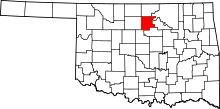 Location in the U.S. state of Oklahoma | |
 Oklahoma's location in the U.S. | |
| Founded | 1893 |
| Named for | John Willock Noble |
| Seat | Perry |
| Largest city | Perry |
| Area | |
| • Total | 743 sq mi (1,924 km2) |
| • Land | 732 sq mi (1,896 km2) |
| • Water | 11 sq mi (28 km2), 1.4% |
| Population (est.) | |
| • (2013) | 11,446 |
| • Density | 16/sq mi (6/km2) |
| Congressional district | 3rd |
| Website |
www |
Noble County is located in the north central part of Oklahoma. As of the 2010 census, the population was 11,561.[1] Its county seat is Perry.[2] It was part of the Cherokee Outlet in Indian Territory until Oklahoma Territory was created in 1890, and the present county land was designated as County P. After the U. S. government opened the area to non-Indian settlement in 1893, it was renamed Noble County for John Willock Noble, then the United States Secretary of the Interior.[3]
Timothy McVeigh was arrested in a traffic stop on a highway in Noble County shortly did after he committed the 1995 Oklahoma City bombing, in which he murdered 168 people. The arresting officer was later elected sheriff of Noble County.
History
During the 18th and 19th centuries, the area now occupied by Noble County was used as a hunting ground by the Osage Indians. In 1835, a treaty with the Cherokees made it part of the so-called Cherokee Outlet. During the time of Cherokee ownership, non-native cattlemen who belonged to the Cherokee Strip Live Stock Association leased grazing land from the tribe. Later, reservations were created in the northeastern part of the county for the Otoe and Ponca tribes. These reservations existed until 1904, when the lands were allotted and added to Noble County.[3]
The Cherokee Outlet became part of Oklahoma Territory at the time of the Oklahoma Organic Act, and was divided into counties. After the 1893 opening of the Cherokee Outlet for settlement by non-Indians, the land was divided into counties. One county, originally designated as County P, was renamed in honor of John W. Noble, interior secretary in 1893. The town of Perry was laid out in August 1893 as the county seat and land-office town[3]
Oklahoma City bomber Timothy McVeigh was arrested in Noble County April 19, 1995 heading north bound on Interstate 35. McVeigh was stopped for not having a car tag on his car. He was minutes from being released when the Noble County Sheriff's Department was notified to hold McVeigh. McVeigh was tried and convicted for the bombing attack that killed 168 persons and injured many more. He was executed in 2001. McVeigh's arresting officer, Charlie Hanger, was elected Noble County Sheriff in 2004.[4][5]
In 2010, the Keystone-Cushing Pipeline (Phase II) was constructed north to south through Noble County.
Geography
According to the U.S. Census Bureau, the county has a total area of 743 square miles (1,920 km2), of which 732 square miles (1,900 km2) is land and 11 square miles (28 km2) (1.4%) is water.[6] The Arkansas River forms part of the county's northeastern boundary. Two of its tributaries, Red Rock Creek in the north and by Black Bear Creek in the south, drain the county before emptying into the Arkansas River.[3]
Major highways
Adjacent counties
- Kay County (north)
- Osage County (northeast)
- Pawnee County (east)
- Payne County (south)
- Logan County (southwest)
- Garfield County (west)
Demographics
| Historical population | |||
|---|---|---|---|
| Census | Pop. | %± | |
| 1900 | 11,798 | — | |
| 1910 | 14,945 | 26.7% | |
| 1920 | 13,560 | −9.3% | |
| 1930 | 15,139 | 11.6% | |
| 1940 | 14,826 | −2.1% | |
| 1950 | 12,156 | −18.0% | |
| 1960 | 10,376 | −14.6% | |
| 1970 | 10,043 | −3.2% | |
| 1980 | 11,573 | 15.2% | |
| 1990 | 11,045 | −4.6% | |
| 2000 | 11,411 | 3.3% | |
| 2010 | 11,561 | 1.3% | |
| Est. 2016 | 11,384 | [7] | −1.5% |
| U.S. Decennial Census[8] 1790-1960[9] 1900-1990[10] 1990-2000[11] 2010-2013[1] | |||
As of the census[12] of 2000, there were 11,411 people, 4,504 households, and 3,211 families residing in the county. The population density was 6/km² (16/mi²). There were 5,082 housing units at an average density of 3/km² (7/mi²). The racial makeup of the county was 86.44% White, 1.58% Black or African American, 7.57% Native American, 0.33% Asian, 0.03% Pacific Islander, 0.65% from other races, and 3.40% from two or more races. 1.80% of the population were Hispanic or Latino of any race.
There were 4,504 households out of which 32.00% had children under the age of 18 living with them, 59.00% were married couples living together, 8.40% had a female householder with no husband present, and 28.70% were non-families. 25.50% of all households were made up of individuals and 11.20% had someone living alone who was 65 years of age or older. The average household size was 2.47 and the average family size was 2.97.
In the county, the population was spread out with 25.50% under the age of 18, 7.90% from 18 to 24, 27.50% from 25 to 44, 23.90% from 45 to 64, and 15.20% who were 65 years of age or older. The median age was 38 years. For every 100 females there were 97.40 males. For every 100 females age 18 and over, there were 96.00 males.
The median income for a household in the county was $33,968, and the median income for a family was $40,180. Males had a median income of $32,224 versus $21,235 for females. The per capita income for the county was $17,022. About 9.60% of families and 12.80% of the population were below the poverty line, including 16.40% of those under age 18 and 11.00% of those age 65 or over.
Politics
| Voter Registration and Party Enrollment as of January 15, 2018[13] | |||||
|---|---|---|---|---|---|
| Party | Number of Voters | Percentage | |||
| Democratic | 1,902 | 31.00% | |||
| Republican | 3,614 | 58.90% | |||
| Others | 620 | 10.10% | |||
| Total | 6,136 | 100% | |||
| Year | Republican | Democratic | Third Parties |
|---|---|---|---|
| 2016 | 76.2% 3,715 | 18.5% 901 | 5.4% 262 |
| 2012 | 75.3% 3,488 | 24.7% 1,143 | |
| 2008 | 76.8% 3,881 | 23.2% 1,174 | |
| 2004 | 74.9% 3,993 | 25.1% 1,335 | |
| 2000 | 68.8% 3,230 | 30.2% 1,416 | 1.1% 51 |
| 1996 | 48.4% 2,318 | 36.7% 1,756 | 15.0% 717 |
| 1992 | 46.8% 2,474 | 25.2% 1,333 | 27.9% 1,476 |
| 1988 | 63.8% 3,015 | 35.2% 1,661 | 1.1% 50 |
| 1984 | 76.1% 4,018 | 23.5% 1,238 | 0.4% 23 |
| 1980 | 69.9% 3,663 | 26.7% 1,398 | 3.4% 179 |
| 1976 | 53.1% 2,634 | 45.9% 2,278 | 1.1% 53 |
| 1972 | 78.4% 4,085 | 19.2% 999 | 2.5% 128 |
| 1968 | 58.9% 2,911 | 28.6% 1,412 | 12.5% 618 |
| 1964 | 44.3% 2,157 | 55.7% 2,713 | |
| 1960 | 62.6% 3,198 | 37.4% 1,910 | |
| 1956 | 63.7% 3,536 | 36.3% 2,017 | |
| 1952 | 71.0% 4,422 | 29.0% 1,803 | |
| 1948 | 46.7% 2,430 | 53.3% 2,770 | |
| 1944 | 57.0% 3,060 | 42.8% 2,300 | 0.2% 13 |
| 1940 | 51.6% 3,441 | 48.3% 3,226 | 0.1% 7 |
| 1936 | 38.6% 2,461 | 61.2% 3,901 | 0.2% 13 |
| 1932 | 27.0% 1,635 | 73.0% 4,414 | |
| 1928 | 66.2% 3,607 | 32.6% 1,777 | 1.2% 64 |
| 1924 | 51.2% 2,680 | 36.8% 1,927 | 12.1% 633 |
| 1920 | 59.7% 2,467 | 36.7% 1,515 | 3.7% 151 |
| 1916 | 44.0% 1,243 | 47.7% 1,346 | 8.3% 234 |
| 1912 | 46.2% 1,266 | 43.3% 1,188 | 10.5% 289 |
Economy
The county economy has largely been based on agriculture and cattle. Wheat was the major crop, although alfalfa, oats, corn, and barley have also been important. The county lies in the Mid-Continent oil and gas region. Natural gas wells began producing in 1915-1919. Oil production began in the 1920s.[3]
Ditch Witch, a Charles Machine Works company, is headquartered in Perry, the county seat.
Communities
City
- Perry (county seat)
Towns
Census-designated place
Other unincorporated places
- Ceres
- Gansel
- Otoe
- Sumner
NRHP sites
The following sites in Noble County are listed on the National Register of Historic Places:
- First National Bank and Trust Company Building, Perry
- Morrison Baptist Church, Morrison
- Morrison Suspension Bridge, Morrison
- Noble County Courthouse, Perry
- Perry Armory, Perry
- Perry Courthouse Square Historic District, Perry
- Renfrow Building, Billings
- Renfrow House, Billings
- Sumner School, Morrison
- Wolleson-Nicewander Building, Perry
References
- 1 2 "State & County QuickFacts". United States Census Bureau. Archived from the original on July 15, 2011. Retrieved November 12, 2013.
- ↑ "Find a County". National Association of Counties. Archived from the original on May 31, 2011. Retrieved 2011-06-07.
- 1 2 3 4 5 Dianna Everett, "Noble County." Encyclopedia of Oklahoma History and Culture. Retrieved October 3, 2013.
- ↑ http://www.officer.com/web/online/Top-News-Stories/Oklahoma-Trooper-Reflects-on-McVeigh-Arrest/1$51844%5Bpermanent+dead+link%5D
- ↑ http://www.oklahomasheriffs.com/Sheriffs%20Photos%20&%20Profiles/Hanger.htm Archived 2009-05-10 at the Wayback Machine.
- ↑ "2010 Census Gazetteer Files". United States Census Bureau. August 22, 2012. Retrieved February 21, 2015.
- ↑ "Population and Housing Unit Estimates". Retrieved June 9, 2017.
- ↑ "U.S. Decennial Census". United States Census Bureau. Archived from the original on May 12, 2015. Retrieved February 21, 2015.
- ↑ "Historical Census Browser". University of Virginia Library. Retrieved February 21, 2015.
- ↑ Forstall, Richard L., ed. (March 27, 1995). "Population of Counties by Decennial Census: 1900 to 1990". United States Census Bureau. Retrieved February 21, 2015.
- ↑ "Census 2000 PHC-T-4. Ranking Tables for Counties: 1990 and 2000" (PDF). United States Census Bureau. April 2, 2001. Retrieved February 21, 2015.
- ↑ "American FactFinder". United States Census Bureau. Archived from the original on September 11, 2013. Retrieved 2008-01-31.
- ↑ https://www.ok.gov/elections/documents/20180115%20-%20Registration%20By%20County%20%28vr2420%29.pdf
- ↑ Leip, David. "Dave Leip's Atlas of U.S. Presidential Elections". uselectionatlas.org. Retrieved 2018-03-29.
Places adjacent to Noble County, Oklahoma | |
|---|---|
Municipalities and communities of Noble County, Oklahoma, United States | ||
|---|---|---|
| City | | |
| Towns | ||
| CDP | ||
| Unincorporated communities |
| |
