Wagoner County, Oklahoma
| Wagoner County, Oklahoma | |
|---|---|
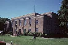 Wagoner County Courthouse in Wagoner | |
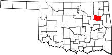 Location in the U.S. state of Oklahoma | |
 Oklahoma's location in the U.S. | |
| Founded | 1907[1] |
| Named for | Henry "Bigfoot" Wagoner[1] |
| Seat | Wagoner |
| Largest city | Coweta |
| Area | |
| • Total | 591 sq mi (1,531 km2) |
| • Land | 562 sq mi (1,456 km2) |
| • Water | 29 sq mi (75 km2), 4.9% |
| Population (est.) | |
| • (2017) | 78,657[2] |
| • Density | 140/sq mi (50/km2) |
| Congressional district | 1st |
| Time zone | Central: UTC−6/−5 |
| Website |
www |
Wagoner County is a county located in the U.S. state of Oklahoma. As of the 2010 census, the population was 73,085.[3] Its county seat is Wagoner.[4]
Wagoner County is included in the Tulsa, OK Metropolitan Statistical Area.
History
According to archaeological studies, this area was inhabited by Caddoan Mound Builders during the period A.D. 300 to 1200.[1]
The western area of Wagoner County was settled by the Creek after their forced removal in Alabama in the 1820s. The eastern portion of the county was settled by the Cherokee.[1]
During the Civil War in 1865, the present county was the scene of the Battle of Flat Rock (also known as the Hay Camp Action). Confederate troops led by Brig. General Stand Watie and Brig. General Richard Gano captured 85 Union troops and killed even more that were harvesting hay.[1]
In 1905, the Sequoyah Convention proposed creating two counties from this area. The western half would be named Coweta and the eastern half would have been named Tumechichee. However, failure of the attempt to create the state of Sequoyah negated the proposal. In 1907 at Oklahoma Statehood, Wagoner County was organized. The towns of Porter and Coweta vied with Wagoner as the county seat. The county was named after the town of Wagoner, which won the election. The town was named after Henry "Bigfoot" Wagoner, a Katy Railroad dispatcher from Parsons, Kansas.[1]
Geography
According to the U.S. Census Bureau, the county has a total area of 591 square miles (1,530 km2), of which 562 square miles (1,460 km2) is land and 29 square miles (75 km2) (4.9%) is water.[5] It is part of the Ozark Highlands. The Verdigris River divides the east and west parts of the county. The Arkansas River forms part of the western and southern boundaries. Grand River also flows south through the county. It was dammed in 1942 to create Fort Gibson Lake.[1]
Adjacent counties
- Rogers County (northwest)
- Mayes County (northeast)
- Cherokee County (east)
- Muskogee County (south)
- Tulsa County (west)
Demographics
| Historical population | |||
|---|---|---|---|
| Census | Pop. | %± | |
| 1910 | 22,086 | — | |
| 1920 | 21,371 | −3.2% | |
| 1930 | 22,428 | 4.9% | |
| 1940 | 21,642 | −3.5% | |
| 1950 | 16,741 | −22.6% | |
| 1960 | 15,673 | −6.4% | |
| 1970 | 22,163 | 41.4% | |
| 1980 | 41,801 | 88.6% | |
| 1990 | 47,883 | 14.5% | |
| 2000 | 57,491 | 20.1% | |
| 2010 | 73,085 | 27.1% | |
| Est. 2017 | 78,657 | [6] | 7.6% |
| U.S. Decennial Census[7] 1790-1960[8] 1900-1990[9] 1990-2000[10] 2010-2013[3] | |||
As of the census[11] of 2010, there were 73,085 people, in the county. The population density was 47.74/km². There were 29,694 housing units at an average density of 55.9 per square mile (19.4/km²). The racial makeup of the county was 80.07% White, 3.75% Black or African American, 9.38% Native American, 0.51% Asian, 0.02% Pacific Islander, 0.85% from other races, and 5.41% from two or more races. Hispanic or Latino of any race were 2.50% of the population.
There were 21,010 households out of which 37.40% had children under the age of 18 living with them, 65.90% were married couples living together, 9.80% had a female householder with no husband present, and 20.50% were non-families. 17.70% of all households were made up of individuals and 6.70% had someone living alone who was 65 years of age or older. The average household size was 2.73 and the average family size was 3.08.
In the county, the population was spread out with 28.10% under the age of 18, 7.90% from 18 to 24, 28.50% from 25 to 44, 25.40% from 45 to 64, and 10.20% who were 65 years of age or older. The median age was 36 years. For every 100 females, there were 97.70 males. For every 100 females age 18 and over, there were 94.90 males.
The median income for a household in the county was $56,819, and the median income for a family was $62,997. The per capita income for the county was $24,976. About 8.3% of families and 12.1% of the population were below the poverty line, including 18.5% of those under age 18 and 5.8% of those age 65 or over.[12]
Politics
| Voter Registration and Party Enrollment as of January 15, 2018[13] | |||||
|---|---|---|---|---|---|
| Party | Number of Voters | Percentage | |||
| Democratic | 12,368 | 32.60% | |||
| Republican | 22,436 | 56.57% | |||
| Others | 4,860 | 12.25% | |||
| Total | 39,664 | 100% | |||
| Year | Republican | Democratic | Third Parties |
|---|---|---|---|
| 2016 | 73.5% 23,005 | 21.5% 6,723 | 5.0% 1,572 |
| 2012 | 72.9% 20,900 | 27.2% 7,791 | |
| 2008 | 70.9% 21,441 | 29.1% 8,810 | |
| 2004 | 67.6% 19,081 | 32.4% 9,157 | |
| 2000 | 60.3% 12,981 | 38.3% 8,244 | 1.4% 292 |
| 1996 | 48.0% 9,392 | 39.6% 7,749 | 12.4% 2,417 |
| 1992 | 42.1% 9,053 | 32.7% 7,041 | 25.2% 5,435 |
| 1988 | 57.7% 10,219 | 41.6% 7,378 | 0.7% 121 |
| 1984 | 70.0% 12,534 | 29.4% 5,271 | 0.6% 108 |
| 1980 | 60.9% 8,969 | 35.6% 5,235 | 3.6% 523 |
| 1976 | 45.9% 5,071 | 53.2% 5,879 | 1.0% 107 |
| 1972 | 72.1% 6,569 | 24.8% 2,257 | 3.1% 281 |
| 1968 | 41.8% 3,187 | 28.6% 2,183 | 29.6% 2,262 |
| 1964 | 41.8% 2,840 | 58.2% 3,957 | |
| 1960 | 56.9% 3,570 | 43.1% 2,707 | |
| 1956 | 58.2% 3,537 | 41.8% 2,544 | |
| 1952 | 52.8% 3,321 | 47.2% 2,966 | |
| 1948 | 44.0% 2,666 | 56.0% 3,389 | |
| 1944 | 59.3% 3,467 | 40.6% 2,373 | 0.1% 8 |
| 1940 | 61.0% 4,647 | 38.7% 2,946 | 0.3% 25 |
| 1936 | 41.4% 2,119 | 58.2% 2,977 | 0.4% 21 |
| 1932 | 27.3% 1,505 | 72.7% 4,015 | |
| 1928 | 60.6% 2,726 | 38.8% 1,745 | 0.6% 26 |
| 1924 | 42.2% 1,646 | 50.9% 1,985 | 7.0% 272 |
| 1920 | 48.3% 1,432 | 46.4% 1,375 | 5.3% 158 |
| 1916 | 35.8% 749 | 49.7% 1,040 | 14.5% 303 |
| 1912 | 32.6% 555 | 52.1% 888 | 15.4% 262 |
Communities
Cities
Towns
Unincorporated communities
Former community
- New Tulsa, Oklahoma - Dissolved in 2001. Now part of Broken Arrow.
National Register of Historic Places
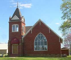
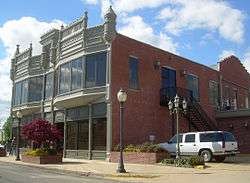
The following sites in Wagoner County are listed on the National Register of Historic Places:
|
|
References
- 1 2 3 4 5 6 7 McMahan, Liz. "Wagoner County - Encyclopedia of Oklahoma History & Culture". Oklahoma Historical Society. Retrieved 24 May 2011.
- ↑ https://www.census.gov/quickfacts/fact/table/wagonercountyoklahoma/PST045216
- 1 2 "State & County QuickFacts". United States Census Bureau. Archived from the original on October 10, 2013. Retrieved November 13, 2013.
- ↑ "Find a County". National Association of Counties. Retrieved 2011-06-07.
- ↑ "2010 Census Gazetteer Files". United States Census Bureau. August 22, 2012. Retrieved February 22, 2015.
- ↑ "Population and Housing Unit Estimates". Retrieved June 9, 2017.
- ↑ "U.S. Decennial Census". United States Census Bureau. Retrieved February 22, 2015.
- ↑ "Historical Census Browser". University of Virginia Library. Retrieved February 22, 2015.
- ↑ Forstall, Richard L., ed. (March 27, 1995). "Population of Counties by Decennial Census: 1900 to 1990". United States Census Bureau. Retrieved February 22, 2015.
- ↑ "Census 2000 PHC-T-4. Ranking Tables for Counties: 1990 and 2000" (PDF). United States Census Bureau. April 2, 2001. Retrieved February 22, 2015.
- ↑ "American FactFinder". United States Census Bureau. Retrieved 2008-01-31.
- ↑ American Factfinder. Accessed April 29, 2013.
- ↑ Registration by Party as of January 15, 2017. Oklahoma State Election Board. Accessed June 2, 2017.
- ↑ Leip, David. "Dave Leip's Atlas of U.S. Presidential Elections". uselectionatlas.org. Retrieved 2018-03-30.
Places adjacent to Wagoner County, Oklahoma | ||||||||||
|---|---|---|---|---|---|---|---|---|---|---|
| ||||||||||
Municipalities and communities of Wagoner County, Oklahoma, United States | ||
|---|---|---|
| Cities | | |
| Towns | ||
| Unincorporated communities |
| |
| Footnotes | ‡This populated place also has portions in an adjacent county or counties | |
| Counties |  | |
|---|---|---|
| Principal city | ||
| Cities over 20k | ||
| Cities 10k-20k | ||
| Cities 5k-10k | ||
| Cities and towns 1k-5k | ||
