Dewey County, Oklahoma
| Dewey County, Oklahoma | |
|---|---|
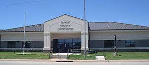 Dewey County Courthouse | |
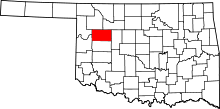 Location in the U.S. state of Oklahoma | |
 Oklahoma's location in the U.S. | |
| Founded | 1891 |
| Seat | Taloga |
| Largest city | Seiling |
| Area | |
| • Total | 1,008 sq mi (2,611 km2) |
| • Land | 999 sq mi (2,587 km2) |
| • Water | 8.8 sq mi (23 km2), 0.9% |
| Population (est.) | |
| • (2013) | 4,844 |
| • Density | 4.8/sq mi (1.9/km2) |
| Congressional district | 3rd |
| Time zone | Central: UTC−6/−5 |
Dewey County is a county in the western part of the U.S. state of Oklahoma. During 2015, the population was 4,995.[1] Its county seat is Taloga.[2] The county was created in 1891 as "County D".[3] In an 1898 election, county voters chose the name Dewey,[4] honoring Admiral George Dewey.[5]
History
Lands assigned to the Choctaw and Seminole tribes extended into the area now occupied by Dewey County. Under the Reconstruction Treaties of 1866 the Choctaw and Chickasaw ceded their western domain to the United States. Known as the Leased District, part of the area became the Cheyenne and Arapaho reservation.[6]
Dewey County was created in Oklahoma Territory in 1891 and was opened to non-Indian settlement on April 19, 1892. It was then named as County D by an act of Congress, and did not receive its present name until a general election in 1898. A wooden structure in Taloga was used as the county courthouse from 1909 until 1926, when the present courthouse was built.[6]
Geography
According to the U.S. Census Bureau, the county has a total area of 1,008 square miles (2,610 km2), of which 999 square miles (2,590 km2) is land and 8.8 square miles (23 km2) (0.9%) is water.[7]
Most of the county is in the Gypsum Hills physiographic region, except that the western one-fourth of the county is in the High Plains region. It is drained by the Canadian and North Canadian Rivers. Canton Lake, built on the Canadian River in 1966, is the only significant lake or reservoir in the county.[6]
Major highways
Adjacent counties
- Woodward County (north)
- Major County (north)
- Blaine County (east)
- Custer County (south)
- Roger Mills County (southwest)
- Ellis County (northwest)
Demographics
| Historical population | |||
|---|---|---|---|
| Census | Pop. | %± | |
| 1900 | 8,819 | — | |
| 1910 | 14,132 | 60.2% | |
| 1920 | 12,434 | −12.0% | |
| 1930 | 13,250 | 6.6% | |
| 1940 | 11,981 | −9.6% | |
| 1950 | 8,789 | −26.6% | |
| 1960 | 6,051 | −31.2% | |
| 1970 | 5,656 | −6.5% | |
| 1980 | 5,922 | 4.7% | |
| 1990 | 5,551 | −6.3% | |
| 2000 | 4,743 | −14.6% | |
| 2010 | 4,810 | 1.4% | |
| Est. 2016 | 4,819 | [8] | 0.2% |
| U.S. Decennial Census[9] 1790-1960[10] 1900-1990[11] 1990-2000[12] 2010-2013[1] | |||
As of the census[13] of 2000, there were 4,743 people, 1,962 households, and 1,336 families residing in the county. The population density was 5 people per square mile (2/km²). There were 2,425 housing units at an average density of 2 per square mile (1/km²). The racial makeup of the county was 92.16% White, 0.13% Black or African American, 4.64% Native American, 0.06% Asian, 0.02% Pacific Islander, 0.72% from other races, and 2.28% from two or more races. 2.68% of the population were Hispanic or Latino of any race.
There were 1,962 households out of which 26.70% had children under the age of 18 living with them, 59.80% were married couples living together, 5.00% had a female householder with no husband present, and 31.90% were non-families. 30.00% of all households were made up of individuals and 16.40% had someone living alone who was 65 years of age or older. The average household size was 2.35 and the average family size was 2.93.
In the county, the population was spread out with 23.30% under the age of 18, 7.10% from 18 to 24, 22.90% from 25 to 44, 25.70% from 45 to 64, and 21.00% who were 65 years of age or older. The median age was 43 years. For every 100 females there were 94.90 males. For every 100 females age 18 and over, there were 91.30 males.
The median income for a household in the county was $28,172, and the median income for a family was $36,114. Males had a median income of $26,675 versus $18,548 for females. The per capita income for the county was $15,806. About 11.40% of families and 15.00% of the population were below the poverty line, including 17.60% of those under age 18 and 15.80% of those age 65 or over.
Politics
| Voter Registration and Party Enrollment as of January 15, 2018[14] | |||||
|---|---|---|---|---|---|
| Party | Number of Voters | Percentage | |||
| Democratic | 875 | 30.81% | |||
| Republican | 1,716 | 60.42% | |||
| Others | 249 | 8.77% | |||
| Total | 2,840 | 100% | |||
| Year | Republican | Democratic | Third parties |
|---|---|---|---|
| 2016 | 87.4% 1,965 | 9.9% 222 | 2.7% 61 |
| 2012 | 85.6% 1,792 | 14.4% 301 | |
| 2008 | 84.3% 1,857 | 15.7% 346 | |
| 2004 | 81.9% 1,843 | 18.1% 408 | |
| 2000 | 72.4% 1,607 | 27.0% 599 | 0.6% 14 |
| 1996 | 51.2% 1,179 | 35.5% 816 | 13.3% 306 |
| 1992 | 44.7% 1,244 | 30.4% 845 | 24.9% 693 |
| 1988 | 60.5% 1,543 | 37.8% 963 | 1.8% 45 |
| 1984 | 75.6% 2,098 | 23.9% 664 | 0.5% 15 |
| 1980 | 67.6% 1,943 | 28.7% 826 | 3.7% 107 |
| 1976 | 43.5% 1,230 | 54.5% 1,540 | 2.0% 55 |
| 1972 | 74.8% 2,106 | 22.2% 626 | 3.0% 84 |
| 1968 | 53.5% 1,508 | 27.4% 773 | 19.1% 540 |
| 1964 | 47.1% 1,438 | 52.9% 1,617 | |
| 1960 | 66.2% 2,115 | 33.8% 1,082 | |
| 1956 | 56.7% 1,896 | 43.3% 1,448 | |
| 1952 | 66.9% 2,583 | 33.2% 1,281 | |
| 1948 | 42.2% 1,494 | 57.8% 2,049 | |
| 1944 | 54.3% 2,166 | 45.4% 1,808 | 0.3% 13 |
| 1940 | 51.9% 2,613 | 47.5% 2,391 | 0.7% 34 |
| 1936 | 38.0% 1,846 | 61.3% 2,980 | 0.8% 37 |
| 1932 | 21.4% 1,051 | 78.6% 3,855 | |
| 1928 | 65.4% 2,486 | 30.9% 1,175 | 3.8% 143 |
| 1924 | 44.4% 1,539 | 32.5% 1,126 | 23.1% 799 |
| 1920 | 51.8% 1,738 | 29.6% 995 | 18.6% 625 |
| 1916 | 29.4% 796 | 36.6% 992 | 34.1% 923 |
| 1912 | 36.8% 1,086 | 36.4% 1,075 | 26.8% 792 |
Economy
The county economy has centered on agriculture since it began to be settled. Principal crops have included corn, cotton, wheat, broomcorn, Kaffir corn, and oats. Truck farmers in the eastern part of the county grew tomatoes, watermelons, apples, blackberries, and other small fruits. Livestock (cattle, horses, mules, sheep and goats) raising had become important by the 1930s. These products were still economically important by the turn of the 21st Century.[6]
Mineral extraction included oil and gas production (mainly in the 1940s and 1950s), bentonite, gypsum, clay and sand. In 2000, Dewey County had only two manufacturing businesses that employed more than ten people.[6]
Communities
See also
References
- 1 2 "State & County QuickFacts". United States Census Bureau. Archived from the original on July 9, 2011. Retrieved November 9, 2013.
- ↑ "Find a County". National Association of Counties. Archived from the original on 2011-05-31. Retrieved 2011-06-07.
- ↑ "Oklahoma: Individual County Chronologies". Oklahoma Atlas of Historical County Boundaries. The Newberry Library. Retrieved February 23, 2015.
- ↑ "Origin of County Names in Oklahoma." Chronicles of Oklahoma. Volume 2, Number 1. March 1924. Archived March 3, 2016, at the Wayback Machine. Retrieved September 18, 2013.
- ↑ Gannett, Henry (1905). The Origin of Certain Place Names in the United States. Govt. Print. Off. p. 105.
- 1 2 3 4 5 Wilson, Linda D. "Dewey County". Encyclopedia of Oklahoma History and Culture. Retrieved March 28, 2015.
- ↑ "2010 Census Gazetteer Files". United States Census Bureau. August 22, 2012. Retrieved February 19, 2015.
- ↑ "Population and Housing Unit Estimates". Retrieved June 9, 2017.
- ↑ "U.S. Decennial Census". United States Census Bureau. Archived from the original on May 12, 2015. Retrieved February 19, 2015.
- ↑ "Historical Census Browser". University of Virginia Library. Retrieved February 19, 2015.
- ↑ Forstall, Richard L., ed. (March 27, 1995). "Population of Counties by Decennial Census: 1900 to 1990". United States Census Bureau. Retrieved February 19, 2015.
- ↑ "Census 2000 PHC-T-4. Ranking Tables for Counties: 1990 and 2000" (PDF). United States Census Bureau. April 2, 2001. Retrieved February 19, 2015.
- ↑ "American FactFinder". United States Census Bureau. Archived from the original on 2013-09-11. Retrieved 2008-01-31.
- ↑ https://www.ok.gov/elections/documents/20180115%20-%20Registration%20By%20County%20%28vr2420%29.pdf
- ↑ Leip, David. "Dave Leip's Atlas of U.S. Presidential Elections". uselectionatlas.org. Retrieved 2018-03-29.
External links
- Encyclopedia of Oklahoma History and Culture - Dewey County
- Oklahoma Digital Maps: Digital Collections of Oklahoma and Indian Territory
Places adjacent to Dewey County, Oklahoma | |
|---|---|
Municipalities and communities of Dewey County, Oklahoma, United States | ||
|---|---|---|
| City | | |
| Towns | ||
| Unincorporated community | ||
