Adair County, Oklahoma
| Adair County, Oklahoma | |
|---|---|
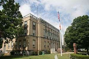 Adair County courthouse | |
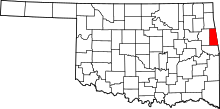 Location in the U.S. state of Oklahoma | |
 Oklahoma's location in the U.S. | |
| Founded | 1907 |
| Named for | The Adair family of the Cherokee tribe. |
| Seat | Stilwell |
| Largest city | Stilwell |
| Area | |
| • Total | 577 sq mi (1,494 km2) |
| • Land | 573 sq mi (1,484 km2) |
| • Water | 3.6 sq mi (9 km2), 0.6% |
| Population (est.) | |
| • (2016) | 22,098[1] |
| • Density | 40/sq mi (20/km2) |
| Congressional district | 2nd |
| Time zone | Central: UTC−6/−5 |
Adair County is a county located in the U.S. state of Oklahoma. As of the 2010 census, the population was 22,286.[2] Its county seat is Stilwell.[3] Adair County was named after the Adair family of the Cherokee tribe.[4] One source says that the county was specifically named for Watt Adair, one of the first Cherokees to settle in the area.[5]
History
The county was created in 1906 from the Goingsnake and Flint districts of the Cherokee Nation.[6] There was a decade-long struggle over what town would become the county seat between Stilwell and Westville.[7] When the county was formed, Westville was identified as the county seat, due partly to its location at the intersection of two major railroads: the Kansas City Southern Railway and the St. Louis – San Francisco Railway.[8] The county seat was moved to Stilwell in 1910.[9]
During the Great Depression and World War II, strawberries became a major crop in Adair County. In 1948, the first Stilwell Strawberry Festival was organized. The 2002 festival saw some 40,000 people in attendance.[7]
The 1910 census counted 10,535 residents.[6] By 1990, it was up to 18,421.[6]
Geography
According to the U.S. Census Bureau, the county has a total area of 577 square miles (1,490 km2), of which 573 square miles (1,480 km2) is land and 3.6 square miles (9.3 km2) (0.6%) is water.[10]
The county is part of the Ozark plateau uplift, the tree-covered foothills of the Boston Mountains.[6] North and central Adair County are drained by the Illinois River and three creeks.[6] Two more creeks lie near Stilwell.[6]
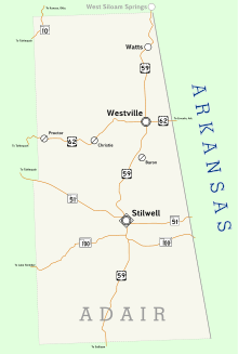
Major highways
Adjacent counties
- Delaware County (north)
- Benton County, Arkansas (northeast)
- Washington County, Arkansas (east)
- Crawford County, Arkansas (southeast)
- Sequoyah County (south)
- Cherokee County (west)
National protected area
Demographics
| Historical population | |||
|---|---|---|---|
| Census | Pop. | %± | |
| 1910 | 10,535 | — | |
| 1920 | 13,703 | 30.1% | |
| 1930 | 14,756 | 7.7% | |
| 1940 | 15,755 | 6.8% | |
| 1950 | 14,918 | −5.3% | |
| 1960 | 13,112 | −12.1% | |
| 1970 | 15,141 | 15.5% | |
| 1980 | 18,575 | 22.7% | |
| 1990 | 18,421 | −0.8% | |
| 2000 | 21,038 | 14.2% | |
| 2010 | 22,683 | 7.8% | |
| Est. 2016 | 22,098 | [11] | −2.6% |
| U.S. Decennial Census[12] 1790-1960[13] 1900-1990[14] 1990-2000[15] 2010-2013[2] | |||
As of the census[16] of 2010, Adair County had a small population relative to its surrounding counties, with only 21,038 people, a large percentage of them, 43.3 percent, Native American. The remainder of the population was 43 percent white, 10.5 percent of more than one race, and 5.3 percent Hispanic or Latino. Less than 1 percent of the population was either Black or African American, Asian, or Pacific Islander, and 2.3 percent were identified as other.
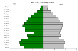
The median age of the population was 36.2 years and two-thirds of the county's population were either under the age of 18 (28 percent) or between the ages of 25 to 44 (24.8 percent). Of the remaining population, 25.9 percent were ages 45 to 64, 12.9 percent were 65 years of age or older, and 13.2 percent were ages 18 to 24. For every 100 females there were 100.1 males. For every 100 females age 18 and over, there were 98.3 males.
There were a total of 8,156 households and 5,982 families in the county in 2010. There were 9,142 housing units. Of the 8,156 households, 31.4 percent included children under the age of 18 and slightly more than half (52.7 percent) included married couples living together. 26.7 percent were non-family, 14.2 percent had a female householder with no husband present, and 26.8 percent contained a single individual of 65 years of age or older. The average household size was 2.77 and the average family size was 3.25.
The median income for a household in the county was $27,258, and the median income for a family was $32,930. Males had a median income of $28,370 versus $23,384 for females. The per capita income for the county was $13,560. About 25.3 percent of families and 27.8 percent of the population were below the poverty line, including 36.8 percent of those under age 18 and 18.7 percent of those age 65 or over.
Politics
| Voter Registration and Party Enrollment as of January 15, 2018[17] | |||||
|---|---|---|---|---|---|
| Party | Number of Voters | Percentage | |||
| Democratic | 5,597 | 53.00% | |||
| Republican | 3,785 | 35.84% | |||
| Others | 1,178 | 11.16% | |||
| Total | 10,560 | 100% | |||
| Year | Republican | Democratic | Third parties |
|---|---|---|---|
| 2016 | 73.5% 4,787 | 21.2% 1,382 | 5.3% 344 |
| 2012 | 67.3% 4,381 | 32.7% 2,127 | |
| 2008 | 69.3% 4,638 | 30.7% 2,052 | |
| 2004 | 66.0% 4,971 | 34.0% 2,562 | |
| 2000 | 58.6% 3,503 | 39.5% 2,361 | 1.9% 113 |
| 1996 | 45.3% 2,956 | 42.8% 2,792 | 11.9% 773 |
| 1992 | 45.5% 2,994 | 40.2% 2,645 | 14.3% 944 |
| 1988 | 57.0% 3,558 | 42.1% 2,624 | 0.9% 58 |
| 1984 | 65.6% 4,423 | 33.6% 2,266 | 0.8% 56 |
| 1980 | 54.1% 3,429 | 43.5% 2,761 | 2.4% 151 |
| 1976 | 48.1% 3,013 | 50.9% 3,183 | 1.0% 63 |
| 1972 | 73.1% 4,720 | 24.8% 1,601 | 2.1% 134 |
| 1968 | 53.0% 2,877 | 28.6% 1,549 | 18.4% 1,000 |
| 1964 | 48.8% 2,859 | 51.2% 3,003 | |
| 1960 | 65.8% 3,655 | 34.2% 1,903 | |
| 1956 | 56.6% 3,152 | 43.4% 2,418 | |
| 1952 | 52.7% 3,037 | 47.3% 2,725 | |
| 1948 | 44.0% 2,407 | 56.0% 3,067 | |
| 1944 | 50.2% 2,792 | 49.6% 2,760 | 0.2% 12 |
| 1940 | 50.5% 3,275 | 49.4% 3,203 | 0.1% 6 |
| 1936 | 45.2% 2,699 | 54.5% 3,257 | 0.3% 16 |
| 1932 | 33.7% 1,941 | 66.3% 3,812 | |
| 1928 | 59.4% 2,867 | 40.2% 1,944 | 0.4% 20 |
| 1924 | 51.6% 2,317 | 43.3% 1,942 | 5.1% 229 |
| 1920 | 58.0% 2,181 | 41.5% 1,559 | 0.6% 21 |
| 1916 | 41.7% 1,010 | 49.2% 1,190 | 9.1% 221 |
| 1912 | 44.2% 850 | 47.6% 916 | 8.2% 158 |
Economy
The county is home to food processing and canning industries; poultry farms; cattle ranches; horse breeders; dog breeders, and strawberry fields.[19]
Communities
Cities
- Stilwell (county seat)
Towns
Census-designated places
Other unincorporated places
NRHP sites
The following sites in Adair County are listed on the National Register of Historic Places:
- Adair County Courthouse, Stilwell
- Breadtown, Westville vicinity
- Ballard Creek Roadbed, Westville vicinity
- Buffington Hotel, Westville
- Golda's Mill, Stilwell
- Opera Block, Westville
- Rev. Jesse Bushyhead Grave, Westville
References
| Wikimedia Commons has media related to Adair County, Oklahoma. |
- ↑ "Population and Housing Unit Estimates". U.S. Census Bureau. August 15, 2017. Retrieved August 15, 2017.
- 1 2 "State & County QuickFacts". United States Census Bureau. Archived from the original on July 6, 2011. Retrieved November 8, 2013.
- ↑ "Find a County". National Association of Counties. Archived from the original on May 31, 2011. Retrieved June 7, 2011.
- ↑ Oklahoma Almanac Online (PDF). Oklahoma Department of Libraries.
- ↑ "Stilwell is part of 'Green County Oklahoma'"" Retrieved September 14, 2014.
- 1 2 3 4 5 6 Whitaker, Rachel. "Adair County". Encyclopedia of Oklahoma History and Culture. Oklahoma Historical Society. Retrieved June 13, 2010.
- 1 2 Barker, Betty Starr. "Stilwell". Encyclopedia of Oklahoma History and Culture. Oklahoma Historical Society. Retrieved June 13, 2010.
- ↑ Hill, Luther B. (1910). A History of the State of Oklahoma. I. The Lewis Publishing Company. p. 470.
- ↑ Oklahoma Almanac 2005
- ↑ "2010 Census Gazetteer Files". United States Census Bureau. August 22, 2012. Retrieved February 18, 2015.
- ↑ "Population and Housing Unit Estimates". Retrieved June 9, 2017.
- ↑ "U.S. Decennial Census". United States Census Bureau. Archived from the original on May 12, 2015. Retrieved February 18, 2015.
- ↑ "Historical Census Browser". University of Virginia Library. Retrieved February 18, 2015.
- ↑ Forstall, Richard L., ed. (March 27, 1995). "Population of Counties by Decennial Census: 1900 to 1990". United States Census Bureau. Retrieved February 18, 2015.
- ↑ "Census 2000 PHC-T-4. Ranking Tables for Counties: 1990 and 2000" (PDF). United States Census Bureau. April 2, 2001. Retrieved February 18, 2015.
- ↑ "American FactFinder". United States Census Bureau. Archived from the original on September 11, 2013. Retrieved May 14, 2011.
- ↑ https://www.ok.gov/elections/documents/20180115%20-%20Registration%20By%20County%20%28vr2420%29.pdf
- ↑ Leip, David. "Dave Leip's Atlas of U.S. Presidential Elections". uselectionatlas.org. Retrieved March 28, 2018.
- ↑ Adair, Oklahoma Almanac, 2005 (accessed May 22, 2013)
External links
- Encyclopedia of Oklahoma History and Culture - Adair County
- Oklahoma Digital Maps: Digital Collections of Oklahoma and Indian Territory
- Oklahoma Almanac, 2005 - Adair County
Places adjacent to Adair County, Oklahoma | |
|---|---|
Municipalities and communities of Adair County, Oklahoma, United States | ||
|---|---|---|
| City | | |
| Towns | ||
| CDPs | ||
| Other unincorporated communities | ||
| Stilwell |
| |
|---|---|---|
| Westville |
| |
