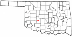
Fort Cobb, Oklahoma
| Fort Cobb, Oklahoma | |
|---|---|
| Town | |
 Location of Fort Cobb, Oklahoma | |
| Coordinates: 35°5′58″N 98°26′19″W / 35.09944°N 98.43861°WCoordinates: 35°5′58″N 98°26′19″W / 35.09944°N 98.43861°W | |
| Country | United States |
| State | Oklahoma |
| County | Caddo |
| Area | |
| • Total | 0.55 sq mi (1.42 km2) |
| • Land | 0.54 sq mi (1.40 km2) |
| • Water | 0.008 sq mi (0.02 km2) |
| Elevation | 1,253 ft (382 m) |
| Population (2010) | |
| • Total | 634 |
| • Density | 1,172/sq mi (452.6/km2) |
| Time zone | UTC−6 (Central (CST)) |
| • Summer (DST) | UTC−5 (CDT) |
| ZIP code | 73038 |
| Area code | 405 |
| FIPS code | 40-27100[1] |
| GNIS feature ID | 1092951[2] |
Fort Cobb is a town in Caddo County, Oklahoma, United States. The population was 634 at the 2010 census.[3]
Geography
Fort Cobb is located west of the center of Caddo County at 35°5′58″N 98°26′19″W / 35.09944°N 98.43861°W (35.099581, -98.438498),[4] in the valley of the Washita River. Oklahoma State Highway 9 passes through the town, leading east 15 miles (24 km) to Anadarko, the county seat, and west 11 miles (18 km) to Carnegie.
According to the United States Census Bureau, Fort Cobb has a total area of 0.54 square miles (1.4 km2), of which 0.01 square miles (0.02 km2), or 1.57%, is water.[3]
Demographics
| Historical population | |||
|---|---|---|---|
| Census | Pop. | %± | |
| 1910 | 382 | — | |
| 1920 | 546 | 42.9% | |
| 1930 | 827 | 51.5% | |
| 1940 | 699 | −15.5% | |
| 1950 | 665 | −4.9% | |
| 1960 | 687 | 3.3% | |
| 1970 | 722 | 5.1% | |
| 1980 | 760 | 5.3% | |
| 1990 | 663 | −12.8% | |
| 2000 | 667 | 0.6% | |
| 2010 | 634 | −4.9% | |
| Est. 2015 | 627 | [5] | −1.1% |
| U.S. Decennial Census[6] | |||
As of the census[1] of 2000, there were 667 people, 270 households, and 189 families residing in the town. The population density was 1,307.1 people per square mile (505.0/km²). There were 317 housing units at an average density of 621.2 per square mile (240.0/km²). The racial makeup of the town was 77.96% White, 1.20% African American, 16.04% Native American, 0.45% from other races, and 4.35% from two or more races. Hispanic or Latino of any race were 5.25% of the population.
There were 270 households out of which 35.2% had children under the age of 18 living with them, 55.9% were married couples living together, 11.5% had a female householder with no husband present, and 30.0% were non-families. 28.1% of all households were made up of individuals and 16.7% had someone living alone who was 65 years of age or older. The average household size was 2.47 and the average family size was 3.05.
In the town, the age distribution of the population shows 28.9% under the age of 18, 7.3% from 18 to 24, 26.7% from 25 to 44, 19.8% from 45 to 64, and 17.2% who were 65 years of age or older. The median age was 37 years. For every 100 females, there were 86.8 males. For every 100 females age 18 and over, there were 74.3 males.
The median income for a household in the town was $25,625, and the median income for a family was $34,000. Males had a median income of $26,786 versus $18,854 for females. The per capita income for the town was $15,085. About 12.5% of families and 17.6% of the population were below the poverty line, including 20.6% of those under age 18 and 17.8% of those age 65 or over.
History
Fort Cobb was established as a U.S. Army frontier post in Indian Territory on October 1, 1859, 1 mile (1.6 km) east of the present location of the town. The fort was named after Secretary of the Treasury Howell Cobb, a friend of the founding officer, Major William Emory. The post was later occupied by both Southern and Northern forces during the Civil War.
Later, Lieutenant Colonel George Armstrong Custer's command was encamped at Fort Cobb from December 18, 1868, to January 6, 1869. Shortly after that, on March 12, 1869, the fort was abandoned in favor of a location 30 miles (48 km) to the south near the Wichita Mountains, and renamed Fort Sill.[7][8]
Education
- Caddo-Kiowa Technology Center
Famous residents
- Gary Gray, formerly of the NBA's Cincinnati Royals
- Reggie Willits, former member of Major League Baseball's Los Angeles Angels organization
- Wendi Willits (older sibling of Reggie), formerly of the WNBA's Los Angeles Sparks
References
- 1 2 "American FactFinder". United States Census Bureau. Archived from the original on 2013-09-11. Retrieved 2008-01-31.
- ↑ "US Board on Geographic Names". United States Geological Survey. 2007-10-25. Retrieved 2008-01-31.
- 1 2 "Geographic Identifiers: 2010 Demographic Profile Data (G001): Fort Cobb town, Oklahoma". U.S. Census Bureau, American Factfinder. Retrieved February 6, 2015.
- ↑ "US Gazetteer files: 2010, 2000, and 1990". United States Census Bureau. 2011-02-12. Retrieved 2011-04-23.
- ↑ "Annual Estimates of the Resident Population for Incorporated Places: April 1, 2010 to July 1, 2015". Archived from the original on June 2, 2016. Retrieved July 2, 2016.
- ↑ "Census of Population and Housing". Census.gov. Archived from the original on May 12, 2015. Retrieved June 4, 2015.
- ↑ Wright, Muriel H., A History of Fort Cobb, 1957 OCLC 8404632
- ↑ Fort Cobb, KS-Cyclopedia - 1912
External links
Municipalities and communities of Caddo County, Oklahoma, United States | ||
|---|---|---|
| City | 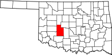 | |
| Towns | ||
| Unincorporated communities | ||
| Footnotes | ‡This populated place also has portions in an adjacent county or counties. | |
| Anadarko |
| |
|---|---|---|
| Apache |
| |
| Binger |
| |
| Bridgeport | ||
| Fort Cobb | ||
| Gracemont |
| |
| Hinton | ||
| Hydro | ||