Bettelainville
| Bettelainville | ||
|---|---|---|
| Commune | ||
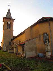 The church in Bettelainville | ||
| ||
 Bettelainville Location within Grand Est region  Bettelainville | ||
| Coordinates: 49°14′15″N 6°18′05″E / 49.2375°N 6.3014°ECoordinates: 49°14′15″N 6°18′05″E / 49.2375°N 6.3014°E | ||
| Country | France | |
| Region | Grand Est | |
| Department | Moselle | |
| Arrondissement | Thionville | |
| Canton | Metzervisse | |
| Intercommunality | Arc mosellan | |
| Government | ||
| • Mayor (2008–2014) | René Kiffer | |
| Area1 | 13.71 km2 (5.29 sq mi) | |
| Population (2009)2 | 615 | |
| • Density | 45/km2 (120/sq mi) | |
| Time zone | UTC+1 (CET) | |
| • Summer (DST) | UTC+2 (CEST) | |
| INSEE/Postal code | 57072 /57640 | |
| Elevation |
198–301 m (650–988 ft) (avg. 283 m or 928 ft) | |
|
1 French Land Register data, which excludes lakes, ponds, glaciers > 1 km2 (0.386 sq mi or 247 acres) and river estuaries. 2 Population without double counting: residents of multiple communes (e.g., students and military personnel) only counted once. | ||
.svg.png)
Bettelainville (German: Bettsdorf) is a commune in the Moselle department in Grand Est in northeastern France.
Altroff (German: Altdorf) and Mancy (German: Menchen) are incorporated in the commune since 1811.
Population
| Historical population | ||
|---|---|---|
| Year | Pop. | ±% |
| 1962 | 302 | — |
| 1968 | 348 | +15.2% |
| 1975 | 393 | +12.9% |
| 1982 | 511 | +30.0% |
| 1990 | 513 | +0.4% |
| 1999 | 598 | +16.6% |
| 2000 | 605 | +1.2% |
| 2006 | 607 | +0.3% |
| 2009 | 615 | +1.3% |

Altroff church
See also
References
| Wikimedia Commons has media related to Bettelainville. |
This article is issued from
Wikipedia.
The text is licensed under Creative Commons - Attribution - Sharealike.
Additional terms may apply for the media files.