San Joaquin County, California
San Joaquin County (/ˌsæn hwɑːˈkiːn/), officially the County of San Joaquin is a county in the U.S. state of California. As of the 2010 census, the population was 685,306.[5] The county seat is Stockton.[7]
San Joaquin County, California | |
|---|---|
| San Joaquin County | |
 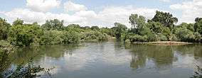 From top down: Downtown Stockton waterfront, Stanislaus River at Caswell Memorial State Park | |
 Seal | |
| Nickname(s): "Sanwa"[1] | |
| Motto(s): "Greatness grows here." | |
.svg.png) Location of San Joaquin County in California | |
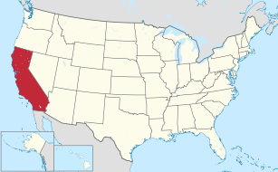 California's location in the United States | |
| Country | |
| State | |
| Region | San Joaquin Valley |
| Incorporated | February 18, 1850[2] |
| Named for | San Joaquin River, which was named for St. Joachim |
| County seat | Stockton |
| Largest city | Stockton |
| Government | |
| • County Administrator | Monica Nino[3] |
| Area | |
| • Total | 1,426 sq mi (3,690 km2) |
| • Land | 1,391 sq mi (3,600 km2) |
| • Water | 35 sq mi (90 km2) |
| Highest elevation | 3,629 ft (1,106 m) |
| Population | |
| • Total | 704,379 |
| • Estimate (2019)[6] | 762,148 |
| • Density | 490/sq mi (190/km2) |
| Time zone | UTC−8 (Pacific Standard Time) |
| • Summer (DST) | UTC−7 (Pacific Daylight Time) |
| Area code(s) | 209 |
| FIPS code | 06-077 |
| GNIS feature ID | 277303 |
| Website | www |
San Joaquin County comprises the Stockton–Lodi–Tracy metropolitan statistical area within the regional San Jose–San Francisco–Oakland combined statistical area. The county is located in Northern California's Central Valley just east of the very highly populated nine-county San Francisco Bay Area region and is separated from the Bay Area by the Diablo Range of low mountains with its Altamont Pass. One of the smaller counties in area in California, it has a high population density and is growing rapidly due to overflow from the Bay area's need for housing.
The City of San Joaquin, despite sharing its name with the county, is located in Fresno County.
History
San Joaquin County was one of the original United States counties of California, created in 1850 at the time of statehood.
The county was named for the San Joaquin River which runs through it. In the early 19th century Lieutenant Gabriel Moraga, commanding an expedition in the lower great California Central Valley, gave the name of San Joaquin (meaning Joachim) to the San Joaquin River, which springs from the southern Sierra Nevada. San Joaquin County is the site of the San Joaquin Valley's first permanent residence.
Prior to incorporation in 1850, the area now encompassing San Joaquin County was inhabited by the Yokuts and Miwok native peoples. These communities lived in villages throughout the region, consuming diverse diets that reflected the flora and fauna of the California Delta. Acorns from Valley Oak trees, salmon runs on the San Joaquin, Mokelumne, Calaveras, and Stanislaus rivers, and Tule Elk were staples of the native diet, which was supplemented with various native berries and plants. The native population of San Joaquin County fell dramatically during a state-wide epidemic of malaria in 1828, and a subsequent rebellion of native peoples in the Central Valley, led by Chief Estanislao.
Between 1843 and 1846, during the era when California was a province of independent Mexico, five Mexican land grants were made in what would become San Joaquin County: Campo de los Franceses, Pescadero (Grimes), Pescadero (Pico), Sanjon de los Moquelumnes and Thompson. The largest of these grants was the Rancho Campos de los Franceses, secured by Charles Weber and Guillermo Gulnac, which was eventually developed into the City of Stockton.
As the Gold Rush drew miners to the Sierra Nevada, Stockton grew into a major logistical and mercantile hub for the San Joaquin Valley and Mother Lode, which allowed for the City and County populations to rise significantly between 1850 and 1870. As the state's gold economy waned in the 1870s, San Joaquin County transitioned into a major national center of agriculture, which it remains to this day. Reclamation of the California delta, which began in 1869, strongly benefited this agricultural growth. The importance of agriculture to the region's economy led to the creation of a dynamic industrial engineering sector in Stockton, Lodi, and nearby Rio Vista in the 1880s. Notably, the Sperry Flour Company, Holt Manufacturing Company, the operation of R.G. LeTourneau, Samson Ironworks, and the canning empire of Tillie Lewis were firms of national and international significance. Holt Manufacturing, led by Benjamin Holt, would pioneer the industrial manufacturing and sales of the tractor, while R.G. LeTourneau patented the bulldozer in 1926.
Importance to railroads
The Central Pacific Railroad in the 1860s utilized San Joaquin County's exceptionally flat terrain to construct a rail line from Sacramento to Stockton and then southwest through Altamont Pass to the San Francisco Bay. In 1909, a second railroad, the Western Pacific, utilized the same route through Stockton to reach the Bay area. In the early 1900s, the Santa Fe Railroad constructed from Bakersfield and Fresno through Stockton north to reach Oakland. Smaller lines constructed at Stockton were the Tidewater Southern to Modesto and the Central California Traction to Sacramento. Both started as electrically powered. These railroads encouraged the growth of farms, orchards, and ranches in San Joaquin county and adjacent counties.[8]
Tracy tire fire
On August 7, 1998, a tire fire ignited at S.F. Royster's Tire Disposal just south of Tracy on South MacArthur Drive, near Linne Rd. The tire dump held over 7 million illegally stored tires and was allowed to burn for more than two years before it was extinguished. Allowing the fire to burn was considered to be a better way to avoid groundwater contamination than putting it out.[9] The cleanup cost $16.2 million and wound up contaminating local groundwater anyway.[10]
Geography
According to the U.S. Census Bureau, the county has a total area of 1,426 square miles (3,690 km2), of which 1,391 square miles (3,600 km2) is land and 35 square miles (91 km2) (2.5%) is water.[11] The county has a very low inland elevation and a very flat drainage basin for the San Joaquin River and its numerous tributaries. With the resulting exceptionally high water table, the county is a marshy and swampy delta with a tendency to flood in the Spring melting snow runoff from the Sierra Mountains.[12]
The center of San Joaquin County is near Stockton at about 37°54'N 121°12'W (37.9,-121.2).
National protected area
Demographics
2011
| Population, race, and income | |||||
|---|---|---|---|---|---|
| Total population[13] | 680,277 | ||||
| White[13] | 403,225 | 59.3% | |||
| Black or African American[13] | 50,400 | 7.4% | |||
| American Indian or Alaska Native[13] | 6,782 | 1.0% | |||
| Asian[13] | 97,902 | 14.4% | |||
| Native Hawaiian or other Pacific Islander[13] | 3,427 | 0.5% | |||
| Some other race[13] | 78,817 | 11.6% | |||
| Two or more races[13] | 39,724 | 5.8% | |||
| Hispanic or Latino (of any race)[14] | 260,636 | 38.3% | |||
| Per capita income[15] | $22,857 | ||||
| Median household income[16] | $53,764 | ||||
| Median family income[17] | $60,725 | ||||
Places by population, race, and income
| Places by population and race | ||||||||
|---|---|---|---|---|---|---|---|---|
| Place | Type[18] | Population[13] | White[13] | Other[13] [note 1] |
Asian[13] | Black or African American[13] |
Native American[13] [note 2] |
Hispanic or Latino (of any race)[14] |
| Acampo | CDP | 387 | 100.0% | 0.0% | 0.0% | 0.0% | 0.0% | 92.2% |
| August | CDP | 8,017 | 63.3% | 27.1% | 4.2% | 2.2% | 3.2% | 70.6% |
| Collierville | CDP | 1,891 | 81.8% | 17.1% | 0.0% | 1.2% | 0.0% | 23.1% |
| Country Club | CDP | 9,311 | 67.0% | 20.7% | 4.7% | 6.4% | 1.1% | 36.4% |
| Dogtown | CDP | 2,407 | 91.4% | 7.1% | 1.5% | 0.0% | 0.0% | 32.4% |
| Escalon | City | 7,106 | 90.8% | 5.0% | 1.6% | 0.8% | 1.8% | 21.4% |
| Farmington | CDP | 299 | 75.9% | 14.0% | 0.0% | 10.0% | 0.0% | 0.0% |
| French Camp | CDP | 4,702 | 70.8% | 15.8% | 2.2% | 10.1% | 1.1% | 55.4% |
| Garden Acres | CDP | 10,516 | 60.5% | 32.6% | 2.4% | 2.3% | 2.1% | 68.0% |
| Kennedy | CDP | 3,756 | 61.1% | 28.8% | 0.8% | 9.2% | 0.1% | 81.2% |
| Lathrop | City | 17,488 | 51.4% | 16.2% | 24.4% | 5.8% | 2.1% | 44.7% |
| Lincoln Village | CDP | 4,363 | 64.6% | 23.2% | 8.2% | 3.3% | 0.7% | 30.5% |
| Linden | CDP | 1,874 | 94.1% | 4.7% | 0.0% | 1.2% | 0.0% | 17.6% |
| Lockeford | CDP | 3,241 | 94.0% | 5.9% | 0.1% | 0.0% | 0.0% | 31.1% |
| Lodi | City | 62,354 | 79.1% | 11.7% | 6.5% | 1.7% | 1.0% | 33.8% |
| Manteca | City | 66,081 | 75.5% | 13.2% | 6.5% | 3.5% | 1.4% | 37.4% |
| Morada | CDP | 4,481 | 66.3% | 18.4% | 12.2% | 2.3% | 0.8% | 16.1% |
| Mountain House | CDP | 8,895 | 37.2% | 13.0% | 32.3% | 13.6% | 3.8% | 17.8% |
| Peters | CDP | 697 | 83.8% | 16.2% | 0.0% | 0.0% | 0.0% | 39.3% |
| Ripon | City | 14,021 | 86.7% | 5.4% | 5.4% | 1.6% | 1.0% | 20.7% |
| Stockton | City | 289,926 | 45.6% | 19.1% | 21.8% | 12.0% | 1.6% | 40.0% |
| Taft Mosswood | CDP | 1,406 | 30.4% | 30.4% | 16.1% | 21.4% | 1.6% | 65.0% |
| Terminous | CDP | 367 | 93.7% | 6.3% | 0.0% | 0.0% | 0.0% | 0.0% |
| Thornton | CDP | 783 | 73.1% | 24.8% | 1.0% | 0.8% | 0.4% | 67.4% |
| Tracy | City | 81,115 | 53.9% | 22.5% | 16.0% | 6.3% | 1.4% | 38.0% |
| Victor | CDP | 244 | 93.4% | 6.6% | 0.0% | 0.0% | 0.0% | 21.7% |
| Waterloo | CDP | 227 | 81.5% | 18.5% | 0.0% | 0.0% | 0.0% | 33.0% |
| Woodbridge | CDP | 4,153 | 77.4% | 16.5% | 6.0% | 0.0% | 0.0% | 23.3% |
| Places by population and income | |||||
|---|---|---|---|---|---|
| Place | Type[18] | Population[19] | Per capita income[15] | Median household income[16] | Median family income[17] |
| Acampo | CDP | 387 | $25,012 | $121,455 | $121,455 |
| August | CDP | 8,017 | $12,109 | $30,231 | $32,769 |
| Collierville | CDP | 1,891 | $26,183 | $52,083 | $66,250 |
| Country Club | CDP | 9,311 | $23,248 | $49,716 | $54,493 |
| Dogtown | CDP | 2,407 | $27,074 | $67,083 | $80,750 |
| Escalon | City | 7,106 | $26,092 | $61,855 | $80,921 |
| Farmington | CDP | 299 | $25,878 | $33,833 | $44,861 |
| French Camp | CDP | 4,702 | $11,630 | $41,993 | $48,531 |
| Garden Acres | CDP | 10,516 | $13,553 | $42,043 | $46,176 |
| Kennedy | CDP | 3,756 | $11,450 | $32,917 | $38,723 |
| Lathrop | City | 17,488 | $20,506 | $64,732 | $65,256 |
| Lincoln Village | CDP | 4,363 | $26,777 | $57,359 | $62,463 |
| Linden | CDP | 1,874 | $32,553 | $79,500 | $78,125 |
| Lockeford | CDP | 3,241 | $19,916 | $40,946 | $51,968 |
| Lodi | City | 62,354 | $25,011 | $49,318 | $58,710 |
| Manteca | City | 66,081 | $23,823 | $60,963 | $66,933 |
| Morada | CDP | 4,481 | $40,146 | $68,516 | $85,351 |
| Mountain House | CDP | 8,895 | $30,915 | $95,977 | $103,271 |
| Peters | CDP | 697 | $30,941 | $71,964 | $78,261 |
| Ripon | City | 14,021 | $31,588 | $75,934 | $83,279 |
| Stockton | City | 289,926 | $20,082 | $47,365 | $51,684 |
| Taft Mosswood | CDP | 1,406 | $11,430 | $31,597 | $32,361 |
| Terminous | CDP | 367 | $44,594 | $57,500 | $51,000 |
| Thornton | CDP | 783 | $15,438 | $46,250 | $50,060 |
| Tracy | City | 81,115 | $26,846 | $76,739 | $83,073 |
| Victor | CDP | 244 | $24,507 | $36,667 | $81,667 |
| Waterloo | CDP | 227 | $29,955 | $29,926 | $91,518 |
| Woodbridge | CDP | 4,153 | $35,400 | $65,867 | $87,614 |
2010
| Historical population | |||
|---|---|---|---|
| Census | Pop. | %± | |
| 1850 | 3,647 | — | |
| 1860 | 9,435 | 158.7% | |
| 1870 | 21,050 | 123.1% | |
| 1880 | 24,349 | 15.7% | |
| 1890 | 28,629 | 17.6% | |
| 1900 | 35,452 | 23.8% | |
| 1910 | 50,731 | 43.1% | |
| 1920 | 79,905 | 57.5% | |
| 1930 | 102,940 | 28.8% | |
| 1940 | 134,207 | 30.4% | |
| 1950 | 200,750 | 49.6% | |
| 1960 | 249,989 | 24.5% | |
| 1970 | 290,208 | 16.1% | |
| 1980 | 347,342 | 19.7% | |
| 1990 | 480,628 | 38.4% | |
| 2000 | 563,598 | 17.3% | |
| 2010 | 685,306 | 21.6% | |
| Est. 2019 | 762,148 | [6] | 11.2% |
| U.S. Decennial Census[20] 1790–1960[21] 1900–1990[22] 1990–2000[23] 2010–2015[5] | |||
The 2010 United States Census reported that San Joaquin County had a population of 685,306. The racial makeup of San Joaquin County was 349,287 (51.0%) White, 51,744 (7.6%) African American, 7,196 (1.1%) Native American, 98,472 (14.4%) Asian, 3,758 (0.5%) Pacific Islander, 131,054 (19.1%) from other races, and 43,795 (6.4%) from two or more races. Hispanic or Latino of any race were 266,341 persons (38.9%).[24] The Filipino American population was 46,447, just under half (47%) of all Asian Americans in San Joaquin County,[25] and as of 1990 have been the largest population of Asian Americans in the county.[26]
| Population reported at 2010 United States Census | |||||||||
|---|---|---|---|---|---|---|---|---|---|
Population | American | American | Islander | races | more races | or Latino (of any race) | |||
| San Joaquin County | 685,306 | 349,287 | 51,744 | 7,196 | 98,472 | 3,758 | 131,054 | 43,795 | 266,341 |
cities | Population | American | American | Islander | races | more races | or Latino (of any race) | ||
| Escalon | 7,132 | 5,823 | 30 | 80 | 96 | 22 | 823 | 258 | 1,928 |
| Lathrop | 18,023 | 7,410 | 1,300 | 231 | 3,968 | 144 | 3,735 | 1,235 | 7,674 |
| Lodi | 62,134 | 42,662 | 517 | 560 | 4,293 | 105 | 11,164 | 2,833 | 22,613 |
| Manteca | 67,096 | 41,840 | 2,869 | 735 | 4,780 | 384 | 11,648 | 4,840 | 25,317 |
| Ripon | 14,297 | 11,392 | 221 | 125 | 599 | 36 | 1,208 | 716 | 3,177 |
| Stockton | 291,707 | 108,044 | 35,548 | 3,086 | 62,716 | 1,822 | 60,332 | 20,159 | 117,590 |
| Tracy | 82,922 | 43,724 | 5,953 | 715 | 12,229 | 747 | 13,173 | 6,381 | 30,557 |
places | Population | American | American | Islander | races | more races | or Latino (of any race) | ||
| Acampo | 341 | 169 | 0 | 1 | 3 | 8 | 136 | 24 | 199 |
| August | 8,390 | 3,914 | 224 | 183 | 358 | 20 | 3,110 | 581 | 5,897 |
| Collierville | 1,934 | 1,552 | 14 | 21 | 49 | 1 | 229 | 68 | 518 |
| Country Club | 9,379 | 5,744 | 472 | 159 | 628 | 42 | 1,537 | 797 | 3,790 |
| Dogtown | 2,506 | 2,040 | 15 | 23 | 57 | 2 | 253 | 116 | 638 |
| Farmington | 207 | 164 | 7 | 1 | 6 | 0 | 18 | 11 | 42 |
| French Camp | 3,376 | 1,678 | 410 | 31 | 163 | 11 | 920 | 163 | 1,748 |
| Garden Acres | 10,648 | 5,244 | 233 | 172 | 358 | 40 | 3,908 | 693 | 7,338 |
| Kennedy | 3,254 | 517 | 200 | 23 | 258 | 4 | 2,109 | 143 | 2,513 |
| Lincoln Village | 4,381 | 2,971 | 154 | 58 | 269 | 13 | 536 | 380 | 1,422 |
| Linden | 1,784 | 1,541 | 6 | 10 | 25 | 1 | 127 | 74 | 385 |
| Lockeford | 3,233 | 2,526 | 10 | 22 | 64 | 13 | 413 | 185 | 956 |
| Morada | 3,828 | 2,848 | 47 | 28 | 412 | 30 | 263 | 200 | 676 |
| Mountain House | 9,675 | 3,467 | 903 | 45 | 3,830 | 71 | 663 | 696 | 1,637 |
| Peters | 672 | 532 | 7 | 15 | 20 | 0 | 60 | 38 | 153 |
| Taft Mosswood | 1,530 | 443 | 192 | 10 | 183 | 1 | 617 | 84 | 1,099 |
| Terminous | 381 | 338 | 2 | 6 | 7 | 0 | 13 | 15 | 40 |
| Thornton | 1,131 | 554 | 43 | 3 | 45 | 1 | 443 | 42 | 770 |
| Victor | 293 | 177 | 0 | 7 | 19 | 0 | 79 | 11 | 150 |
| Waterloo | 572 | 450 | 0 | 5 | 21 | 1 | 77 | 18 | 152 |
| Woodbridge | 3,984 | 2,997 | 15 | 46 | 201 | 7 | 582 | 136 | 1,234 |
unincorporated areas | Population | American | American | Islander | races | more races | or Latino (of any race) | ||
| All others not CDPs (combined) | 70,496 | 48,526 | 2,352 | 795 | 2,815 | 232 | 12,878 | 2,898 | 26,128 |
2000
As of the census[27] of 2000, there were 563,598 people, 181,629 households, and 134,768 families residing in the county. The population density was 403 people per square mile (156/km²). There were 189,160 housing units at an average density of 135 per square mile (52/km²). The racial makeup of the county was 58.1% White, 6.7% Black or African American, 1.1% Native American, 11.4% Asian, 0.4% Pacific Islander, 16.3% from other races, and 6.1% from two or more races. 30.5% of the population were Hispanic or Latino of any race. 9.3% were of German, 5.3% Irish and 5.0% English ancestry according to Census 2000. 66.4% spoke English, 21.3% Spanish, 2.2% Tagalog, 1.8% Mon-Khmer or Cambodian, 1.1% Vietnamese and 1.1% Hmong as their first language.
There were 181,629 households out of which 40.5% had children under the age of 18 living with them, 54.3% were married couples living together, 14.0% had a female householder with no husband present, and 25.8% were non-families. 20.7% of all households were made up of individuals and 8.4% had someone living alone who was 65 years of age or older. The average household size was 3.00 and the average family size was 3.48.
In the county, the population was spread out with 31.0% under the age of 18, 10.0% from 18 to 24, 28.8% from 25 to 44, 19.6% from 45 to 64, and 10.6% who were 65 years of age or older. The median age was 32 years. For every 100 females there were 99.9 males. For every 100 females age 18 and over, there were 97.2 males.
The median income for a household in the county was $41,282, and the median income for a family was $46,919. Males had a median income of $39,246 versus $27,507 for females. The per capita income for the county was $17,365. About 13.5% of families and 17.7% of the population were below the poverty line, including 23.7% of those under age 18 and 10.0% of those age 65 or over.
Metropolitan statistical area
The United States Office of Management and Budget has designated San Joaquin County as the Stockton–Lodi, CA Metropolitan Statistical Area.[28] The United States Census Bureau ranked the Stockton–Lodi, CA Metropolitan Statistical Area as the 76th most populous metropolitan statistical area of the United States as of July 1, 2012.[29]
The Office of Management and Budget has further designated the Stockton–Lodi, CA Metropolitan Statistical Area as a component of the more extensive San Jose–San Francisco–Oakland, CA Combined Statistical Area,[28] the 5th most populous combined statistical area and primary statistical area of the United States as of July 1, 2012.[29][30]
Government and policing
County Government
The Government of San Joaquin County is defined and authorized under the California Constitution and California law as a general law county.[31] Much of the Government of California is in practice the responsibility of county governments, such as the Government of San Joaquin County. The County government provides countywide services such as elections and voter registration, law enforcement, jails, vital records, property records, tax collection, public health, and social services. In addition the County serves as the local government for all unincorporated areas.[32] Some chartered cities such as Stockton and Tracy provide their own municipal services such as police, public safety, libraries, parks and recreation, and zoning. Some other cities arrange to have the County provide some or all of these services on a contract basis.
The County government is composed of the elected five-member four-year-term board of supervisors (BOS), which operates in a legislative, executive, and quasi-judicial capacity; several other elected offices including the Sheriff, District Attorney, and Assessor; and numerous county departments and entities under the supervision of the county administrator.[33]
As of January 2019, the supervisors are:
- Miguel Villapudua (District 1 and Chair),
- Katherine Miller (District 2),
- Tom Patti (District 3 and Vice Chair),
- Charles Winn (District 4), and
- Bob Elliott (District 5).[34]
In addition, several entities of the government of California have jurisdiction conterminous with San Joaquin County, such as the San Joaquin County Superior Court, and the California Department of Corrections and Rehabilitation operates the Deuel Vocational Institution a state prison in unincorporated San Joaquin County near Tracy.[35][36]
Policing
The San Joaquin County sheriff provides court protection and jail administration for the entire county. It provides patrol and detective services for the unicorporated areas of the county. Lathrop contracts with the Sheriff for its police services. Municipalities within the county that have municipal police departments are: Stockton, 310,000; Tracy, 89,000; Manteca, 77,000; Lodi, 65,000; Lathrop, 23,000 (sheriff contract); Ripon, 17,000; Escalon, 7,200,
Politics
Voter registration
| Population and registered voters | ||
|---|---|---|
| Total population[13] | 680,277 | |
| Registered voters[37][note 3] | 293,957 | 43.2% |
| Democratic[37] | 128,530 | 43.7% |
| Republican[37] | 107,147 | 36.4% |
| Democratic–Republican spread[37] | +21,383 | +7.3% |
| Independent[37] | 7,553 | 2.6% |
| Green[37] | 819 | 0.3% |
| Libertarian[37] | 1,300 | 0.4% |
| Peace and Freedom[37] | 686 | 0.2% |
| Americans Elect[37] | 12 | 0.0% |
| Other[37] | 1,410 | 0.5% |
| No party preference[37] | 46,500 | 15.8% |
Cities by population and voter registration
| Cities by population and voter registration | |||||||
|---|---|---|---|---|---|---|---|
| City | Population[13] | Registered voters[37] [note 3] |
Democratic[37] | Republican[37] | D–R spread[37] | Other[37] | No party preference[37] |
| Escalon | 7,106 | 51.3% | 31.0% | 47.1% | -16.1% | 9.0% | 16.5% |
| Lathrop | 17,488 | 40.1% | 49.3% | 25.9% | +23.4% | 6.9% | 20.5% |
| Lodi | 62,354 | 45.5% | 30.7% | 50.2% | -19.5% | 7.0% | 14.9% |
| Manteca | 66,081 | 46.0% | 39.0% | 37.3% | +1.7% | 8.9% | 18.3% |
| Ripon | 14,021 | 56.0% | 24.4% | 54.9% | -30.5% | 8.0% | 16.1% |
| Stockton | 289,926 | 41.7% | 52.7% | 30.0% | +22.7% | 5.3% | 14.0% |
| Tracy | 81,115 | 41.7% | 44.3% | 30.2% | +14.1% | 7.4% | 21.1% |
Overview
In the United States House of Representatives, San Joaquin County is split between California's 9th and 10th congressional districts,[38] represented by Jerry McNerney (D–Stockton) and Josh Harder (D–Turlock), respectively.[39]
In the California State Assembly, San Joaquin County is split between 3 legislative districts:[40]
- the 9th Assembly District, represented by Democrat Jim Cooper,
- the 12th Assembly District, represented by Republican Heath Flora, and
- the 13th Assembly District, represented by Democrat Susan Eggman.
In the California State Senate, San Joaquin County is in the 5th Senate District, represented by Democrat Cathleen Galgiani.[41]
On November 4, 2008, San Joaquin County voted 65.5% for Proposition 8 which amended the California Constitution to ban same-sex marriages.[42]
For most of its history, San Joaquin County has been a Republican-leaning swing county, voting for the national winner in all but 3 presidential elections (1948, 1960, 1976) from 1892 to 2012. In 2016, Hillary Clinton became the first Democratic Party candidate who lost nationally to win the county, & she did so by a sizable margin of around 14 points. On the other hand Donald Trump, posted the worst result in the county in history by a national Republican Party electoral college winner, being held to under 40% of the vote.
| Year | GOP | DEM | Others |
|---|---|---|---|
| 2016 | 39.18% 88,936 | 53.36% 121,124 | 7.46% 16,942 |
| 2012 | 41.91% 86,071 | 55.57% 114,121 | 2.52% 5,172 |
| 2008 | 43.56% 91,607 | 54.19% 113,974 | 2.25% 4,727 |
| 2004 | 53.18% 100,978 | 45.83% 87,012 | 0.99% 1,874 |
| 2000 | 48.90% 81,773 | 47.70% 79,776 | 3.40% 5,690 |
| 1996 | 44.87% 65,131 | 46.34% 67,253 | 8.79% 12,756 |
| 1992 | 37.84% 58,355 | 41.28% 63,655 | 20.89% 32,200 |
| 1988 | 54.39% 75,309 | 44.56% 61,699 | 1.04% 1,445 |
| 1984 | 59.61% 81,795 | 39.24% 53,846 | 1.15% 1,572 |
| 1980 | 55.38% 64,718 | 35.56% 41,551 | 9.06% 10,594 |
| 1976 | 49.60% 50,277 | 48.08% 48,733 | 2.32% 2,351 |
| 1972 | 55.30% 61,646 | 39.53% 44,062 | 5.17% 5,761 |
| 1968 | 47.97% 47,293 | 42.68% 42,073 | 9.35% 9,223 |
| 1964 | 38.13% 36,546 | 61.78% 59,210 | 0.09% 83 |
| 1960 | 52.85% 48,441 | 46.76% 42,855 | 0.39% 361 |
| 1956 | 54.52% 44,491 | 45.27% 36,941 | 0.21% 168 |
| 1952 | 55.82% 45,512 | 43.46% 35,432 | 0.72% 587 |
| 1948 | 49.08%29,135 | 47.01% 27,908 | 3.90% 2,318 |
| 1944 | 47.21% 24,357 | 52.48% 27,074 | 0.30% 157 |
| 1940 | 46.34% 23,403 | 52.55% 26,536 | 1.11% 559 |
| 1936 | 25.61% 10,172 | 73.20% 29,078 | 1.19% 473 |
| 1932 | 32.19% 11,145 | 63.33% 21,929 | 4.48% 1,552 |
| 1928 | 61.10% 16,695 | 37.85% 10,343 | 1.05% 288 |
| 1924 | 48.91% 11,056 | 10.60% 2,397 | 40.49% 9,154 |
| 1920 | 60.94% 12,003 | 32.93% 6,487 | 6.13% 1,208 |
| 1916 | 38.05% 7,861 | 55.44% 11,454 | 6.51% 1,346 |
| 1912 | 0.25% 35 | 58.00% 7,969 | 41.74% 5,735 |
| 1908 | 52.20% 4,470 | 38.90% 3,331 | 8.91% 763 |
| 1904 | 61.65% 4,498 | 31.43% 2,293 | 6.92% 505 |
| 1900 | 52.01% 3,318 | 45.04% 2,873 | 2.95% 188 |
| 1896 | 48.83% 3,500 | 48.83% 3,500 | 2.33% 167 |
| 1892 | 42.08% 2,958 | 44.19% 3,106 | 13.73% 965 |
Crime
County crime
Number of incidents reported and crime rate per 1,000 persons for each type:
| Population and crime rates (2009) | ||
|---|---|---|
| Population[13] | 680,277 | |
| Violent crime[44] | 5,531 | 8.13 |
| Homicide[44] | 51 | 0.07 |
| Forcible rape[44] | 148 | 0.22 |
| Robbery[44] | 1,759 | 2.59 |
| Aggravated assault[44] | 3,573 | 5.25 |
| Property crime[44] | 16,971 | 24.95 |
| Burglary[44] | 7,521 | 11.06 |
| Larceny-theft[44][45] | 17,218 | 25.31 |
| Motor vehicle theft[44] | 3,991 | 5.87 |
| Arson[44] | 121 | 0.18 |
Cities crime
| City population and crime rate (2012) | ||||||||
|---|---|---|---|---|---|---|---|---|
| City | Population[46] | Violent crimes[46] | Violent crime rate per 1,000 persons |
Property crimes[46] | Property crime rate per 1,000 persons | |||
| Escalon | 7,314 | 24 | 3.28 | 227 | 31.04 | |||
| Lodi | 63,718 | 280 | 4.39 | 2,599 | 40.79 | |||
| Manteca | 68,887 | 265 | 3.85 | 2,681 | 38.92 | |||
| Ripon | 14,662 | 6 | 0.41 | 297 | 20.26 | |||
| Stockton | 299,105 | 4,630 | 15.48 | 15,258 | 51.01 | |||
| Tracy | 85,047 | 145 | 1.70 | 2,158 | 25.37 | |||
Economy

Agriculture
As of 2018, the gross value of agricultural production in the county was $2.6 billion.[47] The top product was almonds, followed by grapes, milk, and walnuts.[47]
San Joaquin County is home to one of the largest walnut processing faculties in the world, DeRuosi Nut. Another large company; Pacific State Bancorp (PSBC) was based here but was closed by the California Department of Financial Institutions on August 20, 2010.[48]
Business and Industry
San Joaquin County is home to several large manufacturing, general services, and agricultural companies, including Archer Daniels Midland, Blue Shield of California, Dart Container, Holz Rubber Company, Kubota Tractors, Lodi Iron Works, Miller Packing Company, Pacific Coast Producers, Tiger Lines, Valley Industries, and Woodbridge-Robert Mondavi.[23][49]
As of 2019, about 260,000 people were employed in the county, with nearly 200,000 employed in private industry and about 44,500 employed for government.[50]
As of 2013, the goods movement industry is also an important part of the local economy, with an Amazon fulfillment center in Tracy and the Port of Stockton.[51]
Education
San Joaquin County is home to 14 public school districts and numerous private schools.
| District Name | Enrollment | Lang Arts Performance | Math Performance |
|---|---|---|---|
| Escalon Unified | 3,140 | 49.4% | 46.0% |
| Lincoln Unified | 8,712 | 50.9% | 51.3% |
| Linden Unified | 2,758 | 44.4% | 45.9% |
| Lodi Unified | 31,266 | 38.0% | 43.1% |
| Manteca Unified | 23,643 | 42.7% | 42.4% |
| Ripon Unified | 3,014 | 58.3% | 60.3% |
| Stockton Unified | 38,617 | 29.1% | 38.2% |
| Tracy Unified | 17,375 | 44.3% | 41.2% |
| Averages for all Districts[52] | 45.5% | 48.5% |
On June 8, 2010 Lammersville Unified School District was approved in Mountain House.[53]
The San Joaquin Delta Community College District is composed of San Joaquin Delta College located in Stockton and covers San Joaquin County as well as Rio Vista in Solano County, Galt in Sacramento County, and a large portion of Calaveras County.
A private university, the University of the Pacific, has its main campus in Stockton.
Media
The Record, The Manteca Bulletin, and The Lodi News-Sentinel are daily newspapers. Bilingual Weekly News publishes a weekly newspaper in both Spanish and English. Tracy Press also publishes a weekly newspaper.
Big Monkey Group publishes four Stockton magazines: Weston Ranch Monthly, Brookside Monthly, Spanos Park Monthly and On the Mile. Caravan is a local community arts and events monthly tabloid. The Central Valley Business Journal is a monthly business tabloid. Karima Magazine is a popular/consumer magazine covering the Central Valley as well as newsworthy events in the Bay Area. San Joaquin Magazine is a regional lifestyle magazine covering Stockton, Lodi, Tracy, and Manteca. The Downtowner is a free monthly guide to downtown Stockton's events, commerce, real estate, and other cultural and community happenings.
Poets' Espresso Review is a periodical that has been based in Stockton, mostly distributed by mail, since summer of 2005. Artifact is a San Joaquin Delta College periodical based in Stockton since December 2006, featuring writing in all genres, photography, and visual media by students, staff and faculty as well as community members. The Pacifican, University of the Pacific's newspaper since 1908 features News, Opinion, Lifestyles, and Sports pertinent to the Pacific campus and surrounding Stockton community.
The television show Sons of Anarchy was set in Charming, California, a fictional town in San Joaquin County. Several scenes throughout the series take place in Stockton.
Transportation
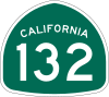
Major highways
.svg.png)
.svg.png)
.svg.png)


Public transportation
San Joaquin Regional Transit District provides city bus service within Stockton. RTD also runs intercity routes throughout the county, and subscription commuter routes to Livermore, Pleasanton, Sacramento, and Santa Clara County.
The cities of Lodi, Escalon, Manteca, Tracy and Ripon operate their own bus systems.
Train and bus service
San Joaquin County Rail Stations | |||||||||||||||||||||||||||||||||||||||||||||||||||||||||||||||||||||||||||||||||||||||||||||||||||||||||||||||||||||||||||||||||||||||||||||||||||||||||||||||||||||||||||
|---|---|---|---|---|---|---|---|---|---|---|---|---|---|---|---|---|---|---|---|---|---|---|---|---|---|---|---|---|---|---|---|---|---|---|---|---|---|---|---|---|---|---|---|---|---|---|---|---|---|---|---|---|---|---|---|---|---|---|---|---|---|---|---|---|---|---|---|---|---|---|---|---|---|---|---|---|---|---|---|---|---|---|---|---|---|---|---|---|---|---|---|---|---|---|---|---|---|---|---|---|---|---|---|---|---|---|---|---|---|---|---|---|---|---|---|---|---|---|---|---|---|---|---|---|---|---|---|---|---|---|---|---|---|---|---|---|---|---|---|---|---|---|---|---|---|---|---|---|---|---|---|---|---|---|---|---|---|---|---|---|---|---|---|---|---|---|---|---|---|---|---|
| |||||||||||||||||||||||||||||||||||||||||||||||||||||||||||||||||||||||||||||||||||||||||||||||||||||||||||||||||||||||||||||||||||||||||||||||||||||||||||||||||||||||||||
Greyhound buses and Amtrak trains both stop in Stockton. Amtrak's Oakland-Stockton-Fresno-Bakersfield "San Joaquin" trains stop at the San Joaquin Street Station. This is the former Santa Fe Railroad station in Stockton. Amtrak's Sacramento-Stockton-Fresno- Bakersfield "San Joaquin" trains stop at the Robert J. Cabral Station which is also used by Altamont Corridor Express trains to San Jose which originate in Stockton. This is the former Southern Pacific Railroad station in Stockton. RTD Hopper is a public bus service operated by San Joaquin Regional Transit connecting Stockton to Ripon, Manteca, Tracy, Lodi, and Lathrop.
Airports
Stockton Metropolitan Airport features passenger service to Los Angeles, Las Vegas, San Diego, and Phoenix, AZ, along with cargo service and general aviation. Other general aviation airports in the county include Lodi Airport and Tracy Municipal Airport.
Port
Port of Stockton is a major inland deepwater port in Stockton, California, located on the San Joaquin River before it joins the Sacramento River to empty into Suisun Bay, eighty miles inland. The port sits on about 4,200 acres (17 km2), and occupies an island in the Sacramento–San Joaquin River Delta.
Communities
Census-designated places
Unincorporated communities
- Atlanta
- Banta
- Goodmans Corner
- Mormon
- New Jerusalem
- Vernalis
- Youngstown
Population ranking
The population ranking of the following table is based on the 2010 census of San Joaquin County.[54]
† county seat
| Rank | City/Town/etc. | Municipal type | Population (2010 Census) |
|---|---|---|---|
| 1 | † Stockton | City | 291,707 |
| 2 | Tracy | City | 82,922 |
| 3 | Manteca | City | 67,096 |
| 4 | Lodi | City | 62,134 |
| 5 | Lathrop | City | 18,023 |
| 6 | Ripon | City | 14,297 |
| 7 | Garden Acres | CDP | 10,468 |
| 8 | Mountain House | CDP | 9,675 |
| 9 | Country Club | CDP | 9,379 |
| 10 | August | CDP | 8,390 |
| 11 | Escalon | City | 7,132 |
| 12 | Lincoln Village | CDP | 4,381 |
| 13 | Woodbridge | CDP | 3,984 |
| 14 | Morada | CDP | 3,828 |
| 15 | French Camp | CDP | 3,376 |
| 16 | Kennedy | CDP | 3,254 |
| 17 | Lockeford | CDP | 3,233 |
| 18 | Dogtown | CDP | 2,506 |
| 19 | Collierviile | CDP | 1,934 |
| 20 | Linden | CDP | 1,784 |
| 21 | Taft Mosswood | CDP | 1,530 |
| 22 | Thornton | CDP | 1,131 |
| 23 | Peters | CDP | 672 |
| 24 | Waterloo | CDP | 572 |
| 25 | Terminous | CDP | 381 |
| 26 | Acampo | CDP | 341 |
| 27 | Victor | CDP | 293 |
| 28 | Farmington | CDP | 207 |
See also
- Conergy
- Irrigation district
- List of museums in the San Joaquin Valley
- List of school districts in San Joaquin County, California
- National Register of Historic Places listings in San Joaquin County, California
- San Joaquin County Historical Society and Museum
Notes
- Other = Some other race + Two or more races
- Native American = Native Hawaiian or other Pacific Islander + American Indian or Alaska Native
- Percentage of registered voters with respect to total population. Percentages of party members with respect to registered voters follow.
References
- Zdenek, Sean (December 23, 2015). "Reading Sounds: Closed-Captioned Media and Popular Culture". University of Chicago Press – via Google Books.
- "Chronology". California State Association of Counties. Retrieved February 6, 2015.
- "County Administrator Office". San Joaquin County. Retrieved January 9, 2015.
- "Boardman North". Peakbagger.com. Retrieved April 19, 2015.
- "State & County QuickFacts". United States Census Bureau. Retrieved April 6, 2016.
- "American FactFinder". Archived from the original on June 2, 2013. Retrieved April 19, 2019.
- "Find a County". National Association of Counties. Retrieved June 7, 2011.
- Wikipedia sites for the Southern Pacific, Atchison Topeka and Santa Fe, Tidewater Southern, and Central California Traction railroads.
- Rubber Threat: Tracy tire fire highlights old problem. Lodi News-Sentinel. 18 August 1998.
- Breitler, Alex. Byproducts from 1998 tire fire found in water, Record. 20 Dec. 2005.
- "2010 Census Gazetteer Files". United States Census Bureau. August 22, 2012. Retrieved October 4, 2015.
- "Some of the richest remaining marsh habitats are in the Sacramento-San Joaquin Delta... has retained many of its original swamps and backwaters." San Joaquin River Wikipedia site.
- U.S. Census Bureau. American Community Survey, 2011 American Community Survey 5-Year Estimates, Table B02001. U.S. Census website. Retrieved 2013-10-26.
- U.S. Census Bureau. American Community Survey, 2011 American Community Survey 5-Year Estimates, Table B03003. U.S. Census website. Retrieved 2013-10-26.
- U.S. Census Bureau. American Community Survey, 2011 American Community Survey 5-Year Estimates, Table B19301. U.S. Census website. Retrieved 2013-10-21.
- U.S. Census Bureau. American Community Survey, 2011 American Community Survey 5-Year Estimates, Table B19013. U.S. Census website. Retrieved 2013-10-21.
- U.S. Census Bureau. American Community Survey, 2011 American Community Survey 5-Year Estimates, Table B19113. U.S. Census website. Retrieved 2013-10-21.
- U.S. Census Bureau. American Community Survey, 2011 American Community Survey 5-Year Estimates. U.S. Census website. Retrieved 2013-10-21.
- U.S. Census Bureau. American Community Survey, 2011 American Community Survey 5-Year Estimates, Table B01003. U.S. Census website. Retrieved 2013-10-21.
- "U.S. Decennial Census". United States Census Bureau. Retrieved October 4, 2015.
- "Historical Census Browser". University of Virginia Library. Retrieved October 4, 2015.
- Forstall, Richard L., ed. (March 27, 1995). "Population of Counties by Decennial Census: 1900 to 1990". United States Census Bureau. Retrieved October 4, 2015.
- "Census 2000 PHC-T-4. Ranking Tables for Counties: 1990 and 2000" (PDF). United States Census Bureau. April 2, 2001. Retrieved October 4, 2015.
- "2010 Census P.L. 94-171 Summary File Data". United States Census Bureau.
- "Profile of General Population and Housing Characteristics: 2010". 2010 Census Summary File 2. United States Census Bureau. 2010. Archived from the original on January 2, 2015. Retrieved January 2, 2014.
- Dawn B. Mabalon, Ph.D.; Rico Reyes; Filipino American National Historical Society (2008). Filipinos in Stockton. Arcadia Publishing. p. 8. ISBN 978-0-7385-5624-6.
- "U.S. Census website". United States Census Bureau. Retrieved May 14, 2011.
- "OMB Bulletin No. 13-01: Revised Delineations of Metropolitan Statistical Areas, Micropolitan Statistical Areas, and Combined Statistical Areas, and Guidance on Uses of the Delineations of These Areas" (PDF). United States Office of Management and Budget. February 28, 2013. Retrieved March 20, 2013.
- "Table 1. Annual Estimates of the Population of Metropolitan and Micropolitan Statistical Areas: April 1, 2010 to July 1, 2012". 2012 Population Estimates. United States Census Bureau, Population Division. March 2013. Archived from the original (CSV) on April 1, 2013. Retrieved March 20, 2013.
- "Table 2. Annual Estimates of the Population of Combined Statistical Areas: April 1, 2010 to July 1, 2012". 2012 Population Estimates. United States Census Bureau, Population Division. March 2013. Archived from the original (CSV) on May 17, 2013. Retrieved March 20, 2013.
- "Counties of California". San Joaquin County website. Retrieved December 29, 2012.
- "About County Government". Guide to Government. League of Women Voters of California. Retrieved December 28, 2012.
- "San Joaquin County". San Joaquin County. Retrieved December 5, 2019.
- "Board of Supervisors". San Joaquin County. Retrieved January 9, 2015.
- "Deuel Vocational Institution." California Department of Corrections and Rehabilitation. Retrieved on June 6, 2011. "23500 Kasson Road Tracy, CA 95376"
- "Tracy city, California Archived February 3, 2008, at the Wayback Machine." U.S. Census Bureau. Retrieved on June 6, 2011.
- California Secretary of State. February 10, 2013 - Report of Registration Archived July 27, 2013, at the Wayback Machine. Retrieved 2013-10-31.
- "Counties by County and by District". California Citizens Redistricting Commission. Archived from the original on September 30, 2013. Retrieved September 24, 2014.
- "California's 9th Congressional District - Representatives & District Map". Civic Impulse, LLC. Retrieved March 9, 2013.
- "Communities of Interest - Counties". California Citizens Redistricting Commission. Archived from the original on October 23, 2015. Retrieved September 24, 2014.
- "Communities of Interest - Counties". California Citizens Redistricting Commission. Archived from the original on October 23, 2015. Retrieved September 24, 2014.
- "County Results - Election Center 2008 - Elections & Politics from CNN.com". www.cnn.com.
- Leip, David. "Dave Leip's Atlas of U.S. Presidential Elections". uselectionatlas.org.
- Office of the Attorney General, Department of Justice, State of California. Table 11: Crimes – 2009 Archived December 2, 2013, at the Wayback Machine. Retrieved 2013-11-14.
- Only larceny-theft cases involving property over $400 in value are reported as property crimes.
- United States Department of Justice, Federal Bureau of Investigation. Crime in the United States, 2012, Table 8 (California). Retrieved 2013-11-14.
- Goldeen, Joe. "Almonds top grapes to become SJ's biggest crop". recordnet.com. Retrieved October 11, 2019.
- DRR. "FDIC: Failed Bank Information - Bank Closing Information for Pacific State Bank, Stockton, CA". www.fdic.gov.
- Lodi City website
- "Employment by Industry (Not Seasonally Adjusted) in San Joaquin County". www.labormarketinfo.edd.ca.gov. Retrieved October 11, 2019.
- "San Joaquin County's Goods Movement System" (PDF). University of the Pacific.
- A statewide average for this value is not computed by the California Department of Education.
- "Voters approve Lammersville school unification". Tracy press. June 8, 2010. Retrieved June 8, 2010.
- Promotions, Center for New Media and. "US Census Bureau 2010 Census". www.census.gov.
External links
| Wikimedia Commons has media related to San Joaquin County, California. |
- Official website

- San Joaquin County Office of Emergency Services (OES)
- San Joaquin County Office of Education
- San Joaquin County Superior Court
- South San Joaquin Irrigation District
Places adjacent to San Joaquin County, California | ||||||||||
|---|---|---|---|---|---|---|---|---|---|---|
| ||||||||||
Municipalities and communities of San Joaquin County, California, United States | ||
|---|---|---|
| Cities | 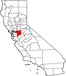 San Joaquin County map | |
| CDPs | ||
| Unincorporated communities | ||
| Ghost towns |
| |

| Authority control |
|
|---|