Farmington, California
Farmington is a census-designated place (CDP) in San Joaquin County, California. The population was 207 at the 2010 census, down from 262 at the 2000 census.
Farmington | |
|---|---|
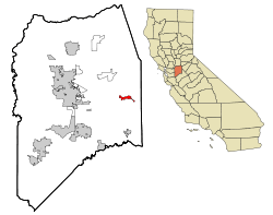 Location in San Joaquin County and the state of California | |
 Farmington Location in the United States | |
| Coordinates: 37°55′47″N 120°59′58″W | |
| Country | |
| County | San Joaquin |
| Government | |
| • Senate | Tom Berryhill (R) |
| • Assembly | Greg Aghazarian (R) |
| • U. S. Congress | Jerry McNerney (D)[1] |
| Area | |
| • Total | 2.542 sq mi (6.584 km2) |
| • Land | 2.542 sq mi (6.584 km2) |
| • Water | 0 sq mi (0 km2) 0% |
| Elevation | 112 ft (34 m) |
| Population (2010) | |
| • Total | 207 |
| • Density | 81/sq mi (31/km2) |
| Time zone | UTC-8 (Pacific (PST)) |
| • Summer (DST) | UTC-7 (PDT) |
| ZIP code | 95230 |
| Area code(s) | 209 |
| FIPS code | 06-23630 |
| GNIS feature ID | 1656009 |
History
Farmington was so named to distinguish its agricultural setting from the nearby mining regions.[3]
Geography
Farmington is located at 37°55′47″N 120°59′58″W (37.929625, -120.999574).[4] According to the United States Census Bureau, the CDP has a total area of 2.5 square miles (6.5 km2), all of it land. The town has a school, firehouse, bar, Circle K, Shell gas station, general store, and post office. Barren, low hills lie to the immediate east of the town, and farther east are the Sierra Nevada mountains. Stockton East Creek flows along the southern border of Farmington, paralleling Highway 4 for a short distance.[5] The creek and many other places nearby were used as locations in the 1958 film The Big Country,[6] as was scenes for the movie, Dirty Mary, Crazy Larry (1974).[7]
Demographics
| Historical population | |||
|---|---|---|---|
| Census | Pop. | %± | |
| U.S. Decennial Census[8] | |||
2010
At the 2010 census Farmington had a population of 207. The population density was 81.4 people per square mile (31.4/km²). The racial makeup of Farmington was 164 (79.2%) White, 7 (3.4%) African American, 1 (0.5%) Native American, 6 (2.9%) Asian, 0 (0.0%) Pacific Islander, 18 (8.7%) from other races, and 11 (5.3%) from two or more races. Hispanic or Latino of any race were 42 people (20.3%).[9]
The whole population lived in households, no one lived in non-institutionalized group quarters and no one was institutionalized.
There were 79 households, 26 (32.9%) had children under the age of 18 living in them, 46 (58.2%) were opposite-sex married couples living together, 5 (6.3%) had a female householder with no husband present, 6 (7.6%) had a male householder with no wife present. There were 6 (7.6%) unmarried opposite-sex partnerships, and 0 (0%) same-sex married couples or partnerships. 14 households (17.7%) were one person and 7 (8.9%) had someone living alone who was 65 or older. The average household size was 2.62. There were 57 families (72.2% of households); the average family size was 2.98.
The age distribution was 45 people (21.7%) under the age of 18, 13 people (6.3%) aged 18 to 24, 49 people (23.7%) aged 25 to 44, 73 people (35.3%) aged 45 to 64, and 27 people (13.0%) who were 65 or older. The median age was 43.9 years. For every 100 females, there were 102.9 males. For every 100 females age 18 and over, there were 102.5 males.
There were 98 housing units at an average density of 38.6 per square mile, of the occupied units 54 (68.4%) were owner-occupied and 25 (31.6%) were rented.The homeowner vacancy rate was 11.5%; the rental vacancy rate was 10.7%. 128 people (61.8% of the population) lived in owner-occupied housing units and 79 people (38.2%) lived in rental housing units.
2000
At the 2000 census there were 262 people, 84 households, and 67 families in the CDP. The population density was 103.1 people per square mile (39.8/km²). There were 95 housing units at an average density of 37.4 per square mile (14.4/km²). The racial makeup of the CDP was 72.90% White, 1.53% Asian, 15.65% from other races, and 9.92% from two or more races. Hispanic or Latino of any race were 26.34%.[10]
Of the 84 households 35.7% had children under the age of 18 living with them, 63.1% were married couples living together, 10.7% had a female householder with no husband present, and 20.2% were non-families. 16.7% of households were one person and 3.6% were one person aged 65 or older. The average household size was 3.12 and the average family size was 3.48.
The age distribution was 30.2% under the age of 18, 7.3% from 18 to 24, 21.8% from 25 to 44, 26.7% from 45 to 64, and 14.1% 65 or older. The median age was 36 years. For every 100 females, there were 106.3 males. For every 100 females age 18 and over, there were 101.1 males.
The median household income was $32,614 and the median family income was $32,727. Males had a median income of $20,250 versus $35,357 for females. The per capita income for the CDP was $13,289. About 15.5% of families and 15.3% of the population were below the poverty line, including 19.5% of those under the age of eighteen and none of those sixty-five or over.
References
- "California's 9th Congressional District - Representatives & District Map". Civic Impulse, LLC. Retrieved March 12, 2013.
- "U.S. Census". Archived from the original on January 12, 2012.
- Gannett, Henry (1905). The Origin of Certain Place Names in the United States. Govt. Print. Off. pp. 124.
- "US Gazetteer files: 2010, 2000, and 1990". United States Census Bureau. 2011-02-12. Retrieved 2011-04-23.
- "Google Maps". Google Maps.
- "Orvis Cattle Company - Big Country". www.orvisranch.com.
- Dirty Mary, Crazy Larry on IMDb
- "Census of Population and Housing". Census.gov. Retrieved June 4, 2016.
- "2010 Census Interactive Population Search: CA - Farmington CDP". U.S. Census Bureau. Archived from the original on December 28, 2016. Retrieved July 12, 2014.
- "U.S. Census website". United States Census Bureau. Retrieved 2008-01-31.
Municipalities and communities of San Joaquin County, California, United States | ||
|---|---|---|
| Cities | 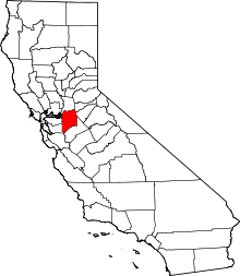 San Joaquin County map | |
| CDPs | ||
| Unincorporated communities | ||
| Ghost towns |
| |
| Authority control |
|
|---|