Southern California
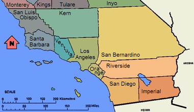
Southern California (colloquially known as SoCal; Spanish: Sur de California) is a geographic and cultural region that generally comprises the southernmost counties of California, and is the second most populous urban agglomeration in the United States.[3][4] The region contains ten counties: Imperial, Kern, Los Angeles, Orange, Riverside, San Bernardino, San Diego, Santa Barbara, San Luis Obispo and Ventura counties. The Colorado Desert and the Colorado River are located on southern California's eastern border with Arizona, and the Mojave Desert is located north on California's Nevada border. Southern California's southern border is part of the Mexico–United States border.
Southern California | |
|---|---|
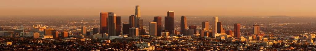
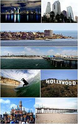 Southern California Images top to bottom, left to right: San Diego Skyline, Downtown Los Angeles, Village of La Jolla, Santa Monica Pier, Surfer at Black's Beach, Hollywood Sign, Disneyland, Hermosa Beach Pier | |
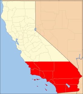 Red: The ten counties of Southern California | |
| Country | |
| State | |
| Counties | |
| Largest city | |
| Area (10-county)[1] | |
| • Total | 146,350 km2 (56,505 sq mi) |
| Population (2019) | 23,860,793[2] |
Constituent metropolitan areas
Southern California includes the heavily built-up urban area which stretches along the Pacific coast from Ventura through Greater Los Angeles down to Greater San Diego (the contiguous urban area in fact continuing into Tijuana, Mexico), and inland to the Inland Empire and Coachella Valley (Palm Springs area). It encompasses eight metropolitan areas (MSAs), three of which together form the Greater Los Angeles Combined Statistical Area (CSA) with over 18 million people, the second-biggest CSA after the New York CSA. These three MSAs are: the Los Angeles metropolitan area (Los Angeles and Orange counties, with 13.3 million people), the Inland Empire ((Riverside and San Bernardino counties, including the Coachella Valley cities, with 4.3 million people), and the Oxnard–Thousand Oaks–Ventura metropolitan area (0.8 million people). In addition, Southern California contains the San Diego metropolitan area with 3.3 million people, Bakersfield metro area with 0.9 million, and the Santa Barbara, San Luis Obispo, and El Centro (Imperial County) metropolitan areas.
The Southern California Megaregion (or megalopolis) is larger still, extending east into Las Vegas, Nevada and south across the Mexican border into Tijuana.[5]
Significance
Within southern California are two major cities, Los Angeles and San Diego, as well as three of the country's largest metropolitan areas.[6] With a population of approximately 4 million, Los Angeles is the most populous city in California and the second most populous in the United States. South of Los Angeles and with a population of approximately 1.4 million is San Diego, the second most populous city in the state and the eighth most populous in the nation.
The counties of Los Angeles, San Diego, Orange, Riverside, and San Bernardino are the five most populous in the state, and are among the top 15 most populous counties in the United States.[7]
The motion picture, television, and music industry are centered in the Los Angeles area in southern California. Hollywood, a district of Los Angeles, gives its name to the American motion picture industry, which is synonymous with the neighborhood name. Headquartered in southern California are The Walt Disney Company (which owns ABC), Sony Pictures, Universal Pictures, MGM, Paramount Pictures, and Warner Bros. Universal, Warner Bros., and Sony also run major record companies.
Southern California is also home to a large homegrown surf and skateboard culture. Companies such as Vans, Volcom, Quiksilver, No Fear, RVCA, and Body Glove are all headquartered here. Skateboarder Tony Hawk; surfers Rob Machado, Tim Curran, Bobby Martinez, Pat O'Connell, Dane Reynolds, and Chris Ward live in southern California. Some of the most famous surf locations are in southern California as well, including Trestles, Rincon, The Wedge, Huntington Beach, and Malibu. Some of the world's largest action sports events, including the X Games,[8] Boost Mobile Pro,[9] and the U.S. Open of Surfing, are held in southern California. The region is also important to the world of yachting with premier events including the annual Transpacific Yacht Race, or Transpac, from Los Angeles to Hawaii. The San Diego Yacht Club held the America's Cup, the most prestigious prize in yachting, from 1988 to 1995 and hosted three America's Cup races during that time. The first modern-era triathlon was held in San Diego’s Mission Bay in 1974. Since then, southern California, and San Diego in particular, have become a mecca for triathlon and multi-sport racing, products and culture.
Southern California is home to many sports franchises and sports networks such as Fox Sports Net.
Many locals and tourists frequent the southern California coast for its beaches. The inland desert city of Palm Springs is also popular.
Northern boundary of southern California
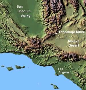
Southern California is not a formal geographic designation and definitions of what constitutes southern California vary. Geographically, California's North-South midway point lies at exactly 37° 9' 58.23" latitude, around 11 miles (18 km) south of San Jose; however, this does not coincide with the popular use of the term. When the state is divided into two areas (northern and southern California), the term southern California usually refers to the 10 southernmost counties of the state. This definition coincides neatly with the county lines at 35° 47′ 28″ North latitude, which form the northern borders of San Luis Obispo, Kern, and San Bernardino counties. That closely matches the lower one-third of California's span of latitude. Another definition for southern California uses Point Conception and the Tehachapi Mountains as geographical landmarks for the northern boundary.
Though there is no official definition for the northern boundary of southern California, such a division has existed from the time when Mexico ruled California and political disputes raged between the Californios of Monterey in the upper part and Los Angeles in the lower part of Alta California. Following the acquisition of California by the United States, the division continued as part of the attempt by several pro-slavery politicians to arrange the division of Alta California at 36 degrees, 30 minutes, the line of the Missouri Compromise. Instead, the passing of the Compromise of 1850 enabled California to be admitted to the Union as a free state, preventing southern California from becoming its own separate slave state.
Subsequently, Californians (dissatisfied with inequitable taxes and land laws) and pro-slavery Southerners in the lightly populated "cow counties" of southern California attempted three times in the 1850s to achieve a separate statehood or territorial status separate from Northern California. The last attempt, the Pico Act of 1859, was passed by the California State Legislature and signed by State Governor John B. Weller. It was approved overwhelmingly by nearly 75 percent of voters in the proposed Territory of Colorado. This territory was to include all the counties up to the then much larger Tulare County (that included what is now Kings, most of Kern, and part of Inyo counties) and San Luis Obispo County. The proposal was sent to Washington, D.C. with a strong advocate in Senator Milton Latham. However, the secession crisis following the election of Abraham Lincoln in 1860 and the subsequent American Civil War led to the proposal never coming to a vote.[10][11]
In 1900, the Los Angeles Times defined southern California as including "the seven counties of Los Angeles, San Bernardino, Orange, Riverside, San Diego, Ventura and Santa Barbara." In 1999, the Times added a newer county, Imperial, to that list.[12]
Southern California was the name of a proposed new state which failed to get on the 2018 California ballot. The ballot measure proposed splitting the existing state into three parts.[13]
The state is most commonly divided and promoted by its regional tourism groups, consisting of northern, central, and southern California regions. The two American Automobile Association (AAA) Auto Clubs of the state, the California State Automobile Association, and the Automobile Club of Southern California, choose to simplify matters by dividing the state along the lines where their jurisdictions for membership apply, as either northern or southern California, in contrast to the three-region point of view. Another influence is the geographical phrase South of the Tehachapis, which would split the southern region off at the crest of that transverse range, but in that definition, the desert portions of north Los Angeles County and eastern Kern and San Bernardino Counties would be included in the southern California region due to their remoteness from the central valley and interior desert landscape.
| County Ref. |
Population | Land mi² |
Land km² |
Pop. /mi² |
Pop. /km² |
|---|---|---|---|---|---|
| Los Angeles County[14] | 9,862,049 | 4,060.87 | 10,517.61 | 2,428.56 | 937.67 |
| San Diego County[15] | 3,095,313 | 4,199.89 | 10,877.67 | 714.56 | 275.89 |
| Orange County[16] | 3,010,759 | 789.40 | 2,044.54 | 3,813.98 | 1,472.59 |
| Riverside County[17] | 2,100,516 | 7,207.37 | 18,667.00 | 291.44 | 112.53 |
| San Bernardino County[18] | 2,015,355 | 20,052.50 | 51,935.74 | 100.50 | 38.80 |
| Kern County[19] | 800,458 | 8,140.96 | 21,084.99 | 98.32 | 37.96 |
| Ventura County[20] | 797,740 | 1,845.30 | 4,779.31 | 432.31 | 166.92 |
| Santa Barbara County[21] | 405,396 | 2,737.01 | 7,088.82 | 148.12 | 57.19 |
| San Luis Obispo County[22] | 265,297 | 3,304.32 | 8,558.15 | 80.29 | 31.00 |
| Imperial County[23] | 163,972 | 4,174.73 | 10,812.50 | 39.28 | 15.17 |
| Southern California | 22,422,614 | 56,512.35 | 146,366.31 | 396.77 | 153.19 |
| California | 36,756,666 | 155,959.34 | 403,932.84 | 235.68 | 91.00 |
Urban landscape
Southern California consists of a heavily developed urban environment, home to some of the largest urban areas in the state, along with vast areas that have been left undeveloped. It is the third most populated megalopolis in the United States, after the Great Lakes Megalopolis and the Northeastern Megalopolis. Much of southern California is famous for its large, spread-out, suburban communities and use of automobiles and highways. The dominant areas are Los Angeles, Orange County, San Diego, and Riverside-San Bernardino, each of which are the centers of their respective metropolitan areas, composed of numerous smaller cities and communities. The urban area is also host to an international metropolitan region in the form of San Diego–Tijuana, created by the urban area spilling over into Baja California.
Traveling south on Interstate 5, the main gap to continued urbanization is Camp Pendleton. The cities and communities along Interstate 15 and Interstate 215 are so interrelated that Temecula and Murrieta have as much connection with the San Diego metropolitan area as they do with the Inland Empire. To the east, the United States Census Bureau considers the San Bernardino and Riverside County areas, Riverside-San Bernardino area as a separate metropolitan area from Los Angeles County. Newly developed exurbs formed in the Antelope Valley, north of Los Angeles, the Victor Valley, and the Coachella Valley with the Imperial Valley. Also, population growth was high in the Bakersfield-Kern County, Santa Maria and San Luis Obispo areas.
Climate
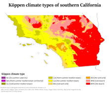
Most of southern California has a Mediterranean-like climate, with warm and dry summers, mild and wet winters, where cool weather and freezing temperatures are rare. Southern California contains other types of climates, including semi-arid, desert and mountain, with infrequent rain and many sunny days. Summers are hot or warm, and dry, while winters are mild, and rainfall is low to moderate depending on the area. Although heavy rain can occur, it is unusual. This climatic pattern was alluded to in the hit song "It Never Rains (In Southern California)". While snow is very rare in lower elevations, mountains above 5,000 feet (1,500 m) receive plentiful snowfall in the winter.
Natural landscape
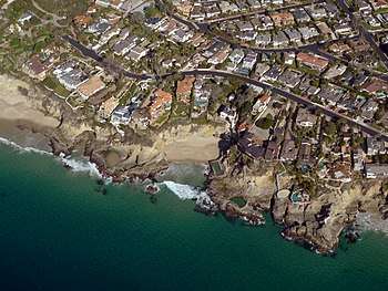
.jpg)
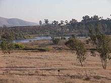
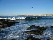
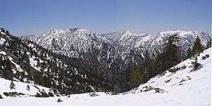
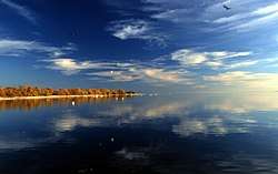
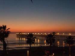
Southern California consists of one of the more varied collections of geologic, topographic, and natural ecosystem landscapes in a diversity outnumbering other major regions in the state and country. The region spans from Pacific Ocean islands, shorelines, beaches, and coastal plains, through the Transverse and Peninsular Ranges with their peaks, and into the large and small interior valleys, to the vast deserts of California.
- Introductory categories include:
- Category: Beaches of southern California
- Category: Mountain ranges of Southern California
- Category: Rivers of Southern California
- Category: Deserts of California
- Category: Parks in Southern California
Geography
Southern California is divided into:
- The Coastal Region, which is densely populated and includes the coastal interior valleys west of the coastal mountains with all of Orange County and portions of San Diego, Los Angeles, Ventura, Santa Barbara, and San Luis Obispo counties.
- A related florist province term is the Cismontane Region on the coastal side of the Transverse and Peninsular mountain ranges, with the term "southern California" popularly referring to this more populated and visited zone.
- The Desert Region, which is larger and sparsely populated with portions of Kern, Los Angeles, San Bernardino, Riverside, Imperial, and San Diego counties. The division between the Coastal Region and the Inland Empire/Imperial Valley winds along the backs of coastal mountain ranges such as the Santa Ana Mountains.
- A related floristic province term is the Transmontane Region on the rain shadow side of the same mountain ranges, with the term southern California including this zone geographically and when distinguishing all the 'southland' from northern California.
Geographic features
- Angeles National Forest (Los Angeles, San Bernardino, & Ventura Counties)
- Antelope Hills (Kern County)
- Antelope Valley (Los Angeles & Kern Counties)
- Arroyo Seco (Los Angeles County)
- Bacon Hills (Kern County)
- Baldwin Hills (Los Angeles County)
- Ballona Wetlands (Los Angeles County)
- Big Bear Lake (San Bernardino County)
- Bissell Hills (Kern County)
- Black Hills (Kern County)
- Bolsa Chica Estuary (Orange County)
- Buena Vista Hills (Kern County)
- Buena Vista Lake (Kern County)
- Cajon Pass (San Bernardino County)
- Calico Mountains (San Bernardino County)
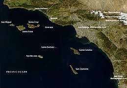
- Channel Islands (Santa Barbara, Ventura & Los Angeles Counties)
- Castaic Lake (Los Angeles County)
- Chino Hills (Orange, Los Angeles, Riverside & San Bernardino Counties)
- Coachella Valley (Riverside County)
- Colorado Desert (San Bernardino, Riverside, Imperial, & San Diego Counties)
- Colorado River (San Bernardino, Riverside & Imperial Counties, Baja California & Sonora)
- Conejo Valley (Ventura County)
- Cucamonga Valley (San Bernardino & Riverside Counties)
- Cuyamaca Mountains (San Diego County)
- Death Valley (San Bernardino & Inyo Counties)
- Diablo Range (Kern County)
- Elk Hills (Kern County)
- Elkhorn Hills (San Luis Obispo County)
- El Mirage Lake (San Bernardino County)
- El Paso Mountains (Kern County)
- Greenhorn Mountains (Kern County)
- High Desert (Los Angeles, Kern, Inyo, & San Bernardino Counties)
- Horned Toad Hills (Kern County)
- Imperial Valley (Imperial County)
- Irish Hills (San Luis Obispo County)
- In-Ko-Pah Mountains (San Diego County)
- Inland Empire (Riverside & San Bernardino Counties)
- Jacumba Mountains (San Diego County)
- Jawbone Canyon (Kern County)
- Kern River (Kern County)
- La Jolla Cove (San Diego County)
- Laguna Mountains (San Diego County)
- Lake Arrowhead (San Bernardino County)
- Lake Casitas (Ventura County)
- Lake Elsinore (Riverside County)
- Lake Isabella (Kern County)
- Lake Perris (Riverside County)
- Lake Piru (Ventura County)
- Lakeview Mountains (Riverside County)
- Lake Webb (Kern County)
- Little San Bernardino Mountains (Riverside & San Bernardino Counties)
- Little Signal Hills (Kern County)
- Los Angeles Basin (Los Angeles & Orange Counties)
- Los Angeles River (Los Angeles County)
- Los Padres National Forest (Kern, Los Angeles, San Luis Obispo, Santa Barbara, & Ventura Counties)
- Lost Hills (Kern County)
- Low Desert (Imperial, San Diego, Riverside & San Bernardino Counties)
- Mojave Desert (Los Angeles, Kern & San Bernardino Counties)
- Mojave River (San Bernardino County)
- Mount San Antonio (Los Angeles County)
- New River (Imperial County, Mexicali Municipality)
- Nine Sisters (San Luis Obispo County)
- Ojai Valley (Ventura County)
- Orange Coast (Orange County)
- Oxnard Plain (Ventura County)
- Palomar Mountain (San Diego County)
- Palo Verde Valley (Riverside & Imperial Counties)
- Palos Verdes Peninsula (Los Angeles County)
- Panamint Range (Inyo County)
- Peninsular Ranges (San Diego, Riverside, & Orange Counties)
- Pleito Hills (Kern County)
- Point Loma (San Diego County)
- Point Mugu (Ventura County)
- Point of Rocks (Kern County)
- Pomona Valley (Los Angeles & San Bernardino Counties)
- Providence Mountains (San Bernardino County)
- Puente Hills (Los Angeles County)
- Pyramid Lake (Los Angeles County)
- Rand Mountains (Kern County)
- Rio Hondo (Los Angeles County)
- Rosamond Hills (Kern County)
- Saddleback Valley (Orange County)
- Salton Sea (Imperial & Riverside Counties)
- San Andreas Fault (All Counties)
- San Bernardino Mountains (San Bernardino County)
- San Bernardino National Forest (Riverside & San Bernardino Counties)
- San Bernardino Valley (San Bernardino County)
- San Diego Bay (San Diego County)
- San Diego River (San Diego County)
- San Emigdio Mountains (Los Angeles, Ventura, & Kern Counties)
- San Fernando Valley (Los Angeles County)
- San Gabriel Mountains (Los Angeles & San Bernardino Counties)
- San Gabriel River (Los Angeles County)
- San Gabriel Valley (Los Angeles County)
- San Jacinto Mountains (Riverside County)
- San Jacinto River (Riverside County)
- San Joaquin Valley (Kern County)
- San Luis Rey River (San Diego County)
- San Pedro Bay (Los Angeles County)
- San Rafael Mountains (Santa Barbara County)
- Santa Ana Mountains (Orange & Riverside Counties)
- Santa Ana River (San Bernardino, Riverside & Orange Counties)
- Santa Ana Valley (Orange County)
- Santa Catalina Island (Los Angeles County)
- Santa Clara River (Ventura County)
- Santa Clara River Valley (Ventura County)
- Santa Clarita Valley (Los Angeles County)
- Santa Margarita River (Riverside, Orange & San Diego Counties)
- Santa Monica Bay (Los Angeles County)
- Santa Monica Mountains (Los Angeles & Ventura Counties)
- Santa Rosa Mountains (Riverside, Imperial & San Diego Counties)
- Santa Susana Mountains (Los Angeles & Ventura Counties)
- Santa Ynez Mountains (Santa Barbara & Ventura Counties)
- Santa Ynez Valley (Santa Barbara County)
- Scodie Mountains (Kern County)
- Sequoia National Forest (Kern County)
- Shale Hills (Kern County)
- Sierra Nevada (Kern County)
- Sierra Pelona Mountains (Los Angeles & Kern Counties)
- Simi Hills (Los Angeles & Ventura Counties)
- Simi Valley (Ventura County)
- Sweetwater River (San Diego County)
- Tehachapi Mountains (Kern & Los Angeles Counties)
- Tejon Hills (Kern County)
- Temescal Mountains (Riverside County)
- Telephone Hills (Kern County)
- Temblor Range (Kern & San Luis Obispo Counties)
- Tijuana River (San Diego County)
- Topatopa Mountains (Ventura County)
- Turtle Mountains (San Bernardino County)
- Ventura River (Ventura County)
- Verdugo Mountains (Los Angeles County)
- Victor Valley (San Bernardino County)
Geology
Earthquakes
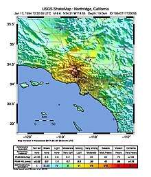
Each year, southern California has about 10,000 earthquakes. Nearly all of them are so small that they are not felt. Only several hundred have been greater than magnitude 3.0, and only about 15–20 have been greater than magnitude 4.0.[24] The magnitude 6.7 1994 Northridge earthquake was particularly destructive, causing a substantial number of deaths, injuries, and structural collapses as well as the most property damage of any earthquake in U.S. history at an estimated $20 billion.[25]
Many faults are able to produce a magnitude greater than 6.7 earthquake, such as the San Andreas Fault, which can produce a magnitude 8.0 event. Other faults include the San Jacinto Fault, the Puente Hills Fault, and the Elsinore Fault Zone. The United States Geological Survey (USGS) has released a California earthquake forecast,[26] which models earthquake occurrence in California.
Regions
Divisions
Southern California is divided culturally, politically, and economically into distinct regions, each containing its own culture and atmosphere, anchored usually by a city with both national and sometimes global recognition, which is often the hub of economic activity for its respective region and being home to many tourist destinations. Each region is further divided into many culturally distinct areas but as a whole, combine to create the southern California atmosphere.
- Coastal southern California
- Southern Central Coast
- Ventura County
- Oxnard Plain
- Los Angeles Basin
- Orange County
- San Diego County
- Inland southern California
- Kern County
- Imperial Valley
- Inland Empire
- San Bernardino County
- High Desert (Section)*
- Morongo Basin*
- San Bernardino Valley
- Riverside County
- Coachella Valley*
- Low Desert (Section)*
- Deserts of California
- High Desert*
- Antelope Valley
- Morongo Basin*
- eastern Kern County
- Low Desert*
- Coachella Valley*
- Lower Colorado River Valley
- Imperial County
- Imperial Valley
- Palo Verde Valley
*Part of multiple regions
Population
| Historical population | |||
|---|---|---|---|
| Census | Pop. | %± | |
| 1850 | 6,492 | — | |
| 1860 | 33,280 | 412.6% | |
| 1870 | 44,158 | 32.7% | |
| 1880 | 91,916 | 108.2% | |
| 1890 | 251,770 | 173.9% | |
| 1900 | 337,328 | 34.0% | |
| 1910 | 808,408 | 139.7% | |
| 1920 | 1,423,786 | 76.1% | |
| 1930 | 3,044,978 | 113.9% | |
| 1940 | 3,840,733 | 26.1% | |
| 1950 | 5,931,975 | 54.4% | |
| 1960 | 9,398,722 | 58.4% | |
| 1970 | 12,103,559 | 28.8% | |
| 1980 | 14,308,742 | 18.2% | |
| 1990 | 18,269,095 | 27.7% | |
| 2000 | 20,637,512 | 13.0% | |
| 2010 | 22,680,010 | 9.9% | |
| Est. 2019 | 23,860,793 | 5.2% | |
| Sources: 1790–1990, 2000, 2010, 2019[27][28][29] Chart does not include Indigenous population figures. Studies indicate that the Native American population in California in 1850 was close to 150,000 before declining to 15,000 by 1900.[30] | |||
As of the 2010 United States Census, southern California has a population of 22,680,010. Despite a reputation for high growth rates, southern California's rate grew less than the state average of 10.0 percent in the 2000s. This was due to California's growth becoming concentrated in the northern part of the state as result of a stronger, tech-oriented economy in the Bay Area and an emerging Greater Sacramento region.
Southern California consists of one Combined Statistical Area, eight Metropolitan Statistical Areas, one international metropolitan area, and multiple metropolitan divisions. The region is home to two extended metropolitan areas that exceed five million in population. These are the Greater Los Angeles Area at 17,786,419, and San Diego–Tijuana at 5,105,768.[31][32] Of these metropolitan areas, the Los Angeles-Long Beach-Santa Ana metropolitan area, Riverside-San Bernardino-Ontario metropolitan area, and Oxnard-Thousand Oaks-Ventura metropolitan area form Greater Los Angeles;[33] while the El Centro metropolitan area and San Diego-Carlsbad-San Marcos metropolitan area form the Southern Border Region.[34][35] North of Greater Los Angeles are the Santa Barbara, San Luis Obispo, and Bakersfield metropolitan areas.
Cities
Los Angeles (with a 2017 census-estimated population of 4.0 million people) and San Diego (at 1.4 million people) are the two largest cities in all of California and are in the top eight largest cities in the United States. In southern California, there are also 12 cities with more than 200,000 residents and 34 cities over 100,000 residents. Many of southern California's most developed cities lie along or in close proximity to the coast, with the exception of San Bernardino and Riverside.
Economy
Industries
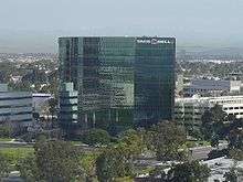
Southern California has a diverse economy and is one of the largest economies in the United States. It is dominated by and heavily dependent upon the abundance of petroleum, as opposed to other regions where automobiles are not nearly as dominant, due to the vast majority of transport that runs on this fuel. Southern California is famous for tourism and the entertainment industry. Other industries include software, automotive, ports, finance, biomedical, and regional logistics. The region was a leader in the housing bubble from 2001 to 2007 and has been heavily impacted by the housing crash.
Since the 1920s, motion pictures, petroleum, and aircraft manufacturing have been major industries. In one of the richest agricultural regions in the U.S., cattle and citrus were major industries until farmlands were turned into suburbs. Although military spending cutbacks have had an impact, aerospace continues to be a major factor.[36]
Major central business districts
Southern California is home to many major business districts. Central business districts (CBD) include Downtown Los Angeles, Downtown San Diego, Downtown San Bernardino and South Coast Metro. Within the Los Angeles Area are the major business districts of Downtown Pasadena, Downtown Burbank, Downtown Santa Monica, Downtown Glendale and Downtown Long Beach. Los Angeles itself has many business districts, such as Downtown Los Angeles and those lining the Wilshire Boulevard Miracle Mile, including Century City, Westwood, and Warner Center in the San Fernando Valley. The area of Santa Monica and Venice (and perhaps some of Culver City) is informally referred to as "Silicon Beach" because of the concentration of financial and marketing technology-centric firms located in the region.
The San Bernardino-Riverside area maintains the business districts of Downtown San Bernardino, Hospitality Business/Financial Centre, University Town which are in San Bernardino and Downtown Riverside.
Orange County is a rapidly developing business center that includes Downtown Santa Ana, the South Coast Metro, and Newport Center districts, as well as the Irvine business centers of The Irvine Spectrum, West Irvine, and international corporations headquartered at the University of California, Irvine. West Irvine includes the Irvine Tech Center and Jamboree Business Parks.
Downtown San Diego is the CBD of San Diego, though the city is filled with business districts. These include Carmel Valley, Del Mar Heights, Mission Valley, Rancho Bernardo, Sorrento Mesa, and University City. Most of these districts are located in Northern San Diego and some within North County regions.
Theme parks and waterparks
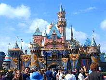
Los Angeles
- Universal Studios Hollywood
- Six Flags Magic Mountain
- Six Flags Hurricane Harbor
- Raging Waters San Dimas
- Pacific Park
- Dry Town Water Park
Orange County
Riverside & San Bernardino
San Diego
- Legoland California
- SeaWorld San Diego
- Belmont Park
- Aquatica San Diego
- Legoland Waterpark
- San Diego Zoo
- San Diego Wild Animal Park
Vinyard-Winery American Viticultural Area (AVA) districts
- California wine AVA-American Viticultural Areas in southern California:
Transportation
- See: Category: Transportation in Southern California
Southern California is home to Los Angeles International Airport, the second-busiest airport in the United States by passenger volume (see World's busiest airports by passenger traffic) and the third-busiest by international passenger volume (see Busiest airports in the United States by international passenger traffic); San Diego International Airport, the busiest single-runway airport in the world; Van Nuys Airport, the world's busiest general aviation airport; major commercial airports at Orange County, Bakersfield, Ontario, Burbank and Long Beach; and numerous smaller commercial and general aviation airports.
Six of the seven lines of the commuter rail system, Metrolink, run out of Downtown Los Angeles, connecting Los Angeles, Ventura, San Bernardino, Riverside, Orange, and San Diego counties with the other line connecting San Bernardino, Riverside, and Orange counties directly.
Southern California is also home to the Port of Los Angeles, the country's busiest commercial port; the adjacent Port of Long Beach, the country's second busiest container port; and the Port of San Diego.
Airports
The following table shows all airports listed by the Federal Aviation Association (FAA) as a hub airport:[37]
| Airport | ID | City (Metro area) | Category | Enplanements (2011) (mil) |
|---|---|---|---|---|
| Los Angeles International Airport | LAX | Los Angeles | Large Hub | 30.5m |
| San Diego International Airport | SAN | San Diego | Large Hub | 8.5m |
| John Wayne Airport | SNA | Orange County | Medium Hub | 4.2m |
| Ontario International Airport | ONT | San Bernardino, Riverside | Medium hub | 2.3m |
| Hollywood Burbank Airport | BUR | Burbank (LA) | Medium Hub | 2.1m |
| Long Beach Airport | LGB | Long Beach (LA) | Small Hub | 1.5m |
| Palm Springs International Airport | PSP | Palm Springs | Small Hub | 0.8m |
| Santa Barbara Municipal Airport | SBA | Santa Barbara | Small Hub | 0.7m |
| San Luis Obispo Regional Airport | SBP | San Luis Obispo | Small Hub | 0.5m |
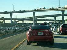
Freeways and highways
Sections of the southern California freeway system are often referred to by names rather than by the official numbers.
| Sign | Interstate | Freeway name |
|---|---|---|
| Interstate 5 | Golden State Freeway Santa Ana Freeway San Diego Freeway Montgomery Freeway | |
| Interstate 8 | Ocean Beach Freeway Mission Valley Freeway | |
| Interstate 10 | Santa Monica (Rosa Parks) Freeway Golden State Freeway San Bernardino Freeway Indio (Dr. June McCarroll) Freeway Blythe Freeway | |
| Interstate 15 | Mojave Freeway Barstow Freeway Ontario Freeway Corona Freeway Temecula Valley Freeway Escondido Freeway | |
| Interstate 40 | Needles Freeway | |
| Interstate 105 | Century (Glenn Anderson) Freeway | |
| Interstate 110 | Harbor Freeway | |
| Interstate 210 | Foothill Freeway | |
| Interstate 215 | Barstow Freeway San Bernardino Freeway Moreno Valley Freeway Escondido Freeway | |
| Interstate 405 | San Diego Freeway | |
| Interstate 605 | San Gabriel River Freeway | |
| Interstate 710 | Long Beach Freeway | |
| Interstate 805 | Jacob Dekema Freeway | |
| Future Interstate 905 |
| Sign | U.S. Route | Freeway name |
|---|---|---|
| U.S. Route 95 | ||
| U.S. Route 101 | Ventura Freeway Hollywood Freeway Santa Ana Freeway El Camino Real | |
| U.S. Route 395 |
Public transportation
- See: Category: Public transportation in Southern California
- Antelope Valley Transit Authority
- Metrolink
- Los Angeles County Metropolitan Transportation Authority
- San Diego trolley and San Diego County MTS
- Orange County Transportation Authority
- Omnitrans (southwestern San Bernardino County)
- Golden Empire Transit (Bakersfield)
- Santa Barbara MTD
- San Luis Obispo Regional Transit Authority
- Gold Coast Transit (Ventura County)
- North County Transit District (northern San Diego County)
- San Diego Coaster (Oceanside to San Diego)
- Big Blue Bus (Santa Monica)
- Riverside Transit Agency (western Riverside County)
Communication
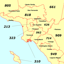
Telephone area codes
- 213 – Downtown Los Angeles
- 323 – Hollywood, South Los Angeles, Mid-Wilshire, and East Los Angeles
- 310 – West Los Angeles, Inglewood, Santa Monica, South Bay and Catalina Island
- 424 – Overlay with 310
- 442 – Overlay with 760
- 562 – Long Beach and the Gateway Cities
- 619 – San Diego including downtown, East County San Diego and the South Bay
- 626 – Pasadena, San Gabriel Valley and Covina Valley
- 657 – Overlay with 714
- 661 – Bakersfield, Santa Clarita, Antelope Valley and California City
- 714 – Santa Ana, Anaheim, Huntington Beach and northern Orange County
- 760 – Oceanside, Escondido, Palm Springs, El Centro, Victorville, Barstow, Ridgecrest, Hesperia, Apple Valley, Blythe, Adelanto and Indio
- 805 – Santa Barbara, Ventura and San Luis Obispo Counties
- 818 – San Fernando Valley, Glendale and Burbank.
- 820 – Overlay with 805
- 858 – Northern San Diego (including La Jolla) and its suburbs (including Del Mar and Poway)
- 909 – Southwestern San Bernardino County, eastern Los Angeles County, and portions of northwestern Riverside County
- 949 – Southern Orange County (Irvine, Newport Beach, Laguna Niguel & San Clemente)
- 951 – Riverside, Temecula and western Riverside County
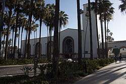
Colleges and universities

.jpg)
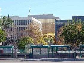
The Tech Coast is a moniker that has gained use as a descriptor for the region's diversified technology and industrial base as well as its multitude of prestigious and world-renowned research universities and other public and private institutions. Amongst these include five University of California campuses (Irvine, Los Angeles, Riverside, Santa Barbara, and San Diego), 12 California State University campuses (Bakersfield, Channel Islands, Dominguez Hills, Fullerton, Los Angeles, Long Beach, Northridge, Pomona, San Bernardino, San Diego, San Marcos, and San Luis Obispo); and private institutions such as the California Institute of Technology, Azusa Pacific University, Chapman University, the Claremont Colleges (Claremont McKenna College, Harvey Mudd College, Pitzer College, Pomona College, Scripps College, Claremont Graduate University and Keck Graduate Institute), Loma Linda University, Loyola Marymount University, Occidental College, Pepperdine University, University of Redlands, University of San Diego, and the University of Southern California.
Medical Facilities
Many cities in the region have world class medical facilities such as Imperial, Los Angeles, Orange, Riverside, San Bernardino, San Diego, San Luis Obispo, Santa Barbara, and Ventura.
Parks and recreation areas
Numerous parks provide recreation opportunities and open space. Locations include:
|
|
Sports
Major professional sports teams in southern California include:
- NFL (American football) Los Angeles Rams, Los Angeles Chargers
- NBA (Basketball) Los Angeles Lakers, Los Angeles Clippers
- MLB (Baseball) Los Angeles Dodgers, Los Angeles Angels, San Diego Padres
- NHL (Ice hockey) Los Angeles Kings, Anaheim Ducks
- MLS (Soccer) LA Galaxy, Los Angeles FC
Southern California also is home to a number of popular NCAA sports programs such as the UCLA Bruins, the USC Trojans, and the San Diego State Aztecs. The Bruins and the Trojans both field football teams in NCAA Division I in the Pac-12 Conference, and there is a longtime rivalry between the schools.
See also
- Category: History of Southern California
- Category: California ranchos – Southern California Counties categories
- Category: Public transportation in Southern California
- California earthquake forecast
- California megapolitan areas
- Geography of southern California
- Largest cities in southern California
- Megaregions of the United States
- San Angeles
- South Coast
- Southern California Association of Governments
References
- "Square Mileage by County". Archived from the original on February 27, 2019. Retrieved March 2, 2019.
- "Population, Population Change, and Estimated Components of Population Change: April 1, 2010 to July 1, 2019 (NST-EST2019-alldata)". Census.gov. United States Census Bureau. Archived from the original on January 26, 2020. Retrieved February 8, 2020.
- "Figures Show California's Motoring Supremacy". Touring Topics. Los Angeles, California: Automobile Club of Southern California. 8 (2): 38–9. March 1916. Archived from the original on October 31, 2015. Retrieved August 15, 2015.
- Cooley, Timothy J. (2014). Surfing about Music. University of California Press. p. 46. ISBN 9780520957213. Archived from the original on November 28, 2015. Retrieved August 15, 2015.
- "Megaregions". Archived from the original on May 16, 2017. Retrieved October 1, 2014.
- The three metropolitan areas are:
- Los Angeles–Long Beach–Santa Ana (the second largest in the US),
- Riverside–San Bernardino–Ontario (the Inland Empire) and
- San Diego–Carlsbad–San Marcos – see: United States metropolitan areas
- "California County Population Estimates" (PDF). California Department of Finance. January 7, 2009. Archived from the original (PDF) on March 29, 2012. Retrieved October 17, 2016.
- Yoon, Peter (August 7, 2006). "X Games Take a Turn for the Better". Los Angeles Times. Archived from the original on December 10, 2008. Retrieved May 23, 2010.
- Higgins, Matt (September 13, 2006). "Construction Stirs Debate on Effects on 'Perfect Wave'". The New York Times. Archived from the original on April 30, 2011. Retrieved September 13, 2008.
- DiLeo, Michael; Smith, Eleanor (1983). Two Californias: The Myths And Realities Of A State Divided Against Itself. Covelo, California: Island Press. p. 30. ISBN 9780933280168. Retrieved October 17, 2016.
- California, Historical Society of Southern; California, Los Angeles County Pioneers of Southern (1901). The Quarterly. Archived from the original on December 7, 2014. Retrieved October 17, 2016.
- Bernstein, Leilah (December 31, 1999). "L.A. Then AND NOW". Los Angeles Times. Archived from the original on February 27, 2017. Retrieved February 27, 2017.
- Myers, John (June 13, 2018). "Radical plan to split California into three states earns spot on November ballot". latimes.com. Archived from the original on February 25, 2020. Retrieved June 14, 2018.
- U.S. Census Bureau (July 1, 2008), Los Angeles County QuickFacts from the US Census Bureau, U.S. Census Bureau: State and County QuickFacts., archived from the original on March 31, 2001, retrieved November 19, 2009
- U.S. Census Bureau (July 1, 2008), San Diego County QuickFacts from the US Census Bureau, U.S. Census Bureau: State and County QuickFacts., archived from the original on April 28, 2001, retrieved November 19, 2009
- U.S. Census Bureau (July 1, 2008), Orange County QuickFacts from the US Census Bureau, U.S. Census Bureau: State and County QuickFacts., archived from the original on May 8, 2001, retrieved November 19, 2009
- U.S. Census Bureau (July 1, 2008), Riverside County QuickFacts from the US Census Bureau, U.S. Census Bureau: State and County QuickFacts., archived from the original on July 6, 2001, retrieved November 19, 2009
- U.S. Census Bureau (July 1, 2008), San Bernardino County QuickFacts from the US Census Bureau, U.S. Census Bureau: State and County QuickFacts., archived from the original on March 31, 2001, retrieved November 19, 2009
- U.S. Census Bureau (July 1, 2008), Kern County QuickFacts from the US Census Bureau, U.S. Census Bureau: State and County QuickFacts., archived from the original on May 11, 2001, retrieved November 19, 2009
- U.S. Census Bureau (July 1, 2008), Ventura County QuickFacts from the US Census Bureau, U.S. Census Bureau: State and County QuickFacts., archived from the original on May 9, 2001, retrieved November 19, 2009
- U.S. Census Bureau (July 1, 2008), Santa Barbara County QuickFacts from the US Census Bureau, U.S. Census Bureau: State and County QuickFacts., archived from the original on July 19, 2001, retrieved November 19, 2009
- U.S. Census Bureau (July 1, 2008), San Luis Obispo County QuickFacts from the US Census Bureau, U.S. Census Bureau: State and County QuickFacts., archived from the original on April 13, 2001, retrieved November 19, 2009
- U.S. Census Bureau (July 1, 2008), Imperial County QuickFacts from the US Census Bureau, U.S. Census Bureau: State and County QuickFacts., archived from the original on July 10, 2001, retrieved November 19, 2009
- "USGS facts". data from southern California Earthquake Center. Archived from the original on February 26, 2009. Retrieved March 18, 2009.
- "Northridge Earthquake". 2005. Archived from the original on July 12, 2006. Retrieved December 11, 2013.
- "UCERF3: A New Earthquake Forecast for California's Complex Fault System" (PDF). USGS. March 3, 2015. Archived (PDF) from the original on February 8, 2017. Retrieved October 17, 2016.
- "California Grew By 356,000 Residents in 2013" (PDF). Archived from the original (PDF) on May 2, 2014. Retrieved September 26, 2016.
- "1990 Census of Population and Housing, Unit Counts, United States, 1990 CPH-2-1" (PDF). Population and Housing Unit Counts, Population Estimates 1790–1990, pages 26–27. United States Census Bureau, U.S. Department of Commerce Economics and Statistics Administration. August 20, 1993. Retrieved January 1, 2012.
- "California QuickFacts from the US Census Bureau". US Census Bureau. Archived from the original on December 28, 2009. Retrieved December 26, 2009.
- "American Indian Civics Project: Indians of Northern California: A Case Study of Federal, State, and Vigilante Intervention, 1850–1860". Americanindiantah.com. Archived from the original on March 17, 2012. Retrieved March 21, 2012.
- "Annual Estimates of the Population of Combined Statistical Areas: April 1, 2000 to July 1, 2009". 2009 Population Estimates. United States Census Bureau, Population Division. March 23, 2010. Archived from the original (CSV) on March 27, 2010. Retrieved March 29, 2010.
- "World Gazetteer; San Diego-Tijuana". World Gazetteer. Archived from the original on October 1, 2007. Retrieved March 20, 2011.
- "Archived copy". Archived from the original on November 17, 2011. Retrieved December 7, 2017.CS1 maint: archived copy as title (link)
- "California Coast, Los Angeles to San Diego Bay". December 15, 2008. Archived from the original on May 25, 2017. Retrieved April 17, 2011.
- Loucky, James, ed. (2008). Transboundary policy challenges in the Pacific border regions of North America. University of Calgary Press. p. 8. ISBN 978-1-55238-223-3. Archived from the original on May 11, 2011. Retrieved February 19, 2011.
- Peter J. Westwick, ed. Blue Sky Metropolis: The Aerospace Century in Southern California Huntington Library/University of California Press
- "Calendar Year 2011 Primary Airports" (PDF). September 27, 2012. Archived (PDF) from the original on February 8, 2017. Retrieved October 17, 2016.
Further reading
- Castillo-Munoz, Veronica. The Other California: Land, Identity, and Politics on the Mexican Borderlands (University of California Press, 2016), 171 pp. $70.00.)
- Deverell, William, and David Igler, eds. A companion to California history (John Wiley & Sons, 2013).
- Fogelson, Robert M. The Fragmented Metropolis: Los Angeles, 1850–1930 (1967), focus on planning, infrastructure, water, and business
- Friedricks, William. Henry E. Huntington and the Creation of Southern California (1992), on Henry Edwards Huntington (1850–1927), railroad executive and collector, who helped build LA and southern California through the Southern Pacific railroad and also trolleys.
- Garcia, Matt. A World of Its Own: Race, Labor, and Citrus in the Making of Greater Los Angeles, 1900–1970. (2001). 330 pp.
- Garcia, Mario T. "A Chicano Perspective on San Diego History," Journal of San Diego History (1972) 18#4 pp 14–21 online
- Lotchin, Roger. Fortress California, 1910–1961 (2002) excerpt and text search, covers military and industrial roles
- Mills, James R. San Diego: Where California Began (San Diego: San Diego Historical Society, 1960), revised edition online
- O'Flaherty, Joseph S. An End and a Beginning: The South Coast and Los Angeles, 1850–1887. (1972). 222 pp.
- O'Flaherty, Joseph S. Those Powerful Years: The South Coast and Los Angeles, 1887–1917 (1978). 356 pp.
- Pryde, Philip R. San Diego: An Introduction to the Region (4th ed. 2004), a historical geography
- Shragge, Abraham. "'A new federal city': San Diego during World War II," Pacific Historical Review (1994) 63#3 pp 333–61 in JSTOR
- Starr, Kevin. The Dream Endures: California Enters the 1940s (1997) pp 90–114, covers 1880s–1940
- Starr, Kevin. Golden Dreams: California in an Age of Abundance, 1950–1963 (2011) pp 57–87
- Starr, Kevin. Coast of Dreams: California on the Edge, 1990–2003 (2004) 372-81
External links
| Wikimedia Commons has media related to Southern California. |
| Wikivoyage has a travel guide for Southern California. |
- California Historical Society Collection, 1860–1960 – USC Libraries Digital Collections
- Historical Society of Southern California
