Escalon, California
Escalon is a city in San Joaquin County, California, United States. The population was 7,132 at the 2010 census, up from 5,963 at the 2000 census. Escalon is a Spanish word meaning "stepping stones." The name comes from founder James Wheeler Jones who came upon the name in a book in the Stockton Free Library and liked the name so much he gave the name to the town.[5]
Escalon, California | |
|---|---|
City | |
| City of Escalon | |
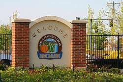 Escalon, Land of Peaches and Cream, welcome sign | |
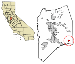 Location of Escalon in San Joaquin County, California | |
 Escalon, California Location in the United States | |
| Coordinates: 37°47.5′N 120°59.5′W | |
| Country | |
| State | |
| County | San Joaquin |
| Incorporated | March 12, 1957[1] |
| Government | |
| • Mayor | Robert Swift |
| • Senate | Cathleen Galgiani (D) |
| • Assembly | Heath Flora (R) |
| • U. S. Congress | Josh Harder (D)[2] |
| Area | |
| • Total | 2.37 sq mi (6.13 km2) |
| • Land | 2.30 sq mi (5.96 km2) |
| • Water | 0.07 sq mi (0.17 km2) 2.85% |
| Elevation | 118 ft (36 m) |
| Population (2010) | |
| • Total | 7,132 |
| • Estimate (2018)[4] | 7,587 |
| • Density | 3,269.01/sq mi (1,262.26/km2) |
| Time zone | UTC-8 (PST) |
| • Summer (DST) | UTC-7 (PDT) |
| ZIP code | 95320 |
| Area code(s) | 209 |
| FIPS code | 06-22790 |
| GNIS feature ID | 1656002 |
| Website | www |
History
Escalon came into being in the late 1800s because of the agricultural production in the immediate area and the need to get products of that agriculture to market by railroad. John Wheeler Jones settled here with his family on the 1850s, and his son, James Wesley Jones, laid out the community of Escalon 40-plus years later. Although Escalon was incorporated in 1957, celebrating its 50-year anniversary in 2007 by proclamation of Escalon's city council, 1994 was officially acknowledged as the year to celebrate the Escalon centennial.[6]
In 1898, the Santa Fe Depot was constructed and operated until 1970. It was located alongside the Santa Fe Railroad Tracks that bisect the heart of Escalon near Main Street's intersections with Second Street. [7]
In 1909, Oliver A. Fisk began construction on the Fisk Building, completing it in 1911. This building is still located at the corner of Main and First Streets in its modified form. The first to occupy this building was the Escalon State Bank, the first bank in town, in 1912. The bank was established by S.J. Irwin, the owner of the Irwin Lumber Company.[8]
Transportation
Highways and Roads
California State Route 120 runs through Escalon connecting it to the bay area and to the west through Oakdale where it merges with California State Route 108 to the Sierra Nevada Mountains. McHenry Avenue runs south towards Modesto crossing the Stanislaus River over the newly rebuilt McHenry Bridge. Escalon currently has 4 stoplights in town all within a 1/4 mile proximity.
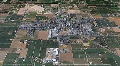
Geography
Escalon is located at 37°47.5'N 120°59.5'W (37.7984,-120.9969), where State Highway 120 crosses the BNSF railroad. According to the United States Census Bureau, the city has a total area of 2.4 square miles (6.2 km2). 2.3 square miles (6.0 km2) of it is land and 2.85% is water.
Economy
Industry
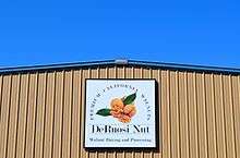
Escalon has a large agricultural industry which is based on the fertile farmland surrounding the city. DeRuosi Nut, GoldRiver Orchards, Grower's Choice, and Roche Bros Inc. are many of the nut processing plants that lie in the heart of Escalon accounting for a great deal of the local agricultural economy. Escalon is always growing its agriculture in new ways.
Principal employers
Major Manufacturing/ Agriculture employers in the city include:
| # | Employer | # of Employees |
|---|---|---|
| 1 | Kraft Heinz (formerly Escalon Premier Brands) | 750 |
| 2 | Hogan Mfg., Inc. | 160 |
| 3 | DeRuosi Nut | 124 |
| 4 | GoldRiver Orchards | |
| 5 | Barton Ranch | |
| 6 | Roche Bros Inc. | |
| 7 | Grower's Choice |
Police
Escalon's Police Department has 12 full-time employees, 4 part-time Animal Services Officers, and volunteers who serve in the capacity of Police Reserve Officers, Cadets, and the Citizen Volunteers.[9]
Education
Escalon has two high schools and one middle school, with four K-5 elementary schools all under Escalon Unified School District, located in the Central Valley.
Schools
- Escalon High
- Vista High
- El Portal Middle
- Dent Elementary
- Van Allen Elementary
- Farmington Elementary
- Collegeville Elementary
- Escalon Charter Academy
Notable People
- Alice Estes Davis - Disney legend /Costume designer for Disney films, television, and theme parks.
- Herbert A. Calcaterra - WWII US Navy sailor
- James Lew - American martial arts actor
- Mike Mitchell - Artist
Churches
Escalon is home to 14 churches 12 within city limits. The Escalon Methodist Church has the distinction of being the first church in Escalon, constructed in 1893. The church used to sit at Lone Tree Corners until September of 1908, when the building was moved to Escalon. This building stood on site of the present church until it was torn down to make room for the new structure, which was completed and dedicated on Sunday, April 10, 1921.[10]
- Escalon Presbyterian Church
- Escalon Christian Reformed Church
- Escalon Covenant Church
- Trinity Church Assembly of God
- First Baptist Church
- Jackson Avenue Church
- Church of Christ
- Saron Lutheran Church
- United Methodist Church
- Impact Community Church
- Seventh Day Adventist Church
- Pentecostal Tabernacle
- Church of Christ
- Saint Patrick's Catholic Church
Gas Stations
Escalon currently has 5 operating gas stations with one being a CFN card lock station. All 5 stations are within 300 Ft of Highway 120. A potential 6th gas station is in discussion at the former Big Boy Market location on Hwy 120.
- Kwik Serv
- Chevron
- Arco Am/Pm
- Valero
- Valley Pacific CFN
Demographics
| Historical population | |||
|---|---|---|---|
| Census | Pop. | %± | |
| 1960 | 1,763 | — | |
| 1970 | 2,366 | 34.2% | |
| 1980 | 3,127 | 32.2% | |
| 1990 | 4,437 | 41.9% | |
| 2000 | 5,963 | 34.4% | |
| 2010 | 7,132 | 19.6% | |
| Est. 2018 | 7,587 | [4] | 6.4% |
| U.S. Decennial Census[11] | |||
The 2010 United States Census[12] reported that Escalon had a population of 7,132. The population density was 3,011.5 people per square mile (1,162.8/km2). The racial makeup of Escalon was 5,823 (81.6%) White, 30 (0.4%) African American, 80 (1.1%) Native American, 96 (1.3%) Asian, 22 (0.3%) Pacific Islander, 823 (11.5%) from other races, and 258 (3.6%) from two or more races. Hispanic or Latino of any race were 1,928 persons (27.0%).
The Census reported that 7,117 people (99.8% of the population) lived in households, 15 (0.2%) lived in non-institutionalized group quarters, and 0 (0%) were institutionalized.
There were 2,476 households, out of which 975 (39.4%) had children under the age of 18 living in them, 1,484 (59.9%) were married couples living together, 291 (11.8%) had a female householder with no husband present, 143 (5.8%) had a male householder with no wife present. There were 130 (5.3%) unmarried. 469 households (18.9%) were made up of individuals, and 241 (9.7%) had someone living alone who was 65 years of age or older. The average household size was 2.87. There were 1,918 families (77.5% of all households); the average family size was 3.28.
The population was spread out, with 1,933 people (27.1%) under the age of 18, 675 people (9.5%) aged 18 to 24, 1,736 people (24.3%) aged 25 to 44, 1,898 people (26.6%) aged 45 to 64, and 890 people (12.5%) who were 65 years of age or older. The median age was 36.0 years. For every 100 females, there were 96.0 males. For every 100 females age 18 and over, there were 95.2 males.
There were 2,610 housing units at an average density of 1,102.1 per square mile (425.5/km2), of which 1,792 (72.4%) were owner-occupied, and 684 (27.6%) were occupied by renters. The homeowner vacancy rate was 2.5%; the rental vacancy rate was 5.9%. 5,082 people (71.3% of the population) lived in owner-occupied housing units and 2,035 people (28.5%) lived in rental housing units.
References
- "California Cities by Incorporation Date". California Association of Local Agency Formation Commissions. Archived from the original (Word) on November 3, 2014. Retrieved August 25, 2014.
- "California's 10th Congressional District - Representatives & District Map". Civic Impulse, LLC. Retrieved March 11, 2013.
- "2016 U.S. Gazetteer Files". United States Census Bureau. Retrieved Jul 19, 2017.
- "Population and Housing Unit Estimates". Retrieved September 1, 2019.
- Tinkham, George H. History of San Joaquin County, California : with Biographical Sketches of Leading Men and Women of the County Who Have Been Identified with Its Growth and Development from the Early Days to the Present. Vol. 1, Historic Record Company, 1923. Archive, archive.org/details/historyofsanjoaq00tink/page/n5/mode/2up.
- Willis, Barbara. Images of America: Escalon. Arcadia Pub., 2008.
- Willis, Barbara. Images of America: Escalon. Arcadia Pub., 2008.
- Willis, Barbara. Images of America: Escalon. Arcadia Pub., 2008.
- Escalon Police Dept web site
- Tinkham, George H. History of San Joaquin County, California : with Biographical Sketches of Leading Men and Women of the County Who Have Been Identified with Its Growth and Development from the Early Days to the Present. Vol. 1, Historic Record Company, 1923. Archive, archive.org/details/historyofsanjoaq00tink/page/n5/mode/2up.
- "Census of Population and Housing". Census.gov. Retrieved June 4, 2015.
- "2010 Census Interactive Population Search: CA - Escalon city". U.S. Census Bureau. Archived from the original on July 15, 2014. Retrieved July 12, 2014.
External links
Municipalities and communities of San Joaquin County, California, United States | ||
|---|---|---|
| Cities | 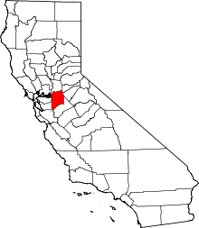 San Joaquin County map | |
| CDPs | ||
| Unincorporated communities | ||
| Ghost towns |
| |
| Authority control |
|
|---|