Kennedy, California
Kennedy is a census-designated place (CDP) in San Joaquin County, California, United States. The population was 3,254 at the 2010 census, down from 3,275 at the 2000 census.
Kennedy | |
|---|---|
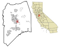 Location in San Joaquin County and the state of California | |
 Kennedy Location in the United States | |
| Coordinates: 37°55′54″N 121°15′6″W | |
| Country | |
| State | |
| County | San Joaquin |
| Government | |
| • Senate | Lois Wolk (D) |
| • Assembly | Greg Aghazarian (R) |
| • U. S. Congress | Jerry McNerney (D)[1] |
| Area | |
| • Total | 1.175 sq mi (3.043 km2) |
| • Land | 1.175 sq mi (3.043 km2) |
| • Water | 0 sq mi (0 km2) 0% |
| Elevation | 23 ft (7 m) |
| Population (2010) | |
| • Total | 3,254 |
| • Density | 2,800/sq mi (1,100/km2) |
| Time zone | UTC-8 (PST) |
| • Summer (DST) | UTC-7 (PDT) |
| Area code(s) | 209 |
| FIPS code | 06-38065 |
| GNIS feature ID | 1853396 |
Geography
Kennedy is located at 37°55′54″N 121°15′6″W (37.931774, -121.251802).[3]
According to the United States Census Bureau, the CDP has a total area of 1.2 square miles (3.1 km2), all of it land.
Demographics
| Historical population | |||
|---|---|---|---|
| Census | Pop. | %± | |
| U.S. Decennial Census[4] | |||
2010
At the 2010 census Kennedy had a population of 3,254. The population density was 2,769.3 people per square mile (1,069.2/km²). The racial makeup of Kennedy was 517 (15.9%) White, 200 (6.1%) African American, 23 (0.7%) Native American, 258 (7.9%) Asian, 4 (0.1%) Pacific Islander, 2,109 (64.8%) from other races, and 143 (4.4%) from two or more races. Hispanic or Latino of any race were 2,513 persons (77.2%).[5]
The census reported that 3,230 people (99.3% of the population) lived in households, 24 (0.7%) lived in non-institutionalized group quarters, and no one was institutionalized.
There were 768 households, 460 (59.9%) had children under the age of 18 living in them, 392 (51.0%) were opposite-sex married couples living together, 169 (22.0%) had a female householder with no husband present, 89 (11.6%) had a male householder with no wife present. There were 55 (7.2%) unmarried opposite-sex partnerships, and 8 (1.0%) same-sex married couples or partnerships. 86 households (11.2%) were one person and 41 (5.3%) had someone living alone who was 65 or older. The average household size was 4.21. There were 650 families (84.6% of households); the average family size was 4.47.
The age distribution was 1,178 people (36.2%) under the age of 18, 371 people (11.4%) aged 18 to 24, 847 people (26.0%) aged 25 to 44, 580 people (17.8%) aged 45 to 64, and 278 people (8.5%) who were 65 or older. The median age was 26.8 years. For every 100 females, there were 102.0 males. For every 100 females age 18 and over, there were 103.1 males.
There were 853 housing units at an average density of 725.9 per square mile, of the occupied units 453 (59.0%) were owner-occupied and 315 (41.0%) were rented.The homeowner vacancy rate was 1.9%; the rental vacancy rate was 7.3%. 1,806 people (55.5% of the population) lived in owner-occupied housing units and 1,424 people (43.8%) lived in rental housing units.
2000
At the 2000 census there were 3,275 people, 766 households, and 627 families in the CDP. The population density was 2,690.4 people per square mile (1,036.5/km²). There were 807 housing units at an average density of 662.9 per square mile (255.4/km²). The racial makeup of the CDP was 29.10% White, 9.19% African American, 1.56% Native American, 10.50% Asian, 0.24% Pacific Islander, 44.24% from other races, and 5.16% from two or more races. Hispanic or Latino of any race were 67.42%.[6]
Of the 766 households 47.7% had children under the age of 18 living with them, 53.5% were married couples living together, 20.4% had a female householder with no husband present, and 18.1% were non-families. 12.9% of households were one person and 5.0% were one person aged 65 or older. The average household size was 4.19 and the average family size was 4.56.
The age distribution was 38.1% under the age of 18, 11.5% from 18 to 24, 26.9% from 25 to 44, 16.2% from 45 to 64, and 7.3% 65 or older. The median age was 25 years. For every 100 females, there were 110.7 males. For every 100 females age 18 and over, there were 111.9 males.
The median household income was $24,375 and the median family income was $27,083. Males had a median income of $30,526 versus $17,019 for females. The per capita income for the CDP was $6,876. About 42.2% of families and 44.8% of the population were below the poverty line, including 52.1% of those under age 18 and 13.6% of those age 65 or over.
References
- "California's 9th Congressional District - Representatives & District Map". Civic Impulse, LLC. Retrieved March 9, 2013.
- U.S. Census Archived 2012-07-02 at the Wayback Machine
- "US Gazetteer files: 2010, 2000, and 1990". United States Census Bureau. 2011-02-12. Retrieved 2011-04-23.
- "Census of Population and Housing". Census.gov. Retrieved June 4, 2016.
- "2010 Census Interactive Population Search: CA - Kennedy CDP". U.S. Census Bureau. Archived from the original on July 15, 2014. Retrieved July 12, 2014.
- "U.S. Census website". United States Census Bureau. Retrieved 2008-01-31.
Municipalities and communities of San Joaquin County, California, United States | ||
|---|---|---|
| Cities | 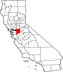 San Joaquin County map | |
| CDPs | ||
| Unincorporated communities | ||
| Ghost towns |
| |