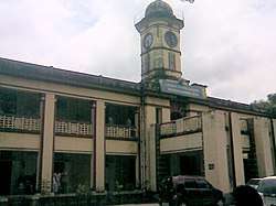
Palakkad
Palakkad ![]()
Palakkad Palghat | |
|---|---|
 Palakkad Municipality | |
 Palakkad  Palakkad | |
| Coordinates: 10.775°N 76.651°E | |
| Country | |
| State | |
| District | Palakkad |
| Government | |
| • Type | Municipality |
| • Body | Palakkad Municipality |
| • Chairperson | Prameela Sasidharan |
| • Deputy Chairman | C Krishnakumar |
| • Member of Parliament | V. K. Sreekandan |
| Area | |
| • City | 26.60 km2 (10.27 sq mi) |
| • Metro | 1,363 km2 (526 sq mi) |
| Elevation | 84 m (276 ft) |
| Population (2011) | |
| • City | 130,955 |
| • Density | 4,900/km2 (13,000/sq mi) |
| • Metro | 293,533 |
| Demonym(s) | Palakkadan |
| Malayalam | |
| • Malayalam | Malayalam, English, Tamil[3] |
| Time zone | UTC+5:30 (IST) |
| Postal Index Number | 678 XXX |
| Area code(s) | +91-(0)491 |
| Vehicle registration | KL-09 |
| Climate | Am/Aw (Köppen) |
| Website | www |
Etymology
The commonly held belief is that the name Palakkad is a fusion of two Tamil words, Pala, which was the name given to barren land during the Sangam period, and Kadu, which means forest.[4]
Geography
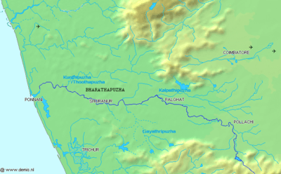
Palakkad is the gateway to Kerala due to the presence of the Palakkad Gap in the Western Ghats. Malayalam is the generally spoken language in Palakkad as it is the official language. The district have many small and medium rivers, which are tributaries of the Bharathapuzha River. Of the number of dams in Palakkad district, the largest Malampuzha dam is 12 km from Palakkad town.[5]
Climate
Palakkad has a tropical wet and dry climate. Temperatures remain moderate throughout the year, with exception in March and April being the hottest months. A very high amount of precipitation is received in Palakkad, mainly due to the South-West monsoon. July is the wettest month, and the total annual rainfall is around 83 inches (211 cm).
| Climate data for Palakkad (1981–2010, extremes 1943–2005) | |||||||||||||
|---|---|---|---|---|---|---|---|---|---|---|---|---|---|
| Month | Jan | Feb | Mar | Apr | May | Jun | Jul | Aug | Sep | Oct | Nov | Dec | Year |
| Record high °C (°F) | 37.6 (99.7) |
40.0 (104.0) |
41.4 (106.5) |
41.8 (107.2) |
41.2 (106.2) |
40.4 (104.7) |
33.6 (92.5) |
33.8 (92.8) |
35.8 (96.4) |
36.2 (97.2) |
38.0 (100.4) |
36.6 (97.9) |
41.8 (107.2) |
| Average high °C (°F) | 32.7 (90.9) |
35.2 (95.4) |
37.3 (99.1) |
36.6 (97.9) |
34.5 (94.1) |
29.9 (85.8) |
28.8 (83.8) |
28.9 (84.0) |
30.4 (86.7) |
31.5 (88.7) |
31.6 (88.9) |
31.5 (88.7) |
32.4 (90.3) |
| Average low °C (°F) | 22.0 (71.6) |
22.4 (72.3) |
24.1 (75.4) |
25.0 (77.0) |
24.8 (76.6) |
23.2 (73.8) |
22.6 (72.7) |
23.0 (73.4) |
23.0 (73.4) |
23.1 (73.6) |
23.1 (73.6) |
22.3 (72.1) |
23.2 (73.8) |
| Record low °C (°F) | 15.6 (60.1) |
15.8 (60.4) |
18.6 (65.5) |
18.8 (65.8) |
19.2 (66.6) |
19.0 (66.2) |
18.8 (65.8) |
19.2 (66.6) |
19.4 (66.9) |
15.8 (60.4) |
16.1 (61.0) |
14.0 (57.2) |
14.0 (57.2) |
| Average rainfall mm (inches) | 3.6 (0.14) |
3.6 (0.14) |
15.7 (0.62) |
61.3 (2.41) |
125.1 (4.93) |
410.6 (16.17) |
453.2 (17.84) |
290.3 (11.43) |
154.9 (6.10) |
196.1 (7.72) |
102.3 (4.03) |
21.3 (0.84) |
1,838 (72.36) |
| Average rainy days | 0.3 | 0.3 | 0.9 | 3.3 | 5.9 | 18.7 | 20.0 | 15.8 | 9.2 | 10.1 | 4.7 | 0.9 | 90.1 |
| Average relative humidity (%) (at 17:30 IST) | 46 | 39 | 38 | 52 | 60 | 79 | 82 | 81 | 75 | 73 | 65 | 56 | 61 |
| Source: India Meteorological Department[6][7] | |||||||||||||
Transport
Air
The nearest international airport is Coimbatore International Airport, which is about 62 km from Palakkad. However, Cochin International Airport and Calicut International Airport serve the city as well.
There has been a proposal for a mini domestic airport at East Yakkara with respect to setting up domestic airports for enhanced air connectivity by the civil aviation ministry of India. 60 acres has been identified for the project at East Yakkara Palakkad.[8]
Railways
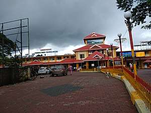
There are two railway stations serving Palakkad - Palakkad Junction is a broad gauge railway junction (located at Olavakkode, which can be called a satellite town, about 4 km from the heart of the main town) and Palakkad Town railway station located in the heart of the Palakkad town. Close to Palakkad Junction is the office of Palakkad Railway Division. The cities of Coimbatore, Tiruppur, Erode, Salem, Thiruvananthapuram, Kollam, Mangalore, Kozhikode and Ernakulam are connected by the broad gauge line. Train services to Pollachi, Dindigul and Madurai are through the broad gauge line through Palakkad Town station.[9]
Road
Palakkad is well connected by roads. The National Highway 544 from Salem to Ernakulam via Coimbatore, Palakkad and Thrissur – Kozhikode National Highway 966 via Malappuram pass through the district.[10]
Demographics
As per Census 2011, population of Palakkad in 2011 is 130,955; of which male and female are 63,833 and 67,122 respectively.[11] Total literates in Palakkad city are 112,479 of which 56,065 are males while 56,414 are females. Average literacy rate of Palakkad city is 94.20 percent of which male and female literacy was 96.83 and 91.73 percent.[12][13] Hindus form 68% of the population with 89098 members.[11] Muslims constitute 27.9% of the population with 36620 members.[11] Christians constitute 3.8% of the population with 5006 members.[11]
The metropolitan area of Palakkad includes Hemambikanagar, Marutharode, Palakkad municipality, Pirayiri, Pudussery Central, Pudussery West, and Puthuppariyaram.[13] Its urban / metropolitan population is 293,566 of which 143,650 are males and 149,916 are females. The literacy rate of Palakkad Metropolitan Area is 92.14%, much higher than the national average of 59.5%.
References
- "Thiruvananthapuram Corporation General Information". Corporation of Thiruvananthapuram. Retrieved 10 July 2018.
- "Urban Agglomerations/Cities having population 1 million and above" (PDF). Office of the Registrar General & Census Commissioner. Ministry of Home Affairs, Government of India. Retrieved 9 July 2018.
- "The Kerala Official Language (Legislation) Act, 1969" (PDF). PRS Legislative Research. Retrieved 19 July 2018.
- A. Sreedhara Menon (1978). Kerala Samskāram. DC Books. p. 237. ISBN 9788126415854.
- Fact sheet on Indian dams at Diehardindian.com Archived 2006-12-13 at the Wayback Machine
- "Station: Palakkad (Palghat) Climatological Table 1981–2010" (PDF). Climatological Normals 1981–2010. India Meteorological Department. January 2015. pp. 581–582. Archived from the original (PDF) on 5 February 2020. Retrieved 29 February 2020.
- "Extremes of Temperature & Rainfall for Indian Stations (Up to 2012)" (PDF). India Meteorological Department. December 2016. p. M109. Archived from the original (PDF) on 5 February 2020. Retrieved 29 February 2020.
- "60 Acres Identified For Airport Project". The Hindu. Chennai, India. 21 May 2011.
- "Train services resume on Pollachi – Palakkad section". Coimbatore. The Hindu. 17 November 2015. Retrieved 25 November 2015.
- "National Highways and their lengths" Archived 6 September 2012 at the Wayback Machine. National Highways Authority of India. Retrieved 4 September 2015.
- http://www.censusindia.gov.in/2011census/C-01/DDW32C-01%20MDDS.XLS
- "Palakkad - Census of India". Censusindia.gov.in. Retrieved 4 September 2015.
- "Palakkad Urban Region". Census2011.co.in. Retrieved 4 September 2015.
External links
| Wikimedia Commons has media related to Palakkad. |

- http://www.palakkad.gov.in - Official Website of Palakkad District Administration
- http://www.palakkadtourism.org - Palakkad District Tourism-Information