Erattupetta
Erattupetta is a municipal town located in Kottayam district of the state of Kerala, India. It is located 38 km east of Kottayam, the district capital. The "Eraaru" part in all the variation of the names arose from the geographical location, where the two rivers (aru) merge as single one. Erattupetta is situated in the foothills of High Ranges. Earlier, the town was known as "Eerappili" or "Eerappuzha". The Muslim migration happened many centuries back. Erattupetta is a secular place with good religious harmony.
Erattupetta | |
|---|---|
 Town's junction | |
| Nickname(s): Petta | |
 Erattupetta Location in Kerala, India | |
| Coordinates: 9.7°N 76.78°E | |
| Country | |
| State | Kerala |
| District | Kottayam |
| Government | |
| • Type | city |
| • Municipal chairman | V.M Siraj (UDF) |
| • Municipal vice chairperson | Balkees Navas |
| Area | |
| • Total | 14.24 km2 (5.50 sq mi) |
| Elevation | 24 m (79 ft) |
| Population (2011) | |
| • Total | 29,675 |
| • Density | 2,100/km2 (5,400/sq mi) |
| Languages | |
| • Official | Malayalam, English |
| Time zone | UTC+5:30 (IST) |
| PIN | 686121 686122 |
| Vehicle registration | KL-35 |
| Literacy | 90% |
| Website | http://lsgkerala.in/erattupettapanchayat/ |
Etymology
The "Eraaru" part in all the variation of the names arose from the geographical location, where the two rivers (aru) merge as a single one. Erattupetta is situated in the foothills of High Ranges. The word "Petta" has Tamil/Telugu origin meaning town. It was the commercial capital of the Poonjar principality until 1949. Erattupetta lies in an ancient trade route originating from Athirampuzha to Tamil Nadu.
Economy
In the past, hill produce from the Cardamom hills were brought down by the Muthuvans for trade. Erattupetta's current economy is primarily rubber and scores of large and small estates dot the landscape. Wagamon, a Hill Station, lies some 22 km east of Erattupetta. Erattupetta has a good number of expatriate population living in Gulf countries, especially in United Arab Emirates and Saudi Arabia.
Demographics
As of 2001 India census, Erattupetta had a population of 29,675. Males constitute 51% of the population and females 49%. Erattupetta has an average literacy rate of 80%, higher than the national average of 59.5%: male literacy is 83%, and female literacy is 76%. In Erattupetta, 14% of the population is under 6 years of age.
Educational Institutions
St George’s College
Government Higher Secondary School
St George Higher Secondary School
Muslim Girls Higher Secondary School
St Mary’s LP School
University College of Teacher Education
Government Muslim LP School
Temples
Angalamman Temple
Angalamman Koil is located in the heart of the town of Erattupetta. The people of Erattupettha are worshiped with great devotion and honor, and the guardian goddess of suffering and suffering.
Nadackal Bhagavathi Temple
Nadackal Sree Bhagwathi Temple has the deity of Bhadrakali. The idol is a Kannady Bimbam.
Nadackal Kavu
Churches
St. George Forane Church Popularly known as Aruvithura palli is a syro-malabar Catholic Church in Erattupetta. This Church is believed to be the oldest Church in eastern Kerala, and is considered to be the mother church of the ancient Syrian Christian community of both the Meenachil and the Kanjirapally Taluks. The church is believed to be founded in A.D 151 in the name of Martha-Mariam. It is commonly believed that in the 13th century, a group of Christians, who had to flee from Nilackal to save themselves from the hands of enemies, brought the statue of St George from Nilackal and placed it in Aruvithura Church for veneration. From that time onwards Aruvithura Church came to be known on behalf of St George. There is also a popular belief that the St. George's Church was established by Saint Thomas the apostle himself. The annual festival of St George of Aruvithura is celebrated during April 15 – May 1 every year.
Mosques
Muhyidheen Juma Masjid
Ninar Palli Juma Masjid
Puthenpalli Juma Masjid
Aman Juma Masjid Nadackal
Geography
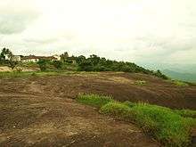
Erattupetta can be accessed easily from north Kerala via Angamaly-Muvattupuzha-Thodupuzha-Muttom route. It is well connected to Tamil Nadu via Kottayam-Kumali (K K) Road to Madurai through the nearest town Mundakkayam via Parathanam which is 27 Kilometres from Erattupetta.
It has an average elevation of 36 metres (118 feet).
Access
- Thiruvananthapuram - Kilimanoor - Kottarakkara - Pathanamthitta - Ranni - Erumeli - Kanjirappally - Erattupetta - 164 km
- Kottayam - Ettumanoor - Pala - Erattupetta 39 km
- Kochi/Cochin - Thrippunithura - Piravom - Elanji - Uzhavoor - Pala - Erattupetta - 78 km
- Thrissur/Trichur-Chalakudy - Angamaly - Perumbavoor - Muvattupuzha - Thodupuzha - erattupatta - 130 km
- Kozhikode - Kuttippuram - Thrissur - Muvattupuzha - Thodupuzha - Erattupetta - 255 km
- Cochin International Airpot - Kalady - Perumbavoor - Muvattupuzha - Thodupuzha - erattupatta - 84 km
- Mundakkayam- Parathanam - Poonjar - Panachikappara - erattupatta - 27 km
Politics
Erattupetta is a municipality. The Current municipal chairman is Sri V. M. Siraj.
Erattupetta comes under the Pathanamthitta loksabha constituency and the Poonjar assembly constituency. Erattupetta is represented in the Loksabha by Sri Anto Antony and in the state assembly by Sri P.C. George.