Stone Ridge, New York
Stone Ridge is a hamlet (and census-designated place) in Ulster County, New York, United States. The population was 1,173 at the 2010 census.
Stone Ridge, New York | |
|---|---|
 | |
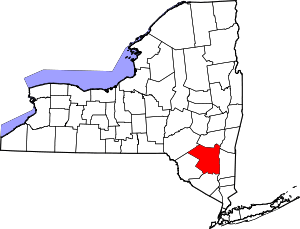
 Location in Ulster County and the state of New York. | |
| Coordinates: 41°50′45″N 74°9′23″W | |
| Country | United States |
| State | New York |
| County | Ulster |
| Area | |
| • Total | 5.2 sq mi (13.6 km2) |
| • Land | 5.2 sq mi (13.5 km2) |
| • Water | 0.0 sq mi (0.1 km2) |
| Elevation | 364 ft (111 m) |
| Population (2010) | |
| • Total | 1,173 |
| • Density | 225.0/sq mi (86.9/km2) |
| Time zone | UTC−5 (Eastern (EST)) |
| • Summer (DST) | UTC−4 (EDT) |
| ZIP Code | 12484 |
| Area code(s) | 845 Exchange: 687 |
| FIPS code | 36-71597 |
| GNIS feature ID | 0966515 |
Stone Ridge is located in the Town of Marbletown, along US 209 where it overlaps NY 213.
History
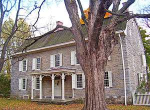
The Main Street Historic District was listed on the National Register of Historic Places in 1988.[1]
Geography
Stone Ridge is located at 41°50'45" north, 74°9'23" west (41.845867, -74.156494).[2]
According to the United States Census Bureau, the CDP has a total area of 5.2 square miles (13 km2), of which 5.2 square miles (13 km2) is land and 0.04 square miles (0.10 km2) (0.76%) is water.
Demographics
At the 2000 census there were 1,173 people, 458 households, and 327 families in the CDP. The population density was 225.0 per square mile (86.9/km2). There were 501 housing units at an average density of 96.1/sq mi (37.1/km2). The racial makeup of the CDP was 94.46% White, 1.71% Black or African American, none Native American, 1.88% Asian, none Pacific Islander, 0.51% from other races, and 1.45% from two or more races. Hispanic or Latino of any race were 3.41%.[3]
Of the 458 households 30.3% had children under the age of 18 living with them, 59.4% were married couples living together, 7.0% had a female householder with no husband present, and 28.6% were non-families. Of all households 25.1% were one person and 9.6% were one person aged 65 or older. The average household size was 2.50 and the average family size was 3.01.
The age distribution was 22.3% under the age of 18, 6.6% from 18 to 24, 25.3% from 25 to 44, 30.2% from 45 to 64, and 15.5% 65 or older. The median age was 43 years. For every 100 females, there were 91.0 males. For every 100 females age 18 and over, there were 90.6 males.
The median household income was $39,271 and the median family income was $68,977. Males had a median income of $35,000 versus $26,176 for females. The per capita income for the CDP was $21,465. About 8.3% of families and 12.2% of the population were below the poverty line, including 8.6% of those under age 18 and 7.9% of those age 65 or over.
Education
- SUNY Ulster
- Rondout Valley Central School District
- High Meadow School[4]
References
- "National Register Information System". National Register of Historic Places. National Park Service. July 9, 2010.
- "US Gazetteer files: 2010, 2000, and 1990". United States Census Bureau. 2011-02-12. Retrieved 2011-04-23.
- "U.S. Census website". United States Census Bureau. Retrieved 2008-01-31.
- High Meadow School