Napoli, New York
Napoli is a town in Cattaraugus County, New York, United States. It is located in the western half of the county, northwest of Salamanca. The only permanent community in the town is Napoli village, formerly "Napoli Corners". The population was 1,248 at the 2010 census.[3]
Napoli, New York | |
|---|---|
Town | |
 Napoli Location within the state of New York | |
| Coordinates: 42°13′10″N 78°53′43″W | |
| Country | United States |
| State | New York |
| County | Cattaraugus |
| Government | |
| • Type | Town Council |
| • Town Supervisor | Joe Winsor (R) |
| • Town Council | Members' List
|
| Area | |
| • Total | 36.55 sq mi (94.65 km2) |
| • Land | 36.38 sq mi (94.21 km2) |
| • Water | 0.17 sq mi (0.44 km2) |
| Elevation | 1,860 ft (567 m) |
| Population (2010) | |
| • Total | 1,248 |
| • Estimate (2016)[2] | 1,302 |
| • Density | 35.79/sq mi (13.82/km2) |
| Time zone | UTC-5 (Eastern (EST)) |
| • Summer (DST) | UTC-4 (EDT) |
| FIPS code | 36-009-49462 |
| GNIS feature ID | 0979249 |
| Website | napoliny |
The town's name presumably comes from "Napoli", the Italian name of Naples. It is pronounced with a non-Italian pronunciation: /nəˈpoʊlaɪ/ nə-POH-ly, with a long "i" sound at the end (much like communities named Pulaski and Chili in other parts of the state).
History
The first permanent settler arrived around 1819. The town of Napoli was formed in 1823 from part of the town of Little Valley. In 1828, a division of Napoli was made, forming the new town of Coldspring to the south.
Continental Charters Flight 44-2 crashed in Napoli on December 26, 1951.
The now-dismantled Gladden Windmill is listed on the National Register of Historic Places.[4]
Geography
According to the United States Census Bureau, the town has a total area of 36.6 square miles (94.7 km2), of which 36.4 square miles (94.2 km2) is land and 0.15 square miles (0.4 km2), or 0.46%, is water.[3]
New York State Route 242 is a northeast-southwest major highway in the town. County Route 7 (Pigeon Valley Road) moves from east to west across the northern part of the town; County Route 10 (Hardscrabble Road / Farm to Market Road) runs north to south through the middle of the town.
Demographics
| Historical population | |||
|---|---|---|---|
| Census | Pop. | %± | |
| 1830 | 852 | — | |
| 1840 | 1,145 | 34.4% | |
| 1850 | 1,233 | 7.7% | |
| 1860 | 1,238 | 0.4% | |
| 1870 | 1,174 | −5.2% | |
| 1880 | 1,126 | −4.1% | |
| 1890 | 962 | −14.6% | |
| 1900 | 967 | 0.5% | |
| 1910 | 741 | −23.4% | |
| 1920 | 636 | −14.2% | |
| 1930 | 578 | −9.1% | |
| 1940 | 570 | −1.4% | |
| 1950 | 619 | 8.6% | |
| 1960 | 670 | 8.2% | |
| 1970 | 778 | 16.1% | |
| 1980 | 886 | 13.9% | |
| 1990 | 1,102 | 24.4% | |
| 2000 | 1,159 | 5.2% | |
| 2010 | 1,248 | 7.7% | |
| Est. 2016 | 1,302 | [2] | 4.3% |
| U.S. Decennial Census[5] | |||
As of the census[6] of 2000, there were 1,159 people, 376 households, and 292 families residing in the town. The population density was 31.8 people per square mile (12.3/km²). There were 541 housing units at an average density of 14.9 per square mile (5.7/km²). The racial makeup of the town was 96.46% White, 0.43% African American, 1.38% Native American, 0.86% Asian, and 0.86% from two or more races. Hispanic or Latino of any race were 0.26% of the population.
There were 376 households out of which 36.2% had children under the age of 18 living with them, 68.1% were married couples living together, 5.9% had a female householder with no husband present, and 22.1% were non-families. 17.6% of all households were made up of individuals and 5.3% had someone living alone who was 65 years of age or older. The average household size was 3.06 and the average family size was 3.43.
In the town, the population was spread out with 32.3% under the age of 18, 7.0% from 18 to 24, 26.3% from 25 to 44, 23.7% from 45 to 64, and 10.7% who were 65 years of age or older. The median age was 35 years. For every 100 females, there were 106.2 males. For every 100 females age 18 and over, there were 109.9 males.
The median income for a household in the town was $33,839, and the median income for a family was $37,692. Males had a median income of $26,411 versus $23,036 for females. The per capita income for the town was $13,077. About 9.3% of families and 20.1% of the population were below the poverty line, including 32.1% of those under age 18 and 9.5% of those age 65 or over.
Attractions
Napoli, like much of western Cattaraugus County, has a sizable Amish community, particularly to the north and west of the hamlet of Napoli. The presence of the Amish and their corresponding large families and high birth rates has ensured that Napoli is one of the few communities in the region that has consistently risen in population since the late 20th century.
Despite a comparable population to other towns and villages in the area, Napoli has a relatively small number of businesses and attractions, with most town residents going to Little Valley or Randolph for their needs. The only church in Napoli is a United Methodist Church in the hamlet.
Notable people
- Andrew Jackson Merchant, former Methodist minister
Communities and locations
- Cold Spring – A location in the northwest part of the town near the intersection of County Roads 7 and 10. (Not to be confused with the town of the same name, which neighbors to the south of Napoli.)
- Cold Springs Creek – A stream flowing southward on the west side of the town.
- Enchanted Lake – A location in the central and western part of town, surrounding "Kings Highway". It is divided into many small vacant lots and appears to be the plans for two communities (one north and one south), though both remain sparsely populated. Some of the streets laid out for Enchanted Lake have not yet been built and exist only on paper.
- Napoli – The hamlet of Napoli is near the center of the town at the intersection of NY Route 242 and County Road 10.
- The Narrows – A location in the eastern part of the town on Route 242. This marks the route of an early road cut into the town.
- Peaslee Hollow – A location in the northwest part of the town.
- Seelysburgh/Elm Creek – A former hamlet in the western part of town; formerly the site of a 19th-century post office.
References
- "2016 U.S. Gazetteer Files". United States Census Bureau. Retrieved Jul 4, 2017.
- "Population and Housing Unit Estimates". Retrieved June 9, 2017.
- "Geographic Identifiers: 2010 Demographic Profile Data (G001): Napoli town, Cattaraugus County, New York". U.S. Census Bureau, American Factfinder. Archived from the original on February 12, 2020. Retrieved October 28, 2014.
- "National Register Information System". National Register of Historic Places. National Park Service. March 13, 2009.
- "Census of Population and Housing". Census.gov. Retrieved June 4, 2015.
- "U.S. Census website". United States Census Bureau. Retrieved 2008-01-31.
External links
Municipalities and communities of Cattaraugus County, New York, United States | ||
|---|---|---|
| Cities | 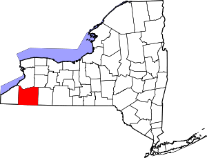 | |
| Towns |
| |
| Villages | ||
| CDPs | ||
| Other hamlets | ||
| Indian reservations | ||
| Ghost towns | ||
| Footnotes |
| |