Maheshtala
Maheshtala is a city and a municipality of the South 24 Parganas district in the Indian state of West Bengal. It is situated on the eastern banks of the Hooghly River. It is a part of the area covered by the Kolkata Metropolitan Development Authority (KMDA).[3]
Maheshtala | |
|---|---|
City | |
 Maheshtala Municipality | |
 Maheshtala Location in West Bengal  Maheshtala Location in India | |
| Coordinates: 22.5120°N 88.2510°E | |
| Country | |
| State | West Bengal |
| Division | Presidency |
| District | South 24 Parganas |
| Region | Greater Kolkata |
| Government | |
| • Type | Municipality |
| • Body | Maheshtala Municipality |
| Area | |
| • Total | 44.18 km2 (17.06 sq mi) |
| Elevation | 9 m (30 ft) |
| Population (2011) | |
| • Total | 448,317 |
| • Density | 10,000/km2 (26,000/sq mi) |
| Languages | |
| • Official | Bengali[1][2] |
| • Additional official | English[1] |
| Time zone | UTC+5:30 (IST) |
| PIN | 700018, 700024, 700044, 700060, 700061, 700066, 700082, 700088, 700140, 700141, 700142, 700143 |
| Telephone code | +91 33 |
| Vehicle registration | WB-19 to WB-22, WB-95 to WB-99 |
| Lok Sabha constituency | Diamond Harbour |
| Vidhan Sabha constituency | Maheshtala, Metiaburuz |
| Website | www |
Geography
 |
| Cities and towns in the western part of Alipore Sadar subdivision (including Budge Budge I & II, Thakurpukur Maheshtala CD blocks) in South 24 Parganas district M: municipal city/ town, CT: census town, R: rural/ urban centre, Owing to space constraints in the small map, the actual locations in a larger map may vary slightly Bakrahat is in Bishnupur II CD block, but Lakshmibala Rural Hospital at Bakrahat serves Budge Budge II CD block and so it is included here. |
Area overview
Alipore Sadar subdivision is the most urbanized part of the South 24 Parganas district. 59.85% of the population lives in the urban areas and 40.15% lives in the rural areas. In the northern portion of the subdivision (shown in the map alongside) there are 21 census towns. The entire district is situated in the Ganges Delta and the subdivision, on the east bank of the Hooghly River, is an alluvial stretch, with industrial development.[4][5][6]
Note: The map alongside presents some of the notable locations in the subdivision. All places marked in the map are linked in the larger full screen map.
Location
Maheshtala is located at 22°30′43″N 88°15′04″E. It has an average elevation of 9 metres (30 ft).
Rameswarpur, Chata Kalikapur, Ganye Gangadharpur and Asuti form a cluster of census towns on the southern side of Maheshtala, as per the map of the Thakurpukur Maheshtala CD block on page 153 of the District Census Handbook 2011 for the South 24 Parganas.[7]
Climate
Köppen-Geiger climate classification system classifies its climate as tropical wet and dry (Aw).
| Climate data for Maheshtala | |||||||||||||
|---|---|---|---|---|---|---|---|---|---|---|---|---|---|
| Month | Jan | Feb | Mar | Apr | May | Jun | Jul | Aug | Sep | Oct | Nov | Dec | Year |
| Average high °C (°F) | 25.4 (77.7) |
27.7 (81.9) |
31.4 (88.5) |
33.1 (91.6) |
33.4 (92.1) |
32.3 (90.1) |
30.7 (87.3) |
30.8 (87.4) |
31.2 (88.2) |
30.8 (87.4) |
28.1 (82.6) |
25.1 (77.2) |
30.0 (86.0) |
| Daily mean °C (°F) | 19.9 (67.8) |
22.7 (72.9) |
27 (81) |
29.3 (84.7) |
30 (86) |
29.5 (85.1) |
28.5 (83.3) |
28.6 (83.5) |
28.5 (83.3) |
27.5 (81.5) |
23.5 (74.3) |
20 (68) |
26.3 (79.3) |
| Average low °C (°F) | 14.5 (58.1) |
17.7 (63.9) |
22.6 (72.7) |
25.6 (78.1) |
26.7 (80.1) |
26.8 (80.2) |
26.4 (79.5) |
26.4 (79.5) |
25.9 (78.6) |
24.2 (75.6) |
19 (66) |
14.6 (58.3) |
22.5 (72.6) |
| Average precipitation mm (inches) | 14 (0.6) |
17 (0.7) |
20 (0.8) |
34 (1.3) |
96 (3.8) |
244 (9.6) |
323 (12.7) |
322 (12.7) |
321 (12.6) |
172 (6.8) |
30 (1.2) |
1 (0.0) |
1,594 (62.8) |
| Source: Climate-Data.org (altitude: 9m)[8] | |||||||||||||
Demographics
According to the 2011 Census of India, Maheshtala had a total population of 448,317, of which 229,693 (51%) were males and 218,624 (49%) were females. There were 46,247 persons in the age range 0-6 years. The total number of literate persons was 329,813 (82.03% of the population 7 years and above).[9]
According to the 2001 Census of India, Maheshtala had a total population of 389,214. Males constitute 53% of the population and females 47%. It has an average literacy rate of 69%, higher than the national average of 59.5%: male literacy is 74%, and female literacy is 63%. 11% of the population is under 7 years of age.[10]
Kolkata Urban Agglomeration
The following municipalities and census towns in the South 24 Parganas district were part of the Kolkata Urban Agglomeration in the 2011 census: Maheshtala (M), Joka (CT), Balarampur (CT), Chata Kalikapur (CT), Budge Budge (M), Nischintapur (CT), Uttar Raypur (CT), Pujali (M) and Rajpur Sonarpur (M).[11]
Civic Administration
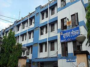
Municipality
Maheshtala Municipality covers an area of 44.18 km2. It has jurisdiction over the Maheshtala city. The municipality was established in 1993. It is divided into 35 administrative wards. As per 2015 municipal election, it is being controlled by the All India Trinamool Congress.[12]
Police stations
Maheshtala and Rabindranagar police stations are located in the Maheshtala municipal area. Maheshtala police station covers an area of 53.137 km2 and Rabindranagar police station covers an area of 6 km2. Both the police stations have jurisdiction over the Maheshtala Municipality and the Thakurpukur Maheshtala CD block.[13][14][15]
Economy
It was reported in 2007, that a London-based company had joined hands with a Bengali NRI to develop a mini township as a joint venture with the Maheshtala Municipality, for which 21.22 acres (85,900 m2) had been acquired near Nungi station. There was expected to be 2,240 middle income group flats in 44 buildings and improve the road infrastructure in the area.[16]
Apart from the Calcutta Riverside residential township, Chief Minister Mamata Banerjee had also announced in 2014 that Maheshtala would also get a 1,000-bed hospital to be developed by Apollo Hospitals and real estate major Hiland Group, a film city, sports academy and an international school conceptualized by cricketer Sourav Ganguly.[17]
Transport
Maheshtala is on the Budge Budge Trunk Road.[18]
Santoshpur, Akra and Nangi railway stations are located nearby.[18]
Education
Maheshtala College, established in 1971, is affiliated with the University of Calcutta. It offers honours courses in Bengali, English, Sanskrit, history, geography, political science, education, philosophy, computer science, mathematics and accountancy and general courses in arts, science and commerce.[19][20]
Techno International Batanagar, established in 2012, offers diploma, undergraduate and postgraduate degree courses in Engineering and Technology and other allied fields.[21]
Maheshtala High School is a Bengali-medium coeducational school. It was established in 1858 and has facilities for teaching from class V to class XII.[22]
Maheshtala Girls High School is a Bengali-medium school for girls. It was established in 1950 and has facilities for teaching from class V to class XII.[23]
Batanagar High School is a Bengali-medium coeducational school. It was established in 1948 and has facilities for teaching from class V to class XII.[24]
Batanagar Sri Ramkrishna Ashram Vivekananda Vidyamandir High School is a Bengali-medium school for boys. It was established in 1956 and has facilities for teaching from class V to class XII.[25]
Batanagar Girls High School is a Bengali-medium school for girls. It was established in 1956 and has facilities for teaching from class V to class XII.[26]
Nangi High School is a Bengali-medium school for boys. It was established in 1947 and has facilities for teaching from class V to class XII.[27]
Nangi Balika Bidyalay Up High School is a Bengali-medium school for girls. It was established in 1948 and has facilities for teaching from class V to class XII.[28]
Akra Krishnanagar High School is a Bengali-medium coeducational school. It was established in 1924 and has facilities for teaching from class V to class XII.[29]
Akra Krishnanagar Balika Bidyalaya Up Secondary School is a Bengali-medium school for girls. It was established in 1964 and has facilities for teaching from class V to class X.[30]
Akra Girls High Madrasha High School is a Bengali-medium school for girls. It was established in 1973 and has facilities for teaching from class V to class XII.[31]
Darul Ulum Qudsia Akra Senior Madrasha Up Senior Secondary School is a Bengali-medium coeducational school. It was established in 1885 and has facilities for teaching from class I to class XII.[32]
Santoshpur Public High Madrasha Secondary School is a Bengali-medium coeducational school. It was established in 1975 and has facilities for teaching from class V to class X.[33]
Sarangabad High School is a Bengali-medium school for boys. It was established in 1856 and has facilities for teaching from class V to class XII.[34]
Sarengabad Arya Rishikul Vidyaniketan Up Secondary School is a Bengali-medium coeducational school. It was established in 1967 and has facilities for teaching from class V to class X.[35]
Sarengabad Jagweshwari Pathshala Uchho Balika Vidyalaya High School is a Bengali-medium school for girls. It was established in 1960 and has facilities for teaching from class V to class XII.[36]
Jagtala Surjaya Kumar Bidyalay Up High School is a Bengali-medium coeducational school. It was established in 1958 and has facilities for teaching from class V to class XII.[37]
Jagtala Surjaya Kumar Balika Vidyalaya Up Secondary School is a Bengali-medium school for girls. It was established in 1973 and has facilities for teaching from class V to class X.[38]
Bangla Jatia Siksha Mandir Up High School is a Bengali-medium coeducational school. It was established in 1946 and has facilities for teaching from class V to class XII.[39]
Sri Sri Maa Sarodamoni Balika Vidyamandir High School is a Bengali-medium school for girls. It was established in 1977 and has facilities for teaching from class V to class XII.[40]
Mahadevnagar High School is a Bengali-medium coeducational school. It was established in 1962 and has facilities for teaching from class V to class X.[41]
Kankhuli Girls High School is a Bengali-medium school for girls. It was established in 1958 and has facilities for teaching from class V to class XII.[42]
Shanti Niketan Hindi High School is a Hindi-medium coeducational school. It was established in 1999 and has facilities for teaching from class I to class XII.[43]
St Agnes High School is a English-medium coeducational school. It was established in 1998 and has facilities for teaching from class I to class XII.[44]
References
- "Fact and Figures". Wb.gov.in. Retrieved 5 July 2019.
- "52nd REPORT OF THE COMMISSIONER FOR LINGUISTIC MINORITIES IN INDIA" (PDF). Nclm.nic.in. Ministry of Minority Affairs. p. 85. Archived from the original (PDF) on 25 May 2017. Retrieved 5 July 2019.
- "Census of India". District-wise list of stautory towns. Directorate of census operations, West Bengal. Archived from the original on 9 August 2007. Retrieved 2 September 2007.
- "District Statistical Handbook 2014 South Twety-four Parganas". Table 2.1 , 2.2, 2.4b. Department of Statistics and Programme Implementation, Government of West Bengal. Retrieved 5 December 2019.
- "Census of India 2011, West Bengal, District Census Handbook, South Twentyfour Parganas, Series – 20, Part XII-A, Village and Town Directory" (PDF). Page 13, Physiography. Directorate of Census Operations, West Bengal. Retrieved 5 December 2019.
- "District Human Development Report: South 24 Parganas". Chapter 9: Sundarbans and the Remote Islanders, p 290-311. Development & Planning Department, Government of West Bengal, 2009. Archived from the original on 5 October 2016. Retrieved 5 December 2019.
- "District Census Handbook South Twentyfour Parganas, Census of India 2011, Series 20, Part XII A" (PDF). Page 153 – Map of Thakurpukur Maheshtala CD block. Directorate of Census Operations, West Bengal. Retrieved 3 November 2019.
- "Climate: Maheshtala". Climate Data. Retrieved 14 January 2014.
- "2011 Census – Primary Census Abstract Data Tables". West Bengal – District-wise. Registrar General and Census Commissioner, India. Retrieved 27 April 2016.
- "Census of India 2001: Data from the 2001 Census, including cities, villages and towns (Provisional)". Census Commission of India. Archived from the original on 16 June 2004. Retrieved 1 November 2008.
- "Provisional Population Totals, Census of India 2011" (PDF). Constituents of Urban Agglomeration Having Population Above 1 Lakh. Census of India 2011. Retrieved 7 November 2019.
- "Maheshtala Municipality". Department of Municipal Affairs. Government of West Bengal. Archived from the original on 21 April 2017. Retrieved 18 May 2015.
- "Maheshtala police station". Diamond Harbour police district. West Bengal police. Retrieved 17 October 2019.
- "Rabindranagar police station". Diamond Harbour police district. West Bengal police. Retrieved 17 October 2019.
- "District Statistical Handbook 2014 South 24 Parganas". Table No. 2.1. Department of Statistics and Programme Implementation, Government of West Bengal. Retrieved 17 October 2019.
- "London-NRI route to mini townships". The Statesman, 18 May 2007. Archived from the original on 29 September 2007. Retrieved 3 September 2007.
- "Calcutta Riverside to change face of Mahestala". Times of India, 2 Dec 2014. Retrieved 28 April 2020.
- Google maps
- "Maheshtala College". MC. Retrieved 29 October 2019.
- "Maheshtala College". Careers 360. Retrieved 29 October 2019.
- "Techno International Batanagar". TIB. Retrieved 29 October 2019.
- "Maheshtala High School". ICBSE. Retrieved 3 November 2019.
- "Maheshtala Girls High School". ICBSE. Retrieved 3 November 2019.
- "Batanagar High School". ICBSE. Retrieved 3 November 2019.
- "Batanagar Sri Ramkrishna Ashram Vivekananda Vidyamandir High School". ICBSE. Retrieved 3 November 2019.
- "Batanagar Girls High School". ICBSE. Retrieved 3 November 2019.
- "Nangi High School". ICBSE. Retrieved 3 November 2019.
- "Nangi Balika Bidyalay Up High School". ICBSE. Retrieved 3 November 2019.
- "Akra Krishnanagar High School". ICBSE. Retrieved 3 November 2019.
- "Akra Krishnanagar Balika Bidyalaya Up Secondary School". ICBSE. Retrieved 3 November 2019.
- "Akra Girls High Madrasha High School". ICBSE. Retrieved 3 November 2019.
- "Darul Ulum Qudsia Akra Senior Madrasha Up Senior Secondary School". ICBSE. Retrieved 3 November 2019.
- "Santoshpur Public High Madrasha Secondary School". ICBSE. Retrieved 3 November 2019.
- "Sarangabad High School". ICBSE. Retrieved 3 November 2019.
- "Sarengabad Arya Rishikul Vidyaniketan Up Secondary School". ICBSE. Retrieved 3 November 2019.
- "Sarengabad Jagweshwari Pathshala Uchho Balika Vidyalaya High School". ICBSE. Retrieved 3 November 2019.
- "Jagtala Surjaya Kumar Bidyalay Up High School". ICBSE. Retrieved 3 November 2019.
- "Jagtala Surjaya Kumar Balika Vidyalaya Up Secondary School". ICBSE. Retrieved 3 November 2019.
- "Bangla Jatia Siksha Mandir Up High School". ICBSE. Retrieved 3 November 2019.
- "Sri Sri Maa Sarodamoni Balika Vidyamandir High School". ICBSE. Retrieved 3 November 2019.
- "Mahadevnagar High School". ICBSE. Retrieved 3 November 2019.
- "Kankhuli Girls High School". ICBSE. Retrieved 3 November 2019.
- "Shanti Niketan Hindi High School". ICBSE. Retrieved 3 November 2019.
- "St Agnes High School". ICBSE. Retrieved 3 November 2019.
| Kolkata Municipal Corporation |
|
|---|---|
| Kolkata Urban Agglomeration Outside KMC |
|
| |