Khardaha
Khardaha is a city and a municipality[2] of North 24 Parganas district in the Indian state of West Bengal. It is near Kolkata and also a part of the area covered by Kolkata Metropolitan Development Authority (KMDA).
Khardaha | |
|---|---|
City | |
 B.T. Road in Khardaha | |
 Khardaha Location in West Bengal, India  Khardaha Khardaha (India) | |
| Coordinates: 22.72°N 88.38°E | |
| Country | |
| State | West Bengal |
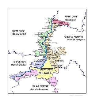
| District | North 24 Parganas |
| Region | Greater Kolkata |
| Government | |
| • Type | Municipality |
| • Body | Khardaha Municipality |
| • Chairman | Taposh Paul[1] |
| Area | |
| • Total | 6.87 km2 (2.65 sq mi) |
| Elevation | 15 m (49 ft) |
| Population (2011) | |
| • Total | 108,496 |
| • Density | 16,000/km2 (41,000/sq mi) |
| Languages | |
| • Official | Bengali, English |
| Time zone | UTC+5:30 (IST) |
| PIN | 700118 |
| Telephone code | +91 33 |
| Vehicle registration | WB |
| Lok Sabha constituency | Dum Dum |
| Vidhan Sabha constituency | Khardaha |
| Website | khardahmunicipality.in |
History
Initially Khardah was a part of South Barrackpore and West Barrackpore municipalities established in 1877. South Barrackpore Municipality was renamed Khardah Municipality in 1920.[3]
Geography
 |
| Cities and towns in the southern portion of Barrackpore subdivision in North 24 Parganas district M: municipal city/ town, CT: census town, N: neighbourhood/ administrative location Owing to space constraints in the small map, the actual locations in a larger map may vary slightly |
Location
Khardaha is located at 22.72°N 88.38°E.[4] It has an average elevation of 15 m (49 ft). It has a railway station on the Sealdah-Ranaghat section, sandwiched between Sodepur and Sukchar (to the south) and Titagarh (to the north). The railway station divides the town into two parts - the eastern part is known as Rahara, while the western part is known as Khardaha.
Khardaha is bounded by Titagarh on the north, Patulia and Bandipur on the east, Panihati on the south and the Hooghly River on the west.[5]
96% of the population of Barrackpore subdivision (partly presented in the map alongside, all places marked in the map are linked in the full screen map) lives in urban areas. In 2011, it had a density of population of 10,967 per km2. The subdivision has 16 municipalities and 24 census towns.[6]
For most of the cities/ towns information regarding density of population is available in the Infobox. Population data is not available for neighbourhoods. It is available for the entire Municipal area and thereafter ward-wise.
Demographics
Population
| Population of Khardaha | |||
|---|---|---|---|
| Census | Population | %± | |
| 1921 | 5,486 | — | |
| 1931 | 6,018 | 9.7% | |
| 1941 | 9,568 | 59.0% | |
| 1951 | 18,524 | 93.6% | |
| 1961 | 28,362 | 53.1% | |
| 1971 | 36,679 | 29.3% | |
| 1981 | 50,202 | 36.9% | |
| 1991 | 88,358 | 76.0% | |
| 2001 | 122,133 | 38.2% | |
| 2011 | 108,496 | −11.2% | |
| Source:[7] | |||
As per the 2011 Census of India, Khardah had a total population of 108,496, of which 54,879 (51%) were males and 53,617 (49%) were females. Population below 6 years was 7,332. The total number of literates in Khardah was 95,469 (94.37% of the population over 6 years). [8]
As of 2001 India census,[9] Khardaha had a population of 116,252. Males constitute 53% of the population and females 47%. Khardaha has an average literacy rate of 81%, higher than the national average of 59.5%: male literacy is 83% and female literacy is 79%. In Khardaha, 8% of the population is under 6 years of age.
Kolkata Urban Agglomeration
The following Municipalities, Census Towns and other locations in Barrackpore subdivision were part of Kolkata Urban Agglomeration in the 2011 census: Kanchrapara (M), Jetia (CT), Halisahar (M), Balibhara (CT), Naihati (M), Bhatpara (M), Kaugachhi (CT), Garshyamnagar (CT), Garulia (M), Ichhapur Defence Estate (CT), North Barrackpur (M), Barrackpur Cantonment (CB), Barrackpore (M), Jafarpur (CT), Ruiya (CT), Titagarh (M), Khardaha (M), Bandipur (CT), Panihati (M), Muragachha (CT) New Barrackpore (M), Chandpur (CT), Talbandha (CT), Patulia (CT), Kamarhati (M), Baranagar (M), South Dumdum (M), North Dumdum (M), Dum Dum (M), Noapara (CT), Babanpur (CT), Teghari (CT), Nanna (OG), Chakla (OG), Srotribati (OG) and Panpur (OG).[10]
Police station
Khardaha police station under Barrackpore Police Commissionerate has jurisdiction over Khardaha Municipal area and Barrackpore II CD Block.[11][12]
Infrastructure
As per the District Census Handbook 2011, Khardaha municipal city covered an area of 6.87 km2. Amongst the civic amenities it had both open and closed drains. Amongst the medical facilities It had 115 medicine shops. Amongst the educational facilities It had 37 primary schools, 1 middle school, 13 secondary/ senior secondary schools and 1 degree college for arts/science/commerce. Amongst the social, recreational and cultural facilities it had 1 orphanage home, 1 stadium, 3 cinema/theatres, 3 public libraries and 3 reading rooms. It had 6 bank branches.[13]
Economy
Industry
Major industries in Khardaha are:
- Khardah Jute Mill was nationalised in 1980 and made a part of National Jute Manufactures Corporation Limited. It was closed in 2004 and after implementation of a revival scheme Khardah Jute Mill was reopened in 2011.[14][15]The Union Cabinet, at a meeting held on 10 October 2018, chaired by Prime Minister Narendra Modi, gave the green signal for the closure of National Jute Manufacturers Corporation Ltd. (NJMC) along with its subsidiary Birds Jute and Exporters Ltd. (BJEL). NJMC had been incurring losses for several years and was under reference to BIFR since 1993. The Mills of NJMC which were proposed for revival, namely, Kinnison Mill at Titagarh, Khardah Mill at Khardah and RBHM Mill at Katihar were under suspension since August, 2016.[16][17]
- Electrosteel Castings Ltd. started manufacturing cast iron pipes at Khardaha in 1955, and evolved as a pioneer in ductile iron pipe manufacturing. It produces 280,000 tonnes of ductile iron pipes annually and exports over half of its production. At Khardaha it also produces ductile iron fittings (5,000 tonnes per annum) and 250,000 tonnes of pig iron annually for captive use. Umang Kejriwal and Mayank Kejriwal have been Managing Directors since 1979.[18][19][20]
Transport
.jpg)
B.T. Road passes through Khardaha.[21]
78 is the most frequent bus in Khardaha which runs from Barrackpore Court to Esplanade. Besides many buses connect Khardaha to various neighbourhoods - 81/1 (Barasat to Rajchandrapur), C28 and S32 (Barrackpore Court to Howrah Station), S11 (Nilganj to Esplanade), E32 (Nilganj to Howrah Station) etc.
Khardaha railway station on the Sealdah-Ranaghat line is 18.5 km from Sealdah railway station.[22][21] It is part of the Kolkata Suburban Railway system.
Commuters
Around a total of 32 lakh people from all around the city commute to Kolkata daily for work. In the Sealdah-Krishnanagar section there are 34 trains that carry commuters from 30 railway stations. In the Sealdah-Shantipur section 32 trains carry commuters from 29 stations.[23]
Education

Rahara Ramakrishna Mission Boys' Home High School has facilities for teaching from class 1 to 12 (Higher secondary) in both Bengali and English mediums. It is an all boys' school.[24] Khardaha also has an all boys' college which is called, Ramakrishna Mission Vivekananda Centenary College, a part of Ramakrishna Math and Mission. Both graduate and post graduate courses are taught. But, only Science subjects are offered here.[25]
An all girls' school is located right by the side of Rahara Mission, called, Bhabhanath Institution for Girls.[26] Kalyannagar Vidyapeeth, another school is also located in the area.[27]
Health
Khardaha Municipal hospital or Balaram sevamandir is the main Govt. funded hospital in Khardaha.[28] There are many private medical dispensaries with their own doctors and specialists scattered through town.
Culture

Every year in the month of December, Khardaha municipality organizes a flower show.[29] Khardaha Utsav is organized on a regular basis, where singers from all over India come to entertain people.[30] Khardaha book fair is a culturally significant event that takes place every year.[30]
Nityanandu Mahaprabhu, a primary religious figure within the Gaudiya Vaishnava tradition of Bengal, came and settled in a hut named Kunjabati at Khardaha.[31][32]
26 Shiva temples were built on the bank of the Ganges, in the early 19th century by Ramhari Biswas and his son, Prankrishna.[32]
David J. McCutchion describes several temples at Khardaha:[33]
- Shyama Sundar temple (18th century?) – renovated atchala with porch on triple archway
- Mahaprabhu temple – straight corniced navaratna structure
- Rasmancha – low octagonal structure with 16 turrets

References
- Khardah Municipality
- "CENSUS OF INDIA 2001". web.cmc.net.in. Archived from the original on 16 November 2011. Retrieved 8 September 2012.
- "Brief history and formation of Khardah Municipality". About us. Khardah Municipality. Retrieved 25 June 2018.
- "Khardah, India". fallingrain.com. Retrieved 8 September 2012.
- "District Census Handbook North Twenty Four Parganas, Census of India 2011, Series 20, Part XII A" (PDF). Map of Barrackpore II CD Block on Page 379. Directorate of Census Operations, West Bengal. Retrieved 27 June 2018.
- "District Statistical Handbook". North 24 Parganas 2013, Tables 2.1, 2.2, 2.4b. Department of Statistics and Programme Implementation, Government of West Bengal. Retrieved 2 May 2018.
- "District Census Handbook North Twenty Four Parganas, Census of India 2011, Series 20, Part XII A" (PDF). Section II Town Directory, Pages 781-783 Statement I: Growth History, Pages 799-803. Directorate of Census Operations V, West Bengal. Retrieved 11 June 2018.
- "2011 Census – Primary Census Abstract Data Tables". West Bengal – District-wise. Registrar General and Census Commissioner, India. Retrieved 7 June 2018.
- "Census of India 2001: Data from the 2001 Census, including cities, villages and towns (Provisional)". Census Commission of India. Archived from the original on 16 June 2004. Retrieved 1 November 2008.
- "Provisional Population Totals, Census of India 2011" (PDF). Constituents of Urban Agglomeration Having Population Above 1 Lakh. Census of India 2011. Retrieved 7 June 2018.
- "District Statistical Handbook". North 24 Parganas 2013, Table 2.1. Department of Statistics and Programme Implementation, Government of West Bengal. Retrieved 11 June 2018.
- "Barrackpore Police Commissionerate". List of Police Stations with telephone numbers. West Bengal Police. Archived from the original on 12 June 2018. Retrieved 11 June 2018.
- "District Census Handbook North Twenty Four Parganas, Census of India 2011, Series 20, Part XII A" (PDF). Section II Town Directory, Pages 781-783 Statement I: Growth History, Pages 799-803; Statement II: Physical Aspects and Location of Towns, Pages 791-794; Statement III: Civic and other Amenities, Pages 795-796; Statement IV: Medical Facilities 2009, Pages 803-805 Section: Educational, Recreational and Cultural Facilities. Directorate of Census Operations V, West Bengal. Retrieved 31 May 2018.
- "National Jute Manufactures Ltd". NJMC. Retrieved 12 July 2018.
- "Mills under suspension of work as on 26 June 2009". Jute Commissioner, Government of India. Retrieved 12 July 2018.
- "News Updates". PM India. Retrieved 23 March 2019.
- "Central government gives green signal to shut National Jute Manufacturers Corporation". Apparel Resources 11 October 2018. Retrieved 23 March 2019.
- "Electrosteel Castings Ltd". ECL. Retrieved 16 July 2018.
- "Electrosteel Castings Ltd". ECL. Retrieved 16 July 2018.
- "Electrosteel Castings Ltd". Zauba Corp. Retrieved 16 July 2018.
- Google maps
- "31311 Sealdah-Kalyani Simanta Local". Time Table. indiarailinfo. Retrieved 12 June 2018.
- Dey, Teesta. "The Suburban Railway Network of Kolkata: A Geographical Apprisal" (PDF). eTraverse, the Indian journal of spatial science, 2012. Archived from the original (PDF) on 18 November 2017. Retrieved 12 June 2018.
- http://www.rkmissionrahara.org/gotopage.asp?GoTo=P0100
- http://rkmvccrahara.org/
- https://schools.olympiadsuccess.com/s/north-twenty-four-pargana/rahara-bhabanath-institution-for-girls-ward-no-10-khardaha-municipality-north-twenty-four-pargana-700118
- http://www.icbse.com/schools/kalyan-nagar-vidyapith-h-s/19113801703
- https://www.google.ca/search?rlz=1C1CHBF_enCA761CA761&q=khardah%20municipal%20hospital&spell=1&sa=X&ved=0ahUKEwiluv35_OzaAhWb_YMKHQiYCksQvS4ITTAB&biw=1920&bih=974&npsic=0&rflfq=1&rlha=0&rllag=22721238,88376329,850&tbm=lcl&rldimm=16735321182514363834&rldoc=1&tbs=lrf:!2m1!1e2!2m1!1e3!3sIAE,lf:1,lf_ui:2#rlfi=hd:;si:16735321182514363834;mv:!1m3!1d17520.78989064332!2d88.3836738!3d22.70904925!2m3!1f0!2f0!3f0!3m2!1i377!2i457!4f13.1;tbs:lrf:!2m1!1e2!2m1!1e3!3sIAE,lf:1,lf_ui:2
- https://www.facebook.com/events/176222865909385
- http://khardah-rahara.blogspot.ca/
- Sen, Sukumar (1991, reprint 2007). Bangala Sahityer Itihas, Vol.I, (in Bengali), Kolkata: Ananda Publishers, ISBN 81-7066-966-9, pp.236, 321-2
- "26 Shiva temples, Khardaha". Trodly. Retrieved 24 March 2019.
- McCutchion, David J., Late Mediaeval Temples of Bengal, first published 1972, reprinted 2017, pages 33, 54,74, 78 . The Asiatic Society, Kolkata, ISBN 978-93-81574-65-2
External links
| Wikimedia Commons has media related to Khardaha. |
- Khardah Municipality official website

North 24 Parganas district topics | |||||||||
|---|---|---|---|---|---|---|---|---|---|
| General |
| ||||||||
| Subdivisions | |||||||||
| Municipalities | |||||||||
| Community development blocks |
| ||||||||
| Rivers | |||||||||
| Transport |
| ||||||||
| Railway stations |
| ||||||||
| Institutes of higher learning |
| ||||||||
| Lok Sabha constituencies | |||||||||
| Vidhan Sabha constituencies |
| ||||||||
| Former Vidhan Sabha constituencies | |||||||||
| See also |
| ||||||||
| Kolkata Municipal Corporation |
|
|---|---|
| Kolkata Urban Agglomeration Outside KMC |
|
| |