Taratala
Taratala is a neighbourhood in Kolkata, West Bengal, India. It is located in the southern part of the city.[1]
Taratala | |
|---|---|
Neighbourhood in Kolkata (Calcutta) | |
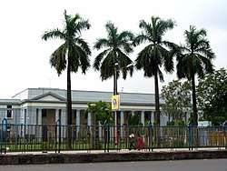 India Government Mint, Taratala, Kolkata | |
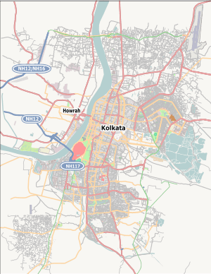 Taratala Location in Kolkata | |
| Coordinates: 22.514132°N 88.315267°E | |
| Country | |
| State | West Bengal |
| City | Kolkata |
| District | Kolkata |
| Metro Station | Taratala(under construction) and Majerhat(under construction) |
| Municipal corporation | Kolkata Municipal Corporation |
| KMC ward | 80 |
| Time zone | UTC+5:30 (IST) |
| Area code(s) | +91 33 |
| Lok Sabha constituency | Kolkata Dakshin |
| Vidhan Sabha constituency | Kolkata Port |
Location
Taratala is situated at the southern part of Kolkata, surrounded by Garden Reach (west and north-west), Behala (south and south-east), Mominpur and Majherhat (north) and New Alipore (east). Taratala is connected to Alipore by Majerhat Bridge.
Educational institutions
Taratala has many educational institutes for higher studies like Institute of Hotel Management Kolkata,[2] Marine Engineering & Research Institute.[3]
Geography
Police district
Taratala police station is part of the South West division of Kolkata Police. Located at 63, Taratala Road, Kolkata-700088, it has jurisdiction over the police district which is bordered on the north along the southern fencing of old Budge Budge Railway line from Diamond Harbour Road to the western limit of Port Commissioner's land.; on the east by Diamond Harbour Road (road excluded) from Majerhat Bridge up to the extreme Southern limit of CPC land as also limit of Calcutta Municipal boundary. Then following Port Commissioner's Port Land Park to its junction of Raja Santosh Road and crossing the road, then following the southern side of Raja Santosh Road, running straight towards west up to where it meets Diamond Harbour Road, high level approach portion of Majerhat Bridge, then southwards following the eastern side of Diamond Harbour Road and Majerhat Bridge to the northern boundary of the railway line at Majerhat; on the south from Diamond Harbour Road extreme southern boundary pillars of CPC land west-wards along the Calcutta Municipal boundary, where it meets Banamali Naskar Road, thence by the north side of Banamali Naskar Road to its junction with Budge Budge Road thence along southern and western boundary of CPC Land; and on the west along the western extremity of CPC Land from Budge Budge Road up to level crossing of old Budge Budge Railway line.[4]
Behala Women police station, located at the same address as above, covers all police districts under the jurisdiction of the South West division i.e. Sarsuna, Taratala, Behala, Parnasree, Thakurpukur and Haridevpur.[4]
Post office
Post Office (Taratala Road S.O) has pin code 700088[5]
References
- Taratala Map mapsofindia.com
- "Institute of Hotel Management, Kolkata". ihmkolkata.org. Retrieved 19 March 2015.
- Official website of Marine Engineering & Research Institute
- "Kolkata Police". South West Division. KP. Retrieved 21 March 2018.
- "Taratala Road S.O Post Office 700088 Pincode – KOLKATA, KOLKATA, West Bengal". kolkataonline.in. Retrieved 19 March 2015.