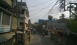
Basirhat
Basirhat is a city and a municipality in North 24 Parganas district of West Bengal, India. It is located on the banks of the Ichamati (Ichhamati) River.

Basirhat | |
|---|---|
City | |
 City of Basirhat | |
 Basirhat Location in West Bengal, India  Basirhat Basirhat (India) | |
| Coordinates: 22°39′26″N 88°53′39″E | |
| Country | |
| State | West Bengal |
| District | North 24 Parganas |
| Government | |
| • Type | Municipality |
| • Body | Basirhat Municipality |
| • Municipality Chairman | Tapan Sarkar[1] |
| Elevation | 6 m (20 ft) |
| Population (2011) | |
| • Total | 144,891 |
| Languages | |
| • Official | Bengali, English |
| Time zone | UTC+5:30 (IST) |
| PIN | 743412 |
| Area code(s) | 3217 |
| Lok Sabha constituency | Basirhat |
| Vidhan Sabha constituency | Basirhat Dakshin, Basirhat Uttar |
History
Basirhat has a long history of farmer's movements like the Tebhaga movement.
Basirhat subdivision was formed on 1 January 1861 as per a Government order and it consisted of Balia Pargana's Basirhāt, Kalinagār, Hāruā and Hasnābād Police Stations. Previously, Basirhat was under the jurisdiction of Barasat sub-division and was named as Basurhāt till 1896. Basirhat municipality was established on 1 April 1869 and it is divided into 23 wards covering an area of 22.5 km².
Geography
Police station
Basirhat police station covers an area of 267 km2 and serves a population of 637,538. Basirhat PS has under it Basirhat town outpost and two other outposts at Panitor and Boatghat. The police district has a 22 km border, out which 14 km is land border and 8 km is riverine border. 11 km of the border remains unfenced. Basirhat PS has jurisdiction over Basirhat municipal area and Basirhat I CD Block.[2]
Around half of the 4,095 km long India-Bangladesh border has been fenced and vigil along the border has been tightened up. As of 2017, Cattle smuggling across the border was unofficially estimated to be a Rs. 4,000 crore business, half of it across the Basirhat border and the balance through Malda and Murshidabad.[3]
In 2017, The Sunday Guardian reported, “The crackdown by the Border Security Force (BSF) on the illegal, but lucrative, business of cow smuggling along the India-Bangladesh border in West Bengal’s North 24 Parganas district, resulted in immense resentment among a section of the area’s minority community. This culminated in the communal flare-up in the state’s Basirhat sub-division earlier this month. A source close to the state’s ruling Trinamool Congress told The Sunday Guardian over phone, “Cow smuggling to Bangladesh, through the riverine border in Basirhat, Taki and other adjoining areas, has taken a hit as the BSF has become very strict and is maintaining a constant vigil. This has hurt the locals, who were earning crores from these illegal activities. Rendered jobless, they blamed the situation on the majority community.””[4]
CD Block HQ
The headquarters of Basirhat I CD Block are located at Basihat.[5]
Demographics
As per the 2011 census, Basirhat Urban Agglomeration had a population of 144,891, out of which 73,491 were males and 71,400 were females. The 0–6 years population was 12,578. Effective literacy rate for the 7+ population was 86.88 percent.[6] Bengali is the principal language spoken in the area.
Education
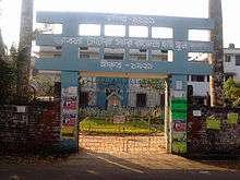
Basirhat College was established in 1947. Affiliated with the West Bengal State University, it offers honours courses in Bengali, English, Sanskrit, philosophy, political science, history, geography, education, accountancy, mathematics, physics, chemistry, botany, zoology, physiology and economics. It also offers general courses in arts, science and commerce, and a post-graduate course in Bengali.[7][8]
Healthcare
Basirhat District Hospital functions with 300 beds.[9]
Basirhat is one of the areas where ground water is affected by arsenic contamination.[10]
Transportation
Railways

Basirhat was connected with Barasat by the narrow gauge Barasat Basirhat Railway operated by Martin's Light Railways. It was closed down in 1955 and subsequently converted to broad gauge. The railway tracks in the region have been electrified and there are EMU services between Sealdah and Hasnabad provided by the Kolkata Suburban Railway.
Roadway
Bus services to Kolkata and other places are available.

Private Buses
DN Series of Routes
MM Series of Routes
- MM2 Basirhat Badartala – Nebukhali
- MM7 Basirhat Court – Dhamakhali
External links
- Basirhat Municipality Website
- Paikpara (Basirhat)
References
- Official District Administration site Archived 20 August 2010 at the Wayback Machine
- "Know your police station". Basirhat PS. North 24 Parganas district police. Retrieved 15 May 2018.
- Guha Roy, Shantanu. "Riots in Basirhat had nothing to do with religion, it's a Hindu-Muslim fight over controlling cow smuggling". Firstpost, 13 July 2013. Retrieved 15 May 2018.
- "Crack down on cow smuggling triggered Basirhat violence". Dibyendu Mondal. The Sunday Guardian, 16 July 2017. Retrieved 20 December 2018.
- "District Census Handbook North Twenty Four Parganas, Census of India 2011, Series 20, Part XII A" (PDF). Map of North Twenty Four Parganas with CD Block HQs and Police Stations (on the fifth page). Directorate of Census Operations, West Bengal. Retrieved 15 May 2018.
- "Urban Agglomerations/Cities having population 1 lakh and above" (PDF). Provisional Population Totals, Census of India 2011. Retrieved 21 October 2011.
- "Basirhat College". BC. Retrieved 15 May 2018.
- "Basirhat College". College Admission. Retrieved 15 May 2018.
- "Health & Family Welfare Department". Health Statistics. Government of West Bengal. Retrieved 15 May 2018.
- "Groundwater Arsenic contamination in West Bengal-India (19 years study )". Groundwater arsenic contamination status of North 24-Parganas district, one of the nine arsenic affected districts of West Bengal-India. SOES. Archived from the original on 27 September 2007. Retrieved 24 August 2007.
North 24 Parganas district topics | |||||||||
|---|---|---|---|---|---|---|---|---|---|
| General |
| ||||||||
| Subdivisions | |||||||||
| Municipalities | |||||||||
| Community development blocks |
| ||||||||
| Rivers | |||||||||
| Transport |
| ||||||||
| Railway stations |
| ||||||||
| Institutes of higher learning |
| ||||||||
| Lok Sabha constituencies | |||||||||
| Vidhan Sabha constituencies |
| ||||||||
| Former Vidhan Sabha constituencies | |||||||||
| See also |
| ||||||||