Komarhat
Komarhat is a census town within the jurisdiction of the Baruipur police station in the Baruipur CD block in the Baruipur subdivision of the South 24 Parganas district in the Indian State of West Bengal.
Komarhat | |
|---|---|
Census Town | |
 Komarhat Location in West Bengal  Komarhat Location in India | |
| Coordinates: 22.3190°N 88.4537°E | |
| Country | |
| State | West Bengal |
| District | South 24 Parganas |
| CD block | Baruipur |
| Area | |
| • Total | 1.88 km2 (0.73 sq mi) |
| Elevation | 9 m (30 ft) |
| Population (2011) | |
| • Total | 5,782 |
| • Density | 3,100/km2 (8,000/sq mi) |
| Languages | |
| • Official | Bengali[1][2] |
| • Additional official | English[1] |
| Time zone | UTC+5:30 (IST) |
| PIN | 743387 |
| Telephone code | +91 33 |
| Vehicle registration | WB-19 to WB-22, WB-95 to WB-99 |
| Lok Sabha constituency | Jadavpur |
| Vidhan Sabha constituency | Baruipur Paschim |
| Website | www |
Geography
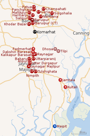 |
| Cities and towns in the southern part of Baruipur subdivision (including Baruipur, Jaynagar I & II, Kultali CD blocks) in South 24 Parganas district M: municipal city/ town, CT: census town, R: rural/ urban centre, N: neighbourhood H: historical place/ religious centre Places linked with coastal activity are marked in blue Owing to space constraints in the small map, the actual locations in a larger map may vary slightly |
Area overview
Baruipur subdivision is a rural subdivision with moderate levels of urbanization. 31.05% of the population lives in the urban areas and 68.95% lives in the rural areas. In the southern portion of the subdivision (shown in the map alongside) there are 20 census towns. The entire district is situated in the Ganges Delta and the southern part is covered by the Baruipur-Jaynagar Plain. Archaeological excavations at Dhosa and Tilpi, on the bank of the Piyali River indicate the existence of human habitation around 2,000 years ago.[3][4][5]
Note: The map alongside presents some of the notable locations in the subdivision. All places marked in the map are linked in the larger full screen map.
Location
Komarhat is located at 22°19′08″N 88°27′13″E. It has an average elevation of 9 metres (30 ft).
Khodar Bazar on the west, Salipur on the north, Baruipur (CT) on the east are census towns adjacent to Baruipur city, and Komarhat is a little away on the south, as per the map of the Baruipur CD block in the District Census Handbook for the South 24 Parganas.[6]
Demographics
According to the 2011 Census of India, Komarhat had a total population of 5,782, of which 2,987 (52%) were males and 2,795 (48%) were females. There were 669 persons in the age range of 0 to 6 years. The total number of literate persons in Komarhat was 4,021 (78.64% of the population over 6 years).[7]
Infrastructure
According to the District Census Handbook 2011, Komarhat covered an area of 1.8752 km2. Among the physical aspects, there is a railway station at Dhapdhapi 1.4 km away. Among the civic amenities, the protected water supply involved borewells. It had 900 domestic electric connections and 100 road light points. Among the medical facilities it had 1 charitable hospital/ nursing home and 14 medicine shops. Among the educational facilities It had was 1 primary school, the nearest secondary school, the nearest senior secondary school at Baruipur 5 km away.[8]
References
- "Fact and Figures". Wb.gov.in. Retrieved 5 July 2019.
- "52nd REPORT OF THE COMMISSIONER FOR LINGUISTIC MINORITIES IN INDIA" (PDF). Nclm.nic.in. Ministry of Minority Affairs. p. 85. Archived from the original (PDF) on 25 May 2017. Retrieved 5 July 2019.
- "District Statistical Handbook 2014 South Twety-four Parganas". Table 2.1 , 2.2, 2.4b. Department of Statistics and Programme Implementation, Government of West Bengal. Retrieved 5 December 2019.
- "Census of India 2011, West Bengal, District Census Handbook, South Twentyfour Parganas, Series – 20, Part XII-A, Village and Town Directory" (PDF). Page 13, Physiography. Directorate of Census Operations, West Bengal. Retrieved 5 December 2019.
- "District Human Development Report: South 24 Parganas". Chapter 9: Sundarbans and the Remote Islanders, p 290-311. Development & Planning Department, Government of West Bengal, 2009. Archived from the original on 5 October 2016. Retrieved 5 December 2019.
- "Census of India 2011, West Bengal, District Census Handbook, South Twentyfour Parganas, Series – 20, Part XII-A, Village and Town Directory" (PDF). Page 383 - Map of Baruipur CD block. Directorate of Census Operations, West Bengal. Retrieved 7 November 2019.
- "CD block Wise Primary Census Abstract Data(PCA)". West Bengal – District-wise CD blocks. Registrar General and Census Commissioner, India. Retrieved 7 November 2019.
- "District Census Handbook South Twenty Four Parganas, Census of India 2011, Series 20, Part XII A" (PDF). Section II Town Directory, Pages 999-1006 Statement I: Status and Growth History, Pages 1006-1010; Statement II: Physical Aspects and Location of Towns, Pages 1010-1015; Statement III: Civic and other Amenities, Pages 1015-1019; Statement IV: Medical Facilities 2009, Pages 1019-1027 Statement V: Educational, Recreational and Cultural Facilities, Pages 1027- 1029: Statement VI:Industry and Banking. Directorate of Census Operations V, West Bengal. Retrieved 9 November 2018.
- Google maps