Loei Province
Loei (Thai: เลย, pronounced [lɤ̄ːj]), is one of the most sparsely populated provinces (changwat) of Thailand lies in upper northeastern Thailand also called Isan. Neighboring provinces are (from east clockwise) Nong Khai, Udon Thani, Nongbua Lamphu, Khon Kaen, Phetchabun, Phitsanulok. In the north it borders Xaignabouli and Vientiane Province of Laos.
Loei เลย | |
|---|---|
 | |
 Flag  Seal | |
| Motto(s): City of the sea of mountains, coldest place in Siam, with beautiful flowers of three seasons | |
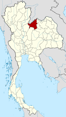 Map of Thailand highlighting Loei Province | |
| Coordinates: 17°29′12″N 101°43′10″E | |
| Country | Thailand |
| Capital | Loei town |
| Government | |
| • Governor | Chaiwat Chuenkosum |
| Area | |
| • Total | 11,425 km2 (4,411 sq mi) |
| Area rank | Ranked 14th |
| Population (2018)[2] | |
| • Total | 642,773 |
| • Rank | Ranked 42nd |
| • Density | 56/km2 (150/sq mi) |
| • Density rank | Ranked 72nd |
| Human Achievement Index | |
| • HAI (2017) | 0.5819 "average" Ranked 42nd |
| Time zone | UTC+7 (ICT) |
| Postal code | 42xxx |
| Calling code | 042 |
| ISO 3166 code | TH-42 |
| Vehicle registration | เลย |
| Website | www |
As of 2020, the provincial governor is Chaiwat Chuenkosum.[4] The province was allocated 225.6 million baht in the FY2019 Thailand budget.[5]
Geography

The province is mountainous. The seat of provincial government, Loei, is in a fertile basin surrounded by mountains whose summits are covered by fog and abundant with varied flora. The best known mountains in the province are Phu Kradueng, Phu Luang, and Phu Ruea. The Loei River, which flows through the province, is a tributary of the Mekong, which forms part of the northern boundary of the province with neighboring Laos. Phu Thap Buek, the highest mountain of the Phetchabun Range, is in the province.[6]
The mountain Phu Kradueng is in Phu Kradueng National Park (อุทยานแห่งชาติภูกระดึง).[7]
Other national parks include Phu Hin Rong Kla, Phu Ruea (อุทยานแห่งชาติภูเรือ),[8] Phu Pha Man, and Phu Suan Sai (อุทยานแห่งชาติภูสวนทราย) (also known as Na Haeo).[9]
The Phu Luang Wildlife Sanctuary is in the province.
The western part of the province reaches the southern end of the Luang Prabang Range mountain area of the Thai highlands.[10]
History
According to tradition, Loei was founded by people from Chiang Saen, the capital of Lan Na. Khun Pha Muang founded the village of Dan-kwa, and Bang Klang Hao founded Dan Sai. Drought and disease later led to the villagers move to the site of present-day Loei. In 1907 King Chulalongkorn (Rama V) created Loei Province. The Loei Cultural Centre (ศูนย์วัฒนธรรมจังหวัดเลย) displays Loei's history, religions, and traditions.[11]
Symbols
The seal of the province shows the stupa at Phra That Si Song Rak, which was built in 1560 by King Maha Chakrapat of the Ayutthaya Kingdom and King Chai Chetha of Lan Xang as a symbol of friendship between the two kingdoms.[12] The provincial tree is the Khasi pine (Pinus kesiya).
The provincial slogan is "city of the sea of mountains, coldest place in Siam, with beautiful flowers of three seasons."[13]
Economy
Agriculture drives Loei's economy. Macadamia nuts, passion fruit, and Arabica coffee are grown in the highlands; bananas, sesame, and rubber on the plains. Loei is an ecotourism destination due to its natural environment and amalgam of northern and northeastern cultures.[14]
Wang Saphung District is the site of a large open pit gold mine that employs many locals. The locality has been the site of a long-standing dispute as well as physical conflict between the villagers of Ban Na Nong Bong and its environs and Tungkum Limited, a subsidiary of Tongkah Harbour PCL. Tungkum's gold mining operation has been accused in the courts of environmental destruction.[15]
Administrative divisions
Provincial government
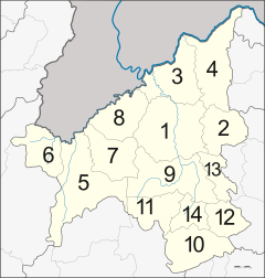
The province is divided into 14 districts (amphoe). The districts are further divided into 89 subdistricts (tambons) and 839 villages (mubans).
Local government
As of 26 November 2019 there are:[16] one Loei Provincial Administration Organisation (ongkan borihan suan changwat) and 29 municipal (thesaban) areas in the province. Loei with Wang Saphung have town (thesaban mueang) status. Further 27 subdistrict municipalities (thesaban tambon). The non-municipal areas are administered by 71 Subdistrict Administrative Organisations - SAO (ongkan borihan suan tambon).[2]
Transport
Route 201 leads from Chiang Khan in the north on the border with Laos, through Loei, to Non Sa-at near Chum Phae. Route 203 leads west to the vicinity of Phu Ruea, and then turns south to Lom Sak.
Loei is served by Loei Airport.[17]
Human achievement index 2017
| Health | Education | Employment | Income |
| 75 | 46 | 15 | 49 |
| Housing | Family | Transport | Participation |
 |
 |
||
| 24 | 16 | 56 | 16 |
| Province Loei, with an HAI 2017 value of 0.5819 is "average", occupies place 42 in the ranking. | |||
Since 2003, United Nations Development Programme (UNDP) in Thailand has tracked progress on human development at sub-national level using the Human achievement index (HAI), a composite index covering all the eight key areas of human development. National Economic and Social Development Board (NESDB) has taken over this task since 2017.[3]
| Rank | Classification |
| 1 - 15 | "high" |
| 16 - 30 | "somewhat high" |
| 31 - 45 | "average" |
| 45 - 60 | "somewhat low" |
| 61 - 77 | "low" |
| Map with provinces and HAI 2017 rankings |
 |
Notes
Reports (data) from Thai government are "not copyrightable" (Public Domain), Copyright Act 2537 (1994), section 7.
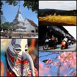
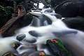
Gallery
 The sunrise at Pha Nok Aen,
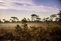
 Phu Kradueng National Park
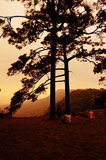 Phu Kradueng
 Phu Kradueng
 Phu Kradueng
 A scenic walkway in the area of Phu Ruea National Park
 Man Daeng Waterfall, Phu Hin Rong Kla National Park
 Na Haeo District
 Chiang Khan
References
- Advancing Human Development through the ASEAN Community, Thailand Human Development Report 2014, table 0:Basic Data (PDF) (Report). United Nations Development Programme (UNDP) Thailand. pp. 134–135. ISBN 978-974-680-368-7. Retrieved 17 January 2016, Data has been supplied by Land Development Department, Ministry of Agriculture and Cooperatives, at Wayback Machine.
- "รายงานสถิติจำนวนประชากรและบ้านประจำปี พ.ศ.2561" [Statistics, population and house statistics for the year 2018]. Registration Office Department of the Interior, Ministry of the Interior (in Thai). 31 December 2018. Retrieved 20 June 2019.
- Human achievement index 2017 by National Economic and Social Development Board (NESDB), pages 1-40, maps 1-9, retrieved 14 September 2019, ISBN 978-974-9769-33-1
- "Loei governor rises as 'savior' in Covid-19 struggle". Thai PBS World. 2 May 2020. Retrieved 2 May 2020.
- Thailand's Budget in Brief Fiscal Year 2019. Bureau of the Budget. 20 December 2018. p. 95. Retrieved 2 May 2020.
- "Ban Thap Boek". Tourism Authority of Thailand (TAT). Retrieved 6 May 2016.
- "Phu Kradueng National Park". Department of National Parks (DNP). Archived from the original on 21 January 2016. Retrieved 5 June 2016.
- "Phu Ruea National Park". Department of National Parks (DNP). Archived from the original on 26 March 2016. Retrieved 5 June 2016.
- "Phu Suan Sai National Park". Department of National Parks (DNP). Archived from the original on 26 March 2016. Retrieved 5 June 2016.
- ดร.กระมล ทองธรรมชาติ และคณะ, สังคมศึกษา ศาสนาและวัฒนธรรม ม.1, สำนักพิมพ์ อักษรเจริญทัศน์ อจท. จำกัด, 2548, หน้า 24-25
- "Loei Cultural Center". Tourism Authority of Thailand (TAT). Retrieved 5 June 2016.
- "Loei". THAILEX Travel Encyclopedia. Retrieved 5 June 2016.
- "About Loei". Tourist Authority of Thailand (TAT). Retrieved 5 June 2016.
- "Loei: General Info". Tourist Authority of Thailand (TAT). Retrieved 5 June 2016.
- Wannasiri, Sutharee; Abbott, Kingsley (5 June 2016). "Struggle against mining violations leaves activists exposed". Bangkok Post. Retrieved 5 June 2016.
- "Number of local government organizations by province". dla.go.th. Department of Local Administration (DLA). 26 November 2019. Retrieved 10 December 2019.
54 Loei: 1 PAO, 2 Town mun., 27 Subdistrict mun., 71 SAO.
- "Loei Airport". OurAirports. Retrieved 3 February 2013.
External links
| Wikimedia Commons has media related to Loei Province. |

- Provincial website
- Local website of Loei (Thai version) : Outloei.com
Places adjacent to Loei Province | ||||||||||
|---|---|---|---|---|---|---|---|---|---|---|
| ||||||||||