Roi Et Province
Roi Et (Thai: ร้อยเอ็ด, pronounced [rɔ́ːj ʔèt]) is one of Thailand's seventy-six provinces (changwat) lies in central northeastern Thailand also called Isan. Neighboring provinces are (from north clockwise) Kalasin, Mukdahan, Yasothon, Sisaket, Surin, and Maha Sarakham.
Roi Et ร้อยเอ็ด | |
|---|---|
 Phra Phuttharattanamongkhon Maha Muni or Luang Pho Yai, Wat Burapha Phiram (Wat Hua Ro) | |
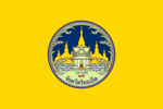 Flag  Seal | |
 Map of Thailand highlighting Roi Et Province | |
| Country | Thailand |
| Capital | Roi Et |
| Government | |
| • Governor | Sarit Withun (since October 2016) |
| Area | |
| • Total | 8,299 km2 (3,204 sq mi) |
| Area rank | Ranked 23rd |
| Elevation | 150 m (490 ft) |
| Population (2018)[2] | |
| • Total | 1,307,208 |
| • Rank | Ranked 14th |
| • Density | 158/km2 (410/sq mi) |
| • Density rank | Ranked 25th |
| Human Achievement Index | |
| • HAI (2017) | 0.6075 "somewhat high" Ranked 25th |
| Time zone | UTC+7 (ICT) |
| Postal code | 45xxx |
| Calling code | 043 |
| ISO 3166 code | TH-45 |
| Website | www |
Toponymy
The name of the province literally means 'one hundred and one' (Thai: ร้อยเอ็ด; RTGS: roi et ). Correctly, the number should be "eleven" (Thai: สิบเอ็ด; RTGS: sip et ), as the province was named after its eleven ancient gates built for its eleven vassal states. In ancient times, the number "eleven" was written "๑๐๑" (101) and the provincial name was written accordingly. Later, people took "๑๐๑" to mean 'one hundred and one' and have since then called it "Roi Et".[4]
Geography
Most of the province is covered by plains about 130–160 meters above sea level, drained by the Chi River. In the north are the hills of the Phu Phan mountain range. The Yang River is the major watercourse. In the south is the Mun River, which also forms the boundary with Surin. At the mouth of the Chi River, where it enters the Mun River, a floodplain provides a good rice farming area.
History
The area was already settled at the time of the Khmer empire, as several ruins show. However, the main history of the province began when Lao people from Champasak settled near Suwannaphum during the Ayutthaya Kingdom. In the late-18th century, King Taksin moved the city to its present site, then called Saket Nakhon.[5]
Symbols
The provincial seal shows the shrine of the city pillar, which is in the artificial lake Bueng Phalan Chai. The spirit of the shrine, Mahesak, is revered by local people.
The provincial tree is Lagerstroemia macrocarpa.
Transportation
Road
Route 214 leads north to Kalasin and south to Kaset Wiset, Surin, and Prasat. Route 2044 leads east to Phon Thong. Route 23 leads west to Maha Sarakham and Ban Phai, and east to Yasothon and Ubon Ratchathani. Route 215 leads south to Suwannaphum and the border with Surin Province.
Air
Roi Et is served by Roi Et Airport to the north of the town.[6]
Administrative divisions
Provincial government

The province is divided into 20 districts (amphoes). The districts are further divided into 193 subdistricts (tambons) and 2,311 villages (mubans).
Local government
As of 26 November 2019 there are:[7] one Roi Et Provincial Administration Organisation (ongkan borihan suan changwat) and 73 municipal (thesaban) areas in the province. Roi Et has town (thesaban mueang) status. Further 72 subdistrict municipalities (thesaban tambon). The non-municipal areas are administered by 129 Subdistrict Administrative Organisations - SAO (ongkan borihan suan tambon).[2]
Human achievement index 2017
| Health | Education | Employment | Income |
| 21 | 48 | 31 | 26 |
| Housing | Family | Transport | Participation |
 |
 |
||
| 1 | 28 | 62 | 48 |
| Province Roi Et, with an HAI 2017 value of 0.6075 is "somewhat high", occupies place 25 in the ranking. | |||
Since 2003, United Nations Development Programme (UNDP) in Thailand has tracked progress on human development at sub-national level using the Human achievement index (HAI), a composite index covering all the eight key areas of human development. National Economic and Social Development Board (NESDB) has taken over this task since 2017.[3]
| Rank | Classification |
| 1 - 15 | "high" |
| 16 - 30 | "somewhat high" |
| 31 - 45 | "average" |
| 45 - 60 | "somewhat low" |
| 61 - 77 | "low" |
| Map with provinces and HAI 2017 rankings |
 |
Gallery
 Roi Et National Museum
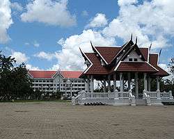 Roi Et City Hall
Notes
Reports (data) from Thai government are "not copyrightable" (Public Domain), Copyright Act 2537 (1994), section 7.
References
- Advancing Human Development through the ASEAN Community, Thailand Human Development Report 2014, table 0:Basic Data (PDF) (Report). United Nations Development Programme (UNDP) Thailand. pp. 134–135. ISBN 978-974-680-368-7. Retrieved 17 January 2016, Data has been supplied by Land Development Department, Ministry of Agriculture and Cooperatives, at Wayback Machine.
- "รายงานสถิติจำนวนประชากรและบ้านประจำปี พ.ศ.2561" [Statistics, population and house statistics for the year 2018]. Registration Office Department of the Interior, Ministry of the Interior (in Thai). 31 December 2018. Retrieved 20 June 2019.
- Human achievement index 2017 by National Economic and Social Development Board (NESDB), pages 1-40, maps 1-9, retrieved 14 September 2019, ISBN 978-974-9769-33-1
- Royal Institute of Thailand (2010). Kotmai Tra Sam Duang Phra Thamnun (Chabap Ratchabandittayasathan) กฎหมายตราสามดวง พระทำนูน (ฉบับราชบัณฑิตยสถาน) [The Code of the Three Great Seals: The Judicial Statute (Royal Institute Version)] (in Thai). Bangkok: Royal Institute of Thailand. pp. 39–40. ISBN 9786167073118.
- "About Roi Et". Tourism Authority of Thailand (TAT). Retrieved 18 August 2019.
- "Rob Muang Airport". OurAirports. Retrieved 4 February 2013.
- "Number of local government organizations by province". dla.go.th. Department of Local Administration (DLA). 26 November 2019. Retrieved 10 December 2019.
47 Roi Et: 1 PAO, 1 Town mun., 72 Subdistrict mun., 129 SAO.
External links

- Province page from the Tourist Authority of Thailand
- Website of Province (Thai only)
Places adjacent to Roi Et Province | |
|---|---|