Mueang Loei District
Mueang Loei (Thai: เมืองเลย; IPA: [mɯ̄aŋ lɤ̄ːj]) is the capital district (amphoe mueang) of Loei Province, northeastern Thailand.
Mueang Loei เมืองเลย | |
|---|---|
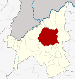 District location in Loei Province | |
| Coordinates: 17°29′6″N 101°43′48″E | |
| Country | Thailand |
| Province | Loei |
| Area | |
| • Total | 1,480.49 km2 (571.62 sq mi) |
| Population (2005) | |
| • Total | 117,039 |
| • Density | 79.1/km2 (205/sq mi) |
| Time zone | UTC+7 (ICT) |
| Postal code | 42000 |
| Geocode | 4201 |
Location
Neighboring districts are (from the north clockwise): Chiang Khan, Pak Chom, Na Duang, Erawan, Wang Saphung, Phu Ruea, and Tha Li of Loei Province.
The important water resource is the Loei River.
History
The district was one of the five original districts of Loei Province established in 1897 during the thesaphiban administrative reforms. At first named Kut Pong after the central tambon, it was later renamed Mueang Loei.
Administration
The district is divided into 14 sub-districts (tambons), which are further subdivided into 130 villages (mubans). The town (thesaban mueang) Loei covers tambon Kut Pong. There are two more townships (thesaban tambons): Na O covers the whole of tambon Na O, and Nam Suai covers parts of tambon Nam Suai. There are a further 13 tambon administrative organizations (TAO).
| No. | Name | Thai name | Villages | Pop. | |
|---|---|---|---|---|---|
| 1. | Kut Pong | กุดป่อง | - | 22,677 | |
| 2. | Mueang | เมือง | 13 | 10,678 | |
| 3. | Na O | นาอ้อ | 9 | 6,051 | |
| 4. | Kok Du | กกดู่ | 10 | 6,567 | |
| 5. | Nam Man | น้ำหมาน | 6 | 3,612 | |
| 6. | Siao | เสี้ยว | 6 | 3,287 | |
| 7. | Na An | นาอาน | 12 | 11,184 | |
| 8. | Na Pong | นาโป่ง | 14 | 9,609 | |
| 9. | Na Din Dam | นาดินดำ | 14 | 10,460 | |
| 10. | Nam Suai | น้ำสวย | 11 | 9,728 | |
| 11. | Chaiyaphruek | ชัยพฤกษ์ | 11 | 6,449 | |
| 12. | Na Khaem | นาแขม | 8 | 6,642 | |
| 13. | Si Song Rak | ศรีสองรัก | 11 | 7,610 | |
| 14. | Kok Thong | กกทอง | 5 | 2,485 |