Uthai Thani Province
Uthai Thani (Thai: อุทัยธานี, pronounced [ʔù.tʰāj tʰāː.nīː]), one of Thailand's seventy-six provinces (changwat) lies in lower northern Thailand. Neighboring provinces are (from north clockwise) Nakhon Sawan, Chai Nat, Suphan Buri, Kanchanaburi and Tak. It lies somewhat off the route between Bangkok, 200 km distant and Chiang Mai.[4]
Uthai Thani อุทัยธานี | |
|---|---|
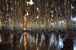 Wat Chan Tharam | |
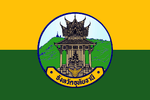 Flag 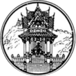 Seal | |
| Nickname(s): Uthai | |
 Map of Thailand highlighting Uthai Thani Province | |
| Country | Thailand |
| Capital | Uthai Thani |
| Government | |
| • Governor | Narong Rakhot |
| Area | |
| • Total | 6,730 km2 (2,600 sq mi) |
| Area rank | Ranked 29th |
| Population (2018)[2] | |
| • Total | 329,433 |
| • Rank | Ranked 67th |
| • Density | 49/km2 (130/sq mi) |
| • Density rank | Ranked 73rd |
| Human Achievement Index | |
| • HAI (2017) | 0.5508 "low" Ranked 64th |
| Time zone | UTC+7 (ICT) |
| Postal code | 61xxx |
| Calling code | 056 |
| ISO 3166 code | TH-61 |
| Website | www |
Geography
The province stretches from the upper plains of the Chao Phraya River valley, to forested mountains in the west. The Sakae Krang River, a tributary of the Chao Phraya River, is the main watercourse of in the province.
The Huai Kha Khaeng Wildlife Sanctuary, at the western boundary bordering Tak Province, was declared a World Heritage Site in 1991. It covers 2,574 km2 and is home to most of the forest animals of Southeast Asia, including tigers and elephants.
History
Originally Mon and Lawa settled in the area. The first Thai settlement in the area was Muang U Thai during the Sukhothai Kingdom, but it was later abandoned when the river changed course. The Patabeut people, of Karen ethnicity, revived the settlement at its current site during the Ayutthaya Kingdom. It served as a fort protecting the boundary of the kingdom.
Uthai Thani is the hometown of the father of King Rama I. Rama I renamed the city from its old name Uthai to Uthai Thani.
In 1892, King Chulalongkorn (Rama V) added the area of Uthai Thani to the Monthon Nakhon Sawan and in 1898 formed the province.
Symbols
The provincial seal depicts the pavilion at Wat Khao Sakae Krang. It houses the statue of Thongdee, the father of King Rama I and a Buddha footprint. The mountain in the background symbolizes the location of the pavilion on top of Khao Sakae Krang.[5]
The provincial flower is the yellow cotton tree (Cochlospermum regium). The provincial tree is the neem (Azadirachta indica v. siamensis).
The flag of Uthai Thani depicts the provincial seal of Uthai Thani in the middle. The yellow colour at the top of the flag is the colour of the Chakri dynasty, symbolizing gold. The green colour at the bottom is the colour of King Rama I as he was born on a Wednesday, which is associated with green in the Thai calendar. The text below the seal says Uthai Thani Province.
Administrative divisions

Provincial government
The province is divided into eight districts (amphoes). These are further divided into 70 subdistricts (tambons) and 642 villages (mubans).
Local government
As of 26 November 2019 there are:[6] one Uthai Thani Provincial Administration Organisation (ongkan borihan suan changwat) and 14 municipal (thesaban) areas in the province. Uthai Thani has town (thesaban mueang) status. There are a further 13 subdistrict municipalities (thesaban tambon). The non-municipal areas are administered by 49 Subdistrict Administrative Organisations (SAO) (ongkan borihan suan tambon).[2]
Human achievement index 2017
| Health | Education | Employment | Income |
| 71 | 57 | 28 | 35 |
| Housing | Family | Transport | Participation |
 |
 |
||
| 66 | 46 | 65 | 9 |
| Uthai Thani Province , with an HAI 2017 value of 0.5508, "low", ranks 64th among Thai provinces. | |||
In 2003, United Nations Development Programme (UNDP) in Thailand began tracking progress on human development at the sub-national level using the Human Achievement Index (HAI), a composite index covering eight key areas of human development. The National Economic and Social Development Board (NESDB) took over this task in 2017.[3]
| Rank | Classification |
| 1 - 15 | "high" |
| 16 - 30 | "somewhat high" |
| 31 - 45 | "average" |
| 45 - 60 | "somewhat low" |
| 61 - 77 | "low" |
| Map with provinces and HAI 2017 rankings |
 |
Notes
Reports (data) from Thai government are "not copyrightable" (Public Domain), Copyright Act 2537 (1994), section 7.
References
- Advancing Human Development through the ASEAN Community, Thailand Human Development Report 2014, table 0:Basic Data (PDF) (Report). United Nations Development Programme (UNDP) Thailand. pp. 134–135. ISBN 978-974-680-368-7. Retrieved 17 January 2016, Data has been supplied by Land Development Department, Ministry of Agriculture and Cooperatives, at Wayback Machine.
- "รายงานสถิติจำนวนประชากรและบ้านประจำปี พ.ศ.2561" [Statistics, population and house statistics for the year 2018]. Registration Office Department of the Interior, Ministry of the Interior (in Thai). 31 December 2018. Retrieved 20 June 2019.
- Human achievement index 2017 by National Economic and Social Development Board (NESDB), pages 1-40, maps 1-9, retrieved 14 September 2019, ISBN 978-974-9769-33-1
- "Uthai Thani". Tourism Authority of Thailand (TAT). Retrieved 20 Apr 2015.
- "Khao Sakae Krang". Tourism Authority of Thailand (TAT). Retrieved 20 Apr 2015.
- "Number of local government organizations by province". dla.go.th. Department of Local Administration (DLA). 26 November 2019. Retrieved 10 December 2019.
74 Uthai Thani: 1 PAO, 1 Town mun., 13 Subdistrict mun., 49 SAO.
External links

| Wikimedia Commons has media related to Uthai Thani Province. |
- Website of the province (Thai only)
Places adjacent to Uthai Thani Province | ||||||||||
|---|---|---|---|---|---|---|---|---|---|---|
| ||||||||||