Erawan District
Erawan (Thai: เอราวัณ; IPA: [ʔēːrāːwān]) is a district (amphoe) in the eastern part of Loei Province, northeastern Thailand.
Erawan เอราวัณ | |
|---|---|
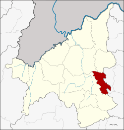 District location in Loei Province | |
| Coordinates: 17°18′36″N 101°56′24″E | |
| Country | Thailand |
| Province | Loei |
| Seat | Pha In Plaeng |
| Area | |
| • Total | 262.0 km2 (101.2 sq mi) |
| Population (2005) | |
| • Total | 37,079 |
| • Density | 141.5/km2 (366/sq mi) |
| Time zone | UTC+7 (ICT) |
| Postal code | 42220 |
| Geocode | 4213 |
The district is named after the Erawan Cave in neighboring Na Wang District very near the boundary to Erawan District.[1]
Geography
Neighboring districts are (from the south clockwise): Pha Khao, Wang Saphung, Mueang Loei, and Na Duang of Loei Province; and Na Wang and Si Bun Rueang of Nong Bua Lamphu Province.
The main river in the district is the Suai.
History
The minor district (king amphoe) was established on 1 April 1995 with territory split off from Wang Saphung District.[2]
The Thai government on 15 May 2007 upgraded all 81 minor districts to full districts.[3] With publication in the Royal Gazette on 24 August the upgrade became official.[4]
Symbols
The district slogan is "Erawan, large elephant. Area of sweet Longan. Tradition of 100,000 rockets. Land of silk production".
Administration
The district is divided into four sub-districts (tambons), which are further subdivided into 45 villages (mubans). Erawan and Pha In Plaeng are also sub-district municipalities (thesaban tambons), and two tambon administrative organizations (TAO) for the remaining two sub-districts.
| No. | Name | Thai name | Villages | Pop.[5] | |
|---|---|---|---|---|---|
| 1. | Erawan | เอราวัณ | 16 | 12,160 | |
| 2. | Pha In Plaeng | ผาอินทร์แปลง | 14 | 12,532 | |
| 3. | Pha Sam Yot | ผาสามยอด | 8 | 7,742 | |
| 4. | Sap Phaiwan | ทรัพย์ไพวัลย์ | 7 | 4,645 |
References
- "History of Erawan district" (in Thai). Loei province.
- ประกาศกระทรวงมหาดไทย เรื่อง แบ่งเขตท้องที่อำเภอวังสะพุง จังหวัดเลย ตั้งเป็นกิ่งอำเภอเอราวัณ (PDF). Royal Gazette (in Thai). 112 (Special 9 ง): 59. 22 March 1995.
- แถลงผลการประชุม ครม. ประจำวันที่ 15 พ.ค. 2550 (in Thai). Manager Online.
- พระราชกฤษฎีกาตั้งอำเภอฆ้องชัย...และอำเภอเหล่าเสือโก้ก พ.ศ. ๒๕๕๐ (PDF). Royal Gazette (in Thai). 124 (46 ก): 14–21. 24 August 2007.
- "Department of provincial administration". Archived from the original on 2007-09-26. Retrieved 2007-08-13.