Phu Luang District
Phu Luang (Thai: ภูหลวง; IPA: [pʰūː lǔaŋ]) is a district (amphoe) of Loei Province, northeastern Thailand.
Phu Luang ภูหลวง | |
|---|---|
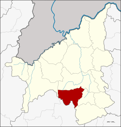 District location in Loei Province | |
| Coordinates: 17°8′24″N 101°39′54″E | |
| Country | Thailand |
| Province | Loei |
| Seat | Nong Khan |
| Area | |
| • Total | 595.0 km2 (229.7 sq mi) |
| Population (2005) | |
| • Total | 23,069 |
| • Density | 38.8/km2 (100/sq mi) |
| Time zone | UTC+7 (ICT) |
| Postal code | 42230 |
| Geocode | 4211 |
Geography
Neighboring districts are (from the south clockwise): Nam Nao of Phetchabun Province; Phu Ruea, Wang Saphung, Nong Hin, and Phu Kradueng of Loei Province.
To the northwest of the district is the plateau of Phu Luang mountain, which also gave the district its name. It is now protected as the Phu Luang Wildlife Sanctuary. In tambon Kaeng Si Phum is the Namtok Huai Lao Forest Park, covering 3.4 km² around the Huai Lao waterfall.
History
The minor district (king amphoe) was established on 28 November 1980 with the two tambons Phu Ho and Nong Khan split off from Wang Saphung District.[1] It was upgraded to a full district on 9 May 1992.[2]
Administration
The district is divided into five sub-districts (tambons), which are further subdivided into 43 villages (mubans). There are no municipal (thesaban) areas. There are five tambon administrative organizations (TAO).
| No. | Name | Thai name | Villages | Pop. | |
|---|---|---|---|---|---|
| 1. | Phu Ho | ภูหอ | 10 | 6,420 | |
| 2. | Nong Khan | หนองคัน | 9 | 4,601 | |
| 4. | Huai Sisiat | ห้วยสีเสียด | 8 | 3,966 | |
| 5. | Loei Wang Sai | เลยวังไสย์ | 8 | 4,138 | |
| 6. | Kaeng Si Phum | แก่งศรีภูมิ | 8 | 3,944 |
Geocode 3 is not used.
References
- ประกาศกระทรวงมหาดไทย เรื่อง แบ่งท้องที่อำเภอวังสะพุง จังหวัดเลย ตั้งเป็นกิ่งอำเภอภูหลวง (PDF). Royal Gazette (in Thai). 97 (178 ง Special): 19. 20 Nov 1980.
- พระราชกฤษฎีกาตั้งอำเภอสอยดาว อำเภอโพนสวรรค์ อำเภอบางขัน อำเภอหว้านใหญ่ อำเภอเมืองปาน อำเภอภูหลวง อำเภอโคกศรีสุพรรณ และอำเภอสำโรง พ.ศ. ๒๕๓๕ (PDF). Royal Gazette (in Thai). 109 (45 ก): 27–29. 9 Apr 1992.