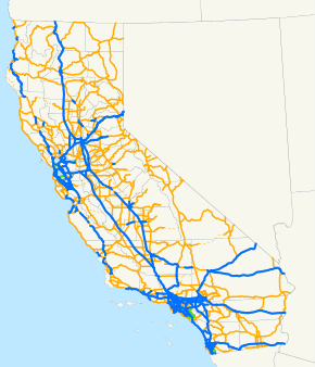
List of state highways in California
This is a list of state highways in the U.S. state of California that have existed since the 1964 renumbering. It includes routes that were defined by the California State Legislature but never built, as well as routes that have been entirely relinquished to local governments. It does not include the few routes that were relinquished before 1964 or the larger number of sign routes that were renumbered in or before 1964.
| State Routes in California | |
|---|---|
   Standard California state route shields, in the shape of a miner's spade to honor the California Gold Rush.[1][2] | |
 | |
| Highway names | |
| Interstates | Interstate XX (I-XX) |
| US Highways | U.S. Route XX (US XX) |
| State | State Route XX (SR XX) |
| System links | |
Each state highway in California is maintained by the California Department of Transportation (Caltrans) and is assigned a Route (officially State Highway Route[3][4]) number in the Streets and Highways Code (Sections 300-635). Under the code, the state assigns a unique Route X to each highway, and does not differentiate between state, US, or Interstate highways.
List
- U.S. Routes and Interstate Highways that traverse California are also defined in the California Streets and Highways code as state routes. This list does not include these state routes as they are listed separately.
- A few cases exist, such as SR 110, where a defined California State Route partially overlaps with a federally defined Interstate Highway, while the remaining portion is signed as a state highway. This table only addresses the portion signed as a California State Route in these cases.
- Lengths for each state route were initially measured as they existed during the 1964 state highway renumbering (or during the year the route was established, if after 1964), and do not necessarily reflect the current mileage.
- The years listed reflect when the route was affected by legislative action, this is not necessarily the same year as the actual construction or signing changes to the route. Most notably, SR 275 was deleted from the Streets and Highways Code in 1996, but remained partially maintained until it was added back in 2010; and SR 42 was signed as such for over 30 years after it was renumbered 105.
- Concurrences are not explicitly codified in the Streets and Highways Code; such highway segments are listed on only one of the corresponding legislative route numbers. For example, the I-80/I-580 concurrency, known as the Eastshore Freeway, is only listed under Route 80 in the highway code while the definition of Route 580 is broken into non-contiguous segments. When a highway is broken into such segments, the total length recorded by Caltrans only reflects those non-contiguous segments and does not include those overlaps that would be required to make the route continuous.
- Some highways are not contiguous as the state has relinquished control of small sections to local governments. The stated length of the highway may or may not reflect the portions under local control.
| Number | Length (mi)[5][lower-alpha 1] | Length (km) | Southern or western terminus | Northern or eastern terminus | Formed | Removed | Notes | |
|---|---|---|---|---|---|---|---|---|
| 655.845[lower-alpha 2][lower-alpha 3] | 1,055.480 | I-5 in Dana Point | US 101 near Leggett | 1934 | current | |||
| 87.295[lower-alpha 2][lower-alpha 3] | 140.488 | Centinela Avenue in Santa Monica | SR 138 near Wrightwood | 1934 | current | |||
| 146.369[lower-alpha 2] | 235.558 | SR 36 near Peanut | Ball Mountain Little Shasta Road in Montague | 1964 | current | |||
| 197[lower-alpha 2] | 317 | I-80 / San Pablo Avenue in Hercules | SR 89 near Markleeville | 1934 | current | |||
| 6.718 | 10.812 | Border with Mexico east of Calexico | I-8 / CR S32 south of Holtville | 1990 | current | |||
| — | — | SR 1 in Long Beach | I-210 / SR 134 in Pasadena | 1964 | 1984 | Now part of I-710 | ||
| 38.497 | 61.955 | SR 1 in Santa Cruz | SR 17 in Los Gatos | 1934 | current | Parts of SR 85, I-680, SR 237, and the entireties of SR 262, and SR 238 were formally SR 9 until the highway was truncated in 1963-1964. | ||
| 2.7 | 4.3 | SR 125 / SR 905 in Otay Mesa | Border with Mexico at Otay Mesa East Port of Entry | 1994 | current | The first segment from SR 905 east to Enrico Fermi Drive opened on March 19, 2016.[6] The remaining segments are still under construction. | ||
| 33.06 | 53.20 | 9th Street in San Pedro | Colorado Blvd in Pasadena | 1964 | 1981 | The segment of SR 11 south of 0.03 mile north O'Farrell Street in San Pedro as well as the segment north of Glenarm Street in Pasadena that were re-designated as part of SR 110 after July, 1964 have been relinquished; the segment from 0.03 mile north of O'Farrell Street to I-10 in Los Angeles is presently part of I-110; the segment from I-10 to Glenarm Street is presently part of SR 110. | ||
| 140.64[lower-alpha 2][lower-alpha 4] | 226.34 | SR 116 in Sebastopol | SR 49 near San Andreas | 1934 | current | |||
| 9.73[lower-alpha 4] | 15.66 | I-580 in Oakland | I-80 / I-580 in Berkeley | 1964 | current | |||
| 116.645[lower-alpha 4] | 187.722 | I-5 near Santa Clarita | US 395 near Inyokern | 1964 | current | Aerospace Highway segment formerly part of US 6 | ||
| 3.8 | 6.1 | Newhall Avenue in Santa Clarita | Via Princessa in Santa Clarita | 1964 | current | Formerly part of US 6 / SR 14. | ||
| 5.59[lower-alpha 5] | 9.00 | I-5 in San Diego | I-8 in San Diego | 1957 | current | Future southern extension of I-15 | ||
| 111.17[lower-alpha 2] | 178.91 | SR 20 near Rumsey | SR 49 near Drytown | 1934 | current | |||
| 26.49 | 42.63 | SR 1 in Santa Cruz | I-280 / I-880 in San Jose | 1934 | current | Parts of I-580 and the entirety of I-880 were formally SR 17 until the highway was truncated in 1984. | ||
| 117.21[lower-alpha 2][lower-alpha 4] | 188.63 | SR 210 in San Bernardino | SR 138 near Pearblossom | 1934 | current | |||
| 4.4[lower-alpha 3] | 7.1 | Bellflower city limit at Rose Street | Bellflower–Downey city limit at Gardendale Street | 1934 | current | currently being relinquished to the City of Bellflower; Also, SR 164 (north of Gallatin Road) is signed California 19 along Rosemead Blvd. | ||
| 211.882[lower-alpha 2] | 340.991 | SR 1 in Fort Bragg | I-80 near Emigrant Gap | 1934 | current | |||
| — | — | I-680 in Benicia | I-80 in Cordelia | 1934 | 1976 | Now I-680 (old I-680 became I-780) | ||
| 14.725[lower-alpha 2] | 23.698 | SR 1 in Long Beach | SR 55 in Orange | 1934 | current | |||
| 32.03[lower-alpha 2] | 51.55 | SR 1 in Malibu | SR 126 in Fillmore | 1934 | current | |||
| 13.492[lower-alpha 4] | 21.713 | I-580 / I-980 in Oakland | I-680 in Walnut Creek | 1934 | current | |||
| 74.632 | 120.109 | SR 198 east of San Lucas | US 101 near Gilroy | 1934 | current | |||
| 62.162[lower-alpha 2] | 100.040 | SR 99 near Stockton | SR 88 near Pioneer | 1934 | current | |||
| 19.974 | 32.145 | SR 1 near Malibu | SR 118 in Chatsworth | 1934 | current | |||
| 10.943 | 17.611 | SR 89 in Tahoe City | NV 28 in Kings Beach | 1934 | current | |||
| 105.648 | 170.024 | I-80 in Vallejo | SR 20 in Upper Lake | 1934 | current | |||
| — | — | I-210 / SR 57 in Glendora | I-10 in Redlands | 1952 | 2007 | Now SR 210 | ||
| — | — | I-15 / SR 91 in Corona | I-10 in Ontario | 1964 | 1974 | Now I-15 | ||
| 74.387 | 119.714 | I-5 in Orland | SR 36 / SR 89 near Chester | 1934 | current | |||
| 289.699[lower-alpha 2] | 466.225 | US 101 in Ventura | I-5 near Tracy | 1934 | current | |||
| 13.368[lower-alpha 3] | 21.514 | Rice Avenue in Oxnard | SR 118 in Somis | 1934 | current | |||
| 54.056[lower-alpha 2] | 86.995 | SR 17 near Redwood Estates | SR 1 in San Francisco | 1964 | current | |||
| 248.856 | 400.495 | US 101 near Fortuna | US 395 near Susanville | 1934 | current | |||
| 21.494[lower-alpha 4] | 34.591 | US 101 in Novato | I-80 in Vallejo | 1934 | current | |||
| 59[lower-alpha 2] | 95 | I-10 in Redlands | SR 18 near Big Bear Lake | 1934 | current | |||
| 50.017[lower-alpha 3][lower-alpha 4] | 80.495 | SR 1 in Huntington Beach | SR 2 in the Angeles National Forest | 1934 | current | Northernmost section from Crystal Lake Road to SR 2 has been closed indefinitely since 1978 due to a massive rockslide | ||
| 185.594[lower-alpha 2] | 298.685 | SR 1 in Morro Bay | SR 140 in Yosemite National Park | 1934 | current | |||
| — | — | SR 1 in Inglewood | SR 91 in Anaheim | 1960 | 2000 | |||
| 98[lower-alpha 2] | 158 | SR 119 near Taft | SR 99 in Selma | 1934 | current | |||
| 107.02 | 172.23 | SR 273 / SR 299 in Redding | SR 36 near Susanville | 1935 | current | |||
| 70[lower-alpha 2] | 113 | SR 113 in Knights Landing | SR 32 in Hamilton City | 1934 | current | |||
| 110.696[lower-alpha 2] | 178.148 | SR 1 near Cambria | SR 99 in Famoso | 1964 | current | |||
| 3.078[lower-alpha 4] | 4.954 | I-110 in San Pedro | SR 91 in Compton | 1949 | current | |||
| — | — | SR 14 / SR 138 at Lancaster | SR 122 at Lancaster | 1964 | current | unconstructed | ||
| 295.065[lower-alpha 2][lower-alpha 3] | 474.861 | SR 41 at Oakhurst | SR 70 at Vinton | 1934 | current | |||
| 10.7 | 17.2 | US 50 / SR 99 in Sacramento | I-80 / SR 244 in North Highlands | 1979 | current | Signed as Business I-80. Former routing of I-80. | ||
| — | — | I-5 in Santa Ana | I-5 in Santa Ana | 1964 | 1965 | |||
| 17.222 | 27.716 | I-5 in San Diego | SR 67 in Santee | 1964 | current | |||
| 7.45 | 11.99 | SR 29 in Lower Lake | SR 20 near Clearlake | 1934 | current | |||
| 14.212[lower-alpha 3] | 22.872 | I-5 in National City | Chase Avenue El Cajon city limits | 1961 | current | |||
| 17.807 | 28.658 | Finley Avenue in Newport Beach | SR 91 in Anaheim | 1964 | current | |||
| 9.21[lower-alpha 4] | 14.82 | I-5 in Carmel Valley, San Diego | I-15 in Rancho Penasquitos, San Diego | 1964 | current | |||
| 25.84[lower-alpha 2][lower-alpha 4] | 41.59 | I-5 / SR 22 in Santa Ana | I-210 / SR 210 in Glendora | 1964 | current | |||
| 241[lower-alpha 2] | 388 | US 101 near Santa Margarita | I-15 near Barstow | 1964 | current | |||
| 33.76[lower-alpha 2] | 54.33 | SR 152 near El Nido | CR J16 / CR J59 in Snelling | 1934 | current | |||
| 70[lower-alpha 2] | 113 | I-5 / I-10 / US 101 in Los Angeles | I-10 in Beaumont | 1964 | current | |||
| 6.97[lower-alpha 4] | 11.22 | SR 185 in San Leandro | I-880 in Oakland | 1964 | current | Also signed along SR 112 and SR 260 | ||
| 151.438 | 243.716 | I-10 in Whitewater | AZ 95 SPUR in Earp | 1934 | current | |||
| 38.043[lower-alpha 2] | 61.224 | SR 137 in Tulare | SR 180 near Squaw Valley | 1934 | current | |||
| — | — | SR 1 near Malibu Beach | I-5 south of San Fernando | 1964 | current | unconstructed | ||
| 94.217[lower-alpha 4][lower-alpha 6] | 151.628 | SR 99 near Bakersfield | SR 70 in Olivehurst | 1934 | current | |||
| 32.321[lower-alpha 3] | 52.016 | SR 210 in La Verne | I-215 in San Bernardino | 1964 | current | |||
| 24.38 | 39.24 | I-8 in El Cajon | SR 78 in Ramona | 1934 | current | |||
| 22.02[lower-alpha 2] | 35.44 | Asilomar State Beach in Pacific Grove | US 101 in Salinas | 1934 | current | |||
| — | — | SR 198 | SR 180 near Kings Canyon National Park | 1964 | 1972 | Now SR 245 | ||
| 178.528[lower-alpha 2] | 287.313 | SR 99 near Sacramento | US 395 in Hallelujah Junction | 1964 | current | |||
| 16 | 26 | SR 91 in Corona | I-10 / SR 57 in San Dimas | 1934 | current | |||
| 7.204[lower-alpha 3] | 11.594 | SR 39 in La Habra | I-605 in Whittier | 1964 | current | Formerly part of US 101 | ||
| 17.764 | 28.588 | I-5 in Mission Viejo | I-405 in Costa Mesa | 1964 | current | |||
| 111.471[lower-alpha 2][lower-alpha 3] | 179.395 | I-5 in San Juan Capistrano | Southern city limit of Palm Desert | 1934 | current | |||
| 13.306 | 21.414 | I-5 near San Ysidro | I-5 in San Diego | 1924 | current | |||
| 52.63 | 84.70 | I-5 in Oceanside | SR 79 near Lake Henshaw | 1964 | current | |||
| 0.353[lower-alpha 4] | 0.568 | I-880 in Oakland | SR 185 in Oakland | 1964 | current | |||
| 215.39[lower-alpha 2] | 346.64 | I-5 in Oceanside | I-10 near Blythe | 1934 | current | |||
| 106.731[lower-alpha 2][lower-alpha 3] | 171.767 | I-8 near Descanso | I-10 in Beaumont | 1934 | current | |||
| — | — | I-215 near Riverside | I-15 near Devore | 1964 | current | unconstructed | ||
| 52.176[lower-alpha 3] | 83.969 | I-880 in San Jose | I-280 in San Francisco | 1964 | current | Former routing of US 101 | ||
| 13.998[lower-alpha 3] | 22.528 | SR 71 in Chino Hills | I-10 in Upland | 1964 | current | |||
| 96[lower-alpha 2][lower-alpha 3][lower-alpha 4] | 154 | SR 1 at San Gregorio | West Sacramento city limit | 1934 | current | |||
| 24.2 | 38.9 | US 101 in San Jose | US 101 in Mountain View | 1964 | current | Formerly part of SR 9 from 1934 to 1964 | ||
| 90.67 | 145.92 | SR 111 near Calexico | I-10 in Indio | 1964 | current | |||
| 9[lower-alpha 4] | 14 | SR 85 in San Jose | US 101 in San Jose | 1964 | current | |||
| 122[lower-alpha 2] | 196 | SR 99 in Stockton | NV 88 near Paynesville | 1934 | current | |||
| 243[lower-alpha 2] | 391 | US 395 near Coleville | I-5 near Mount Shasta | 1934 | current | |||
| 15.5[lower-alpha 3][lower-alpha 4] | 24.9 | SR 1 near Venice | SR 91 in Anaheim | 1964 | current | |||
| 59.047[lower-alpha 3] | 95.027 | I-110 / Vermont Avenue in Gardena | I-215 / SR 60 in Riverside | 1964 | current | |||
| 27.769[lower-alpha 4] | 44.690 | SR 1 in Half Moon Bay | SR 185 / SR 238 in Hayward | 1964 | current | |||
| — | — | SR 77 near Moraga | I-580 in Richmond | 1964 | current | unconstructed | ||
| 63.324 | 101.910 | I-5 in San Diego | I-8 near Boulevard | 1934 | current | |||
| 146.519 | 235.799 | SR 299 in Willow Creek | I-5 near Yreka | 1934 | current | |||
| 56.858 | 91.504 | I-8 near Ocotillo | I-8 east of Holtville | 1934 | current | |||
| 424.85[lower-alpha 2] | 683.73 | I-5 near Wheeler Ridge | SR 36 near Red Bluff | 1964 | current | Formerly part of a longer route, US 99 | ||
| — | — | SR 1 / SR 17 near Santa Cruz | SR 1 near Santa Cruz | 1964 | current | unconstructed | ||
| — | — | I-5 near Elkhorn | I-80 near Auburn | 1964 | current | unconstructed | ||
| 1.6 | 2.6 | SR 47 near Terminal Island | SR 1 near Long Beach | 1984 | current | Formerly part of SR 47 | ||
| — | — | I-5 near Miramar | US 395 (now SR 163) near Miramar | 1964 | 1969 | Now I-15 | ||
| 36.04[lower-alpha 2][lower-alpha 4] | 58.00 | SR 99 near Galt | SR 49 in Sutter Creek | 1934 | current | |||
| — | — | SR 38 in Redlands | SR 30 in Highland | 1964 | 1972 | Became part of SR 30; now SR 210; old route of SR 30 renumbered SR 330. | ||
| 4.801[lower-alpha 3] | 7.726 | SR 1 in Torrance | Lawndale city limits | 1938 | current | |||
| 120[lower-alpha 4] | 193 | SR 99 / SR 132 in Modesto | US 395 near Bridgeport | 1934 | current | |||
| 1.870[lower-alpha 4] | 3.009 | US 101 in East Palo Alto | SR 84 in Menlo Park | 1984 | current | Unsigned route | ||
| — | — | Sunset Cliffs Blvd / Nimitz Blvd in San Diego | I-5 in San Diego | 1964 | 1972 | Now I-8 | ||
| 11.9[lower-alpha 3][lower-alpha 5] | 19.2 | I-10 / I-110 in Los Angeles | Glenarm Street in Pasadena | 1981 | current | SR 110 once carried routings of US 99, US 6 and US 66 | ||
| 130.175[lower-alpha 2][lower-alpha 3] | 209.496 | Border with Mexico in Calexico | I-10 near Whitewater | 1934 | current | |||
| 1.9 | 3.1 | Doolittle Drive in San Leandro | SR 185 in San Leandro | 1964 | current | Signed as part of SR 61, but also as SR 112. | ||
| 59[lower-alpha 2] | 95 | SR 12 near Rio Vista | SR 99 near Yuba City | 1934 | current | |||
| 0.926 | 1.490 | US 101 in East Palo Alto | SR 84 in Menlo Park | 1964 | current | unsigned route | ||
| 35.24[lower-alpha 2] | 56.71 | I-8 near Holtville | SR 111 in Calipatria | 1934 | current | |||
| 46.5[lower-alpha 2] | 74.8 | SR 1 near Jenner | SR 121 near Sonoma | 1964 | current | |||
| — | — | I-5 in San Diego | Border with Mexico near Otay Mesa | 1972 | 1986 | Now SR 905 | ||
| — | — | San Bruno | Daly City | 1964 | 1965 | Decommissioned in favor of I-280 | ||
| 47.605[lower-alpha 4] | 76.613 | SR 126 in Ventura | I-210 near San Fernando | 1934 | current | |||
| 29.783 | 47.931 | SR 33 in Taft | SR 99 near Bakersfield | 1964 | current | |||
| 153[lower-alpha 2] | 246 | I-5 near Manteca | US 6 in Benton | 1934 | current | |||
| 33.57[lower-alpha 2] | 54.03 | SR 37 at Sears Point | SR 128 near Lake Berryessa | 1934 | current | |||
| — | — | SR 14 near Palmdale | SR 58 | 1964 | current | unconstructed | ||
| 7.375 | 11.869 | I-580 in Oakland | I-80 in Richmond | 1934 | current | |||
| 10.33[lower-alpha 2] | 16.62 | SR 88 near Ione | SR 16 near Drytown | 1934 | current | |||
| 23.839[lower-alpha 4] | 38.365 | Otay Mesa Road in Otay Mesa | SR 52 in Santee | 1964 | current | |||
| 47.167[lower-alpha 2][lower-alpha 3] | 75.908 | US 101 in Ventura | I-5 in Santa Clarita | 1934 | current | |||
| 91.033 | 146.503 | I-15 in Baker | NV 373 north of Death Valley Junction | 1933 | current | |||
| 120.52[lower-alpha 2][lower-alpha 4] | 193.96 | SR 1 near Albion | I-505 in Winters | 1934 | current | |||
| 14.095 | 22.684 | SR 1 near Watsonville | US 101 near San Juan Bautista | 1964 | current | |||
| 22.503[lower-alpha 3][lower-alpha 4] | 36.215 | San Jose city limit | Stanislaus county line | 1964 | current | |||
| 4.317 | 6.948 | US 101 in Strawberry | Main Street in Tiburon | 1934 | current | |||
| 76 | 122 | I-580 near Tracy | SR 49 in Coulterville | 1934 | current | |||
| 13.635 | 21.943 | SR 1 in Laguna Beach | SR 241 near Irvine | 1964 | current | |||
| 16.0 | 25.7 | US 101 / SR 170 in Toluca Lake | I-210 / SR 710 in Pasadena | 1964 | current | |||
| 21[lower-alpha 2] | 34 | US 101 in Los Alamos | US 101 / SR 166 in Santa Maria | 1934 | current | |||
| 18 | 29 | US 395 in Lone Pine | SR 190 near Keeler | 1934 | current | |||
| 29 | 47 | SR 43 near Corcoran | SR 65 near Lindsay | 1934 | current | |||
| 105.376[lower-alpha 2] | 169.586 | I-5 near Gorman | SR 18 near Crestline | 1934 | current | |||
| 143.26[lower-alpha 2] | 230.55 | SR 36 in Susanville | SR 161 / ORE 39 in Hatfield | 1946 | current | |||
| 101.645[lower-alpha 2] | 163.582 | I-5 near Gustine | Yosemite National Park | 1934 | current | |||
| — | — | SR 29 in Vallejo | I-80 in Vallejo | 1964 | 1988 | |||
| 11.467 | 18.454 | SR 90 in Brea | SR 71 in Chino Hills | 1964 | current | Section from SR 71 to SR 210 near Upland is unconstructed. | ||
| — | — | SR 99 near Elk Grove | SR 244 near Carmichael | 1964 | current | unconstructed | ||
| 1.95[lower-alpha 3] | 3.14 | Alameda Padre Serra in Santa Barbara | SR 192 in Santa Barbara | 1934 | current | |||
| 67 | 108 | I-5 / SR 33 near Coalinga | SR 41 near Friant | 1934 | current | |||
| 12.632[lower-alpha 6][lower-alpha 3] | 20.329 | US 101 near Soledad | SR 25 near Paicines | 1934 | current | |||
| 11.681 | 18.799 | SR 89 at Canyondam | SR 36 near Westwood | 1934 | current | |||
| — | — | I-5 near Sacramento | SR 143 near SR 16 | 1964 | current | unconstructed | ||
| 4.623 | 7.440 | SR 70 near Oroville | SR 99 near Chico | 1964 | current | |||
| 36.427 | 58.624 | US 101 in Carpinteria | SR 126 in Santa Paula | 1964 | current | |||
| 6.925 | 11.145 | Shasta Dam | I-5 in Shasta Lake | 1934 | current | |||
| 104.419[lower-alpha 2][lower-alpha 4] | 168.046 | SR 1 in Watsonville | SR 99 near Chowchilla | 1934 | current | |||
| 0.55 | 0.89 | James W. Marshall Monument | SR 49 in Coloma | 1934 | current | |||
| 32.3 | 52.0 | US 101 near Los Olivos | US 101 in Santa Barbara | 1964 | current | |||
| 74.79 | 120.36 | SR 99 in Delano | SR 178 near Lake Isabella | 1964 | current | |||
| 26[lower-alpha 2] | 42 | SR 1 near Castroville | SR 152 near Hollister | 1964 | current | |||
| SR 156U | 6.9 | 11.1 | SR 156 near Hollister | SR 156 near Hollister | 1964 | current | Signed as SR 156 Business | |
| — | — | I-805 in San Diego | SR 125 near the Sweetwater Reservoir | 1964 | 1994 | Planned since 1964 but never fully constructed | ||
| 15.828 | 25.473 | US 395 at June Lake Junction | US 395 south of Lee Vining | 1964 | current | |||
| — | — | SR 134 in Pasadena | I-210 in La Cañada Flintridge | 1964 | 1992 | |||
| 49.651[lower-alpha 3] | 79.906 | SR 4 in Antioch | Business I-80 in Sacramento | 1964 | current | |||
| 19.36 | 31.16 | US 97 near Dorris | SR 139 / ORE 39 in Hatfield | 1964 | current | |||
| 93.25[lower-alpha 2][lower-alpha 4] | 150.07 | US 101 in Longvale | Foreman Creek Road in Brush Creek | 1964 | current | |||
| 11.088 | 17.844 | A Street & Ash Street in San Diego | I-15 in Miramar | 1972 | current | Former US 395 | ||
| — | — | Lacy Street & Avenue 26 in Los Angeles | I-5 in Los Angeles | 1964 | 1965 | |||
| 9.56[lower-alpha 3] | 15.39 | Gallatin Road in Pico Rivera | Grand Avenue in Temple City | 1964 | current | Signed as part of SR 19 except off of IH-210. | ||
| 9.56[lower-alpha 3] | 15.39 | I-210 in Pasadena | Foothill Road in Pasadena | 1964 | current | Signed as part of SR 19 except off of IH-210. | ||
| 38.27 | 61.59 | I-5 near Los Banos | SR 99 in Turlock | 1970 | current | |||
| — | — | I-5 in Los Angeles | SR 60 in Los Angeles | 1964 | 1965 | |||
| 95.886[lower-alpha 2] | 154.314 | SR 1 in Guadalupe | SR 99 in Mettler | 1964 | current | |||
| 21.331 | 34.329 | US 395 in Mono City | NV 359 east of Mono City | 1964 | current | |||
| 124[lower-alpha 2][lower-alpha 6] | 200 | SR 41 / SR 180 in Fresno | SR 266 in Oasis | 1934 | current | |||
| 23.867[lower-alpha 4] | 38.410 | US 101 in Klamath | SR 96 in Weitchpec | 1919 | current | |||
| 9.8[lower-alpha 3] | 15.8 | US 101 in Hollywood | I-5 in Sun Valley | 1964 | current | |||
| — | — | I-5 in San Diego | I-805 in San Diego | 1964 | 1994 | Planned since 1964 but never fully constructed | ||
| 8.917 | 14.351 | SR 36 in Mineral | SR 36 / SR 89 east of Mineral | 1964 | current | |||
| 24.944 | 40.143 | SR 138 in Hesperia | SR 18 near Lake Arrowhead | 1964 | current | |||
| 13.096 | 21.076 | I-80 in Colfax | SR 20 / SR 49 in Grass Valley | 1964 | current | |||
| 37.89[lower-alpha 2] | 60.98 | US 101 in Hopland | SR 29 in Middletown | 1964 | current | |||
| — | — | US 101 in Santa Maria | Sisquoc | 1964 | 1994 | |||
| 27.024 | 43.491 | I-10 near Desert Center | SR 62 near Rice | 1972 | current | |||
| — | — | SR 79 near San Jacinto | SR 60 near Moreno Valley | 1964 | 1965 | |||
| 167[lower-alpha 2][lower-alpha 3][lower-alpha 4] | 269 | SR 58 / SR 99 in Bakersfield | NV 372 near Pahrump, Nevada | 1934 | current | |||
| — | — | I-80 near Vacaville | SR 128 near Lake Berryessa | 1964 | current | unconstructed | ||
| 112.31[lower-alpha 2][lower-alpha 4] | 180.75 | SR 33 in Mendota | General Grant Grove | 1934 | current | |||
| SR 180S | 12.8 | 20.6 | SR 180 in Fresno | SR 180 in Fresno | 1964 | current | SR 180 Freeway; Signed as SR 180 | |
| — | — | SR 116 near Forestville | US 101 | 1964 | current | unconstructed | ||
| 12.645 | 20.350 | US 395 in Bridgeport | NV 338 north of Bridgeport | 1964 | current | |||
| 10.969 | 17.653 | US 101 in Salinas | SR 1 in Castroville | 1933 | current | |||
| 14.139 | 22.755 | SR 223 near Arvin | SR 178 in Bakersfield | 1964 | current | |||
| 10.826[lower-alpha 3] | 17.423 | SR 92 / SR 238 in Hayward | I-880 in Oakland | 1964 | current | |||
| 2.07 | 3.33 | Border with Mexico near Los Algodones | I-8 near Winterhaven | 1972 | current | |||
| — | — | SR 1 near Pacifica | SR 87 | 1964 | 1969 | Now I-380; section from US 101 to SR 87 deleted 1970; section from SR 1 to I-280 is unconstructed | ||
| 5.405 | 8.699 | SR 1 in Venice | I-10 near Culver City | 1964 | current | |||
| 1.85 | 2.98 | Border with Mexico in Tecate | SR 94 near Potrero | 1972 | current | |||
| — | — | south end of Fallen Lake | SR 89 near Camp Richardson | 1964 | 1965 | |||
| 5.565 | 8.956 | SR 18 near Crestline | SR 173 in Lake Arrowhead | 1964 | current | |||
| 187.59[lower-alpha 6] | 301.90 | SR 99 at Tipton | SR 127 at Death Valley Junction | 1964 | current | |||
| 11.387 | 18.326 | SR 70 near Oroville | Pearson Road in Paradise | 1964 | current | |||
| 21.043 | 33.865 | SR 154 near Santa Barbara | SR 150 near Carpinteria | 1964 | current | |||
| 37[lower-alpha 2][lower-alpha 3] | 60 | Oak Tree Lane in Placer County | SR 49 in Placerville | 1964 | current | |||
| — | — | I-15 near Temecula | I-15 near Devore | 1974 | 1982 | former I-15E; now I-215 | ||
| — | — | SR 49 near Downieville | Eureka Mine Rd near Saddleback Mountain | 1964 | 1965 | |||
| 7.42 | 11.94 | Harrison Street near Oasis | SR 111 in Mecca | 1964 | 2014 | |||
| — | — | SR 2 / Angeles Forest Highway | SR 249 south of Palmdale | 1964 | 1965 | |||
| 6.725 | 10.823 | US 199 near Hiouchi | US 101 near Fort Dick | 1964 | current | |||
| 141.273[lower-alpha 2] | 227.357 | US 101 near San Lucas | Sequoia National Park | 1964 | current | |||
| 2.681 | 4.315 | US 101 near McKinleyville | SR 299 near Blue Lake | 1964 | current | |||
| 25.3[lower-alpha 2] | 40.7 | SR 99 in Kingsburg | SR 245 north of Woodlake | 1933 | current | |||
| 10.53 | 16.95 | California Correctional Institution | SR 58 near Tehachapi | 1964 | current | |||
| 8.67 | 13.95 | Minaret Summit | US 395 near Mammoth Lakes | 1964 | current | |||
| 6.76 | 10.88 | SR 58 in Bakersfield | SR 99 near Oildale | 1964 | current | |||
| — | — | Highland Avenue in San Bernardino | I-215 near Verdemont | 1964 | 1991 | |||
| 1.36 | 2.19 | SR 4 near Bear Valley | Bear Valley | 1979 | current | |||
| 1.36 | 2.19 | SR 152 west of Los Banos | SR 33 | 1964 | 1972 | Became part of SR 33, its pre-1964 designation | ||
| — | — | SR 1 in Rockport | US 101 in Leggett | 1964 | 1984 | Now SR 1, its pre-1964 designation (SR 1 was split before 1964; it went along both current and along proposed SR 211 route that was unsigned). | ||
| 8 | 13 | Cabrillo National Monument | I-5 / I-8 in San Diego | 1964 | 2003 | |||
| 40.41[lower-alpha 5] | 65.03 | I-210 / SR 57 in Glendora | I-10 in Redlands | 2007 | current | Proposed to be added to I-210 | ||
| 5.395[lower-alpha 4] | 8.682 | Ocean Avenue in Ferndale | US 101 in Fernbridge | 1984 | current | Formerly the non-contiguous, northernmost segment of SR 1; Current SR 1 north of Usal Road was SR 208. | ||
| — | — | SR 99 in Delano | SR 65 in Woody | 1964 | 1965 | Now SR 155 | ||
| — | — | Los Angeles | I-10 in El Monte | 1964 | 1965 | |||
| 7.984 | 12.849 | 25th Street in San Pedro | Carson Street in Torrance | 1964 | current | |||
| — | — | SR 19 in Long Beach | I-5 in Anaheim | 1964 | 1998 | |||
| — | — | I-15 in Murrieta | SR 60 in Moreno Valley | 1982 | 1994 | Now part of I-215 after being upgraded to Interstate standards | ||
| — | — | SR 60 in Pomona | SR 66 west of Claremont | 1964 | 1965 | Now Garey Avenue | ||
| 18.275 | 29.411 | SR 198 in Visalia | SR 198 near Woodlake | 1964 | current | |||
| 2.525[lower-alpha 4] | 4.064 | UC Santa Barbara | US 101 in Goleta | 1964 | current | |||
| 2.85 | 4.59 | SR 1 in Seaside | SR 68 in Del Rey Oaks | 1964 | current | |||
| 4.7 | 7.6 | SR 99 in Salida | SR 108 near Modesto | 1964 | current | |||
| 6 | 10 | SR 84 near Rio Vista | SR 160 near Walnut Grove | 1964 | current | |||
| 2.682 | 4.316 | SR 12 / SR 29 near Vallejo | SR 121 in Napa | 1964 | current | |||
| — | — | US 101 in Ukiah | East Side Road in Talmage | 1964 | current | |||
| 31.92 | 51.37 | I-5 near Taft | SR 58 near Arvin | 1964 | current | |||
| 1.8 | 2.9 | Carpinteria State Beach | US 101 in Carpinteria | 1964 | 1996 | |||
| 4.643 | 7.472 | US 101 in Santa Barbara | US 101 in Santa Barbara | 1964 | 2014 | Still remains in the route log, as if the entire route was relinquished instead of decommissioned | ||
| — | — | SR 63 near Orosi | Orange Cove | 1964 | 1965 | Now SR 63, which extended to SR 180 also | ||
| 15.612[lower-alpha 3][lower-alpha 4] | 25.125 | US 101 in Arroyo Grande | US 101 in San Luis Obispo | 1964 | current | |||
| — | — | SR 86 | West of Brawley | 1964 | 1998 | Planned since 1964 but never fully constructed | ||
| 9.16 | 14.74 | SR 58 near Atascadero | SR 41 near Creston | 1964 | current | |||
| — | — | US 101 in San Francisco | I-280 in San Francisco | 1964 | current | unconstructed | ||
| — | — | I-5 in Irvine | SR 91 in Anaheim | 1988 | 1996 | Replaced by segments of SR 133 and SR 241 along the Eastern Toll Road | ||
| — | — | SR 86 | SR 195 near Mecca | 1964 | 1972 | Now Avenue 66 | ||
| 4.11[lower-alpha 3] | 6.61 | US 101 in Oxnard | SR 118 near Saticoy | 1964 | current | |||
| 3.882 | 6.247 | SR 152 near Chowchilla | SR 99 near Chowchilla | 1964 | current | |||
| — | — | I-5 in French Camp | SR 99 | 1964 | current | unconstructed | ||
| — | — | I-5 | SR 99 north of Stockton | 1964 | current | unconstructed | ||
| 17.721 | 28.519 | SR 9 in Boulder Creek | SR 9 north of Boulder Creek | 1964 | current | |||
| 11 | 18 | SR 82 in Mountain View | I-680 in Milpitas | 1964 | current | |||
| 14.393[lower-alpha 5] | 23.163 | I-680 in Fremont | I-238 / I-580 in Castro Valley | 1964 | current | Former northernmost segment is now I-238; section from I-580 to SR 61 is unconstructed. | ||
| — | — | I-580 west of Tracy | SR 4 near Brentwood | 1964 | current | unconstructed | ||
| — | — | SR 1 near Seal Beach | I-405 | 1964 | 1968 | Now I-605 from I-405 to SR 22; section from SR 22 to SR 1 is unconstructed but proposed to be I-605 | ||
| 24.534 | 39.484 | Oso Parkway near Rancho Santa Margarita | SR 91 in Anaheim / Yorba Linda | 1988 | current | Section from Oso Parkway to I-5 is unconstructed. | ||
| — | — | SR 1 in San Francisco | US 101 near Fell and Oak Streets in San Francisco | 1968 | 1972 | Former I-80; was never constructed | ||
| — | — | I-110 in Los Angeles | SR 110 in Los Angeles | 1964 | 1965 | never built | ||
| — | — | I-680 | SR 4 north of Concord | 1964 | current | |||
| 29.625 | 47.677 | SR 74 near Mountain Center | I-10 in Banning | 1970 | current | |||
| — | — | I-10 in Baldwin Park | I-210 in Irwindale | 1964 | 1968 | Now I-605 | ||
| — | — | I-80 | Auburn Blvd in Carmichael | 1964 | current | |||
| 42 | 68 | SR 198 near Exeter | SR 180 near Dunlap | 1972 | current | Formerly SR 69 | ||
| — | — | I-5 near Los Angeles, California | SR 60 at Downey Rd near Los Angeles, California | 1964 | 1965 | |||
| 26[lower-alpha 2] | 42 | Lompoc western city limit | SR 154 in Santa Ynez | 1964 | current | |||
| 78.084 | 125.664 | SR 62 in Yucca Valley | I-15 in Barstow | 1964 | current | |||
| — | — | SR 134 near Pasadena | I-210 in Monrovia | 1964 | 1992 | Was signed as part of US 66; now Colorado Blvd. | ||
| — | — | SR 2 north of La Cañada | SR 14 south of Palmdale | 1964 | current | unconstructed; Angeles Forest Highway (CR N3) follows the general alignment. | ||
| — | — | I-5 in Orange | SR 91 in Anaheim | 1964 | 1981 | Now State College Boulevard | ||
| — | — | I-580 near Point San Quentin | State Route 1 near Point Reyes Station | 1964 | current | unconstructed; section from US 101 to I-580 is Sir Francis Drake Boulevard and is proposed to be changed to SR 251 | ||
| — | — | I-5 in National City | I-805 in National City | 1964 | 1994 | Proposed in 1964 but never fully constructed | ||
| 17.18 | 27.65 | SR 128 in Boonville | US 101 in Ukiah | 1964 | current | |||
| 31.595 | 50.847 | US 101 near Phillipsville | US 101 near Stafford | 1964 | current | Former routing of US 101 | ||
| 8.789 | 14.145 | US 101 in Eureka | US 101 in Arcata | 1964 | current | |||
| — | — | I-80 in Roseville | SR 65 in Roseville | 1965 | 1994 | Proposed in 1964 but never fully constructed | ||
| — | — | SR 34 | US 101 near Ventura | 1965 | current | unconstructed | ||
| — | — | I-405 near Torrance | US 101 near Hollywood | 1965 | current | unsigned; runs along Western Avenue; proposed to become a freeway | ||
| 1.48 | 2.38 | I-215 in San Bernardino | SR 210 in San Bernardino | 1965 | current | Unsigned route | ||
| 1.924[lower-alpha 3] | 3.096 | Webster Street / Atlantic Avenue in Alameda | I-880 in Oakland | 1965 | current | Signed as part of SR 61, but also as SR 260. | ||
| 6.12 | 9.85 | Walnut Avenue in Irvine | SR 241 near Orange | 1991 | current | |||
| — | — | US 101 near Longvale | I-5 near Willows | 1965 | 1972 | |||
| 1.07 | 1.72 | I-880 in Fremont | I-680 in Fremont | 1965 | current | |||
| 8.125 | 13.076 | SR 3 in Yreka | SR 96 north of Yreka | 1965 | current | Co-signed with Business I-5. Formerly part of US 99 | ||
| 0.527 | 0.848 | US 97 in Weed | I-5 in Weed | 1965 | current | Co-signed with Business I-5 | ||
| 11.721 | 18.863 | NV 266 south of Oasis | NV 264 north of Oasis | 1965 | current | |||
| 12.69 | 20.42 | I-80 / SR 89 in Truckee | SR 28 in Kings Beach | 1965 | current | |||
| — | — | SR 27 | I-405 | 1965 | 1970 | Mulholland Drive; never constructed | ||
| 30 | 48 | SR 33 in Avenal | SR 145 near Kerman | 1972 | current | |||
| 9.805[lower-alpha 3] | 15.780 | US 395 near Bridgeport | Bodie | 1970 | current | |||
| 14.84[lower-alpha 2] | 23.88 | US 101 in Cummings | US 101 in Cooks Valley | 1970 | current | Former routing of US 101 | ||
| 16.23 | 26.12 | I-5 in Anderson | I-5 in Redding | 1967 | current | Formerly part of US 99 | ||
| — | — | I-5 in San Diego | I-15 in San Diego | 1965 | 1999 | |||
| — | — | I-80 in West Sacramento | 9th Street and Capitol Mall in Sacramento | 1967 | 1996 | |||
| — | — | West Sacramento | Sacramento | 2010 | current | Unsigned route; Tower Bridge only | ||
| — | — | SR 198 near Three Rivers | Oak Grove | 1965 | current | unconstructed | ||
| — | — | Interstate 80 in San Francisco | Interstate 280 & 5th Street in San Francisco | 1991 | current | unconstructed | ||
| 3[lower-alpha 4] | 5 | Soda Bay Road at Clear Lake | SR 29 near Glenview | 1970 | current | |||
| 0.691 | 1.112 | Naval Air Station North Island | SR 75 in Coronado | 1967 | current | mostly unsigned highway | ||
| 0.356 | 0.573 | US 101 near Scotia | US 101 in Rio Dell | 1970 | current | Former routing of US 101 | ||
| 8.302 | 13.361 | SR 70 in Chilcoot | Frenchman Lake | 1970 | current | |||
| — | — | SR 70 in Portola | Grizzly Reservoir | 1970 | 1998 | Planned since 1970 but never fully constructed | ||
| 305.777[lower-alpha 2] | 492.100 | US 101 in Arcata | Former NV 8A east of Cedarville | 1964 | current | |||
| 15.422 | 24.819 | SR 210 in San Bernardino | SR 18 in Running Springs | 1972 | current | |||
| 20.753 | 33.399 | SR 79 in Aguanga | SR 74 near Anza | 1974 | current | |||
| — | — | Interstate 80 in San Francisco | Interstate 280 & 5th Street in San Francisco | 1969 | current | unconstructed | ||
| — | — | US 101 in San Francisco | I-80 in San Francisco | 1968 | 1991 | Originally planned as I-480. Demolished in 1991. | ||
| 1.3[lower-alpha 6] | 2.1 | California Boulevard in Pasadena | I-210 / SR 134 in Pasadena | 1984 | current | Formerly part of SR 7. Route not signed. | ||
| 8.964 | 14.426 | I-5 in San Diego | Border with Mexico near Otay Mesa | 1986 | current | Future I-905; section from I-5 south to Mexico is unconstructed | ||
| ||||||||
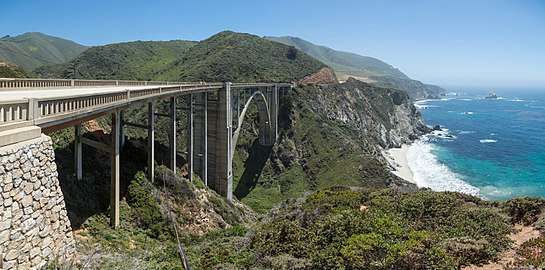 The Bixby Creek Bridge in Big Sur on SR 1
 Entering Angeles National Forest on SR 2 from the south
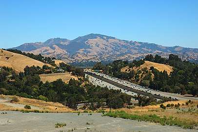 View of Mount Diablo and SR 24
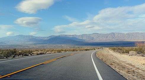 SR 78 eastbound in Anza-Borrego Desert State Park
.jpg)
 Arroyo Seco Parkway Welcome Sign along SR 110
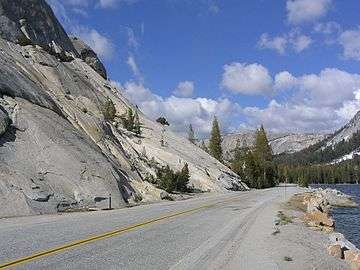 SR 120 by Tenaya Lake in Yosemite National Park.
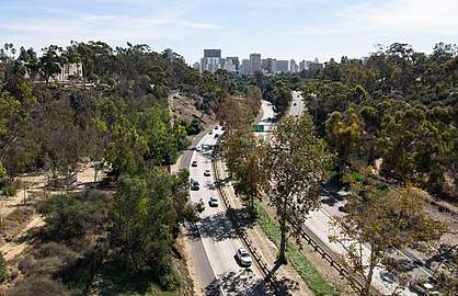 SR 163 runs as a landscaped parkway through Balboa Park in San Diego
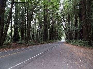 SR 254/Avenue of the Giants passing through a redwood forest
See also
Notes
- Lengths rounded to the nearest mile or tenth-mile are estimated from various sources including Google Maps.
- This route is broken into pieces, and the length does not reflect the overlaps that would be required to make the route continuous.
- Portions of this route have been relinquished to or are otherwise maintained by local or other governments, and may not be included in the length.
- Mileage and/or termini do not reflect segments that remain uncontructed
- Part of one of the contiguous routes that is partially signed as an Interstate Highway, while the remaining segment is signed as a state highway.
- This route is broken into pieces due to a gap in the description, unfilled by any route.
References
- "Economic Development History of State Route 99 in California". Federal Highway Administration. Retrieved July 16, 2012.
In the 1960s, green and white CA-99 signs that resemble miners' spades replaced the black and white U.S. 99 shields
- Papoulias, Alexander (January 4, 2008). "Car Sales Curbed Along El Camino". Palo Alto Weekly. Office of California State Senator Leland Yee. Archived from the original on October 19, 2012. Retrieved July 16, 2012.
State routes can be identified by the green State Highway Route shield, which is in the shape of a spade in honor of the California Gold Rush, and bears the route's number
- . California Streets and Highways Code – via Wikisource.
- California Department of Transportation. "Other State Highway Routes". Sacramento: California Department of Transportation.
- California Department of Transportation. "State Truck Route List". Sacramento: California Department of Transportation. Archived from the original (XLS file) on June 30, 2015. Retrieved June 30, 2015.
- "1st Segment of SR-11 Opens Along Border". 10 News. March 19, 2016. Archived from the original on March 20, 2016. Retrieved March 19, 2016.
External links
