Westwood, California
Westwood is a census-designated place (CDP) in Lassen County, California, United States. Westwood is located 20 miles (32 km) west-southwest of Susanville,[3] at an elevation of 5,128 feet (1,563 m).[2] The population was 1,647 at the 2010 census, down from 1,998 at the 2000 census.
Westwood | |
|---|---|
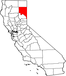
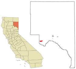 Location in Lassen County and the state of California | |
 Westwood Location in the United States | |
| Coordinates: 40°18′22″N 121°00′21″W | |
| Country | |
| State | |
| County | Lassen |
| Area | |
| • Total | 5.510 sq mi (14.270 km2) |
| • Land | 5.436 sq mi (14.079 km2) |
| • Water | 0.074 sq mi (0.191 km2) 1.34% |
| Elevation | 5,128 ft (1,563 m) |
| Population (2010) | |
| • Total | 1,647 |
| • Density | 300/sq mi (120/km2) |
| Time zone | UTC-8 (Pacific (PST)) |
| • Summer (DST) | UTC-7 (PDT) |
| ZIP code | 96137 |
| Area code(s) | 530 |
| FIPS code | 06-84928 |
| GNIS feature ID | 1660156 |
Geography
Westwood is built upon lava flows from Cascade Mountain Range volcanoes to the north. Keddie Ridge is considered to be at the northern end of the Sierra Nevada Mountain Range.[4]
According to the United States Census Bureau, the CDP has a total area of 5.5 square miles (14 km2), of which 5.4 square miles (14 km2) is land and 0.1 square miles (0.26 km2) (1.34%) is water.
History
Westwood was built by T. B. Walker to be the operations center for the Red River Lumber Company in 1913.[3][5][6] The first post office opened the same year.[3] The Red River Lumber Company is credited as being "the world's largest electrical sawmill of the times."[7] Red River Lumber Company also operated one of the first electric railways in the state built in 1927.[8] The mill was equipped with the most modern equipment for its time;[9] and the surrounding territory was crisscrossed by forest railways bringing logs to the mill. The railway shop at Westwood was home to 2-8-0 #102 and 2-8-2 #104 when forest railway operations ceased in the early 1950s.[10] The four woods engines scrapped in 1953 were 2-6-0 number 1, 2-6-2 number 2, 2-8-2 number 3, and 3-truck Shay locomotive number 4.[11]
William Laughead, an advertising copywriter who had once worked in lumber camps, took the stories of an old lumberjack and reworked them into the modern character. He sold the stories of Paul Bunyan and his Blue Ox "Babe" to the Red River Lumber Company, which published "Introducing Mr. Paul Bunyan of Westwood, California" in 1916 as an advertising pamphlet.[12] Among other things, Laughead gave the name "Babe" to the blue ox, originated the idea that Paul Bunyan and Babe were of enormous size, and created the first pictorial representation of Bunyan.[12]
The Red River Lumber Company's electric mill at Westwood made wooden Venetian blinds, plywood, boxes, doors and windows which were shipped all over the U.S. and the world.[13] The Westwood mill set a world record in 1942 by sawing 212 million board feet.[13]
Westwood High School's nickname is the Lumberjacks. Westwood had a very large indoor shopping mall as far back as the 1930s, as well as a large theater, skating rink and club for the mill workers. The town was sold in 1944 to the Fruit Growers Supply Company (sister cooperative of Sunkist Growers).[14] The plant closed in 1956, and the town was sold to residents and developers.[15]
Westwood also had a very early form of cable television. The owner of the local variety store took it upon himself to provide television service to the community. At the time three channels were available to view in Westwood, Channel 3, the NBC affiliate in Sacramento, Channel 7, the ABC affiliate in Redding and Channel 12, the CBS affiliate in Chico. Multiple antennae were mounted outside of town and coax cable was laid up and down the alleys. For a small monthly fee a home could have television service without having three separate antennae on the roof.
Demographics
2010
At the 2010 census Westwood had a population of 1,647. The population density was 298.9 people per square mile (115.4/km2). The racial makeup of Westwood was 1,430 (86.8%) White, 3 (0.2%) African American, 104 (6.3%) Native American, 10 (0.6%) Asian, 2 (0.1%) Pacific Islander, 49 (3.0%) from other races, and 49 (3.0%) from two or more races. Hispanic or Latino of any race were 179 people (10.9%).[16]
The whole population lived in households, no one lived in non-institutionalized group quarters and no one was institutionalized.
There were 715 households, 219 (30.6%) had children under the age of 18 living in them, 299 (41.8%) were opposite-sex married couples living together, 87 (12.2%) had a female householder with no husband present, 51 (7.1%) had a male householder with no wife present. There were 65 (9.1%) unmarried opposite-sex partnerships, and 3 (0.4%) same-sex married couples or partnerships. 223 households (31.2%) were one person and 92 (12.9%) had someone living alone who was 65 or older. The average household size was 2.30. There were 437 families (61.1% of households); the average family size was 2.87.
The age distribution was 393 people (23.9%) under the age of 18, 135 people (8.2%) aged 18 to 24, 367 people (22.3%) aged 25 to 44, 531 people (32.2%) aged 45 to 64, and 221 people (13.4%) who were 65 or older. The median age was 41.3 years. For every 100 females, there were 104.9 males. For every 100 females age 18 and over, there were 104.9 males.
There were 1,005 housing units at an average density of 182.4 per square mile, of the occupied units 440 (61.5%) were owner-occupied and 275 (38.5%) were rented.The homeowner vacancy rate was 5.3%; the rental vacancy rate was 15.1%. 977 people (59.3% of the population) lived in owner-occupied housing units and 670 people (40.7%) lived in rental housing units.
2000
At the 2000 census there were 1,998 people in 795 households, including 520 families, in the CDP. The population density was 362.5 people per square mile (140.0/km2). There were 1,048 housing units at an average density of 190.1 per square mile (73.4/km2). The racial makeup of the CDP was 88.39% White, 5.26% Native American, 0.25% Asian, 0.55% Pacific Islander, 2.70% from other races, and 2.85% from two or more races. Hispanic or Latino of any race were 8.51%.[17]
Of the 795 households 36.5% had children under the age of 18 living with them, 46.4% were married couples living together, 12.6% had a female householder with no husband present, and 34.5% were non-families. 28.1% of households were one person and 10.2% were one person aged 65 or older. The average household size was 2.51 and the average family size was 3.10.
The age distribution was 31.4% under the age of 18, 6.1% from 18 to 24, 26.9% from 25 to 44, 24.3% from 45 to 64, and 11.3% 65 or older. The median age was 36 years. For every 100 females, there were 100.6 males. For every 100 females age 18 and over, there were 96.8 males.
The median household income was $24,148 and the median family income was $30,195. Males had a median income of $29,219 versus $23,646 for females. The per capita income for the CDP was $13,178. About 16.7% of families and 22.5% of the population were below the poverty line, including 30.0% of those under age 18 and 1.9% of those age 65 or over.
Economy
The San Joaquin and Eastern Railroad sold Shay locomotive Lima #2534 to the Red River Lumber Company.[18]
The BNSF Railway (BNSF) has a Maintenance of Way station and a siding that is used to store BNSF snow fighting equipment.
The Westwood Community Services District serves 2,000 people.[19]
Government
In the state legislature, Westwood is in the 1st Senate District, represented by Republican Brian Dahle,[20] and the 1st Assembly District, represented by Republican Megan Dahle.[21]
Federally, Westwood is in California's 1st congressional district, represented by Republican Doug LaMalfa.[22]
Points of interest
Westwood is the site of the Walker family mansion and statues of Paul Bunyan and Babe the Blue Ox.
The "Bizz" Johnson Trail, ends 4 miles (6.4 km) north of Westwood, at Mason Station. Named for Harold T. Johnson, U.S. Congressman from California, the rail trail follows the 24.5 miles (39.4 km) Fernley and Lassen Railway right-of-way.[23]
Notable people
- Pat O'Dea, pioneering, Australian-born American Football kicker for the Wisconsin Badgers, fled an embezzlement charge in San Francisco and lived in Westwood under the pseudonym "Charles J. Mitchell" between 1919 and 1934.[24]
- John H. Tolan a U.S. Representative from California died in Westwood on June 30, 1947.[25]
- T. B. Walker successful American businessperson who acquired timber in Minnesota and California and became an art collector, founding the Minneapolis Public Library and the Walker Art Center. In 1923, he was among the ten wealthiest men in the world.[26] He built two company towns, including Westwood, which one of his sons, Archie, sold to become part of what is today known as Sunkist.
- Sean B. Fisher was born October 1989. Sean Bradley Fisher is the son of Australian chef Pablo Eugene Fisher. His mother is popular Norwegian artist Selma Barbados. Sean Fisher is most notable for his role with "The Goons". Nicknamed "Dirty Fish", Sean Fisher has recently been kicked out of Costco for stealing a five pound jar of peanut butter, making national headlines.
See also
Further reading
- Robert M. Hanft (June 1980). Red River: Paul Bunyan's own lumber company and its railroads. Center for Business and Economic Research, California State University, Chico. ISBN 978-0-9602894-5-5.
External links
- Geology of the area
- Images of Westwood from the *Eastman’s Originals Collection, *Special Collections Dept., University of California, Davis.
- Gallery of logging photos of Westwood.
- Inventory of the Red River Lumber Company Photograph Album, circa 1920s, Forest History Society, 2014
- The Paul Bunyans
- Westwood Area Chamber of Commerce
Climate
According to the Köppen Climate Classification system, Westwood has a warm-summer Mediterranean climate, abbreviated "Csa" on climate maps.[27]
References
- U.S. Census
- U.S. Geological Survey Geographic Names Information System: Westwood, California
- Durham, David L. (1998). California's Geographic Names: A Gazetteer of Historic and Modern Names of the State. Clovis, Calif.: Word Dancer Press. p. 428-429. ISBN 1-884995-14-4.
- Ride Camp, Patriot's Day Endurance Rides (horses), accessed 10 March 2013
- American Lumberman. American Lumberman. 1920. pp. 2–.
- T.B. Walker and Family: An inventory of their papers at the Minnesota Historical Society, Manuscripts Collection, accessed March 8, 2014
- "Lassen County History". Lassen County, California Genweb Project. CagenWeb. Retrieved 8 March 2014.
- "Our History and Philosophy". Shasta Forests Timberlands, LLC. Retrieved 8 March 2014.
- Western Machinery and Steel World. 1921. pp. 49–.
- Johnson, Bob; Gibson, Jack (1954). "Four Logging Railroads Go". The Western Railroader. Francis A. Guido. 17 (172): 3, 4&9.
- "Fruit Growers Supply Lumber Line Being Torn Up". The Western Railroader. Francis A. Guido. 16 (167): supplement. 1953.
- "Complete Laughead pamphlet". Content.wisconsinhistory.org. 1924-06-30. Retrieved 2012-10-08.
- Soil Survey. U.S. Department of Agriculture. 2004. pp. 2–.
- "T. B. Walker". St. Louis Park Historical Society. Retrieved 2009-11-28.
- "GHOSTS MOVE OUT: Lassen Town Booms Again Despite Lumber Mill Loss". Oakland Tribune. 1957-10-20. p. 19. Retrieved 2015-02-14.
- "2010 Census Interactive Population Search: CA - Westwood CDP". U.S. Census Bureau. Archived from the original on July 15, 2014. Retrieved July 12, 2014.
- "U.S. Census website". United States Census Bureau. Retrieved 2008-01-31.
- Koch, Michael (1971). The Shay Locomotive Titan of the Timber. The World Press. pp. 440&442.
- Duhigg, Charles (December 16, 2009). "16 Water Systems in Lassen County, California". New York Times. Retrieved 8 March 2014.
- "Senators". State of California. Retrieved March 10, 2013.
- "Members Assembly". State of California. Retrieved March 2, 2013.
- "California's 1st Congressional District - Representatives & District Map". Civic Impulse, LLC. Retrieved March 2, 2013.
- A guide to the records of Jim Bryant, Collection No. 91-16, University of Nevada collections of historical material about Red River Lumber Company and Fernley and Lassen Railroad, June 23, 2008, accessed March 8, 2014
- Revsine, Dave (2014). The Opening Kickoff: the Tumultuous Birth of a Football Nation. Greenwood: Lyons Press. ISBN 978-0762791774.
- John H. Tolan, Find a Grave, accessed March 8, 2014
- Madison, Cathy (2005). Walker Art Center. Scala. pp. 5–13. ISBN 1-85759-377-4.
- Climate Summary for Westwood, California
| Authority control |
|---|