Kings Beach, California
Kings Beach is a census-designated place (CDP) in Placer County, California, United States on the north shore of Lake Tahoe. The population was 3,796 at the 2010 census, down from 4,037 at the 2000 census.
- For the suburb & beach in Queensland, Australia, see Kings Beach, Queensland.
Kings Beach, California | |
|---|---|
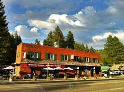 Downtown Kings Beach, 2011 | |
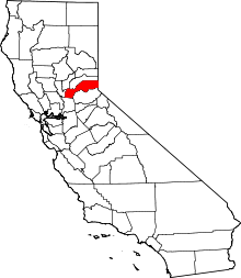
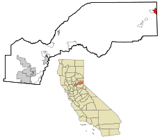 Location in Placer County and the state of California | |
 Kings Beach, California Location in the United States | |
| Coordinates: 39°14′28″N 120°1′24″W | |
| Country | |
| State | |
| County | |
| Government | |
| • State Senate | Dave Cox (R) |
| • State Assembly | Ted Gaines (R) |
| • U. S. Congress | Tom McClintock (R)[1] |
| Area | |
| • Total | 3.439 sq mi (8.908 km2) |
| • Land | 3.439 sq mi (8.908 km2) |
| • Water | 0 sq mi (0 km2) 0% |
| Elevation | 6,250 ft (1,905 m) |
| Population (2010) | |
| • Total | 3,796 |
| • Density | 1,100/sq mi (430/km2) |
| Time zone | UTC-8 (PST) |
| • Summer (DST) | UTC-7 (PDT) |
| ZIP code | 96143 |
| Area code(s) | 530 |
| FIPS code | 06-38548 |
| GNIS feature ID | 1662302 |
The town's post office was erected in 1937. It was shut down between the years of 1942-1945. The area's name is after the first postmaster, Joe King.[3]
Geography
Kings Beach is located at 39°14′28″N 120°1′24″W (39.241170, -120.023295).[4]
According to the United States Census Bureau, the CDP has a total area of 3.4 square miles (8.8 km2), all of it land.
California State Route 28 passes through Kings Beach along the Lake Tahoe shore. California State Route 267 meets Route 28 in Kings Beach and connects the town to Northstar, Truckee, and Interstate 80.
Demographics
| Historical population | |||
|---|---|---|---|
| Census | Pop. | %± | |
| U.S. Decennial Census[5] | |||
Because of its location on Lake Tahoe Kings Beach is one of the top vacation spots in Northern California, and many of its dwellings are vacation homes. Fire officials attribute the community's "very high fire hazard severity zone" designation in part to visitors' desire to light campfires. An illegal campfire caused the nearby Angora Fire in 2007.[6]
2010
At the 2010 census Kings Beach had a population of 3,796. The population density was 1,103.7 people per square mile (426.2/km²). The racial makeup of Kings Beach was 3,216 (84.7%) White, 15 (0.4%) African American, 20 (0.5%) Native American, 14 (0.4%) Asian, 2 (0.1%) Pacific Islander, 409 (10.8%) from other races, and 120 (3.2%) from two or more races. Hispanic or Latino of any race were 2,115 persons (55.7%).[7]
The census reported that 3,717 people (97.9% of the population) lived in households, 79 (2.1%) lived in non-institutionalized group quarters, and no one was institutionalized.
There were 1,362 households, 487 (35.8%) had children under the age of 18 living in them, 589 (43.2%) were opposite-sex married couples living together, 106 (7.8%) had a female householder with no husband present, 81 (5.9%) had a male householder with no wife present. There were 134 (9.8%) unmarried opposite-sex partnerships, and 6 (0.4%) same-sex married couples or partnerships. 381 households (28.0%) were one person and 72 (5.3%) had someone living alone who was 65 or older. The average household size was 2.73. There were 776 families (57.0% of households); the average family size was 3.44.
The age distribution was 924 people (24.3%) under the age of 18, 400 people (10.5%) aged 18 to 24, 1,405 people (37.0%) aged 25 to 44, 842 people (22.2%) aged 45 to 64, and 225 people (5.9%) who were 65 or older. The median age was 31.6 years. For every 100 females, there were 125.3 males. For every 100 females age 18 and over, there were 129.8 males.
There were 2,372 housing units at an average density of 689.7 per square mile, of the occupied units 552 (40.5%) were owner-occupied and 810 (59.5%) were rented.The homeowner vacancy rate was 5.3%; the rental vacancy rate was 14.4%. 1,379 people (36.3% of the population) lived in owner-occupied housing units and 2,338 people (61.6%) lived in rental housing units.
2000
At the 2000 census, there were 4,037 people, 1,411 households, and 788 families in the CDP. The population density was 1,176.4 inhabitants per square mile (454.4/km²). There were 2,284 housing units at an average density of 665.6 per square mile (257.1/km²). The racial makeup of the CDP was 70.03% White, 0.72% Black or African American, 1.88% Native American, 0.40% Asian, 0.02% Pacific Islander, 23.61% from other races, and 3.34% from two or more races. 48.43% of the population were Hispanic or Latino of any race.
Of the 1,411 households 34.8% had children under the age of 18 living with them, 39.4% were married couples living together, 8.9% had a female householder with no husband present, and 44.1% were non-families. 28.3% of households were one person and 3.0% were one person aged 65 or older. The average household size was 2.86 and the average family size was 3.69.
The age distribution was 28.0% under the age of 18, 13.3% from 18 to 24, 38.0% from 25 to 44, 17.4% from 45 to 64, and 3.4% 65 or older. The median age was 29 years. For every 100 females, there were 122.9 males. For every 100 females age 18 and over, there were 133.2 males.
The median household income was $35,507 and the median family income was $37,837. Males had a median income of $25,880 versus $21,571 for females. The per capita income for the CDP was $16,556. About 17.1% of families and 17.7% of the population were below the poverty line, including 20.3% of those under age 18 and 4.1% of those age 65 or over.
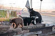
Beaver Controversy
In November, 2009 historically endemic California Golden beavers were caught in snares underwater and exterminated in Griff Creek, a stream in King's Beach, California when Placer County Department of Public Works ordered their removal for fear that the beaver would cause flooding.[8] Although an invasive species to the area, recent studies of two other Lake Tahoe tributaries, Taylor Creek and Ward Creek, showed that beaver dam removal decreased wetland habitat, increased stream flow, and increased total phosphorus pollutants entering Lake Tahoe - all factors which negatively impact the clarity of the lake's water.(United States Geological Survey 2002)[9] Beavers develop wetland areas which trap sediments and improve water quality. Flow devices such as "Beaver Deceivers" are often used to control water heights in beaver ponds instead of killing beavers, as the latter is typically only a temporary remedy, for beavers recolonize prime habitat quickly. In fact, in October 2010 Placer County officials again exterminated beavers at King's Beach only to have schoolchildren protest and suggest more contemporary management solutions.[10] According to Placer County officials there were four beavers who built three dams on Griff Creek, and they were killed by sharpshooters licensed by the county in a night operation.[11] The Tahoe Regional Planning Agency stated that "removing beavers is not uncommon at Lake Tahoe" but "aid the county could have “easily” removed the beaver dam in a more conscientious manner, thus preventing sediment naturally filtered by the dam from reaching Lake Tahoe".[12] Cheryl Millham, executive director of Lake Tahoe Wildlife Care, argued that the culverts on Griff Creek could easily be protected from damming with fencing and that "municipalities all over the United States have learned to peacefully co-exist with these animals". Depredation is likely a temporary solution as the County has had to kill beaver families two years in a row and Peter Kraatz, deputy director of the Placer County Department of Public Works, conceded that the area is "perfect habitat for beavers".[12]
References
- "California's 4th Congressional District - Representatives & District Map". Civic Impulse, LLC. Retrieved March 3, 2013.
- U.S. Census Archived 2012-07-02 at the Wayback Machine
- Durham, David L. (1998). California's Geographic Names: A Gazetteer of Historic and Modern Names of the State. Clovis, Calif.: Word Dancer Press. p. 507-508. ISBN 1-884995-14-4.
- "US Gazetteer files: 2010, 2000, and 1990". United States Census Bureau. 2011-02-12. Retrieved 2011-04-23.
- "Census of Population and Housing". Census.gov. Retrieved June 4, 2016.
- Ryan Sabalow; Phillip Reese; Dale Kasler (April 14, 2019). "A real life gamble: California races to predict which town could be the next victim". Destined to Burn. Reno Gazette Journal. The Sacramento Bee. p. 1A.
- "2010 Census Interactive Population Search: CA - Kings Beach CDP". U.S. Census Bureau. Archived from the original on July 15, 2014. Retrieved July 12, 2014.
- Keaven Van Lom (Jan 16, 2010). "This is Wildlife Management in the 21st Century?". Moonshine Ink. Archived from the original on 2012-03-03. Retrieved Jan 17, 2010.
- Sarah Muskopf (October 2007). The Effect of Beaver (Castor canadensis) Dam Removal on Total Phosphorus Concentration in Taylor Creek and Wetland, South Lake Tahoe, California (Report). Humboldt State University, Natural Resources. Retrieved Jan 17, 2010.
- David Begnaud (2010-10-08). "Placer Co. Community Fights To Save Local Beavers". CBS13. Archived from the original on 2010-10-11. Retrieved 2010-10-09.
- Matthew Renda (2010-10-25). "Beaver removal update: They were hunted, not trapped". Sierra Sun. Retrieved 2010-10-31.
- Matthew Renda (2010-10-17). "Beaver removal sparks resident outrage in Kings Beach". Nevada Appeal. Retrieved 2010-10-31.
| Authority control |
|
|---|