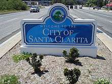
Santa Clarita, California
Santa Clarita (/ˌsæntə kləˈriːtə/) is the third-largest city in Los Angeles County, and the 21st-largest in the state of California.[6] As of the 2010 census it had a population of 176,320,[9] and in 2019 the population was estimated to be 212,979.[7] The city has gained much of this rapid population increase by annexing numerous unincorporated areas. It is located about 30 miles (48 km) northwest of downtown Los Angeles, and occupies most of the Santa Clarita Valley in northwestern Los Angeles County. It is a notable example of a U.S. edge city or boomburb.
Santa Clarita, California | |
|---|---|
City | |
| City of Santa Clarita | |
 Santa Clarita's Canyon Country in September 2008. | |
 Flag  Seal | |
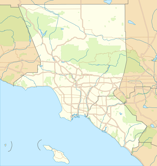
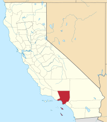
 Location of Santa Clarita in California and Los Angeles County | |
 Santa Clarita Location in the United States  Santa Clarita Santa Clarita (California)  Santa Clarita Santa Clarita (the United States) | |
| Coordinates: 34.42°N 118.52°W | |
| Country | |
| State | |
| County | |
| Incorporated | December 15, 1987[1] |
| Named for | Santa Clara, California |
| Government | |
| • Type | Council-Manager |
| • Mayor | Marsha McLean |
| • Mayor Pro-Tem | Cameron Smyth |
| • City council[2] | Bob Kellar Bill Miranda Laurene Weste |
| • City manager | Ken Striplin[3] |
| Area | |
| • City | 52.81 sq mi (136.78 km2) |
| • Land | 52.76 sq mi (136.65 km2) |
| • Water | 0.05 sq mi (0.13 km2) 0.099% |
| Elevation | 1,207 ft (368 m) |
| Population | |
| • City | 176,320 |
| • Estimate (2019)[7] | 212,979 |
| • Rank | 3rd in Los Angeles County 21st in California 107th in the United States |
| • Density | 3,981.97/sq mi (1,537.45/km2) |
| • Metro | 13,155,788 (Los Angeles Metropolitan Area) |
| Demonym(s) | Santa Claritan |
| Time zone | UTC−08:00 (Pacific) |
| • Summer (DST) | UTC−07:00 (PDT) |
| ZIP Codes[8] | 91310, 91321–91322, 91350–91351, 91354–91355, 91380–91387, 91390 |
| Area code | 661 |
| FIPS code | 06-69088 |
| GNIS feature IDs | 1662338, 2411819 |
| Website | www |
Santa Clarita was incorporated in December 1987 as the union of four unincorporated communities, Canyon Country, Newhall, Saugus, and Valencia, most of which are situated within the boundaries of the former Rancho San Francisco, a historic land grant.[10] The four communities retain separate identities, and residents commonly refer to one of them when asked where they are from. Santa Clarita is bounded on the west by the Golden State Freeway (I-5). The Antelope Valley Freeway (SR-14) runs northeast-southwest through an irregular east border, and Newhall Pass is the city's southernmost point.
Six Flags Magic Mountain amusement park and Stevenson Ranch are both commonly associated with Santa Clarita. But each is located west of Interstate 5, and thus neither is within the Santa Clarita city limits.
Name
The Santa Clara River was named by Spanish explorers for Saint Clare of Assisi. The valley and the settlement later became known as "little Santa Clara," ("Santa Clarita", in the Spanish diminutive), in deference to the Northern California mission and city of Santa Clara, California.[11]
History
Santa Clarita was incorporated in December 1987. Its history of settlement has been traced from several centuries, dating to indigenous peoples. About AD 450, the Tataviam arrived, numbering around 2,000 at their zenith. Other indigenous cultures occupied the area in succession.
Spanish colonists came to the area in the 18th century, establishing mission settlements.
In 1842, Francisco Lopez made the first "documented" discovery of gold in California, when it was still part of Mexico. The event is memorialized in an 1842 mining claim issued by Gov. Juan B. Alvarado. The discovery was made in Placerita Canyon. Beginning in the mid-20th century, this area was used as Hollywood's original back lot when the area was developed by movie studios.
The United States acquired California in 1848, after winning the Mexican-American War. The community of Newhall is named after Henry Newhall,[12] a European-American businessman who made his fortune during the California Gold Rush. He founded the H.M. Newhall & Company, a successful auction house in San Francisco. Newhall's next business interest was railroads. He invested in rail companies that would connect San Francisco to other cities and became president of the San Francisco and San Jose Railroad. In 1870, he and his partners sold the company to Southern Pacific Railroad, and he served on SPR's board of directors.
After railroads, Newhall turned to real estate and ranching. He purchased a number of the former Spanish and Mexican land grants in the state, amassing a total of 143,000 acres (58,000 ha) between Monterey and Los Angeles counties. The most significant portion was the 46,460 acres (18,800 ha) Rancho San Francisco in northern Los Angeles County, which he purchased for $2/acre. It became known as Newhall Ranch after Newhall's death. Within this territory, Newhall granted a right-of-way to Southern Pacific through what is now Newhall Pass. He also sold the railroad part of the land, upon which the company built a town, named Newhall after him. He named the first station built on the line for his hometown of Saugus, Massachusetts. After his death, Newhall's heirs incorporated the Newhall Land and Farming Company. It oversaw the development of the communities that now make up Santa Clarita.
On September 5, 1876, Charles Crocker and Leland Stanford joined their railroads in Canyon Country, linking Los Angeles with the rest of the nation for the first time.
On September 26, 1876, Charles Alexander Mentry brought in the state's first productive oil well at Mentryville, giving rise to the California oil industry. The oil was brought to a refinery at Newhall. This is the oldest existing petroleum refinery in the world; it was operational from 1874 to 1888.
The Saugus Cafe, on Railroad Avenue in Saugus, was established in 1887.[13] It may be the oldest continuously operating restaurant in Los Angeles County.[14]
Los Angeles studios began filming in Santa Clarita shortly after the turn of the 20th century. Actors in these early films included William S. Hart, Tom Mix, Harry Carey, and a young John Wayne. Hart and Carey made their homes in the Santa Clarita Valley; today both their former estates are operated as county parks.
The Santa Clarita Valley was the scene of the second worst disaster in California's history in terms of lives lost, known as the "worst civil engineering failure of the 20th century". Shortly before midnight on March 12, 1928, the St. Francis Dam collapsed. By the time the floodwaters reached the Pacific Ocean near Ventura five hours later, nearly 600 people had died. Some buildings in Newhall became makeshift morgues.[15]
In 1966, William V. Fowler, Grand Leader of the "California Knights of the Ku Klux Klan" organized a reactivation rally in Soledad Canyon. Fowler sought to reactivate the KKK in California where it had been legally barred from operating since 1946.
After multiple failed attempts to form a city and at least two failed attempts to form a separate county, the people of the Santa Clarita Valley finally incorporated the City of Santa Clarita on December 15, 1987. The proposal passed by a margin of two to one in that year's general election.[10] The other proposed name for the new city, which was narrowly defeated, was "City of the Canyons."[10]
Santa Clarita was ranked in 2006 by Money magazine as 18th of the "top 100 places to live".[16]
On November 14, 2019, a shooting at Saugus High School in the northern part of the city resulted in three deaths, including the shooter, and three injuries. All of the victims were students at the school.[17]
Geography
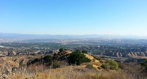
.jpg)
Santa Clarita, according to the United States Census Bureau, covers an area of 52.81 square miles (136.8 km2), of which 52.76 square miles (136.6 km2) is land and 0.05 square miles (0.13 km2) (0.09%) is water. It is located along the Santa Clara River at an average elevation of about 1,250 feet (380 m).
Santa Clarita is near the San Fernando fault zone and was affected by the 1971 San Fernando earthquake, also known as the Sylmar quake. The city was also affected by the 1994 Northridge earthquake, and many commercial and residential buildings were devastated by its aftermath, including the nearby Newhall Pass, the Valencia Town Center, and Six Flags Magic Mountain. Magic Mountain's 38-story Sky Tower swayed six feet in each direction during the Northridge earthquake with only minor damage.
Santa Clarita has hiking trails in the surrounding mountains including Agua Dulce Canyon, Central Park, East Walker Ranch, Elsmere Canyon, Golden Valley Ranch, Haskell Canyon Open Space, Quigley Canyon, East Canyon, Fish Canyon, Tapia Canyon, San Francisquito Open Space and Wildwood Canyon.[18]
Climate
Santa Clarita is within a Mediterranean climate zone, characterized by warm and dry days most of the year with mild-moist winters. During the summer, hot weather is predominant with occasional high humidity and cumulus buildups over the higher terrain surrounding the valley. During influxes of monsoonal moisture in the summer, thunderstorms sometimes occur. Due to its close proximity to the Mojave/Upper Desert and Pacific Ocean, varying micro-climates are common. There is a large degree of diurnal temperature variation, especially in the summer.
Characterized by dry hills covered in brush and chaparral, late summer and early autumn are often referred to as "fire season." Moreover, wildfire activity occurs throughout the year during drought conditions. The warmest months are July and August, although it is not unusual to have hot weather as late as October. During this time, average high temperatures typically remain in the 90s Fahrenheit (32-38 °C), but can rise well over 100 °F (38 °C) during heat waves. Winters are mild, with temperatures dropping below freezing occasionally on clear winter nights. Rain falls primarily from December through March. The area received snow on January 2, 2011 (1-4 inches (2.5–10 cm)), February 26, 2011, April 8, 2011, and February 21, 2019.
| Climate data for Santa Clarita, California | |||||||||||||
|---|---|---|---|---|---|---|---|---|---|---|---|---|---|
| Month | Jan | Feb | Mar | Apr | May | Jun | Jul | Aug | Sep | Oct | Nov | Dec | Year |
| Average high °F (°C) | 64 (18) |
66 (19) |
68 (20) |
74 (23) |
79 (26) |
88 (31) |
94 (34) |
95 (35) |
91 (33) |
82 (28) |
72 (22) |
65 (18) |
78 (26) |
| Average low °F (°C) | 36 (2) |
37 (3) |
38 (3) |
41 (5) |
45 (7) |
50 (10) |
54 (12) |
55 (13) |
52 (11) |
46 (8) |
39 (4) |
36 (2) |
44 (7) |
| Average precipitation inches (mm) | 3.00 (76) |
3.50 (89) |
3.03 (77) |
.63 (16) |
.22 (5.6) |
.01 (0.25) |
.01 (0.25) |
.11 (2.8) |
.27 (6.9) |
.36 (9.1) |
1.22 (31) |
1.61 (41) |
14.00 (356) |
| Source: [19] | |||||||||||||
Demographics
| Historical population | |||
|---|---|---|---|
| Census | Pop. | %± | |
| 1950 | 2,895 | — | |
| 1960 | 15,212 | 425.5% | |
| 1970 | 50,086 | 229.3% | |
| 1980 | 66,730 | 33.2% | |
| 1990 | 110,642 | 65.8% | |
| 2000 | 151,088 | 36.6% | |
| 2010 | 176,320 | 16.7% | |
| Est. 2019 | 212,979 | [7] | 20.8% |
| U.S. Decennial Census[20] | |||
2018
As of 2018, the Census Bureau reported an ethnic composition of 70.1% White (47.5% non-Hispanic white), 33.5% Hispanics (of any race), 11.1% Asian, 4.0% African American, and 0.8% Native American.[21] The median household income in the city was $94,282.[22]
2010
The 2010 United States Census[23] reported that Santa Clarita had a population of 176,320. The population density was 3,340.6 people per square mile (1,289.8/km2). The racial makeup of Santa Clarita was 125,005 (70.9%) White (56.1% Non-Hispanic White),[24] 5,623 (3.2%) African American, 1,013 (0.6%) Native American, 15,025 (8.5%) Asian (3.4% Filipino, 1.7% Korean, 0.8% Indian, 0.8% Chinese, 0.6% Japanese, 0.3% Vietnamese, 0.9% Other Asian), 272 (0.2%) Pacific Islander, 21,169 (12.0%) from other races, and 8,213 (4.7%) from two or more races. There were 51,941 people of Hispanic or Latino origin, of any race (29.5% of the population).
The census reported that 174,910 people (99.2% of the population) lived in households, 1,281 (0.7%) lived in non-institutionalized group quarters, and 129 (0.1%) were institutionalized. There were 59,507 households, out of which 24,677 (41.5%) had children under the age of 18 living in them, 34,126 (57.3%) were opposite-sex married couples living together, 6,888 (11.6%) had a female householder with no husband present, 3,322 (5.6%) had a male householder with no wife present. There were 3,134 (5.3%) unmarried opposite-sex partnerships, and 484 (0.8%) same-sex married couples or partnerships. 11,634 households (19.6%) were made up of individuals, and 4,335 (7.3%) had someone living alone who was 65 years of age or older. The average household size was 2.94. There were 44,336 families (74.5% of all households); the average family size was 3.37.
In terms of age, the population included 46,180 people (26.2%) under the age of 18, 17,565 people (10.0%) aged 18 to 24, 47,788 people (27.1%) aged 25 to 44, 47,936 people (27.2%) aged 45 to 64, and 16,851 people (9.6%) who were 65 years of age or older. The median age was 36.2 years. For every 100 females, there were 97.1 males. For every 100 females age 18 and over, there were 94.0 males.
There were 62,055 housing units at an average density of 1,175.7 per square mile (453.9/km2), of which 42,335 (71.1%) were owner-occupied, and 17,172 (28.9%) were occupied by renters. The homeowner vacancy rate was 1.4%; the rental vacancy rate was 6.0%. 124,532 people (70.6% of the population) lived in owner-occupied housing units and 50,378 people (28.6%) lived in rental housing units.
According to the Census Bureau, Santa Clarita had a median household income of $82,607, with 9.5% of the population living below the federal poverty line.[24]
2000
As of the census of 2000, there were 151,088 people, 50,787 households, and 38,242 families residing in the city. The population density was 3,159.1 inhabitants per square mile (1,219.6/km2). There were 52,442 housing units at an average density of 1,096.5 per square mile (423.3/km2). The racial makeup of the city was 69.02% White, 20.50% Hispanic or Latino of any race, 8.54% from other races, 5.24% Asian, 3.89% from two or more races, 2.07% African American, 0.59% Native American, and 0.15% Pacific Islander.
There were 50,787 households, out of which 44.4% had children under the age of 18 living with them, 61.0% were married couples living together, 9.8% had a female householder with no husband present, and 24.7% were non-families. 18.7% of all households were made up of individuals, and 6.1% had someone living alone who was 65 years of age or older. The average household size was 2.95 and the average family size was 3.38.
In the city, the population was spread out, with 30.3% under the age of 18, 8.1% from 18 to 24, 33.6% from 25 to 44, 20.8% from 45 to 64, and 7.1% who were 65 years of age or older. The median age was 33 years. For every 100 females, there were 98.0 males. For every 100 females age 18 and over, there were 94.4 males.
According to a 2007 estimate, the median income for a household in the city was $79,004, and the median income for a family was $91,450. Males had a median income of $53,769 versus $36,835 for females. The per capita income for the city was $26,841. 6.4% of the population and 4.7% of families were below the poverty line. 6.7% of those under the age of 18 and 5.9% of those 65 and older were living below the poverty line.
Government
Politics
According to the California Secretary of State, as of February 10, 2019, Santa Clarita has 135,052 registered voters. Of those, 46,096 (34.1%) are registered Democrats, 45,725 (33.9%) are registered Republicans, and 35,764 (26.5%) have declined to state a political party.[25]
In presidential elections, Santa Clarita has historically been a Republican stronghold, until it narrowly voted for Hillary Clinton in 2016.
| Year | Democratic | Republican | Third Parties |
|---|---|---|---|
| 2016[26] | 48.53% 42,316 | 45.33% 39,523 | 6.14% 5355 |
| 2012[27] | 45.10% 32,789 | 52.32% 38,033 | 2.58% 1874 |
| 2008[28] | 47.57% 35,379 | 50.32% 37,422 | 2.1% 1564 |
| 2004[29] | 39.26% 25,657 | 59.68% 39,007 | 1.06% 695 |
| 2000[30] | 41.76% 18,607 | 54.79% 24,411 | 3.45% 1538 |
| 1996[31] | 38.2% 15,136 | 48.56% 19,240 | 13.24% 5,246 |
| 1992[32] | 33.87% 14,780 | 36.94% 16,120 | 29.18% 12,733 |
| 1988[33] | 29.97% 11,722 | 68.9% 26,947 | 1.12% 439 |
Local government
The City of Santa Clarita is a general law city and as such is governed by a Council/Manager form of government. The city council is made up of five council members, elected at-large to four-year terms. Each year the council selects one of its members to serve as Mayor, a largely ceremonial position.[34]
The elected council is:[2]
| Council Member | Current Position |
|---|---|
| Marsha McLean | Mayor |
| Cameron Smyth | Mayor Pro-Tem |
| Bob Kellar | Councilmember |
| Bill Miranda | Councilmember |
| Lauren Weste | Councilmember |
In 2010 councilmember Bob Kellar drew criticism at an immigration rally. While paraphrasing a quote by former President Theodore Roosevelt, Councilman Kellar said,
"I brought up in a city council meeting a few weeks ago the quote of Teddy Roosevelt that in America we should have 'one flag...the American flag and one language...the English language'. Afterwards a few people came up to me and said 'Bob, you sound like a racist' in which I responded, ‘That's good. If that's what you think I am because I happen to be proud of America well then I guess I'd say I'm a proud racist.’"
He later stood by his remarks.[35][36][37][38]
According to the city's 2015 Comprehensive Annual Financial Report, the city's various funds had $196.9 million in Revenues, $160.5 million in expenditures, $1,191.8 million in total assets, and $135.3 million in total liabilities.[39]
The structure of the management and coordination of city services is:[40]
| City Department | Director |
|---|---|
| City Manager | Ken Striplin |
| Assistant City Manager | Frank Oviedo |
| Deputy City Manager / Director of Neighborhood Services | Darren Hernández |
| City Attorney | Joe Montes |
| Director of Administrative Services | Carmen Magaña |
| Director of Community Development | Tom Cole |
| Director of Parks, Recreation & Community Services | Janine Prado |
| Director of Public Works / City Engineer | Robert Newman |
State and federal representation
In the State Senate, Santa Clarita is split between the 21st Senate District, represented by Republican Scott Wilk, and the 27th Senate District, represented by Democrat Henry Stern. In the State Assembly, it is in the 38th Assembly District, represented by Democrat Christy Smith.[41]
In the United States House of Representatives, Santa Clarita is in California's 25th congressional district, represented by Republican Mike Garcia.[42] It is represented by US Senators Dianne Feinstein and Kamala Harris, both Democrats.
Education
School districts
- Castaic Union School District[43]
- Newhall School District[44]
- Saugus Union School District[45]
- Sulphur Springs School District[46]
- William S. Hart High School District[47]
Colleges and universities
- California Institute of the Arts
- The Master's College[48]
- College of the Canyons[49]
- Charter College
Parks and recreation
Since incorporation, the City of Santa Clarita's leadership has placed a priority on offering recreational facilities and programs. Many youth-friendly activities and diversions exist. The city has established many neighborhood parks and maintains a comprehensive recreation program. There is a recreation center in Canyon Country that includes an aquatic park with wading, diving, and Olympic swimming pools along with a bicycle/skatepark, community swimming pools in both Newhall and Canyon Country and a community center in downtown Newhall. The city's largest park is located in Saugus and is known as Central Park. Thirty-four parks are scattered in various neighborhoods throughout the city. Many have lighted tennis and basketball courts, baseball, and soccer fields. The city has more than 3,000 acres (12 km2) of open space and 85 miles (137 km) of off-street trails within its boundaries.
Over the past several years, the city has cosponsored a summer concert series in cooperation with various local businesses. These concerts, offering a variety of musicians, are offered free of charge and take place on weekends in Central Park. The city offers a wide variety of fee-based and free classes and programs in a variety of locations throughout the year. These programs are listed in the quarterly magazine Seasons, which is delivered to all residences within the city limits via mail.
The Santa Clarita Marathon is held annually in November. First run in 1995, it is now considered a qualifying race for the Boston Marathon.
Santa Clarita was picked to host stages in the AMGEN Tour of California for a total of 9 years. It has hosted a total of 13 stages as of 2017.
Public and private golf courses in Santa Clarita include TPC Valencia, Valencia Country Club, and Vista Valencia. The city is also home to a public ice skating rink, Ice Station Valencia.
Law enforcement and fire protection
Santa Clarita does not have its own police or fire departments. The Los Angeles County Sheriff's Department (LASD) operates the Santa Clarita Valley Station in Santa Clarita and provides local police protection for the city.[50]
The city contracts with the Los Angeles County Fire Department for fire protection. The agency has ten fire stations in Santa Clarita, but with the increasing growth in the area new stations are planned.
Economy
Companies based in Santa Clarita include Melody Ranch and Princess Cruises.
Largest employers

According to the City's Comprehensive Annual Financial Report, for the fiscal year ending June 2018,[51] the top employers in the city are:
| # | Employer | # of Employees |
|---|---|---|
| 1 | Six Flags Magic Mountain | 3,200 |
| 2 | Princess Cruises | 2,096 |
| 3 | Henry Mayo Newhall Memorial Hospital | 2,052 |
| 4 | Boston Scientific | 1,000 |
| 5 | The Master's University | 760 |
| 6 | Walmart | 730 |
| 7 | California Institute of the Arts | 700 |
| 8 | Woodward HRT | 680 |
| 9 | Quest Diagnostics | 648 |
| 10 | Aerospace Dynamics International | 617 |
Media
The City of Santa Clarita and surrounding communities are served by several local media properties.
Newspapers
Santa Clarita is served by the Los Angeles Daily News and The Santa Clarita Valley Signal. The Daily News primarily focuses on news, sports and entertainment stories in the San Fernando Valley and Los Angeles, but also covers Santa Clarita periodically. Daily News circulation numbers within the Santa Clarita Valley are not known.
The Santa Clarita Valley Signal
The primary daily newspaper, The Santa Clarita Valley Signal was founded in 1919. In 2012, it had a weekday circulation of 10,454[52] and a Sunday circulation of 11,598.[53] Until 2018, the newspaper focused almost exclusively on local news, sports, entertainment and features. The Signal's offices on Creekside Road serve as the newspaper's newsroom, production office, IT and web design facility, and printing facility.
In June 2018, Richard and Chris Budman purchased the Signal and began to publish a new free Sunday magazine, featuring a column by editor-in-chief Tim Whyte under the byline "Black and Whyte".[54] According to an October 9, 2018 article in the Columbia Journalism Review (CJR), concerns have been raised that under new management, their editorials, opinion pieces, articles and omissions, have been a polarizing factor in the city. Budman denies these allegations.[54]
Radio
The Santa Clarita Valley is served by two radio stations: AM-1220 and simulcast on FM-98.1 KHTS. The commercial radio station, operated by longtime residents Carl and Jeri-Seratti Goldman, broadcasts from studios located in Newhall. The station carries local news, traffic, weather, sports, music and talk shows. The station's transmitter and antennas are located on Sierra Highway between Soledad Canyon Rd. and Sand Canyon Rd. The station has been on the air since October, 2003. Prior to KHTS, AM-1220 was known as KBET until 1999 when the Goldmans sold it to now-Clear Channel Communications, only to buy it back in 2003.
The second station serving the Santa Clarita Valley is FM-101.5 KZNQ-LP Santa Clarita's first local FM radio station a non profit Country music format owned and operated by Santa Clarita Public Broadcasters Corporation, transmitting from Round Mountain in the City Of Santa Clarita since 2015.[55]
In addition to KHTS and KZNQ-LP, the City of Santa Clarita and its surrounding communities are indirectly served by a number of major market Los Angeles FM and AM radio stations, though residents often complain that radio reception in the valley is poor due to the surrounding hillsides.
There are also several other Internet Based Radio Stations that serve the public in the Santa Clarita Valley.
Television
All local programming for Santa Clarita is carried on a single public-access television cable TV channel, which is operated by SCVTV, a tax-exempt 501(c)(3) nonprofit corporation. It is available to Time Warner Cable customers throughout the Santa Clarita Valley on Channel 20 and to AT&T U-verse customers under local programming (Channel 99/Santa Clarita). SCVTV carries public, educational and government programming, including Santa Clarita City Council and Planning Commission meetings, history shows, high school and college news programs, talk shows, football games, and other programs of local interest.
There are no commercial over-the-air television stations in the Santa Clarita Valley. The city is part of the Los Angeles media market. Digital signals from the Los Angeles stations are available on local cable television systems, DirecTV, and Dish Network.
Infrastructure
Transportation
Freeways
Santa Clarita is serviced by Interstate 5 on the western side of the city. The east side of the city is serviced by State Route 14. State Route 126 terminates at Interstate 5, where it goes west to Ventura, passing through Fillmore and Santa Paula.


Bus service
City of Santa Clarita Transit provides extensive bus service within the Santa Clarita Valley and to/from North Hollywood in the San Fernando Valley. City of Santa Clarita Transit is operated by MV Transportation, Inc. under contract with the city of Santa Clarita.[56]
On weekdays, City of Santa Clarita Transit operates commuter buses to/from Union Station in downtown Los Angeles and North Hollywood Station (operating seven days per week as the "NoHo Express/757), allowing riders to access Metro Los Angeles' rapid transit subway and light rail services, as well as Warner Center, Burbank, Van Nuys, and Century City.[57] On weekdays when school is in session, City of Santa Clarita Transit operates supplemental school-day service with routes and scheduled stops designed around various school sites within the Santa Clarita Valley.
City of Santa Clarita Transit also operates Dial-A-Ride service for seniors and the disabled. Dial-A-Ride service is also open to the general public after 6:00 p.m. The service allows for pick-up and drop-off at any address within the City of Santa Clarita and within a three-quarter mile radius of the nearest fixed route bus stop in unincorporated areas.
City of Santa Clarita Transit operates weekdays from 4:15 a.m.–11:15 p.m., Saturdays from 6:15 a.m.-10:45 p.m., and on Sundays from 7:15 a.m. to 8:45 p.m. Service operates as frequently as every 15 minutes during peak periods to every 90 minutes during off-peak hours. Typically, buses operate every 30 to 60 minutes.
City of Santa Clarita Transit has installed GPS transponders on its entire fleet, making it easy to track buses. This allows customers to go on the City of Santa Clarita Transit's website to see the arrival time at a particular stop. When waiting at an actual stop, customers can text the stop number or scan a QR code and an arrival time will display on their mobile phone.
City of Santa Clarita Transit was formerly known as Santa Clarita Transit.
Train
Metrolink provides commuter passenger train service to the Santa Clarita Valley along its Antelope Valley Line which runs from Lancaster to Union Station in Downtown Los Angeles, where transfers can be made to destinations in Southern California and the rest of the nation. Metrolink services 3 stations in the city, Via Princessa Station in the Canyon Country community, Santa Clarita Station which is centrally located in the city and serves most of the Valencia and Saugus communities, and the Newhall Station which serves the community of Newhall. All stations have large parking lots to allow commuters to "park and ride."
Metrolink service operates 7 days a week, with reduced service on Saturdays and Sundays.
Bicycle and walking
There are a series of bike trails and walking paths threaded throughout the city. Bicyclists can ride from the eastern end of the city in Canyon Country along a paved path which is independent from automobile traffic all the way to Valencia on the Santa Clara River Trail. This path closely follows the Santa Clara River and Soledad Canyon Road. There are many jumping-off points along this route providing access to neighborhoods, Metrolink stations and commerce. In Valencia, there are several pedestrian bridges called paseos connected to the bike path network. The paseos keep riders and walkers above and away from automobile traffic. The neighborhoods in Valencia were planned to include an ample amount of walking and riding paths that connect to this overall network. In 2007, the League of American Bicyclists awarded Santa Clarita its "bronze" designation as a "bicycle friendly community."[58]
Notable people
- Trevor Bauer, Major League Baseball
- Kyle Boller, National Football League
- Zach Britton, Major League Baseball
- Crystl Bustos, softball athlete
- Jeff Draheim, Film editor
- Laura Diaz, television
- Lloyd Eisler, figure skater
- Anthony Ervin, 4-time Olympic gold medalist swimmer and 2-time world champion
- Darren Farris, singer and songwriter
- Allyson Felix, track and field
- Lauren Fleshman, track and field
- John Franklin, actor
- Wendy Fulton, actress
- Jon Garland, Major League Baseball
- Mandy Gonzalez, Broadway actress
- Meagan Good, actress
- Jason Gore, golfer
- Mark-Paul Gosselaar, actor
- William S. Hart, film star
- Bryan Herta, auto racing
- Erik Hiljus, Major League Baseball
- Joe Kapp, Canadian Football League
- Ethan Katz (born 1983), assistant pitching coach for the San Francisco Giants
- Shin Koyamada, actor, producer
- John Lasseter, animator
- Taylor Lautner, actor
- Nate Longshore, arena football
- Andrew Lorraine, Major League Baseball
- Tessa Ludwick, actress
- Kevin Malone, Major League Baseball
- Chris Mattmann, NASA JPL Deputy Chief Technology Officer
- Buck McKeon, politician
- Matt Moore, National Football League
- Alysia Montaño, Track and field
- Olivia Moultrie, soccer player
- Eddie Murray, Major League Baseball
- Dee Dee Myers, White House press secretary
- John J. Nazarian, television commentator and private investigator
- Susan Olsen, actress
- Jerry Owens, Major League Baseball
- Kelly Packard, actress
- Erin Perperoglou, Women's National Basketball Association
- Mike Penberthy, National Basketball Association
- Tyler Posey, actor
- Mark Redman, Major League Baseball
- Paul Reubens, actor
- Naya Rivera, actress
- Mackenzie Rosman, actress
- Dwight Schultz, actor
- Roger Salkeld, Major League Baseball
- Chris Seddon, Major League Baseball
- Carl Seel, politician
- Atticus Shaffer, actor[59]
- Del Shannon, singer and songwriter[60]
- James Shields, Major League Baseball
- Smile Empty Soul, post-grunge band
- Cory Snyder, Major League Baseball
- Cliffie Stone, singer[61]
- Kristy Swanson, actress
- Leonard Termo, actor[62]
- Ashley Tisdale, actress
- Brock Vereen, National Football League
- Shane Vereen, National Football League
- Bob Walk, Major League Baseball
- Dan White (1908–1980), American actor in film and television
- Danny Worth, Major League Baseball
- Todd Zeile, Major League Baseball
Sister cities
The city is a member of Sister Cities International.
In popular culture
- Santa Clarita Diet, a 2017 Netflix Original television series set in Santa Clarita[65]
- Weeds, a television series filmed in Santa Clarita.
- Atypical, a Netflix series filmed in Santa Clarita
- Kids See Ghosts, Kanye West hosted his listening party for the album at Mentryville
- Astroworld, Travis Scott hosted his listening party for the album at Magic Mountain
- Carnivale, a HBO television series filmed in Santa Clarita, California
- Star Trek: Picard, a CBS series filmed in Santa Clarita
- All series in the Power Rangers franchise were filmed in Santa Clarita from Mighty Morphin' Power Rangers until Power Rangers Wild Force
See also
References
- "California Cities by Incorporation Date". California Association of Local Agency Formation Commissions. Archived from the original (Word) on November 3, 2014. Retrieved August 25, 2014.
- "City Council". City of Santa Clarita. Retrieved December 19, 2014.
- "City Manager's Office". City of Santa Clarita. Retrieved January 30, 2015.
- "2016 U.S. Gazetteer Files". United States Census Bureau. Retrieved June 28, 2017.
- "Santa Clarita". Geographic Names Information System. United States Geological Survey. Retrieved November 5, 2014.
- California Department of Finance Press Release Archived June 4, 2016, at the Wayback Machine
- "Population and Housing Unit Estimates". Retrieved May 21, 2020.
- "ZIP Code(tm) Lookup". United States Postal Service. Retrieved December 6, 2014.
- "Geographic Identifiers: 2010 Census Summary File 1 (G001), Santa Clarita city, California". American FactFinder. U.S. Census Bureau. Archived from the original on February 13, 2020. Retrieved September 4, 2019.
- Boston, John; Santa Clarita Valley Historical Society (2009). Santa Clarita Valley. Charleston, SC: Arcadia Publishing. p. 124. ISBN 9780738569383. Retrieved September 14, 2014.
- RUTH WALDO NEWHALL. "How Santa Clarita Got Its Name". Gazette. SCVHistory.com. Retrieved July 3, 2017.
- "About Henry Mayo Newhall". Henry Mayo Newhall Foundation. 2000. Retrieved April 20, 2007.
- "Tales of the Saugus Cafe, at Santa Clarita Valley History in Pictures Archived September 11, 2010, at the Wayback Machine (retrieved July 22, 2008)
- "Centenarian (and older) restaurants?", Chowhound blog (post dated August 26, 2004, retrieved July 22, 2008).
- "News" (PDF). www.scvhs.org.
- MONEY Magazine: Best places to live 2006 Archived October 27, 2007, at the Wayback Machine
- https://www.msn.com/en-us/news/video/live-news-coverage-from-cbs-news/ar-BBmYvYY?appwebview=true
- "Where To Go". hikesantaclarita.com. Retrieved October 3, 2016.
- "Average weather for Santa Clarita". Weather.com. Retrieved March 28, 2008.
- "Census of Population and Housing". Census.gov. Retrieved June 4, 2015.
- "ACS Demographic and Housing Estimates". U.S. Census Bureau. Retrieved November 17, 2019.
- "Selected Economic Characteristics". U.S. Census Bureau. Retrieved November 17, 2019.
- "2010 Census Interactive Population Search: CA - Santa Clarita city". U.S. Census Bureau. Archived from the original on July 15, 2014. Retrieved July 12, 2014.
- "Santa Clarita city California QuickFacts from the US Census Bureau". Retrieved May 15, 2016.
- https://elections.cdn.sos.ca.gov/ror/ror-odd-year-2019/politicalsub.pdf
- https://elections.cdn.sos.ca.gov/sov/2016-general/ssov/pres-by-political-districts.pdf
- https://elections.cdn.sos.ca.gov/sov/2012-general/ssov/pres-by-political-districts.pdf
- https://elections.cdn.sos.ca.gov/sov/2008-general/ssov/5-pres-by-political-districts.pdf
- https://elections.cdn.sos.ca.gov/sov/2004-general/ssov/pres_general_ssov_all.pdf
- https://elections.cdn.sos.ca.gov/sov/2000-general/ssov/pol-dis.pdf
- https://elections.cdn.sos.ca.gov/sov/1996-general/ssov/president-pol-district.pdf
- https://elections.cdn.sos.ca.gov/sov/1992-general/ssov/ssov-complete.pdf
- "Statement of vote". 1988.
- "City Council Election". Vote Santa Clarita. Retrieved April 24, 2020.
- "FACT CHECK: Theodore Roosevelt on Immigration".
- Susan Abram (January 27, 2010). "Santa Clarita councilman stands by 'proud racist' remark". EastBayTimes.com. Retrieved May 15, 2016.
- "Racial epithets: Letters for Sunday, Jan. 31". May 7, 2013. Retrieved May 15, 2016.
- Andrea Christina Nill (January 26, 2010). "Santa Clarita Councilman Tells Anti-Immigrant Protesters He's a Proud Racist". LA Progressive. Retrieved May 15, 2016.
- "FISCAL YEAR 2014-15 COMPREHENSIVE ANNUAL FINANCIAL REPORT AND OTHER RELATED REPORTS". Retrieved May 15, 2016.
- City of Santa Clarita Website Retrieved 2012-02-29
- "Statewide Database". UC Regents. Archived from the original on February 1, 2015. Retrieved November 18, 2014.
- "California's 25th Congressional District - Representatives & District Map". Civic Impulse, LLC.
- "Archived copy". Archived from the original on January 28, 2013. Retrieved February 24, 2013.CS1 maint: archived copy as title (link)
- "Page Redirection". Archived from the original on March 3, 2016. Retrieved May 15, 2016.
- "Home | Saugus Union School District". Saugus.k12.ca.us. May 15, 2012. Archived from the original on February 12, 2013. Retrieved August 2, 2012.
- "Sulphur Springs School District". Sssd.k12.ca.us. Retrieved August 2, 2012.
- "William S. Hart Union High School District". Hart.k12.ca.us. Retrieved August 2, 2012.
- "The Master's College - Home". Masters.edu. Retrieved August 2, 2012.
- "College of the Canyons". Canyons.edu. June 19, 2012. Retrieved August 2, 2012.
- "Santa Clarita Valley Station Archived January 23, 2010, at the Wayback Machine." Los Angeles County Sheriff's Department. Retrieved on January 21, 2010.
- "City of Santa Clarita, California Comprehensive Annual Financial Report".
- Taitl. "Verified Audit Circulation". Retrieved May 15, 2016.
- Taitl. "Verified Audit Circulation". Verifiedaudit.com. Retrieved August 2, 2012.
- Darrach, Amanda (October 9, 2018). "Both Sides Now: When a California town's newspaper gets troubling new owners, critics start their own". Columbia Journalism Review (CJR). Retrieved October 9, 2018.
- "Q-101.5 / KZNQ Hot Country Hit Radio". Q-101.5 / KZNQ Hot Country Hit Radio.
- "City of Santa Clarita Transit".
- "NoHo Express". City of Santa Clarita Transit. Retrieved June 21, 2019.
- McLean, Marsha (September 30, 2007). "Santa Clarita Named Bicycle Friendly Community". The Signal. Archived from the original on July 19, 2011. Retrieved April 15, 2011.
- Mark Bennett. "Caught in the 'Middle' - Terre Haute Tribune Star: Lifestyles". Tribstar.com.
- AP. "Del Shannon, a 60's Songwriter, Dies at Home in Apparent Suicide". NYTimes.com.
- "Cliffie Stone Good Luck Token, 1960s". scvhistory.com. SCTV. Retrieved July 31, 2016.
- Barnes, Mike (November 2, 2012). "Character Actor Leonard Termo Dies at 77". The Hollywood Reporter. Retrieved November 22, 2012.
- "Tena, Ecuador" at Santa Clarita Sister Cities (SCVIP) website.
- "Sariaya, Philippines" at Santa Clarita Sister Cities (SCVIP) website.
- Respers, Lisa (February 2, 2017). "'Santa Clarita Diet' brings attention to city". CNN Entertainment.
External links
| Wikivoyage has a travel guide for Santa Clarita. |


| Authority control |
|
|---|