Cordelia, California
Cordelia is an unincorporated community in Solano County, California, United States. Cordelia is located along Interstate 80 and at the northern end of Interstate 680, 7 miles (11 km) west of Fairfield.
Cordelia | |
|---|---|
 Cordelia | |
| Coordinates: 38°12′38″N 122°08′09″W | |
| Country | |
| State | |
| County | Solano |
| Metro area | San Francisco Bay Area |
| Elevation | 23 ft (7 m) |
| Time zone | UTC-8 (Pacific (PST)) |
| • Summer (DST) | UTC-7 (PDT) |
| Area code(s) | 707 |
| FIPS code | 06-00951 |
| GNIS feature ID | 218147 |
| U.S. Geological Survey Geographic Names Information System: Cordelia, California | |
References
Municipalities and communities of Solano County, California, United States | ||
|---|---|---|
| Cities | 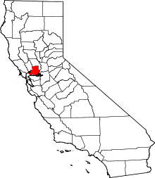 Solano County map | |
| CDPs | ||
| Unincorporated communities | ||
| Ghost towns |
| |
| Bodies of water |
|  |
|---|---|---|
| Counties | ||
| Major cities | ||
| Cities and towns 100k–250k | ||
| Cities and towns 50k–99k | ||
| Cities and towns 25k–50k | ||
| Cities and towns 10k–25k |
| |
| Sub-regions | ||
This article is issued from Wikipedia. The text is licensed under Creative Commons - Attribution - Sharealike. Additional terms may apply for the media files.