Hopland, California
Hopland (formerly Sanel)[3] is a census-designated place[4] in Mendocino County, California.[2] It is located on the west bank of the Russian River 13 miles (21 km) south-southeast of Ukiah,[3] in the Sanel Valley, at an elevation of 502 feet (153 m).[2] The population was 756 at the 2010 census.
Hopland | |
|---|---|
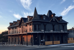 Downtown Hopland | |
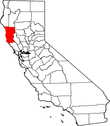
 Hopland Location in California | |
| Coordinates: 38°58′23″N 123°06′59″W | |
| Country | |
| State | |
| County | Mendocino |
| Area | |
| • Total | 3.573 sq mi (9.254 km2) |
| • Land | 3.525 sq mi (9.129 km2) |
| • Water | 0.048 sq mi (0.125 km2) 1.35% |
| Elevation | 502 ft (153 m) |
| Population (2010) | |
| • Total | 756 |
| • Density | 210/sq mi (82/km2) |
| Time zone | UTC-8 (Pacific) |
| • Summer (DST) | UTC-7 (PDT) |
| ZIP code | 95449 |
| Area code(s) | 707 |
| FIPS code | 06-34652 |
| GNIS feature IDs | 1658778; 2628739 |
| U.S. Geological Survey Geographic Names Information System: Hopland, California; U.S. Geological Survey Geographic Names Information System: Hopland, California | |
Hopland is a small town of fewer than 800 people located at the start of the Redwoods of Northern California. It is about 90 minutes drive along U.S. Route 101 north of San Francisco, and a 30-minute drive along State Route 175 to California's largest natural lake Clear Lake. It is a rustic farming community situated amongst oak covered coastal foothills. Summer temperatures can exceed 100 °F (38 °C).
Historic buildings in town include the old Hopland High School (c.1923-1965),[5] currently the Brutocao Cellars tasting room, as well as the Thatcher Hotel, built in the late 1800s and recently reopened after undergoing a complete renovation. Other establishments in Hopland include Cafe Poppy, The Golden Pig, Hopland Tap House, Bluebird Cafe, Brutocao Cellars, Saracina Winery, Campovida Winery and Fetzer Vineyards, a major producer of both red and white wines in North America, including Zinfandel, Chardonnay and Merlot.
Approximately 5 mi (8 km) east of Hopland is the University of California's Hopland Research and Extension Center (formerly called the "Hopland Field Station"), a 5,300-acre (21.4 km2) research and education facility that UC has operated since 1951.
Geography
According to the United States Census Bureau, the CDP covers an area of 3.6 square miles (9.3 km²), 98.65% of it land, and 1.35% of it water.
Climate
| Month | High (°F) | Low (°F) | Precip. (inches) |
|---|---|---|---|
| January | 57 | 36 | 4.89 |
| February | 60 | 40 | 5.98 |
| March | 62 | 41 | 6.47 |
| April | 67 | 43 | 1.16 |
| May | 74 | 47 | 1.98 |
| June | 82 | 51 | 0.72 |
| July | 90 | 55 | 0.03 |
| August | 90 | 55 | 0.05 |
| September | 87 | 53 | 0.35 |
| October | 78 | 49 | 1.18 |
| November | 65 | 41 | 3.72 |
| December | 57 | 35 | 4.17 |
History
The settlement that became Hopland was originally called Sanel.[3] Over the years it was centered on either side of the Russian River.[3] Sanel began on the west bank of the river in 1859.[3] In 1874, the town moved to the east bank to be connected to the toll road built to there.[3] When the railroad arrived on the west side of the river, the town moved back to its original site.[3]
The Sanel post office opened in 1860, closed for a time in 1869, moved and changed its name to Hopland in 1879, reverted to its original site and name in 1890, and changed its name finally to Hopland in 1891.[3] The town gets its name from the fact that from the 1870s to the mid-1950s, much of the region’s economy was based on the growing and drying of bitter hops, a key flavoring and preservative in beer.[7] Downy mildew pushed hops out of the area completely by the late 1950s.[8]
Demographics
| Historical population | |||
|---|---|---|---|
| Census | Pop. | %± | |
| U.S. Decennial Census[9] | |||
The 2010 United States Census[10] reported that Hopland had a population of 756. The population density was 211.6 people per square mile (81.7/km²). The racial makeup of Hopland was 521 (68.9%) White, 4 (0.5%) African American, 38 (5.0%) Native American, 10 (1.3%) Asian, 0 (0.0%) Pacific Islander, 142 (18.8%) from other races, and 41 (5.4%) from two or more races. Hispanic or Latino of any race were 263 persons (34.8%).
The Census reported that 739 people (97.8% of the population) lived in households, 17 (2.2%) lived in non-institutionalized group quarters, and 0 (0%) were institutionalized.
There were 263 households, out of which 94 (35.7%) had children under the age of 18 living in them, 117 (44.5%) were opposite-sex married couples living together, 37 (14.1%) had a female householder with no husband present, 29 (11.0%) had a male householder with no wife present. There were 28 (10.6%) unmarried opposite-sex partnerships, and 4 (1.5%) same-sex married couples or partnerships. 56 households (21.3%) were made up of individuals and 12 (4.6%) had someone living alone who was 65 years of age or older. The average household size was 2.81. There were 183 families (69.6% of all households); the average family size was 3.27.
The population was spread out with 195 people (25.8%) under the age of 18, 77 people (10.2%) aged 18 to 24, 211 people (27.9%) aged 25 to 44, 216 people (28.6%) aged 45 to 64, and 57 people (7.5%) who were 65 years of age or older. The median age was 34.6 years. For every 100 females, there were 124.3 males. For every 100 females age 18 and over, there were 122.6 males.
There were 287 housing units at an average density of 80.3 per square mile (31.0/km²), of which 109 (41.4%) were owner-occupied, and 154 (58.6%) were occupied by renters. The homeowner vacancy rate was 2.7%; the rental vacancy rate was 6.1%. 272 people (36.0% of the population) lived in owner-occupied housing units and 467 people (61.8%) lived in rental housing units.
Government
In the state legislature, Hopland is in the 2nd Senate District, represented by Democrat Mike McGuire,[11] and the 2nd Assembly District, represented by Democrat Jim Wood.[12]
Federally, Hopland is in California's 2nd congressional district, represented by Democrat Jared Huffman.[13]
Media
- KORB 88.7 MHz, the only FM broadcast station licensed to Hopland
References
- U.S. Census Archived 2012-01-25 at the Wayback Machine
- U.S. Geological Survey Geographic Names Information System: Hopland, California
- Durham, David L. (1998). California's Geographic Names: A Gazetteer of Historic and Modern Names of the State. Clovis, Calif.: Word Dancer Press. p. 79. ISBN 1-884995-14-4.
- U.S. Geological Survey Geographic Names Information System: Hopland, California
- "Healdsburg Tribune, Enterprise and Scimitar 13 May 1965 — California Digital Newspaper Collection". cdnc.ucr.edu. Retrieved 2019-09-09.
- Forrey, Rip. "Climate data for various locations in Sonoma, Napa, Mendocino, Lake and Marin counties, California" (PDF). University of California Cooperative Extension Sonoma County. Archived from the original (PDF) on 2007-06-30. Retrieved 2007-12-01.
- http://roadjournals.viamagazine.com/2011/02/02/hopland-calif-with-the-hops-gone-maybe-they-should-call-it-grapeland%5B%5D
- "Archived copy". Archived from the original on 2007-05-29. Retrieved 2011-05-18.CS1 maint: archived copy as title (link)
- "Census of Population and Housing". Census.gov. Retrieved June 4, 2016.
- "2010 Census Interactive Population Search: CA - Hopland CDP". U.S. Census Bureau. Archived from the original on July 15, 2014. Retrieved July 12, 2014.
- "Senators". State of California. Retrieved March 10, 2013.
- "Members Assembly". State of California. Retrieved March 2, 2013.
- "California's 2nd Congressional District - Representatives & District Map". Civic Impulse, LLC. Retrieved March 1, 2013.