List of listed buildings in Troqueer, Dumfries and Galloway
This is a list of listed buildings in the civil parish of Troqueer in Dumfries and Galloway, Scotland.
List
| Name | Location | Date Listed | Grid Ref. [note 1] | Geo-coordinates | Notes | LB Number [note 2] | Image |
|---|---|---|---|---|---|---|---|
| Terraughtie House | 55°03′34″N 3°40′07″W | Category B | 17171 |  | |||
| Dalskairth House Lodge And Gatepiers | 55°02′32″N 3°39′52″W | Category B | 17163 | | |||
| Mabie House Mabie Lodge | 55°01′12″N 3°37′59″W | Category B | 17170 | | |||
| Cargen House Red Lodge And Gatepiers (Formerly To Cargen House) | 55°01′56″N 3°37′03″W | Category B | 17185 | | |||
| Cargen House Walled Garden And Pavilion | 55°02′09″N 3°37′27″W | Category B | 17186 | | |||
| Goldielea House (Woodley Park) | 55°02′41″N 3°40′27″W | Category C(S) | 17199 | | |||
| Dalskairth House Wellhead | 55°02′21″N 3°39′50″W | Category B | 17154 | | |||
| Garroch Viaduct | 55°03′34″N 3°38′58″W | Category B | 17156 | | |||
| Mabie House | 55°01′14″N 3°38′41″W | Category B | 17168 | | |||
| Kirkconnel House | 54°59′47″N 3°35′46″W | Category A | 17204 | | |||
| Castlehill House And Gatepiers On Main Road | 55°03′36″N 3°40′50″W | Category B | 17159 | | |||
| Dalskairth House Cylindrical Structure Beside Main Drive | 55°02′23″N 3°39′50″W | Category B | 17162 | | |||
| Dalskairth House Former Stables | 55°02′31″N 3°39′54″W | Category B | 17164 | | |||
| Dalskairth House Sundial | 55°02′24″N 3°39′53″W | Category B | 17165 | | |||
| Kirkconnel House Gatepiers | 54°59′49″N 3°35′50″W | Category C(S) | 17166 | | |||
| Hillhead Farmhouse And Steading | 55°02′06″N 3°40′32″W | Category B | 17202 | | |||
| Kirkconnel House Former Stables/Outbuildings | 54°59′46″N 3°35′50″W | Category C(S) | 17167 | | |||
| Goldielea Stables | 55°02′42″N 3°40′35″W | Category C(S) | 17200 | | |||
| Goldielea Viaduct | 55°02′44″N 3°40′31″W | Category A | 17201 | 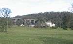 | |||
| Islesteps Bridge (A710 Over Cargen Pow) | 55°02′23″N 3°37′13″W | Category C(S) | 17203 | | |||
| Dalskairth House | 55°02′24″N 3°39′55″W | Category B | 17161 | | |||
| Mabie Former Stables (Forestry Commission) | 55°01′13″N 3°38′38″W | Category B | 17169 | | |||
| Cargen House Cargen Grove (Formerly Cargen House Stables) | 55°02′09″N 3°37′35″W | Category B | 17187 | | |||
| Cargen House Cargen Grove Gatepiers (On Roadside) | 55°02′07″N 3°37′36″W | Category C(S) | 17188 | | |||
| Dalskairth House Lennox's Tower | 55°02′14″N 3°40′21″W | Category C(S) | 17155 | |
Key
The scheme for classifying buildings in Scotland is:
- Category A: "buildings of national or international importance, either architectural or historic; or fine, little-altered examples of some particular period, style or building type."[1]
- Category B: "buildings of regional or more than local importance; or major examples of some particular period, style or building type, which may have been altered."[1]
- Category C: "buildings of local importance; lesser examples of any period, style, or building type, as originally constructed or moderately altered; and simple traditional buildings which group well with other listed buildings."[1]
In March 2016 there were 47,288 listed buildings in Scotland. Of these, 8 per cent were Category A, and 50 per cent were Category B, with the rest listed at Category C.[2]
Notes
- Sometimes known as OSGB36, the grid reference (where provided) is based on the British national grid reference system used by the Ordnance Survey.
• "Guide to National Grid". Ordnance Survey. Retrieved 2007-12-12.
• "Get-a-map". Ordnance Survey. Retrieved 2007-12-17. - Historic Environment Scotland assign a unique alphanumeric identifier to each designated site in Scotland, for listed buildings this always begins with "LB", for example "LB12345".
References
- All entries, addresses and coordinates are based on data from Historic Scotland. This data falls under the Open Government Licence
- "What is Listing?". Historic Environment Scotland. Retrieved 29 May 2018.
- Scotland's Historic Environment Audit 2016 (PDF). Historic Environment Scotland and the Built Environment Forum Scotland. pp. 15–16. Retrieved 29 May 2018.
| Wikimedia Commons has media related to Troqueer. |
This article is issued from Wikipedia. The text is licensed under Creative Commons - Attribution - Sharealike. Additional terms may apply for the media files.