List of listed buildings in Minnigaff, Dumfries and Galloway
This is a list of listed buildings in the civil parish of Minnigaff in Dumfries and Galloway, Scotland.
List
| Name | Location | Date Listed | Grid Ref. [note 1] | Geo-coordinates | Notes | LB Number [note 2] | Image |
|---|---|---|---|---|---|---|---|
| Minnigaff, Millcroft Road, 1 And 2 Reid Terrace | 54°57′43″N 4°28′58″W | Category C(S) | 19300 |  | |||
| Monigaff Parish Church Graveyard, Heron Monument | 54°58′06″N 4°29′08″W | Category A | 19313 | | |||
| Murray's Monument | 55°01′05″N 4°22′00″W | Category C(S) | 19314 | | |||
| Queen Mary's Bridge | 54°58′18″N 4°28′50″W | Category B | 19319 | | |||
| Strathmaddie, Farmhouse | 54°56′39″N 4°24′10″W | Category C(S) | 19320 | | |||
| Minnigaff, 9 Creebridge | 54°57′39″N 4°28′53″W | Category C(S) | 19283 | | |||
| Minnigaff, 4 Creebridge | 54°57′38″N 4°28′53″W | Category C(S) | 19285 | | |||
| Minnigaff, Millcroft Road, Minnigaff Mill | 54°57′51″N 4°29′03″W | Category B | 19299 | | |||
| Craignine Bridge | 54°58′03″N 4°24′26″W | Category B | 17036 | | |||
| Bargaly Bridge | 54°58′17″N 4°24′17″W | Category C(S) | 17040 | | |||
| Bargaly, Sundial | 54°58′09″N 4°24′11″W | Category B | 17043 | | |||
| Bargrennan Church | 55°03′23″N 4°35′12″W | Category B | 17047 | | |||
| Mains Of Machermore, Farmhouse And Steading | 54°57′03″N 4°27′45″W | Category C(S) | 17067 | | |||
| Minnigaff,Youth Hostel (Former School) And Boundary Walls | 54°57′55″N 4°28′57″W | Category C(S) | 19305 | | |||
| Minnigaff, Old Minnigaff, War Memorial | 54°58′00″N 4°28′58″W | Category C(S) | 19310 | | |||
| Minnoch Bridge | 55°02′27″N 4°33′52″W | Category C(S) | 19311 | | |||
| Minnigaff, 7 Creebridge | 54°57′39″N 4°28′52″W | Category C(S) | 19282 | | |||
| Minnigaff, Creebridge, Creebridge House Hotel | 54°57′41″N 4°28′54″W | Category C(S) | 19290 | | |||
| Minnigaff, Creebridge, Ivy Bank And Railings | 54°57′40″N 4°28′56″W | Category C(S) | 19293 | | |||
| Cairnsmore, Walled Garden | 54°56′44″N 4°23′29″W | Category C(S) | 17034 | | |||
| Bargaly, Sundial Dated 1828 | 54°58′07″N 4°24′11″W | Category B | 17044 | | |||
| Bargaly, Walled Garden | 54°58′09″N 4°24′11″W | Category C(S) | 17046 | | |||
| Drannandow, Farmhouse | 55°00′01″N 4°31′16″W | Category B | 17056 | | |||
| Kirkton House | 54°58′10″N 4°29′15″W | Category B | 17061 | | |||
| Minnigaff, The Old Schoolhouse And Boundary Walls | 54°57′56″N 4°28′56″W | Category C(S) | 19303 | | |||
| Minnigaff, Old Edinburgh Road, Willowbank | 54°57′58″N 4°28′55″W | Category C(S) | 19306 | | |||
| Old Bridge Of Palnure | 54°57′01″N 4°24′29″W | Category C(S) | 19316 | | |||
| Palnure, Smiddy | 54°56′30″N 4°25′04″W | Category C(S) | 19318 | | |||
| Minnigaff, 10 Creebridge | 54°57′39″N 4°28′54″W | Category C(S) | 19288 | | |||
| Garlies Lodge And Motor House | 55°03′41″N 4°35′00″W | Category C(S) | 17058 | | |||
| Minnigaff, Old Minnigaff, Elmlea | 54°57′58″N 4°28′59″W | Category C(S) | 19307 | | |||
| Whitehills | 54°58′20″N 4°29′37″W | Category B | 19321 | | |||
| Minnigaff, 3 Creebridge | 54°57′38″N 4°28′52″W | Category C(S) | 19280 | | |||
| Minnigaff, 8 Creebridge | 54°57′38″N 4°28′54″W | Category C(S) | 19287 | | |||
| Minnigaff, 12 Creebridge | 54°57′39″N 4°28′54″W | Category C(S) | 19289 | | |||
| Cairnsmore House | 54°56′49″N 4°23′27″W | Category B | 17031 | | |||
| Craigdews | 55°01′23″N 4°20′29″W | Category C(S) | 17035 | | |||
| Cumloden, Glenmalloch Lodge | 54°59′02″N 4°27′59″W | Category B | 17051 | | |||
| Cumloden Waulkmill | 54°58′19″N 4°28′49″W | Category B | 17055 | | |||
| Glencaird | 55°04′42″N 4°33′37″W | Category B | 17059 | | |||
| Kirroughtree House Hotel | 54°57′50″N 4°27′57″W | Category B | 17064 | | |||
| Machermore Castle | 54°56′58″N 4°28′21″W | Category B | 17066 | | |||
| Minnigaff, Millcroft Road, 4 Reid Terrace | 54°57′43″N 4°28′59″W | Category C(S) | 19301 | | |||
| Buchan Bridge | 55°05′34″N 4°28′51″W | Category C(S) | 17030 | | |||
| Cairnsmore Stables | 54°56′47″N 4°23′21″W | Category B | 17033 | | |||
| Auchinleck Bridge | 55°00′19″N 4°25′43″W | Category C(S) | 17038 | | |||
| Bargaly House | 54°58′06″N 4°24′15″W | Category B | 17041 | | |||
| Bargaly, Tomb Of Andrew Heron | 54°58′05″N 4°24′14″W | Category B | 17045 | | |||
| Cumloden House | 54°58′43″N 4°28′28″W | Category A | 17052 | 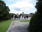 | |||
| 1-6(Inc Nos) Kirroughtree Court, Former Kirroughtree Stables | 54°57′53″N 4°28′00″W | Category C(S) | 17062 | | |||
| Minnigaff, Millcroft Road, 6 Reid Terrace | 54°57′43″N 4°28′59″W | Category C(S) | 19304 | | |||
| Monigaff Parish Church, Graveyard And Graveyard Walls | 54°58′07″N 4°29′07″W | Category B | 19312 | | |||
| Minnigaff, 2 Creebridge, Ye Olde Toll Bar | 54°57′38″N 4°28′53″W | Category C(S) | 19284 | | |||
| Minnigaff, Creebridge Dunbar House | 54°57′37″N 4°28′52″W | Category C(S) | 19291 | | |||
| Minnigaff, Creebridge Hollenlea | 54°57′39″N 4°28′56″W | Category C(S) | 19292 | | |||
| Cairnsmore, Open Barns | 54°56′49″N 4°23′21″W | Category C(S) | 17032 | | |||
| Cumloden, Garden Cottage And Walled Garden | 54°58′52″N 4°28′05″W | Category B | 17037 | | |||
| Bargaly Lodge, Gatepiers And Railings | 54°58′02″N 4°24′22″W | Category C(S) | 17042 | | |||
| Cumloden Lodge And Gatepiers | 54°58′21″N 4°28′44″W | Category C(S) | 17053 | | |||
| Cumloden Stables, Archway And Sundial | 54°58′44″N 4°28′20″W | Category B | 17054 | | |||
| Minnigaff, Millcroft Road, 5 Reid Terrace | 54°57′43″N 4°28′59″W | Category C(S) | 19302 | | |||
| Old Parish Church | 54°58′06″N 4°29′06″W | Category B | 19317 | | |||
| Mattie White's Bridge | 54°59′26″N 4°26′54″W | Category C(S) | 19277 | | |||
| Minnigaff, 1 Creebridge | 54°57′38″N 4°28′52″W | Category C(S) | 19279 | | |||
| Minnigaff, 5 Creebridge, Craigdhu | 54°57′39″N 4°28′52″W | Category C(S) | 19281 | | |||
| Minnigaff, Creebridge, Riverstead | 54°57′37″N 4°28′52″W | Category C(S) | 19295 | | |||
| Minnigaff,Flowerbank With Quadrant And Boundary Walls And Gatepiers | 54°57′47″N 4°29′00″W | Category C(S) | 19296 | | |||
| Minnigaff, Millcroft Road, Mill Cottage | 54°57′50″N 4°29′00″W | Category C(S) | 19298 | | |||
| Auchinleck, House | 55°00′28″N 4°25′32″W | Category B | 17039 | | |||
| Buchan | 55°05′33″N 4°28′44″W | Category B | 17050 | | |||
| Garlies Castle | 54°59′31″N 4°28′04″W | Category A | 17057 | | |||
| Glen Trool Lodge | 55°05′22″N 4°29′53″W | Category B | 17060 | | |||
| Minnigaff, Old Minnigaff, Jacksholm And 1 Penkiln Terrace | 54°57′59″N 4°29′00″W | Category C(S) | 19308 | | |||
| Minnigaff, Old Minnigaff, Maple Cottage | 54°58′03″N 4°29′00″W | Category C(S) | 19309 | | |||
| Martyr's Tomb | 55°04′41″N 4°30′45″W | Category C(S) | 19276 | | |||
| Middle Bridge Of Cree | 55°03′17″N 4°35′09″W | Category C(S) | 19278 | | |||
| Minnigaff, 6 Creebridge | 54°57′38″N 4°28′54″W | Category C(S) | 19286 | | |||
| Minnigaff, Creebridge, Masonfield And Railings | 54°57′38″N 4°28′45″W | Category C(S) | 19294 | | |||
| Minnigaff, Millcroft Road, Lynbank | 54°57′49″N 4°29′00″W | Category C(S) | 19297 | | |||
| Bargrennan, The Schoolhouse | 55°03′26″N 4°35′06″W | Category C(S) | 17048 | | |||
| Kirroughtree, Doocot | 54°57′55″N 4°28′18″W | Category B | 17063 | | |||
| Kirroughtree, Ice House | 54°57′53″N 4°27′59″W | Category C(S) | 17065 | | |||
| Galloway Hydroelectric Power Scheme, Clatteringshaws Dam | 55°03′05″N 4°16′44″W | Category B | 51699 | .jpg) |
Key
The scheme for classifying buildings in Scotland is:
- Category A: "buildings of national or international importance, either architectural or historic; or fine, little-altered examples of some particular period, style or building type."[1]
- Category B: "buildings of regional or more than local importance; or major examples of some particular period, style or building type, which may have been altered."[1]
- Category C: "buildings of local importance; lesser examples of any period, style, or building type, as originally constructed or moderately altered; and simple traditional buildings which group well with other listed buildings."[1]
In March 2016 there were 47,288 listed buildings in Scotland. Of these, 8 per cent were Category A, and 50 per cent were Category B, with the rest listed at Category C.[2]
Notes
- Sometimes known as OSGB36, the grid reference (where provided) is based on the British national grid reference system used by the Ordnance Survey.
• "Guide to National Grid". Ordnance Survey. Retrieved 2007-12-12.
• "Get-a-map". Ordnance Survey. Retrieved 2007-12-17. - Historic Environment Scotland assign a unique alphanumeric identifier to each designated site in Scotland, for listed buildings this always begins with "LB", for example "LB12345".
References
- All entries, addresses and coordinates are based on data from Historic Scotland. This data falls under the Open Government Licence
- "What is Listing?". Historic Environment Scotland. Retrieved 29 May 2018.
- Scotland's Historic Environment Audit 2016 (PDF). Historic Environment Scotland and the Built Environment Forum Scotland. pp. 15–16. Retrieved 29 May 2018.
| Wikimedia Commons has media related to Minnigaff. |
This article is issued from Wikipedia. The text is licensed under Creative Commons - Attribution - Sharealike. Additional terms may apply for the media files.