List of listed buildings in Kirkinner, Dumfries and Galloway
This is a list of listed buildings in the civil parish of Kirkinner, in Dumfries and Galloway, Scotland.
List
| Name | Location | Date Listed | Grid Ref. [note 1] | Geo-coordinates | Notes | LB Number [note 2] | Image |
|---|---|---|---|---|---|---|---|
| Malzie Bridge | 54°51′19″N 4°32′20″W | Category C(S) | 13117 |  | |||
| Baldoon Castle Gatepiers | 54°51′09″N 4°27′13″W | Category A | 10109 | 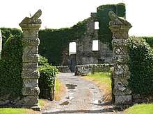 | |||
| 37 Main Street | 54°49′57″N 4°27′26″W | Category C(S) | 10120 | | |||
| Longcastle Schoolhouse And Former School Rooms (Now Workshops) | 54°48′00″N 4°31′10″W | Category C(S) | 13116 | | |||
| Barnbarroch Stables | 54°49′59″N 4°29′44″W | Category B | 10111 | | |||
| Braehead, Craigielea | 54°50′23″N 4°27′38″W | Category C(S) | 10113 | | |||
| Kirkinner Parish Church (C Of S) St Kennera And Churchyard With Vans-Agnew Mausoleum | 54°49′59″N 4°27′24″W | Category B | 13113 | | |||
| Kirkinner School With Retaining Wall | 54°50′01″N 4°27′30″W | Category C(S) | 13114 | | |||
| Knockencurr Farm And Steadings | 54°48′55″N 4°27′00″W | Category B | 13115 | | |||
| Milldriggan Mill | 54°50′20″N 4°27′35″W | Category B | 13120 | | |||
| Stewarton House | 54°49′07″N 4°24′59″W | Category B | 13122 | | |||
| 1 And 2 Stewarton Cottages | 54°49′00″N 4°25′09″W | Category B | 13123 | | |||
| Barwhanny Windmill And Barn | 54°48′51″N 4°28′31″W | Category B | 10112 | | |||
| Kirkinner Manse | 54°50′01″N 4°27′17″W | Category B | 13112 | | |||
| Milldriggan Mill House | 54°50′20″N 4°27′37″W | Category B | 13119 | | |||
| Braehead, Holly Cottage And Millers Cottage | 54°50′24″N 4°27′41″W | Category C(S) | 10114 | | |||
| Barnbarroch House | 54°50′00″N 4°29′45″W | Category B | 13618 | | |||
| 47 Main Street | 54°49′55″N 4°27′24″W | Category C(S) | 13111 | | |||
| Over Airies | 54°48′17″N 4°29′40″W | Category B | 13121 | | |||
| 12 Main Street | 54°49′58″N 4°27′26″W | Category C(S) | 10118 | | |||
| 45 Main Street | 54°49′56″N 4°27′24″W | Category C(S) | 10121 | | |||
| Malzie Smithy | 54°51′18″N 4°32′19″W | Category C(S) | 13118 | | |||
| Baldoon Mains | 54°51′12″N 4°27′15″W | Category B | 10110 | | |||
| 25 Main Street | 54°49′58″N 4°27′29″W | Category C(S) | 10119 | |
Key
The scheme for classifying buildings in Scotland is:
- Category A: "buildings of national or international importance, either architectural or historic; or fine, little-altered examples of some particular period, style or building type."[1]
- Category B: "buildings of regional or more than local importance; or major examples of some particular period, style or building type, which may have been altered."[1]
- Category C: "buildings of local importance; lesser examples of any period, style, or building type, as originally constructed or moderately altered; and simple traditional buildings which group well with other listed buildings."[1]
In March 2016 there were 47,288 listed buildings in Scotland. Of these, 8 per cent were Category A, and 50 per cent were Category B, with the rest listed at Category C.[2]
Notes
- Sometimes known as OSGB36, the grid reference (where provided) is based on the British national grid reference system used by the Ordnance Survey.
• "Guide to National Grid". Ordnance Survey. Retrieved 2007-12-12.
• "Get-a-map". Ordnance Survey. Retrieved 2007-12-17. - Historic Environment Scotland assign a unique alphanumeric identifier to each designated site in Scotland, for listed buildings this always begins with "LB", for example "LB12345".
References
- All entries, addresses and coordinates are based on data from Historic Scotland. This data falls under the Open Government Licence
- "What is Listing?". Historic Environment Scotland. Retrieved 29 May 2018.
- Scotland's Historic Environment Audit 2016 (PDF). Historic Environment Scotland and the Built Environment Forum Scotland. pp. 15–16. Retrieved 29 May 2018.
| Wikimedia Commons has media related to Kirkinner. |
This article is issued from Wikipedia. The text is licensed under Creative Commons - Attribution - Sharealike. Additional terms may apply for the media files.